Zumwalt Meadow Trail
View Photos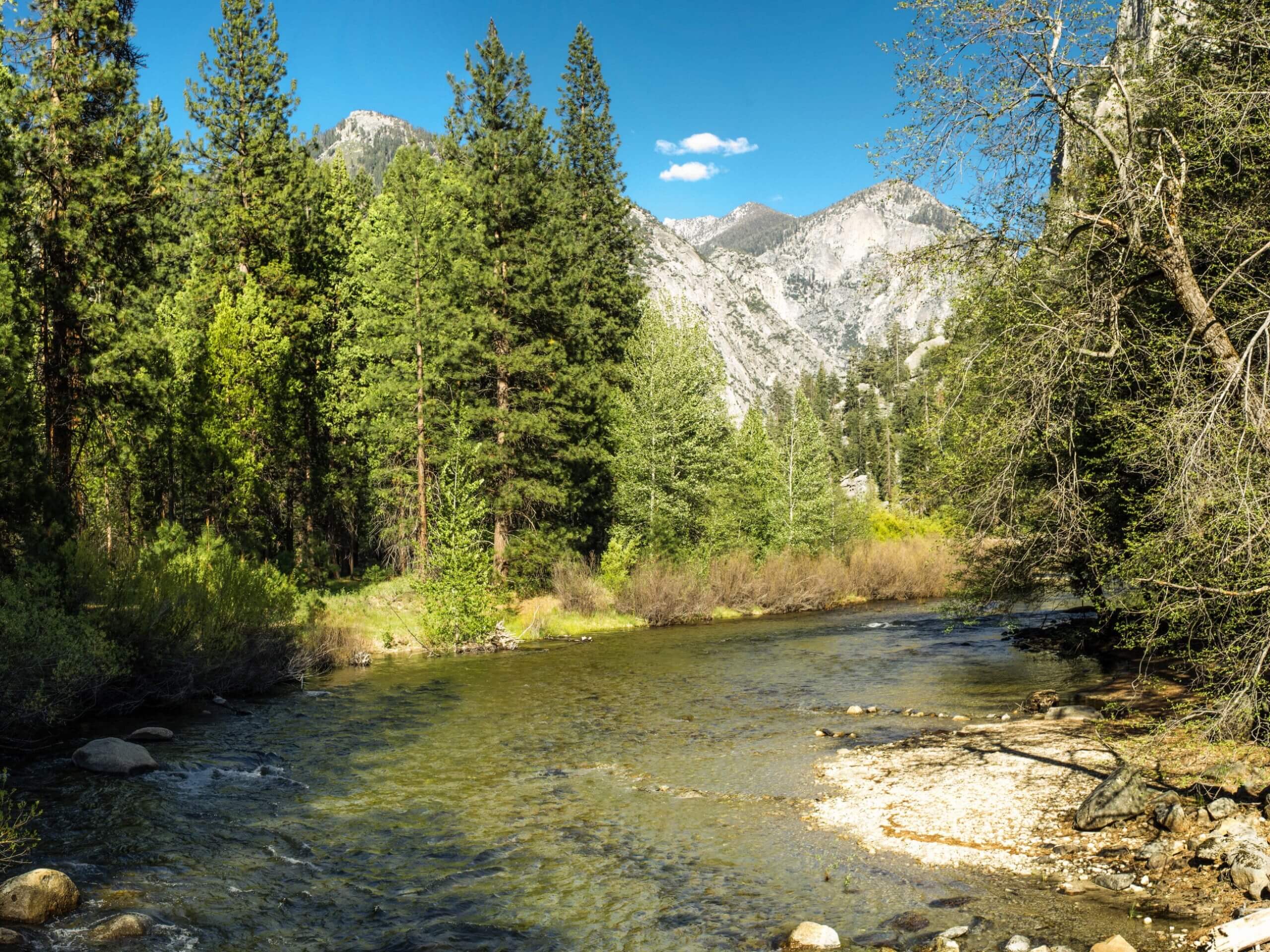
Zumwalt Meadow Trail
Difficulty Rating:
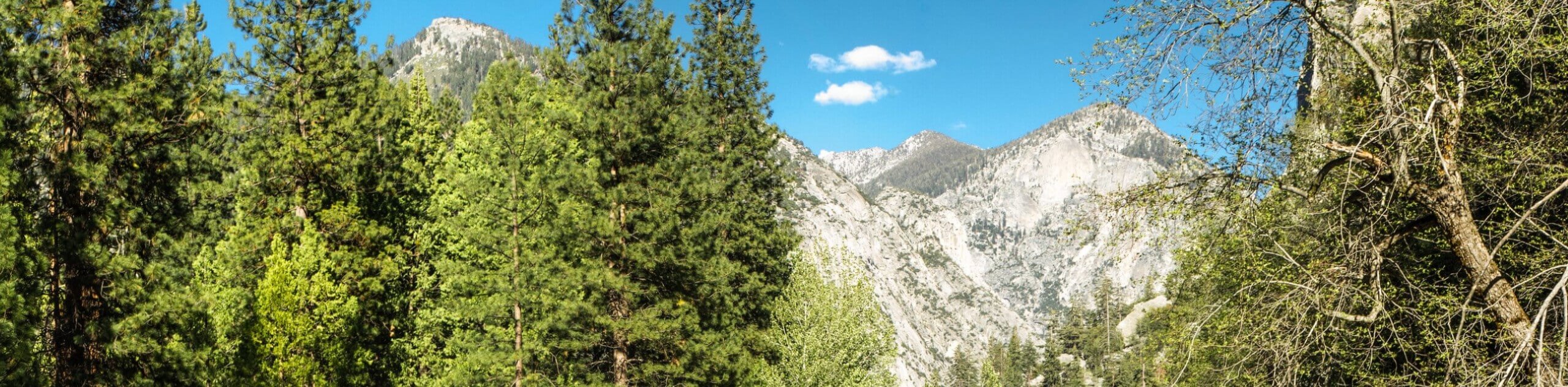
Explore the Zumwalt Meadow Trail and you will be rewarded with awe-inspiring scenery. This family-friendly adventure in the Kings Canyon National Park offers wonderful views of the lush meadow, the South Fork Kings River, and the bounding granite cliffs of Cedar Grove.
Getting there
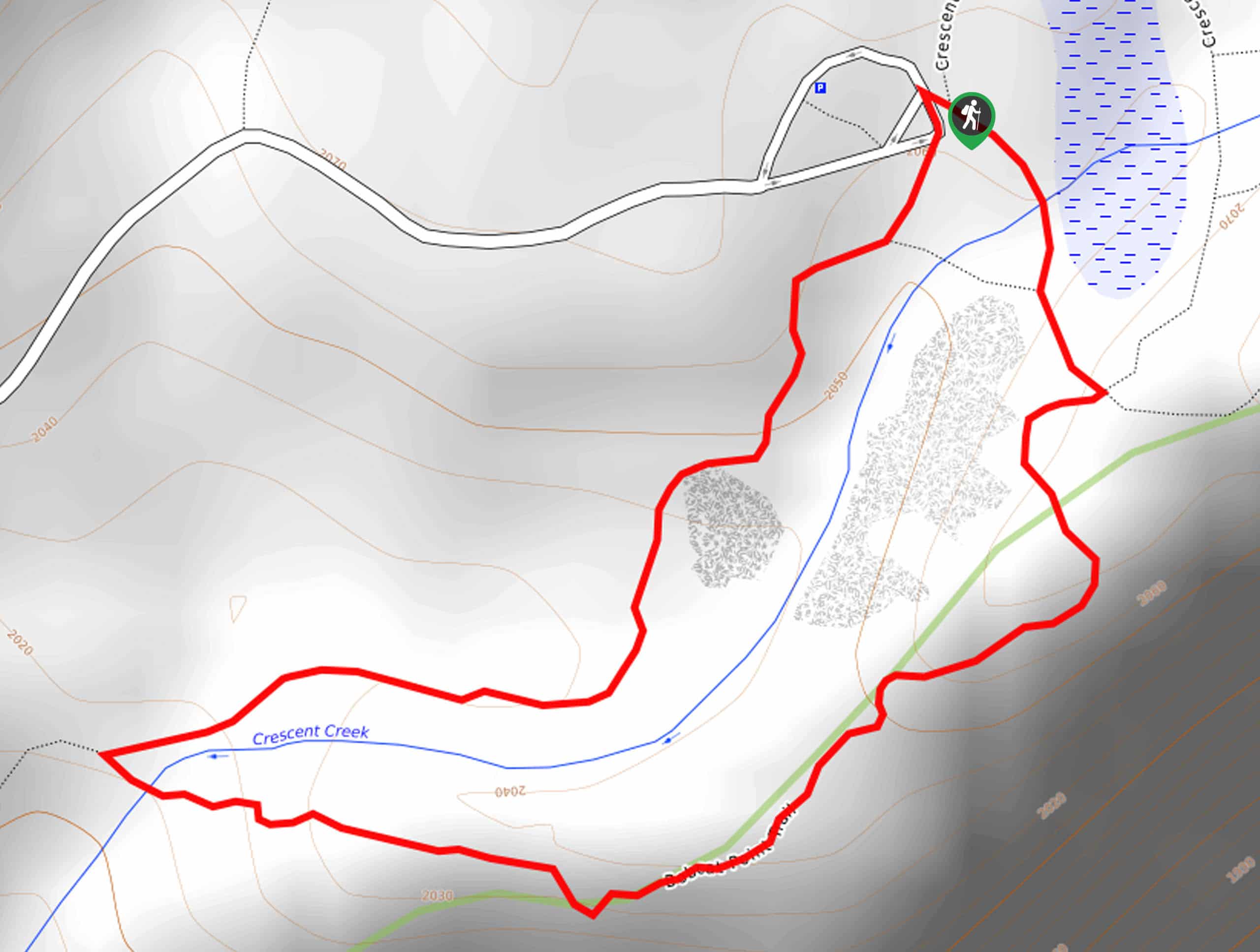
The Zumwalt Meadow Trail is accessed from the Zumwalt Meadows to Roaring River Falls Trailhead off the Kings Canyon Scenic Byway.

About
| Backcountry Campground | No |
| When to do | April-October |
| Pets allowed | No |
| Family friendly | Yes |
| Route Signage | Average |
| Crowd Levels | High |
| Route Type | Out and back |
Zumwalt Meadow Trail
Elevation Graph
Weather
Zumwalt Meadow Trail Description
Those seeking a short, easy-going outdoor adventure in the Kings Canyon National Park will enjoy this route. The Zumwalt Meadows Hike is a family-friendly adventure in Cedar Grove that travels through the mixed-conifer forests, along the luxuriant meadows, and along the banks of the Kings River. Indulge yourself in the wonderful scenery as you get out into the fresh air. We encourage hikers to wear a pair of supportive footwear as much of the path is rocky and uneven. Note entrance to the park costs $35USD per vehicle or $20USD per person for pedestrians or cyclists.
Embark on your adventure along the Zumwalt Meadows Trail from the trailhead off the carpark. Setting out from here, the Zumwalt Meadows to Roaring Fork River Falls will guide you southwestwardly through the mixed forestlands along the Kings River. Soon after your departure, the trail will intersect with the river. Cross over the footbridge, and you will confront a junction, veer left here, and you will be diverted onto the Zumwalt Meadows Loop Trail. Now tracking eastwardly, you will be granted impressive views of the expansive meadow framed by towering granite cliffs.
Admire the wonderful scenery and mind your footing as you progress. Eventually, the route will curve north, leading you to another junction. Here you can choose to complete the loop or retrace your footing along the path back to the trailhead—which is what we chose to do.
Similar hikes to the Zumwalt Meadow Trail hike

Eagle and Bobcat Loop Hike
The Eagle and Bobcat Loop Hike is an amazing adventure that the whole family can enjoy. Wander through luxuriant meadows…
Bobcat Point Loop Hike
Seeking incredible vistas of the Sierra Nevada Mountain Range? The Bobcat Point Loop Hike is an incredible adventure in the…

Huckleberry and Alta Loop Hike
The Huckleberry and Alta Loop Hike is a beautiful adventure that offers a wealth of incredible scenery for hikers to…
Comments