
Bobcat Point Loop Hike
View Photos
Bobcat Point Loop Hike
Difficulty Rating:
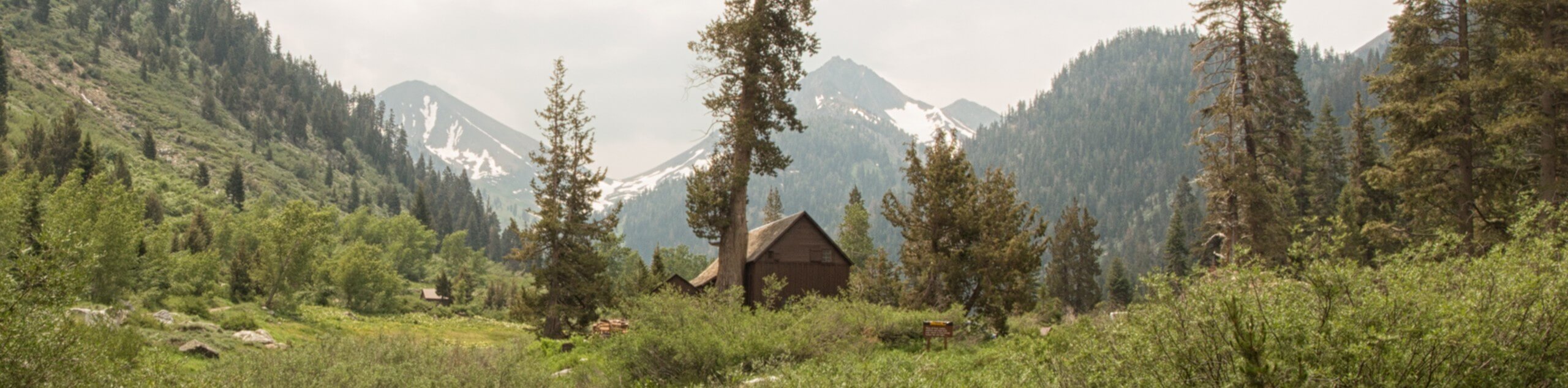
Seeking incredible vistas of the Sierra Nevada Mountain Range? The Bobcat Point Loop Hike is an incredible adventure in the Sequoia National Park that boasts remarkable views comparable to those from Moro Rock—with a fraction of the crowds.
Getting there
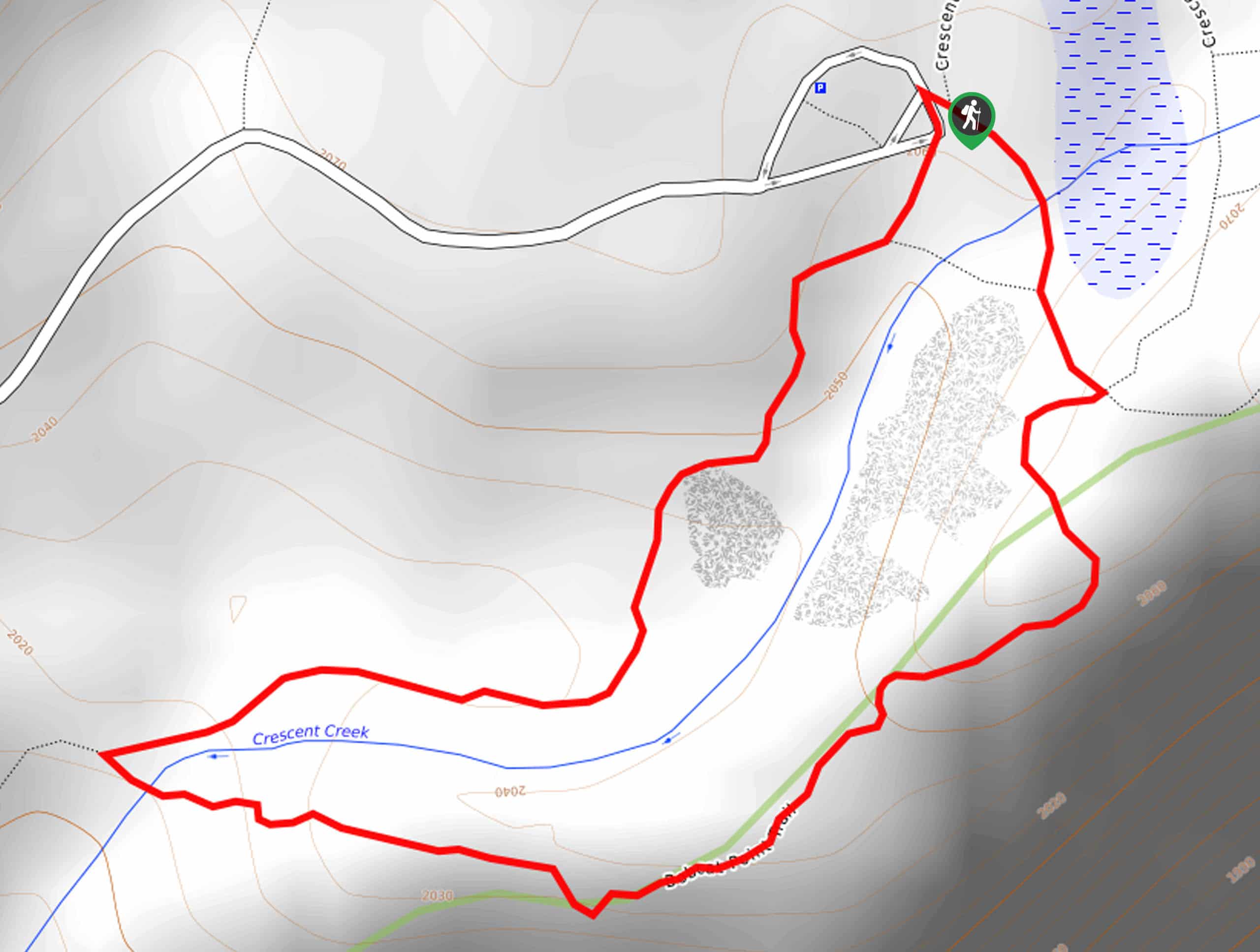
The Bobcat Point Loop is accessed via the Sugar Pine Trailhead off Crescent Meadow Road.

About
| Backcountry Campground | No |
| When to do | May-October |
| Pets allowed | No |
| Family friendly | Yes |
| Route Signage | Average |
| Crowd Levels | Moderate |
| Route Type | Circuit |
Bobcat Point Loop Hike
Elevation Graph
Weather
Bobcat Point Loop Hike Description
A magnet for photographers and eager explorers alike, the Bobcat Point Loop is an impressively scenic adventure. Family-friendly and easy-going, this is a perfect trek for those who lack the time or patience to wait to summit the Moro Rock. Be sure to charge your camera prior to your departure, as the views are postcard-worthy! Dress in layers and be prepared to weather windy conditions! Note entrance to the park costs $35USD per vehicle or $20USD per person for pedestrians or cyclists.
Embark on your trek along the Bobcat Point Loop from the Sugar Pine Trailhead. Setting out from here, follow the Sugar Pine Trail southwest, gradually descending through the woodlands along Crescent Creek. Soon after your departure, you will encounter an intersection, keep left here, and you will be diverted onto the Bobcat Point Trail. Hike to Bobcat Point and revel in the impressive vistas of the High Sierra! Snap a few pictures, then continue along the path to Crescent Meadow.
Revel in the beauty of the luxuriant meadow, then merge onto the High Sierra Trail and venture the route north back to the trailhead.
Similar hikes to the Bobcat Point Loop Hike hike

Eagle and Bobcat Loop Hike
The Eagle and Bobcat Loop Hike is an amazing adventure that the whole family can enjoy. Wander through luxuriant meadows…

Huckleberry and Alta Loop Hike
The Huckleberry and Alta Loop Hike is a beautiful adventure that offers a wealth of incredible scenery for hikers to…
Cold Springs Nature Trail
The Cold Springs Nature Trail is a lovely adventure that meanders along the charming Kaweah River. Wander amid lush vegetation…
Comments