
Waterdog Lake Trail
View Photos
Waterdog Lake Trail
Difficulty Rating:
The Waterdog Lake Trail is a wonderfully scenic hiking route in the San Juan Mountains of Colorado that will see you traverse a very steep path on the way to a beautiful lake. While out hiking the trail, you will work your way up a series of wide switchbacks through the forest and pass through several charming meadows, before following the banks of Park Creek to the endpoint of the route at Waterdog Lake. Be sure to bring plenty of water for this steep hike, as well as bug spray to protect yourself from the plentiful amount of backcountry insects.
Getting there
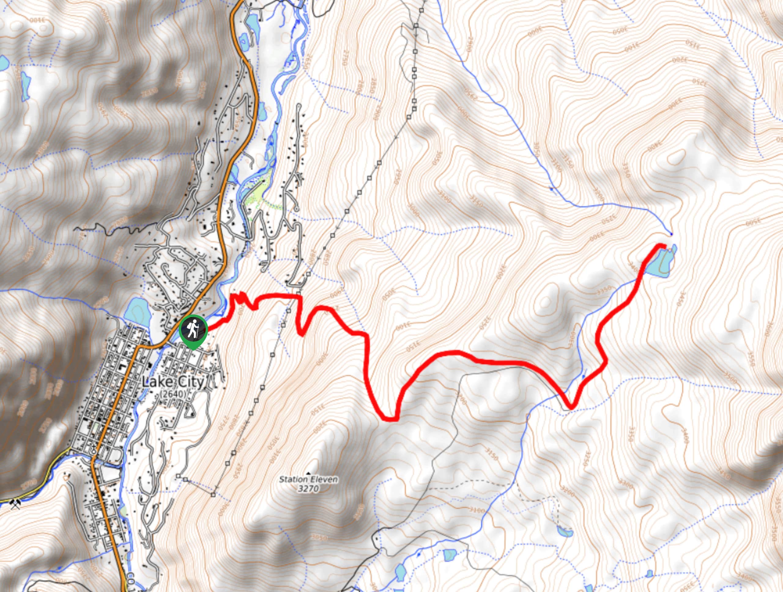
The starting point for the Waterdog Lake Trail can be found at the Waterdog Trail parking area on Hotchkiss Street in Lake City.

About
| Backcountry Campground | No |
| When to do | June-October |
| Pets allowed | Yes |
| Family friendly | No |
| Route Signage | Average |
| Crowd Levels | Moderate |
| Route Type | Out and back |
Waterdog Lake Trail
Elevation Graph
Weather
Waterdog Lake Trail Description
Featuring a large amount of elevation gain spread throughout its length, the Waterdog Lake Trail is a tough hiking route that will be sure to get your heartrate up and your legs burning. If you are after a challenging route in the San Juan Mountains that also features gorgeous views, this will definitely be the hike for you.
Setting out from the trailhead on Hotchkiss Road, you will make your way initially to the northeast along the road, before branching off to the right on a path leading uphill. Here, you will climb uphill through the forest along a series of switchback paths that will also reveal several beautiful meadows.
Shortly after a viewpoint with breathtaking views of the surrounding mountains, you will meet up with the banks of Park Creek and follow it to the northeast to arrive at the peaceful shores of Waterdog Lake. take some time here to appreciate the lovely lakeside setting, before heading back down along the same trail to return to the trailhead.
Similar hikes to the Waterdog Lake Trail hike

Twin Buttes and Lightner Creek Loop Trail
The Twin Buttes and Lightner Creek Loop Trail is a great hiking route in Durango, Colorado that features some challenging…

Meadow Loop via Horse Gulch Trail
The Meadow Loop via Horse Gulch Trail is a great hiking route in Durango that will take you uphill for…

The Ridge Trail
The Ridge Trail - also known as Raiders Ridge Trail - is an amazing hiking route in Durango, Colorado that…
Comments