
Vallecito Creek Trail
View Photos
Vallecito Creek Trail
Difficulty Rating:
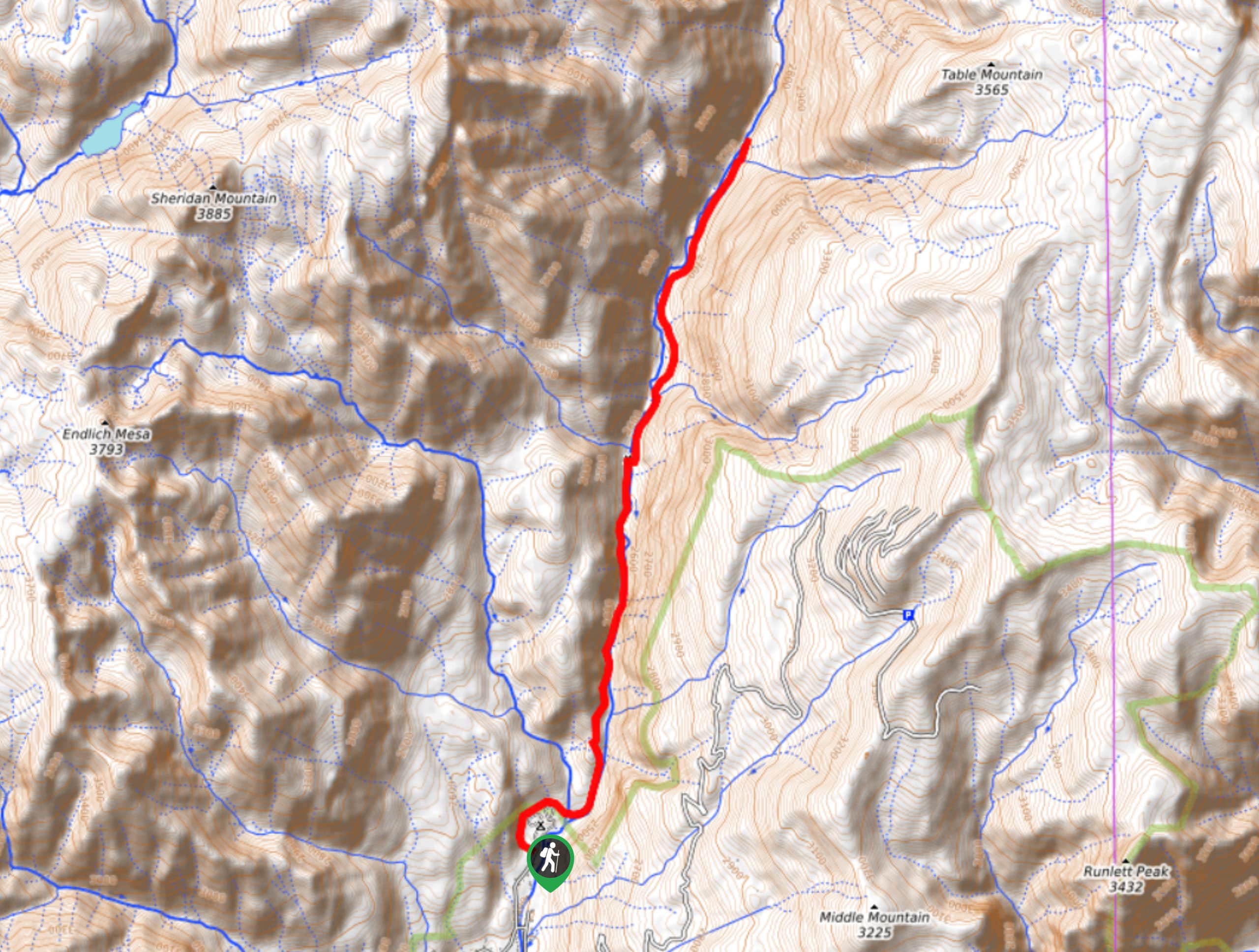
The Vallecito Creek Trail is a long and fairly easy-going hiking route in the San Juan Mountains of Colorado that will produce some beautiful views of the surrounding area. While out on the trail, you will hike through a wooded gulch alongside Vallecito Creek, enjoying the views of the surrounding mountain peaks as you work your way through the tree cover. Those looking for a quicker hike can shorten their route by turning back at the bridge, rather than continuing through the gulch.
Getting there
The Vallecito Creek Trailhead can be found along County Road 500 next to the Vallecito Campground.

About
| Backcountry Campground | Vallecito Campground |
| When to do | June-October |
| Pets allowed | Yes |
| Family friendly | Older Children only |
| Route Signage | Average |
| Crowd Levels | High |
| Route Type | Out and back |
Vallecito Creek Trail
Elevation Graph
Weather
Vallecito Creek Trail Description
If you are after a long-distance hiking route that isn’t very challenging but will still produce some beautiful views, then you will want to check out the Vallecito Creek Trail. Just be sure to wear proper hiking boots with good support, as the trail can be fairly rocky in places.
Setting out from the trailhead, you will make your way around the edge of the Vallecito Campground, before meeting up with the banks of the creek. Here, you will make your way to the northeast as you hike along the water’s edge through the tree cover. Take your time and appreciate the mountain views surrounding you, as you continue along the trail and traverse the undulating terrain of the gulch. Eventually, you will arrive at the endpoint of the route at a bridge, at which point, you can simply turn back along the trail on the return to the parking area.
Similar hikes to the Vallecito Creek Trail hike

Twin Buttes and Lightner Creek Loop Trail
The Twin Buttes and Lightner Creek Loop Trail is a great hiking route in Durango, Colorado that features some challenging…

Meadow Loop via Horse Gulch Trail
The Meadow Loop via Horse Gulch Trail is a great hiking route in Durango that will take you uphill for…

The Ridge Trail
The Ridge Trail - also known as Raiders Ridge Trail - is an amazing hiking route in Durango, Colorado that…
Comments