
Pass Creek and Coal Creek Loop Trail
View Photos
Pass Creek and Coal Creek Loop Trail
Difficulty Rating:
Hiking the Pass Creek and Coal Creek Loop Trail is an amazing experience in Colorado that will take you through a variety of terrain with scenic views of the surrounding San Juan Mountains. While out hiking the trail, you will climb uphill along wooded slopes and traverse alpine meadows, all while taking in the views of nearby peaks like Engineer Mountain. Don’t forget to bring bear spray and make plenty of noise along the trail to prevent a potentially dangerous encounter.
Getting there
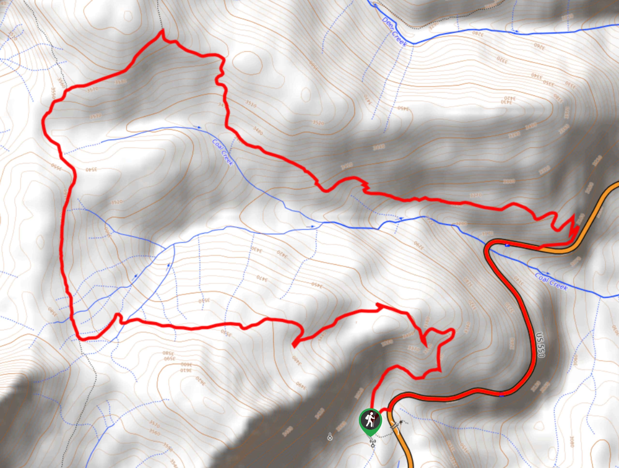
The starting point for the Pass Creek and Coal Creek Loop Trail can be found at the Engineer Mountain Trailhead on US-550 near Coal Bank Pass.

About
| Backcountry Campground | No |
| When to do | Year-Round |
| Pets allowed | Yes |
| Family friendly | No |
| Route Signage | Average |
| Crowd Levels | Moderate |
| Route Type | Circuit |
Pass Creek and Coal Creek Loop Trail
Elevation Graph
Weather
Pass Creek and Coal Creek Loop Trail Description
If you are in search of a challenging but manageable hiking route in the San Juan Mountains that offers some breathtaking mountain views and the opportunity for a bit of solitude outdoors, then the Pass Creek and Coal Creek Loop Trail will be the ideal route for you to explore.
Setting out from the trailhead, you will make your way initially to the northeast to begin climbing up the forested slopes, before turning to the west to continue gaining elevation. After winding your way through the woodland landscape, you will meet up with the Engineer Mountain Trail and follow it north through several meadows that offer views of nearby Engineer Mountain.
Eventually, you will come to a junction with the Coal Creek Trail and follow it to the east, descending the hillside slightly to come close to the banks of the creek. Traversing the slope of the hill to the southeast, you will pass through the forest and meet up with US-550, following it south on the return leg into the trailhead where you began your adventure.
Similar hikes to the Pass Creek and Coal Creek Loop Trail hike

Twin Buttes and Lightner Creek Loop Trail
The Twin Buttes and Lightner Creek Loop Trail is a great hiking route in Durango, Colorado that features some challenging…

Meadow Loop via Horse Gulch Trail
The Meadow Loop via Horse Gulch Trail is a great hiking route in Durango that will take you uphill for…

The Ridge Trail
The Ridge Trail - also known as Raiders Ridge Trail - is an amazing hiking route in Durango, Colorado that…
Comments