Lizard Head Trail
View Photos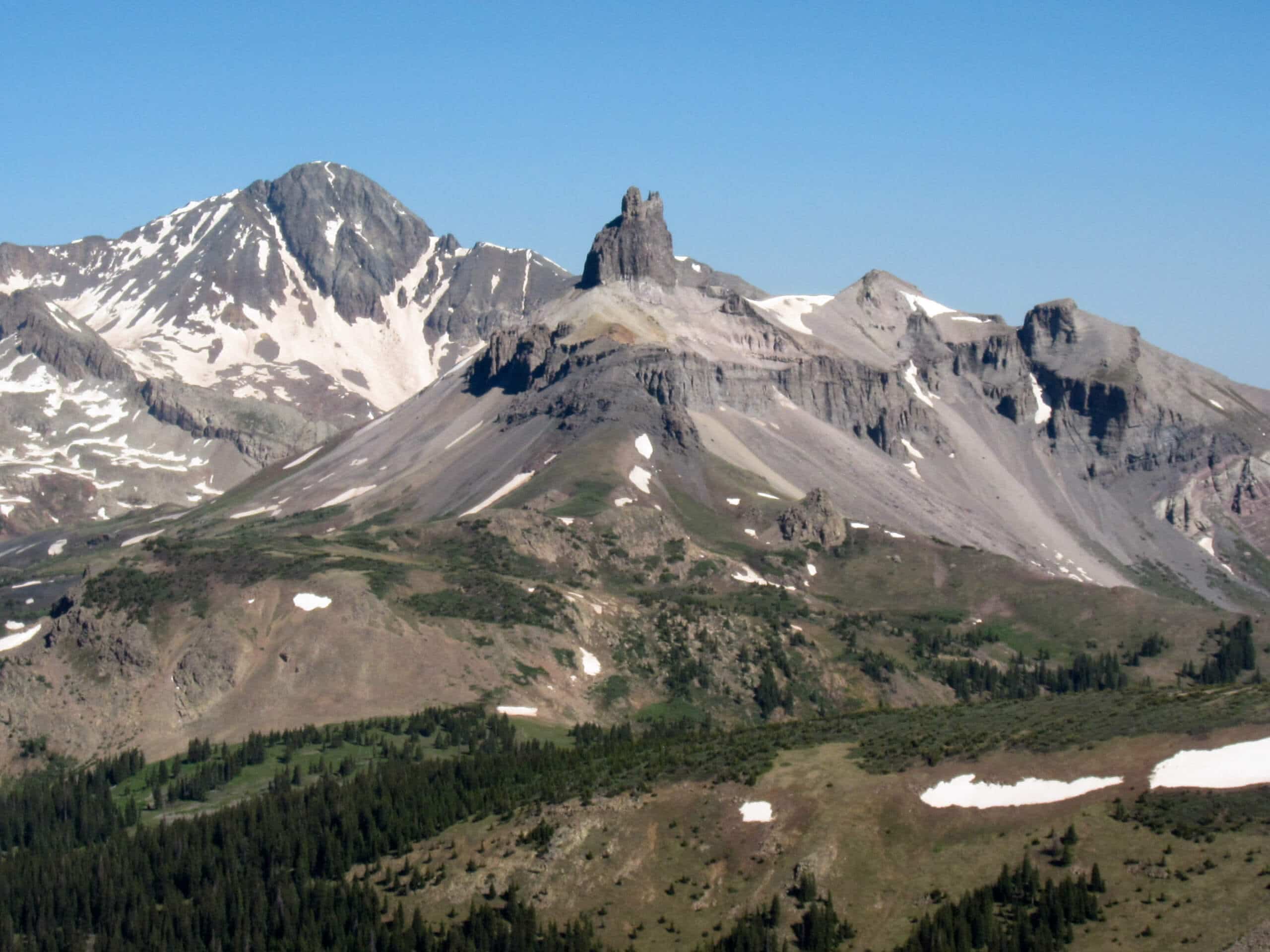
Lizard Head Trail
Difficulty Rating:
The Lizard Head Trail is a long and difficult adventure in the San Juan Mountains of Colorado that will lead you through a variety of rugged terrain and offer stunning views of the surrounding landscape. While out hiking the trail, you will work your way through forests and meadows, before traversing the mountainous terrain surrounding Lizard Head for incredible views of the Lizard Head Wilderness Area around you. While there are trails that are technically more challenging, the overall distance of this route is the real killer.
Getting there
The starting point for the Lizard Head Trail can be found at the Cross Mountain Trailhead, just off Colorado State Highway 145.

About
| Backcountry Campground | No |
| When to do | June-September |
| Pets allowed | Yes - On Leash |
| Family friendly | No |
| Route Signage | Average |
| Crowd Levels | Moderate |
| Route Type | Out and back |
Lizard Head Trail
Elevation Graph
Weather
Lizard Head Trail Description
Due to its overall length, the Lizard Head Trail is a challenging adventure that will be sure to give you a run for your money. If you plan on completing this nearly 18.6mi hike, be sure to wear proper hiking footwear and bring plenty of water.
Although it will make for a very long day on the trails, the Lizard Head Trail is a scenic adventure that will offer some amazing views of the surrounding Lizard Head Wilderness. Featuring plenty of elevation gain throughout the trail and some absolutely stunning views, this route is the definition of being rewarded for your effort.
Setting out from the parking area, you will make your way to the northwest and enter into the cover of the forest alongside the banks of Lizard Head Creek. After 0.5mi, keep right at the fork and continue on through the wonderfully atmospheric forest landscape as the trail climbs further uphill to the north.
After 1.7mi of hiking from the fork, you will pass through several alpine meadows and enjoy some views of the surrounding mountain landscape. Continue working your way uphill to the north for 1.0mi through a mixture of meadow and light forest, before arriving at a junction in the trail below the summit of Lizard Head.
Taking the path on the right, you will leave the imposing summit of Lizard Head behind and work your way east through some rugged terrain towards the summit of Blackface. After passing through a small stretch of woodland terrain, you will exit the tree cover and walk along the ridge of Blackface while taking in spectacular views of the surrounding area.
Arriving at the edge of the forest along the northeast point of the ridge, you will keep right at the junction and carefully traverse a series of switchbacks for 0.5mi, making sure not to head all the way down the hillside. Instead, you will find a path branching off to the right that will lead you across a mixture of forest, meadows, and rockfields, before arriving at the Lizard Head Pass Parking Area.
Here, you can pause for a rest and use the toilet facilities, before heading back along the same route for the return leg of the journey. If you are feeling tired and don’t want to backtrack along the entire trail, you can also walk along State Highway 145 to the southwest to return to the trailhead and complete your time along the Lizard Head Trail.
Trail Highlights
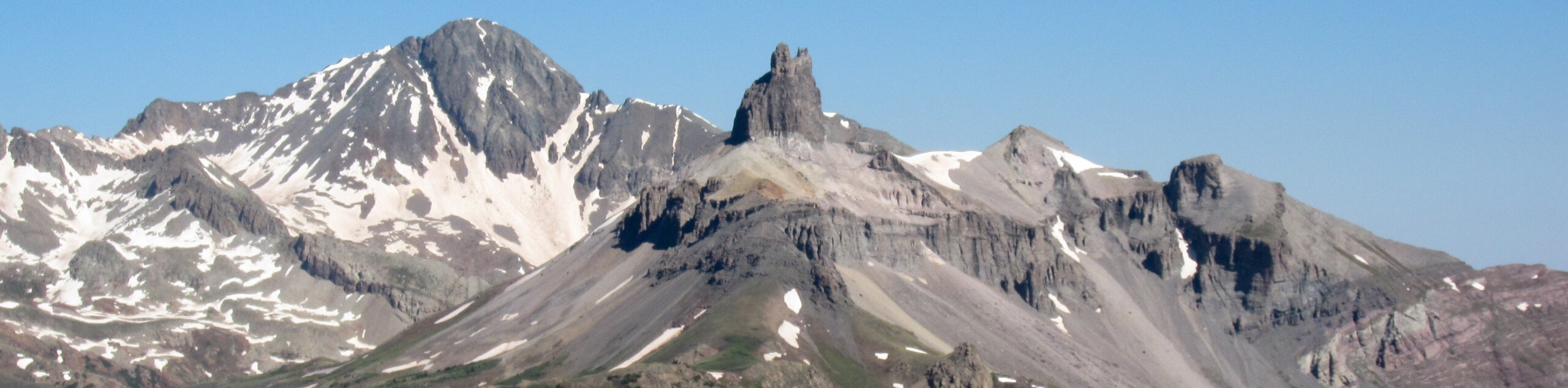
Lizard Head
Located in the Lizard Head Wilderness Area, Lizard Head is a 13119ft peak that is the 556th tallest in Colorado. While it might not be the tallest, the mountain’s spire-like shape certainly makes it one of the more impressive in the area.
Insider Hints
Bring plenty of water, as portions of the trail are exposed to the sun.
Wear proper hiking boots.
You can avoid the return leg of the hike by walking SW on highway 145 to return to the trailhead.
Toilet facilities can be found at the halfway point of the hike.
Similar hikes to the Lizard Head Trail hike

Twin Buttes and Lightner Creek Loop Trail
The Twin Buttes and Lightner Creek Loop Trail is a great hiking route in Durango, Colorado that features some challenging…

Meadow Loop via Horse Gulch Trail
The Meadow Loop via Horse Gulch Trail is a great hiking route in Durango that will take you uphill for…

The Ridge Trail
The Ridge Trail - also known as Raiders Ridge Trail - is an amazing hiking route in Durango, Colorado that…
Comments