
Lake Eileen Trail
View Photos
Lake Eileen Trail
Difficulty Rating:
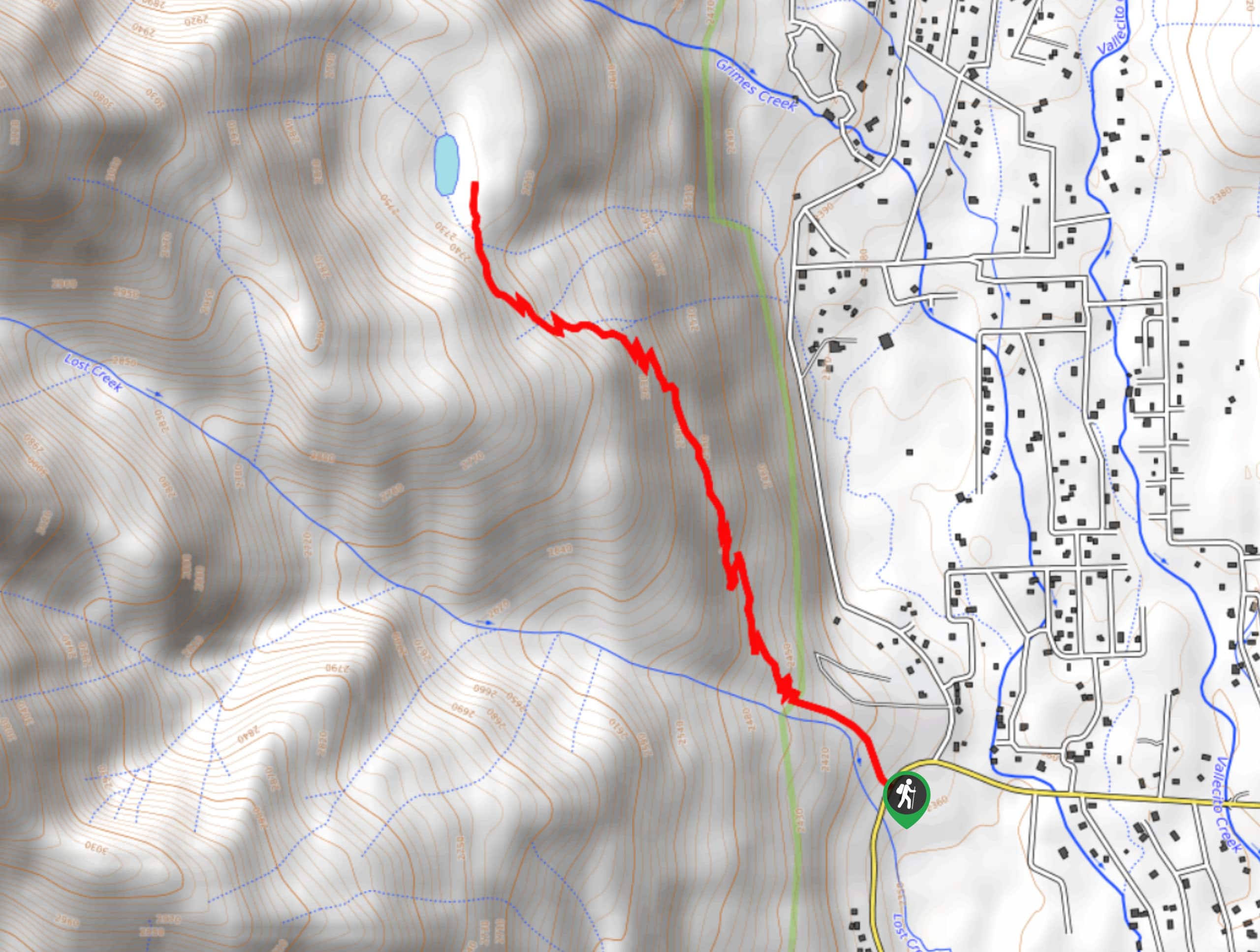
The Lake Eileen Trail is a relatively short and steep hiking route near Vallecito that will lead you uphill to a small lake set in the San Juan Mountains. While out hiking the trail, you will climb sharply uphill along a route through the forest, before arriving at the tranquil shores of Lake Eileen. Be careful when exploring the landscape around the lake, as the terrain is fairly boggy.
Getting there
The trailhead for the Lake Eileen Trail can be found along County Road 501 in Vallecito, Colorado.

About
| Backcountry Campground | No |
| When to do | May-November |
| Pets allowed | Yes |
| Family friendly | Older Children only |
| Route Signage | Average |
| Crowd Levels | High |
| Route Type | Out and back |
Lake Eileen Trail
Elevation Graph
Weather
Lake Eileen Trail Description
If you are looking for an excuse to get your heartrate up and aren’t overly keen on taking a lengthy journey into the mountains, then you should check out the Lake Eileen Trail. The majority of this hike passes through the forest, before arriving at the scenic shores of the lake, making for a great adventure in the wilds of Colorado.
Setting out from the trailhead, you will make your way to the northwest and enter into the cover of the forest, before crossing over the banks of Lost Creek. Here, you will continue on climbing up the hillside as you take in the beauty of your woodland surroundings.
Eventually, you will arrive at the shores of Lake Eileen and be able to take in the stunning views of the surrounding mountains. Once you have explored the area, carefully head back down the steep hillside on the return to the trailhead where you began.
Similar hikes to the Lake Eileen Trail hike

Twin Buttes and Lightner Creek Loop Trail
The Twin Buttes and Lightner Creek Loop Trail is a great hiking route in Durango, Colorado that features some challenging…

Meadow Loop via Horse Gulch Trail
The Meadow Loop via Horse Gulch Trail is a great hiking route in Durango that will take you uphill for…

The Ridge Trail
The Ridge Trail - also known as Raiders Ridge Trail - is an amazing hiking route in Durango, Colorado that…
Comments