Handies Peak Hike
View Photos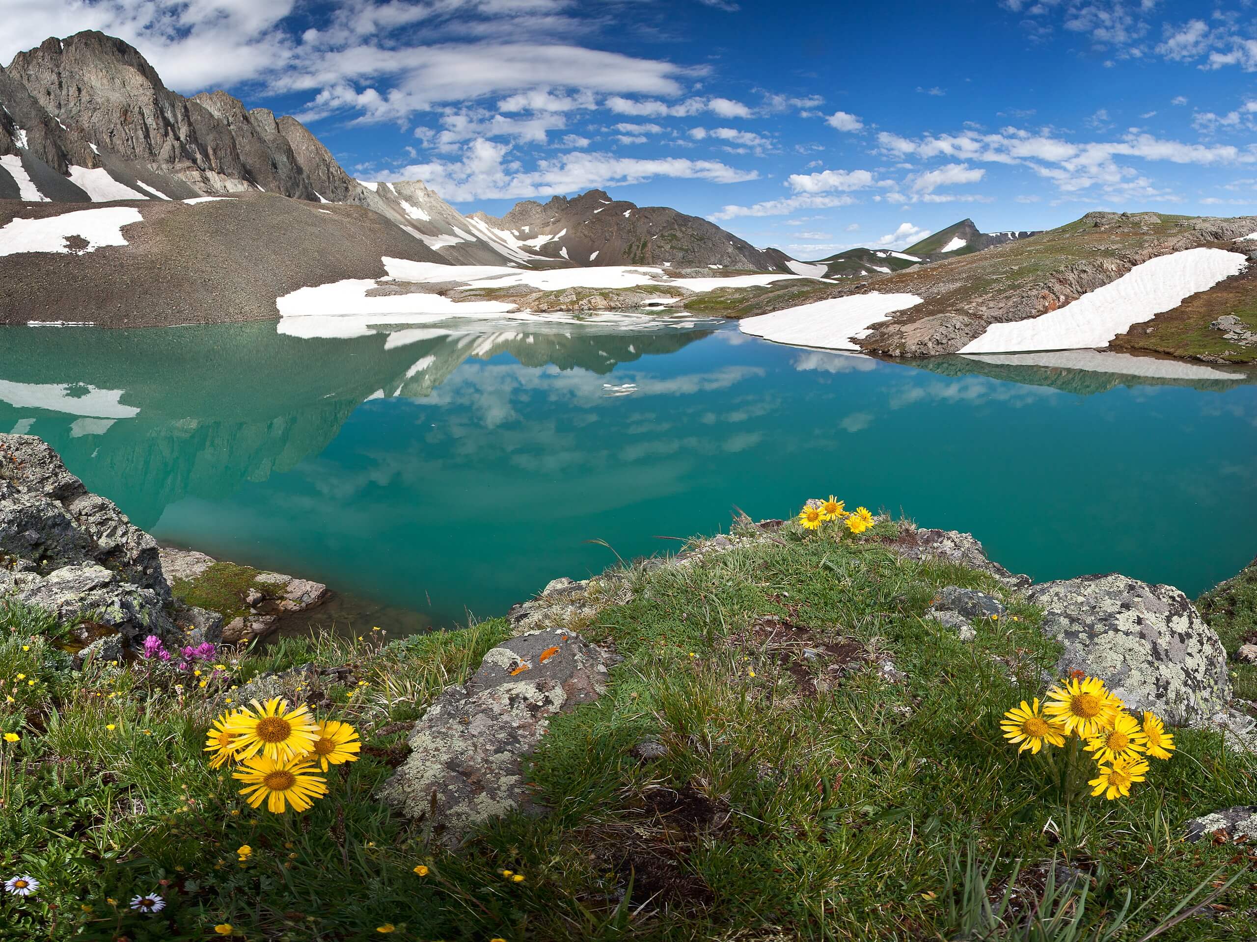
Handies Peak Hike
Difficulty Rating:
The Handies Peak Hike is a breathtaking adventure in the San Juan Mountains that will lead you up to the summit of a rugged fourteener. While out on the trail, you will climb uphill above the American Basin, before traversing the steep slopes of Handies Peak on the way to the summit for spectacular views. Hikers should take note that the road leading into the trailhead is quite rugged and will require a 4x4 high clearance vehicle to safely traverse.
Getting there
The starting point for the Handies Peak Hike can be found at the Handies Peak Southwest Slope Trailhead on County Road 12, 20.0mi northeast of Silverton.

About
| Backcountry Campground | No |
| When to do | Year-Round |
| Pets allowed | Yes |
| Family friendly | No |
| Route Signage | Average |
| Crowd Levels | Moderate |
| Route Type | Out and back |
Handies Peak Hike
Elevation Graph
Weather
Handies Peak Hike Description
Although it is one of the easier routes leading up a fourteener, the Handies Peak Hike is still a challenging adventure that should be treated with caution. Be sure to wear proper hiking books with good support to have the best footing along the trail. Additionally, the road leading to the trailhead is very rugged, so make sure that you only attempt it with a 4×4 high clearance vehicle.
Even though it can be a bit of a pain to get there, once you find yourself on the trail and hiking up to the summit of Handies Peak, you will forget about the logistics and be able to focus on the stunning views. If you are dead set on summiting a fourteener in Colorado, the Handies Peak Hike is a great place to start due to the relatively easy nature of the trail compared to others in the state.
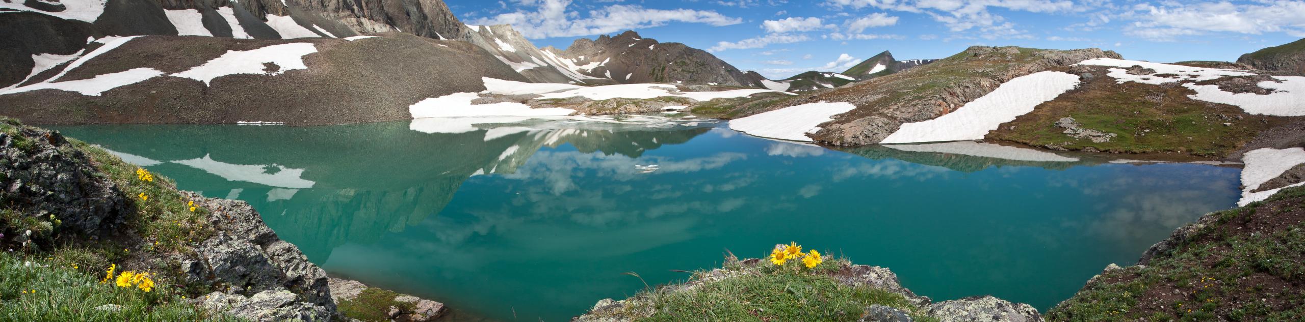
Setting out from the parking area, you will make your way south along the road for 1.0mi, as it climbs uphill through the American Basin alongside the banks of Lake Fork. Take some time here to enjoy the sweeping views across the basin, as you gradually work your way to a fork in the trail.
Taking the path on the left, you will traverse the rocky terrain near the shores of Sloan Lake, before beginning the steep ascent towards the summit of Handies Peak. Here, you will make your way through a series of switchbacks to the northeast to make your way up onto the ridge, at which point, it is only a short push up to the summit.
After reaching the top of Handies Peak, you will be inundated with breathtaking views of the surrounding landscape, including Whitecross Mountain to the northeast, Cinnamon Mountain to the northwest, and the American Basin in between. Once you have taken in the views, simply head back down along the same trail to return to the trailhead below.
Trail Highlights
Handies Peak
Situated in the San Juan sub-range of the Rocky Mountains, Handies Peak (14052ft) is a rugged fourteener overlooking the American Basin. While it is a fairly high and prominent peak, the route leading up to the summit is short and non-technical, making it one of the easier fourteeners in Colorado to climb.
Frequently Asked Questions
Is Handies Peak a fourteener?
At 14052ft Handies Peak is one of the easiest fourteeners to climb, as it is a short route to the summit that requires no scrambling.
How long does it take to hike Handies Peak?
It takes approximately 4 hours round trip to summit Handies Peak.
Insider Hints
Wear proper hiking footwear to better traverse the trail.
You will need a 4x4 vehicle with high clearance in order to reach the trailhead.
Keep an eye out for cheeky marmots along the trail!
Similar hikes to the Handies Peak Hike hike

Twin Buttes and Lightner Creek Loop Trail
The Twin Buttes and Lightner Creek Loop Trail is a great hiking route in Durango, Colorado that features some challenging…

Meadow Loop via Horse Gulch Trail
The Meadow Loop via Horse Gulch Trail is a great hiking route in Durango that will take you uphill for…

The Ridge Trail
The Ridge Trail - also known as Raiders Ridge Trail - is an amazing hiking route in Durango, Colorado that…
Comments