
Geyser Trail
View Photos
Geyser Trail
Difficulty Rating:
The Geyser Trail is a great family-friendly route in Colorado that will take you uphill through the forest to reach the location of a natural geyser. While out hiking the trail, you will work your way up a wooded slope through a plentiful amount of birch trees, before taking in the views of the bubbling geyser. If you are looking for a secluded adventure in the San Juan Mountains, then this is an ideal trail.
Getting there
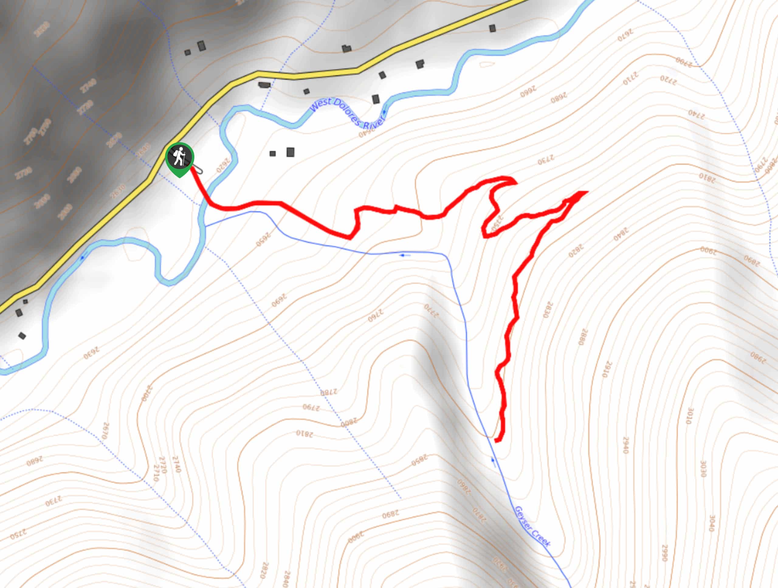
The starting point for the Geyser Trail can be found along Dunton Road, just 2.2mi southwest of the Dunton Hot Springs.

About
| Backcountry Campground | No |
| When to do | April-October |
| Pets allowed | Yes - On Leash |
| Family friendly | Yes |
| Route Signage | Average |
| Crowd Levels | Low |
| Route Type | Out and back |
Geyser Trail
Elevation Graph
Weather
Geyser Trail Description
Although it is a bit out of the way to access, the Geyser Trail is an awesome hiking route to explore if you find yourself in this secluded part of the San Juan Mountains, as you will be able to meander through the beautiful forests and take in the views of an interesting natural feature.
Setting out from the parking area, you will head to the southeast and cross over the West Dolores River, before entering into the dense cover of the forest. Here, you will climb uphill alongside the banks of Geyser Creek, enjoying the views of the surrounding birch trees as you make your way to the geyser. Once there, you can pause for a quick rest and experience the bubbling waters of this fascinating geological feature, before heading back downhill on the return to the trailhead.
Similar hikes to the Geyser Trail hike

Twin Buttes and Lightner Creek Loop Trail
The Twin Buttes and Lightner Creek Loop Trail is a great hiking route in Durango, Colorado that features some challenging…

Meadow Loop via Horse Gulch Trail
The Meadow Loop via Horse Gulch Trail is a great hiking route in Durango that will take you uphill for…

The Ridge Trail
The Ridge Trail - also known as Raiders Ridge Trail - is an amazing hiking route in Durango, Colorado that…
Comments