
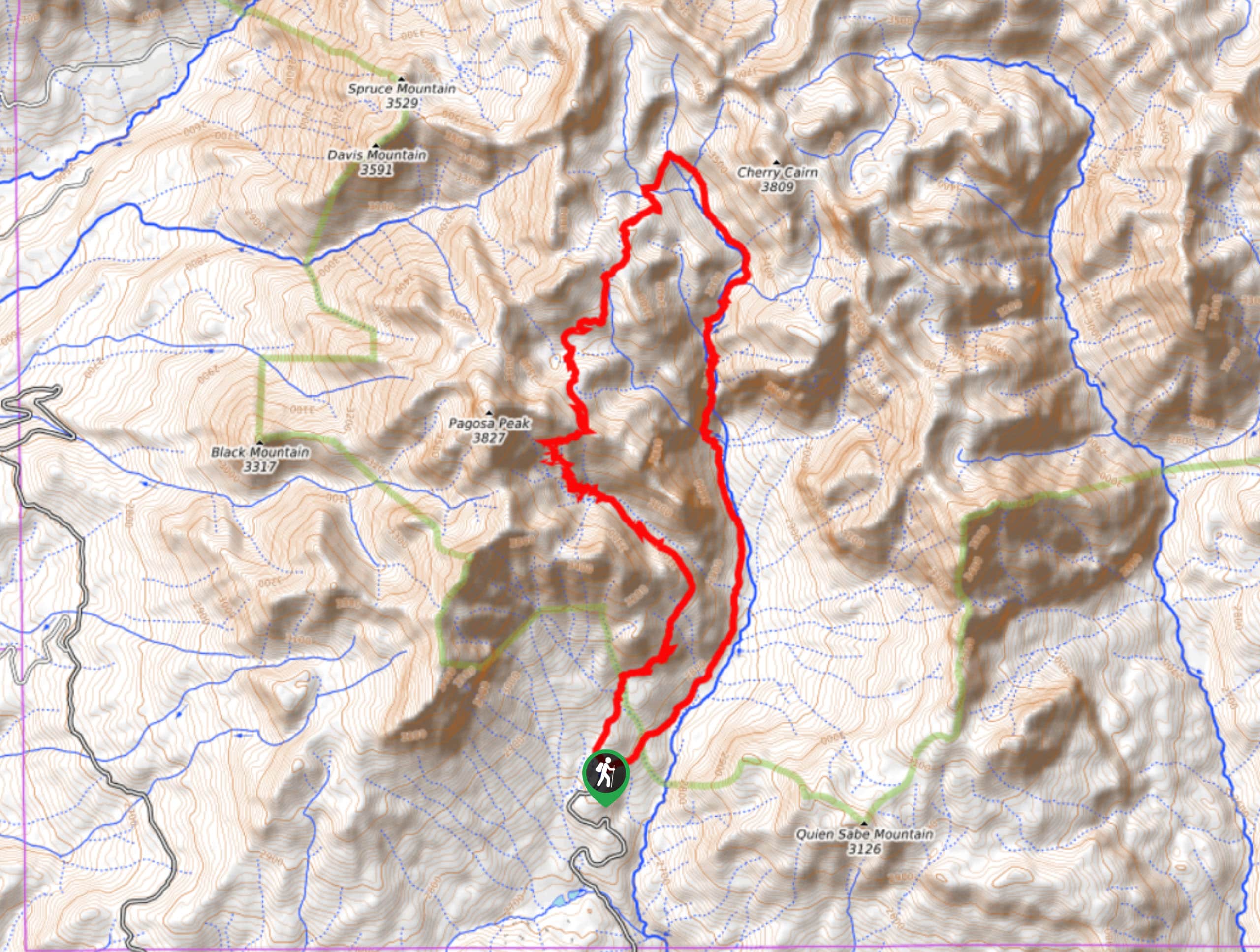
Four Mile Creek and Anderson Trail Loop
View Photos
Four Mile Creek and Anderson Trail Loop
Difficulty Rating:
The Four Mile Creek and Anderson Trail Loop is a challenging route north of Pagosa Springs that will take you into the San Juan Mountains to view several waterfalls. While out hiking the trail, you will pass through stunning forests along the banks of Four Mile Creek and take in the views of the Lower and Upper Four Mile Creek Falls, before visiting Four Mile Lake and looping around through the mountains along the Anderson Trail. Hikers should be aware that this hike passes through bear country, so make sure to bring bear spray and follow all best bear safety practices while out on the trail.
Getting there
The trailhead for the Four Mile Creek and Anderson Trail Loop can be found at the Four Mile Trailhead along County Road 645.

About
| Backcountry Campground | Four Mile Lake |
| When to do | July-September |
| Pets allowed | Yes |
| Family friendly | No |
| Route Signage | Average |
| Crowd Levels | Low |
| Route Type | Circuit |
Four Mile Creek and Anderson Trail Loop
Elevation Graph
Weather
Four Mile Creek and Anderson Trail Loop Description
While an adventure along the Four Mile Creek and Anderson Trail Loop can certainly be completed in a single day by experienced and physically fit hikers, most people will choose to break this up into a multi-day adventure with an overnight stay near Four Mile Lake. however you approach the hike, you will be inundated with beautiful views of the San Juan Mountains.
Setting out from the trailhead, you will make your way to the northeast through the forest and follow along the winding banks of Four Mile Creek. As you continue through the beautiful terrain, you will pass through some lovely alpine meadows, before arriving at a series of stunning waterfalls along Four Mile Creek.
After taking in the views of the cascading falls, you will continue uphill to the north to make your way further into the mountains, where you will come to a campsite next to the charming shores of Four Mile Lake. From here, you will follow the Anderson Trail as it traverses the undulating terrain to the southwest, skirting around the slopes of Pagosa Peak, before descending back into the trailhead where you began your lengthy adventure.
Similar hikes to the Four Mile Creek and Anderson Trail Loop hike

Twin Buttes and Lightner Creek Loop Trail
The Twin Buttes and Lightner Creek Loop Trail is a great hiking route in Durango, Colorado that features some challenging…

Meadow Loop via Horse Gulch Trail
The Meadow Loop via Horse Gulch Trail is a great hiking route in Durango that will take you uphill for…

The Ridge Trail
The Ridge Trail - also known as Raiders Ridge Trail - is an amazing hiking route in Durango, Colorado that…
Comments