Engineer Mountain Trail
View Photos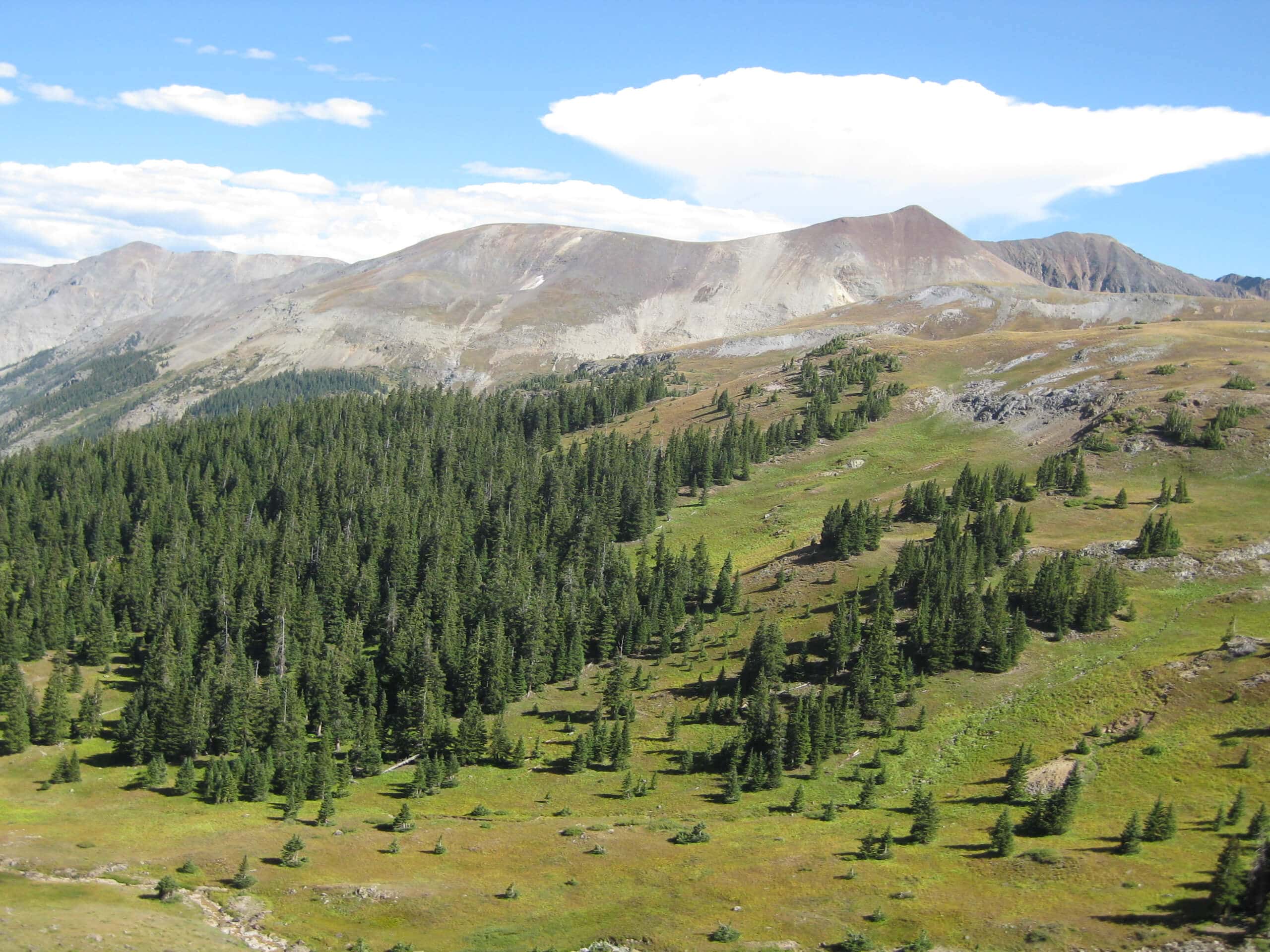
Engineer Mountain Trail
Difficulty Rating:
Hiking the Engineer Mountain Trail is a fun, albeit challenging, adventure in the San Juan Mountains of Colorado that will take you through the rugged landscape just below the summit. While out on the trail, you will climb uphill through the forests and meadows that make up the lower slopes of Engineer Mountain, passing just below the summit while taking in amazing views of the rugged peak and surrounding landscape. While this route doesn’t climb up to the summit of the peak, it is still an exceptionally scenic journey that is perfectly suited for those who don’t want to challenge themselves with technical terrain.
Getting there
The starting point for the Engineer Mountain Trail can be found 19.1mi north of Hermosa, just off US-550.

About
| Backcountry Campground | No |
| When to do | May-October |
| Pets allowed | Yes |
| Family friendly | No |
| Route Signage | Average |
| Crowd Levels | Moderate |
| Route Type | Out and back |
Engineer Mountain Trail
Elevation Graph
Weather
Engineer Mountain Trail Description
While it does feature some steep and rugged terrain, the only challenging aspect of the Engineer Mountain Trail is the overall length, as you will not actually be making the technical ascent of the mountain. Be sure to wear proper hiking boots and bring plenty of water to stay hydrated on your hike. Additionally, you should make sure to bring bear spray in order to protect yourself in the event of an interaction, as well as bug spray to keep the pests away.
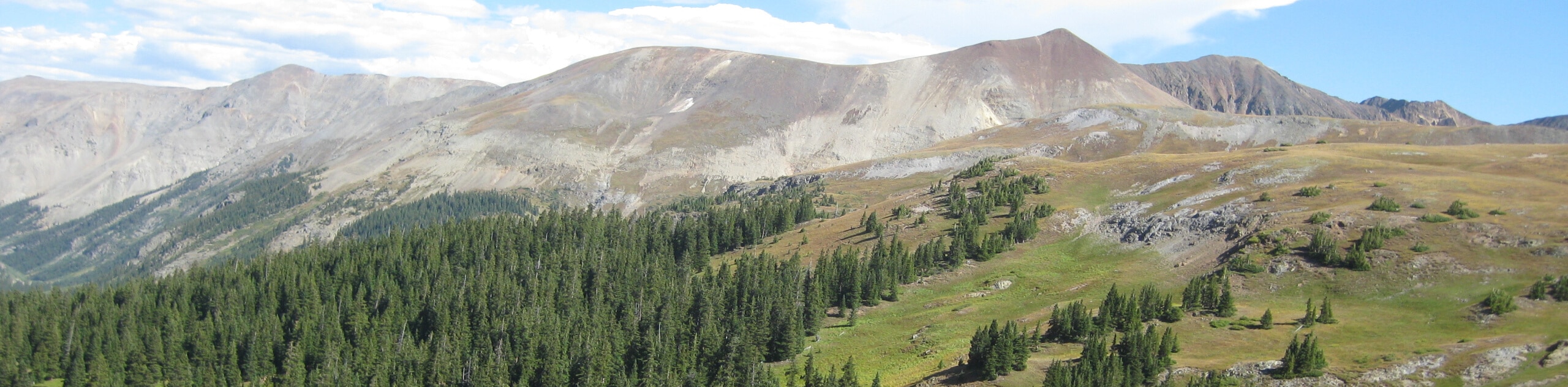
The Engineer Mountain Trail might not have an amazing summit viewpoint, but there will be plenty of scenic views to be had along this lengthy trail. In addition to climbing through the serene woodland landscape, you will also pass through wonderful alpine meadows and have the chance to gaze out at nearby peaks, making this an excellent option if you are looking for a long distance hike near Durango.
Setting out from the trailhead, follow the path leading to the northwest for 260ft, where you will quickly come to a junction. Taking the path on the right, you will begin climbing uphill through a mixture of meadows and tranquil forests, gaining elevation as you work your way towards the Engineer Mountain.
Once you have been on the trail for 2.4mi, the forest cover will begin to thicken and the terrain will become more rugged, as you continue climbing further uphill. After another 2.4mi, you will break free of the forest and enter into a beautiful alpine meadow that offers amazing views of Engineer Mountain to the west.
Continue on to the north and make your way across the peaceful meadow. If you time your hike properly, the warm summer weather will help countless wildflowers bloom across the meadow, making for a truly amazing backdrop as you traverse the trail.
After another 1.7mi along the trail, you will descend slightly through the forest and make a brief climb up to the endpoint of the route near a junction with the Coal Creek Trail. At this point, you can pause for a quick rest before heading back along the same trail to relive the wonderful scenery of Engineer Mountain and the surrounding Colorado landscape.
Trail Highlights
Engineer Mountain
Situated in the San Juan subrange of the Rocky Mountains, Engineer Mountain is a prominent peak that can be found just west of Coal Ban Pass. The position of the mountain along US-550 makes it one of the most-photographed peaks in the San Juan Mountains, thanks to the numerous scenic viewpoints along the highway that feature it in the backdrop.
Insider Hints
Wear good hiking boots with ankle support.
There are plenty of bugs along the trail, so repellent will come in handy.
Bears are sometimes spotted in the area, so bring bear spray and exercise all precautions.
Time your hike for the summer to experience the beautiful wildflower covered meadows.
Similar hikes to the Engineer Mountain Trail hike

Twin Buttes and Lightner Creek Loop Trail
The Twin Buttes and Lightner Creek Loop Trail is a great hiking route in Durango, Colorado that features some challenging…

Meadow Loop via Horse Gulch Trail
The Meadow Loop via Horse Gulch Trail is a great hiking route in Durango that will take you uphill for…

The Ridge Trail
The Ridge Trail - also known as Raiders Ridge Trail - is an amazing hiking route in Durango, Colorado that…
Comments