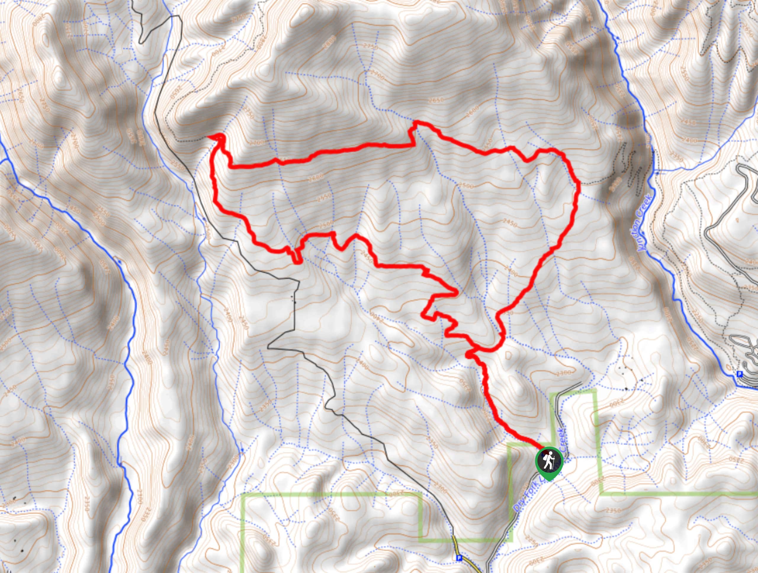
Dry Fork Loop Trail
View Photos
Dry Fork Loop Trail
Difficulty Rating:
The Dry Fork Loop Trail is a great intermediate length hiking route near Durango, Colorado that features a serene woodland landscape and scenic views. While out on the trail, you will climb uphill through a beautiful meadow, before looping around the forest to reach the viewpoint known as Gudy’s Rest. This is a fantastic adventure that should be explored if you find yourself in Durango.
Getting there
The starting point for the Dry Fork Loop Trail can be found along County Road 208, just 7.1mi northwest of Durango.

About
| Backcountry Campground | No |
| When to do | April-November |
| Pets allowed | Yes |
| Family friendly | Older Children only |
| Route Signage | Average |
| Crowd Levels | Moderate |
| Route Type | Lollipop |
Dry Fork Loop Trail
Elevation Graph
Weather
Dry Fork Loop Trail Description
Featuring a beautiful stretch of woodland landscape and scenic views from a bench that surveys the surrounding landscape, the Dry Fork Loop Trail is an exceptional route that is perfectly suited for a fun day out on the trails near Durango.
Setting out from the parking area, you will follow the trail to the northwest and climb through a scenic meadow, before entering into the cover of the forest. Keeping right at the junction in the trail, you will cross over Dry Fork Lightner Creek and climb further uphill to reach the stunning viewpoint at Gudy’s Rest.
This beautiful vista was named after Gudy Gaskill, the woman largely recognized for being the driving spirit behind the creation of the Colorado Trail. After taking in the views, you will head west along the hillside and begin descending to the southeast, once again traversing the forests and meadows on the return to the trailhead.
Similar hikes to the Dry Fork Loop Trail hike

Twin Buttes and Lightner Creek Loop Trail
The Twin Buttes and Lightner Creek Loop Trail is a great hiking route in Durango, Colorado that features some challenging…

Meadow Loop via Horse Gulch Trail
The Meadow Loop via Horse Gulch Trail is a great hiking route in Durango that will take you uphill for…

The Ridge Trail
The Ridge Trail - also known as Raiders Ridge Trail - is an amazing hiking route in Durango, Colorado that…
Comments