Castle Rock via Elbert Creek Trail
View Photos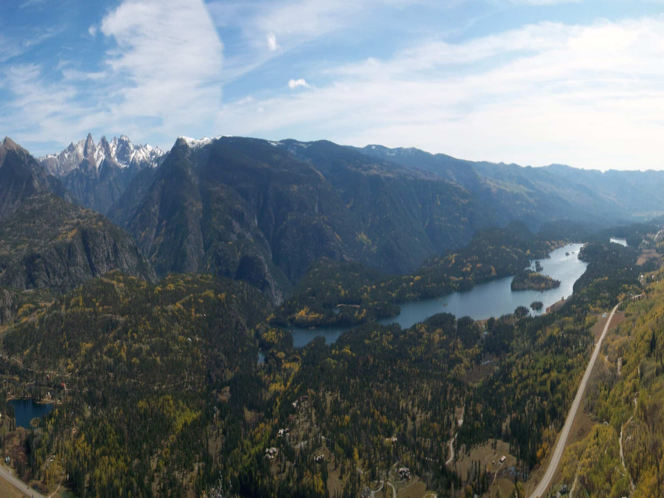
Castle Rock via Elbert Creek Trail
Difficulty Rating:
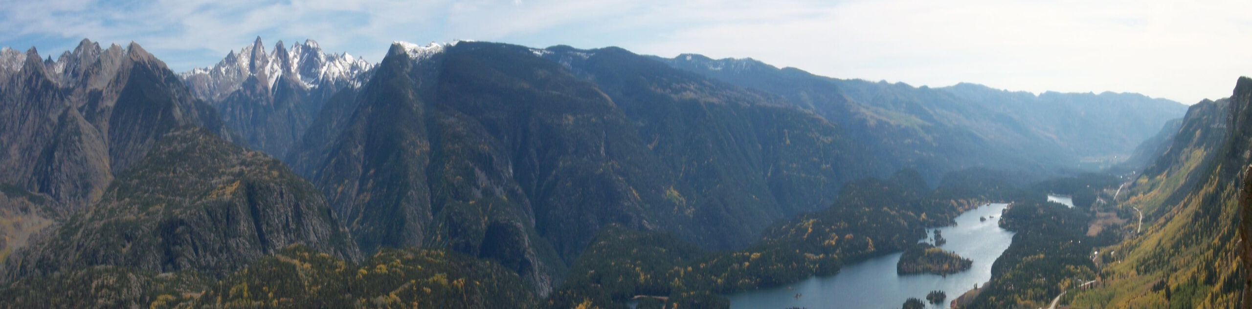
The Castle Rock via Elbert Creek Trail is a fantastic hiking route in the San Juan Mountains that offers incredible views of the surrounding area. While out hiking the trail, you will make your way up the steep and forested mountainside, before looping around to the east for the final push to the summit of Castle Rock and stunning views of the valley. Take note that this trail can get quite muddy after periods of wet weather, so be sure to wear appropriate hiking footwear for the conditions.
Getting there
The starting point for the Castle Rock via Elbert Creek Trail can be found along US-550 near the junction with Needles Drive.

About
| Backcountry Campground | No |
| When to do | March-October |
| Pets allowed | Yes |
| Family friendly | Older Children only |
| Route Signage | Average |
| Crowd Levels | Moderate |
| Route Type | Out and back |
Castle Rock via Elbert Creek Trail
Elevation Graph
Weather
Castle Rock via Elbert Creek Trail Description
While it may be a bit steep in certain areas, the Castle Rock via Elbert Creek Trail is an exceptional hiking route if you are looking to experience the rugged terrain and natural beauty of the San Juan Mountains of Colorado.
Setting out from the trailhead, you will make your way to the northwest and almost immediately begin climbing up the steep mountainside. As you do so, you will pass through a dense and beautifully scenic stretch of forest, before the trail cuts back around to the east.
Here, you will make the final push uphill through some rocky terrain to reach the top of Castle Rock, where you will experience incredible views across the surrounding San Juan Mountains. After experiencing the scenery, carefully make your way down from the summit and back through the forest on the return leg into the trailhead.
Similar hikes to the Castle Rock via Elbert Creek Trail hike

Twin Buttes and Lightner Creek Loop Trail
The Twin Buttes and Lightner Creek Loop Trail is a great hiking route in Durango, Colorado that features some challenging…

Meadow Loop via Horse Gulch Trail
The Meadow Loop via Horse Gulch Trail is a great hiking route in Durango that will take you uphill for…

The Ridge Trail
The Ridge Trail - also known as Raiders Ridge Trail - is an amazing hiking route in Durango, Colorado that…
Comments