
Cascade Creek East Fork Hike
View Photos
Cascade Creek East Fork Hike
Difficulty Rating:
The Cascade Creek East Fork Hike is a fantastic adventure in the San Juan Mountains that will lead you along a winding creek for waterfall views. While out on the trail, you will pass through a lovely woodland landscape alongside the banks of Cascade Creek, taking time to stop off at the halfway and end points of the trail for some exceptional waterfall views. Hikers should take note that sections of this trail are a bit rugged and often quite wet, making proper hiking footwear with good support a necessity.
Getting there
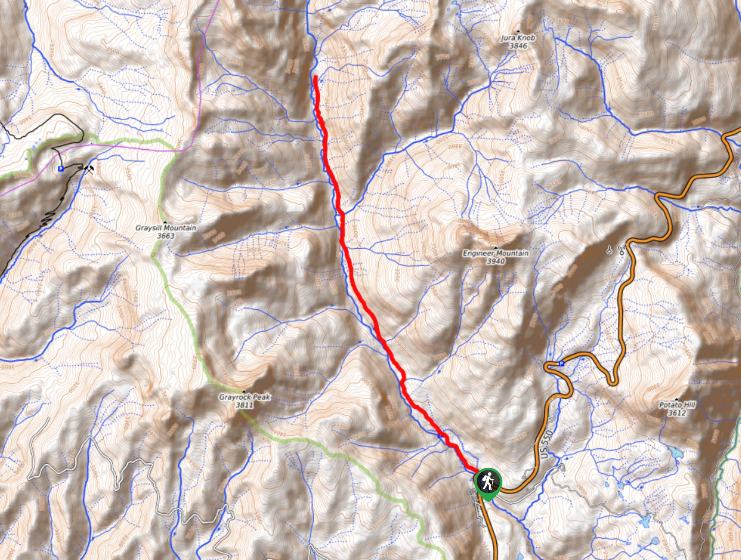
The trailhead for the Cascade Creek East Fork Hike can be found along US 550, just 2.0mi north of the Durango Nordic Center.

About
| Backcountry Campground | No |
| When to do | July-October |
| Pets allowed | Yes - On Leash |
| Family friendly | No |
| Route Signage | Average |
| Crowd Levels | Moderate |
| Route Type | Out and back |
Cascade Creek East Fork Hike
Elevation Graph
Weather
Cascade Creek East Fork Hike Description
Whether you are simply looking for a longer hike through the San Juan Mountains or are after some incredible waterfall views, the Cascade Creek East Fork hike is the perfect route to get you outside and enjoying the breathtaking Colorado wilderness.
Setting out from the parking area, you will head to the northwest and cross over US 550, picking up Cascade Creek 783 and following it to the northwest. Here, you will continue along the road until it narrows into a footpath and enters into the dense cover of the forest.
Keep on hiking through the wonderful woodland setting to the northwest as the trail runs parallel to the banks of Cascade Creek. Eventually, you will come to the point where Graysill Creek flows into Cascade Creek, offering some beautiful waterfall views. After taking in the views, continue north along the trail as it cuts through the valley, eventually bringing you through several charming meadows to arrive at the endpoint of the trail and another scenic waterfall. From here, you can turn back and retrace your steps to the trailhead where you started.
Similar hikes to the Cascade Creek East Fork Hike hike

Twin Buttes and Lightner Creek Loop Trail
The Twin Buttes and Lightner Creek Loop Trail is a great hiking route in Durango, Colorado that features some challenging…

Meadow Loop via Horse Gulch Trail
The Meadow Loop via Horse Gulch Trail is a great hiking route in Durango that will take you uphill for…

The Ridge Trail
The Ridge Trail - also known as Raiders Ridge Trail - is an amazing hiking route in Durango, Colorado that…
Comments