Big Lake Trail
View Photos
Big Lake Trail
Difficulty Rating:
The Big Lake Trail is a fantastic hiking route in the San Juan Mountains that will take you through some steep terrain to reach a lake. While out hiking the trail, you will make your way through a beautifully serene stretch of forest and climb up a steep slope to arrive at the shores of scenic Big Lake. Although the trail is quite steep, this route is the perfect challenge for beginner hikers or families with kids.
Getting there
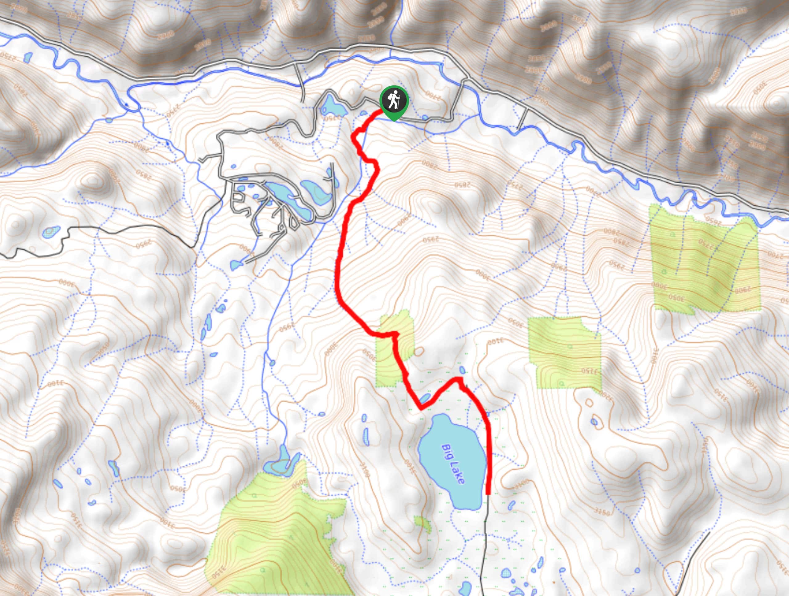
The Big Lake Trailhead can be found along Silverlakes Road, just 6.5mi southeast of the Lost Elk Lodge in Jasper, Colorado.

About
| Backcountry Campground | Big Lake |
| When to do | May-October |
| Pets allowed | Yes |
| Family friendly | Yes |
| Route Signage | Average |
| Crowd Levels | Moderate |
| Route Type | Out and back |
Big Lake Trail
Elevation Graph
Weather
Big Lake Trail Description
Whether you are a seasoned hiker looking for a moderate trail or a beginner trying to challenge themselves, the Big Lake Trail is a fantastic option that will allow you to fully take in the natural beauty of the San Juan Mountains of Colorado.
Setting out from the trailhead on Silverlakes Road, you will make your way to the south and immediately enter into the cover of the forest. Here, you will begin climbing up the steep hillside, taking some time to enjoy the tranquil atmosphere of the forest and the intermittent views through the breaks in the foliage.
After trudging your way through the steep and rugged terrain, you will break free of the forest canopy and arrive at a large meadow surrounding the shores of Big Lake. Here, you can take some time to explore the area and experience the views, before heading back down along the trail.
Similar hikes to the Big Lake Trail hike

Twin Buttes and Lightner Creek Loop Trail
The Twin Buttes and Lightner Creek Loop Trail is a great hiking route in Durango, Colorado that features some challenging…

Meadow Loop via Horse Gulch Trail
The Meadow Loop via Horse Gulch Trail is a great hiking route in Durango that will take you uphill for…

The Ridge Trail
The Ridge Trail - also known as Raiders Ridge Trail - is an amazing hiking route in Durango, Colorado that…
Comments