Mount San Jacinto Hike
View Photos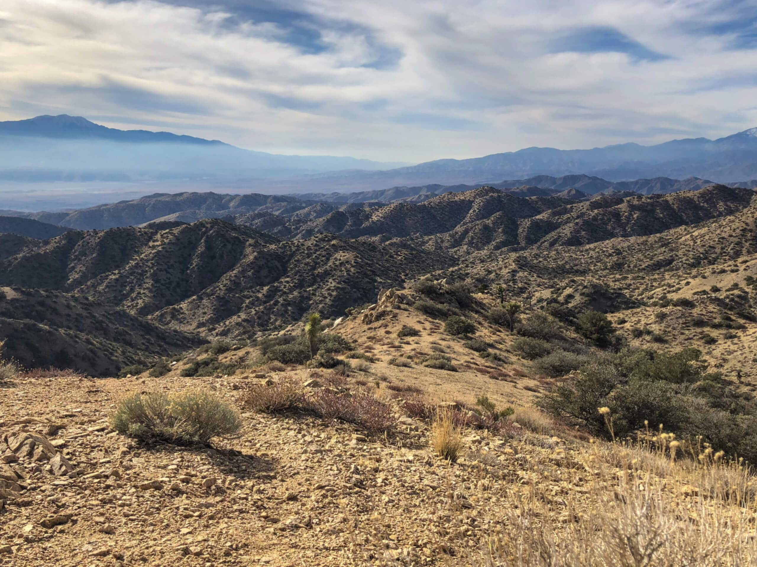
Mount San Jacinto Hike
Difficulty Rating:
The Mount San Jacinto Hike is an unforgettable, albeit challenging, adventure in the San Bernardino National Forest that will take you up to the summit of Southern California’s second tallest peak. While out hiking the trail, you will make your way through a pristine stretch of wilderness, before pushing on to the summit of Mount San Jacinto for incredible views that stretch out to the ocean on a clear day. If you are planning on hiking in Southern California, then you certainly will not want to miss this trail.
Getting there
The trailhead for the Mount San Jacinto Hike can be found at the Upper Terminal Mountain Station of the Palm Springs Aerial Tramway.

About
| Backcountry Campground | No |
| When to do | March-November |
| Pets allowed | No |
| Family friendly | No |
| Route Signage | Average |
| Crowd Levels | High |
| Route Type | Out and back |
Mount San Jacinto Hike
Elevation Graph
Weather
Mount San Jacinto Hike Description
While the Mount San Jacinto Hike is a challenging adventure, it is not the terrain that is overly difficult, but rather the elevation along the trail and its overall distance. Make sure that you are prepared and physically fit for such a journey. Additionally, there is a cost to access the trail via the Palm Springs Aerial Tramway, so be sure to factor that into your journey. Lastly, this is a popular route, so try to arrive early to at least beat out some of the crowds.
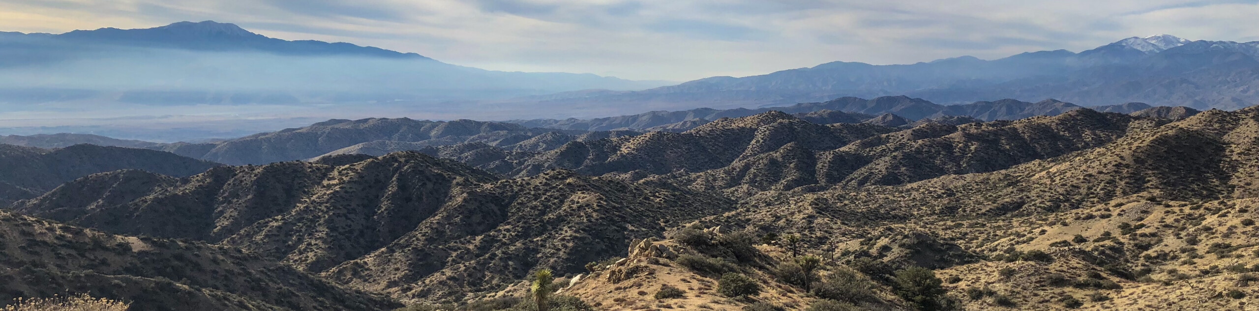
Although it is a heavily-trafficked trail, the Mount San Jacinto Hike is an incredible adventure that will yield plenty of amazing views and memories. While there is a fair amount of elevation gain, the terrain leading up to the summit is actually fairly mild, making this a great hike if you are looking to push yourself without too much trouble. If you find yourself in Southern California, this is one of the must-do routes in the area.
Setting out from the Upper Terminal Mountain Station of the Palm Springs Aerial Tramway, you will follow the path to the southwest as it descends slightly through a series of switchbacks. After 0.3mi, you will pass by a ranger station where you can pop in to pick up your free wilderness pass before continuing on your hike.
From the ranger station, continue on along the trail as it leads to the southwest for another 0.5mi, at which point you will turn left at a junction and cross over Long Valley Creek. Keeping straight for the next 1.3mi, you will pass through a beautiful stretch of forest and arrive at a junction in the path near another ranger station.
Turning left here, you will make your way southwest and uphill for the next 0.9mi, before turning right at another junction. With your direction now turned to the north, you will press on uphill for 0.8mi, keeping left along the lower slopes of Jean Peak to arrive at the point where the real climb begins.
Taking the path on the left, you will work your way up the slopes of Mount San Jacinto, keeping left for 0.8mi to come to another junction. Here, you will turn right to face the peak and complete the final 0.3mi push up to the rock-strewn summit of Mount San Jacinto.
From the top of the second tallest peak in Southern California, take a few moments to appreciate the natural beauty of the San Bernardino National Forest spread out before you, including views that extend out to the Pacific Ocean on a clear day, as well as San Gorgonio to the northwest. After pausing for a quick break, simply head back along the trail to retrace your steps for the return leg of the Mount San Jacinto Hike.
Trail Highlights
San Jacinto Peak
Often referred to as Mount San Jacinto, this rugged peak stands tall at 10834ft and is the second tallest peak in Southern California. It is situated in the San Jacinto Mountain Range and serves as the southern border of the San Gorgonio Pass. Known as I a kitch (smooth cliffs) to the Cahuilla Indians, San Jacinto Peak is one of the most prominent peaks in the contiguous states it has been said that “No Southern California Hiker worth his salt would miss climbing San Jack at least once).
Frequently Asked Questions
Can you see the ocean from the summit of Mount San Jacinto?
Yes, on a clear day views from the summit of Mount San Jacinto extend out to the Pacific Ocean.
Can I bring my dog up Mount San Jacinto?
Due to the nature of the terrain and the need to utilize the Palm Springs Aerial Tramway, dogs are not permitted on the trail leading up Mount San Jacinto.
Insider Hints
Pop into the Peaks Restaurant either before or after your hike for a delicious meal.
There is a fee of $10 per vehicle for parking, so make sure to take that into consideration before heading out.
You will need to purchase a ticket to use the tram and access the trail, so be sure to do so in advance.
A wilderness pass is needed to explore the trail. This is free and can be picked up at the nearby ranger station found along the trail.
Similar hikes to the Mount San Jacinto Hike hike

Palm View Peak Trail
The Palm View Peak Trail is a great hiking route in the San Bernardino National Forest that features a solid…

Cram Peak Ridge Trail
The Cram Peak Ridge Trail is a fantastic, albeit difficult, hiking route in the San Bernardino National Forest that will…
Highway 138 VOE Trail
The Highway 138 VOE Trail is a fantastic hiking route north of the Valley of Enchantment that will see you…
Comments