
Hurkey Creek Trail
View Photos
Hurkey Creek Trail
Difficulty Rating:
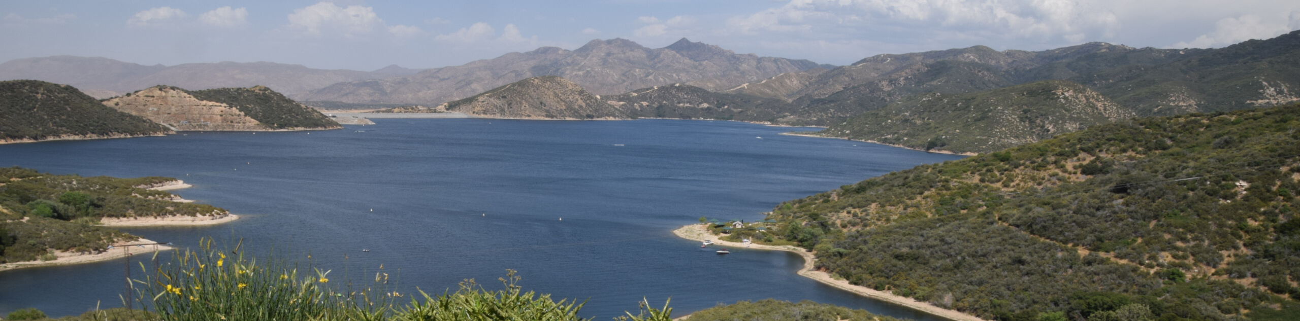
The Hurkey Creek Trail is a great family-friendly hiking route in the San Bernardino National Forest that features some rugged terrain and scenic views. While out hiking the trail, you will climb slightly uphill through some rocky terrain, where you will have some stunning views of nearby mountain peaks. Hikers should take note that wildfires in recent years have destroyed much of the shade along the trail, leaving it very exposed to the sun.
Getting there
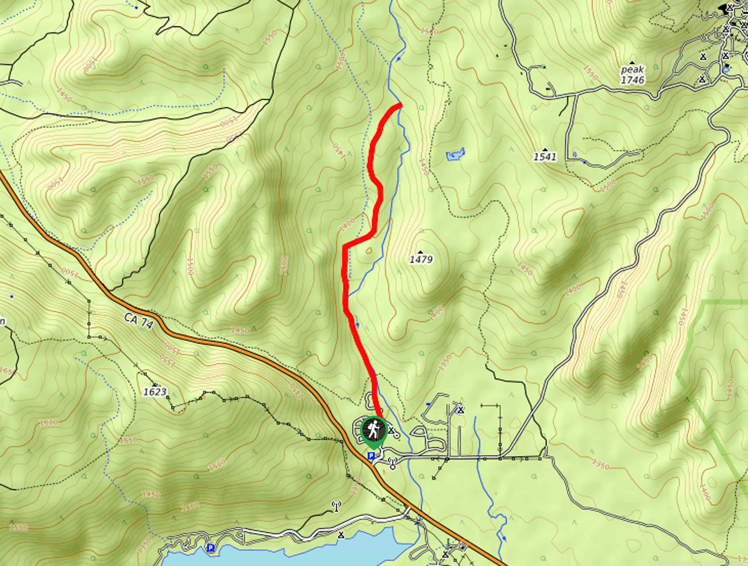
The starting point for the Hurkey Creek YTrail can be found at Hurkey Creek Park along the Pines to Palms Highway/CA-74.

About
| Backcountry Campground | Hurkey Creek Park |
| When to do | Year-Round |
| Pets allowed | Yes |
| Family friendly | Yes |
| Route Signage | Average |
| Crowd Levels | Moderate |
| Route Type | Out and back |
Hurkey Creek Trail
Elevation Graph
Weather
Hurkey Creek Trail Description
While the landscape along Hurkey Creek is quite beautiful, recent wildfires have destroyed mu8ch tof the tree canopy and shade that comes along with it. If you are planning on hiking this trail, be sure to wear sunscreen or bring protective clothing. Additionally, there are some rocky stretches of terrain along the route, so be sure to wear proper hiking boots for the best footing.
Whether you are looking for a quick day hike or are planning on camping overnight in the area, the Hurkey Creek Trail is an excellent hiking route that can be enjoyed by explorers of all ages and skill levels. Gorgeous mountain views and a charming creekside setting await on this short adventure in the scenic expanse of the San Bernardino National Forest.
Setting out from the trailhead at the Hurkey Creek Campground, make your way north along the camp road for 0.1mi to pass by the cabin on your left and pick up the trail branching off to the right. Here, you will continue on to the north through the tree cover, much of which has been scarred by recent wildfires.
Continuing on to the north, you will follow closely alongside the winding banks of Hurkey Creek as it cuts across the picturesque landscape. Take some time here to appreciate the natural beauty of the surrounding forests and mountains, while also keeping an eye out for any wildlife that may be present in the area.
After roughly 0.8mi along the trail, the path will bend to the northeast through some rocky terrain, before climbing gently uphill to arrive at the endpoint of the route along Hurkey Creek. This is a lovely place to pause for lunch and to explore the creekside setting, so make sure to spend a bit of time enjoying the peaceful setting.
Once you have taken in the views of the surrounding mountains, simply head back along the same path to return to the trailhead where you began your adventure on the Hurkey Creek Trail. If you are camping in the area for a few days, make sure to explore some of the other amazing trails that can be found close by.
Frequently Asked Questions
Where is Hurkey Creek located?
Hurkey Creek can be found in the San Jacinto Mountains of California, just southeast of the city of Hemet.
Can I camp at Hurkey Creek?
Yes, there is a large campground at Hurkey Creek that offers great facilities for camping in the San Jacinto Mountains.
Insider Hints
Wear proper hiking footwear.
Toilet facilities can be found at the Hurkey Creek Park.
This trail is fairly exposed to the sun, so make sure to wear sunscreen or protective clothing.
Similar hikes to the Hurkey Creek Trail hike

Bluff Mesa Hike
The Bluff Mesa Hike is a fantastic adventure in Southern California that features a lovely woodland setting and can be…
Highway 138 VOE Trail
The Highway 138 VOE Trail is a fantastic hiking route north of the Valley of Enchantment that will see you…
Ponderosa Nature Trail
The Ponderosa Nature Trail is a quick and easy hiking loop in the San Bernardino National Forest that features a…
Comments