Heart Rock Trail
View Photos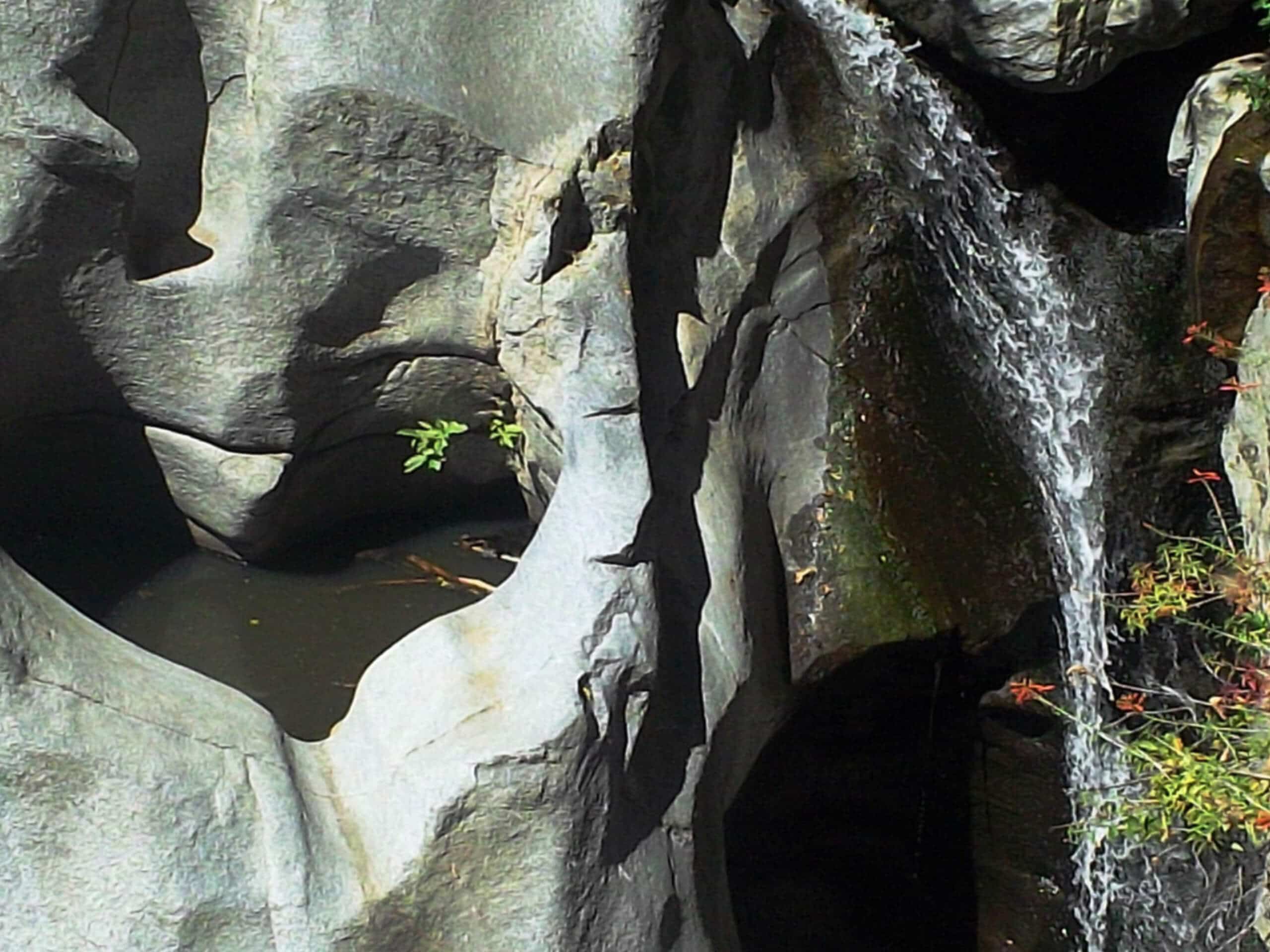
Heart Rock Trail
Difficulty Rating:
The Heart Rock Trail is a laidback adventure in the San Bernardino National Forest that will take you through the woodlands to view an interesting geological feature. While out hiking the trail, you will meander along paved and rocky paths through the forest, before arriving at the weathered, heart-shaped formation known as Heart Rock. Although the trailhead is located beyond Camp Seely, make sure not to park there as it is private property. Instead, utilize the parking lot a bit further south along CA-138 and walk the remainder of the way.
Getting there
The parking area for the Heart Rock Trail can be found along CA-138, just before Camp Seely. You will then need to walk NW through Camp Seely to access the trailhead.

About
| Backcountry Campground | Camp Seely |
| When to do | Year-Round |
| Pets allowed | Yes - On Leash |
| Family friendly | Yes |
| Route Signage | Average |
| Crowd Levels | High |
| Route Type | Circuit |
Heart Rock Trail
Elevation Graph
Weather
Heart Rock Trail Description
Even though it is only a short adventure the Heart Rock Trail still features some rugged woodland terrain that is uneven under foot, so make sure to wear proper hiking footwear for this trail. This is also an extremely popular route that sees a fair amount of foot traffic, so try to arrive early to secure parking. Lastly, although the hike begins near Camp Seely, the parking area is actually located a bit further south along CA-138.
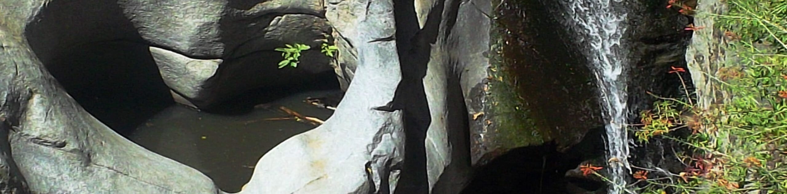
If you enjoy quick little adventures that feature charming waterfalls, then the Heart Rock Trail is a great route for you to explore in your spare time. Throughout the hike you will meander through wonderfully scenic forest terrain, take in the views of Seely Creek Falls, and have the chance to check out Heart Rock, a weathered depression in the stone near the falls that is in a near-perfect heart shape. This is a fun adventure no matter your age or skill level.
Setting out from the trailhead near Camp Seely, you will follow the road to the northwest for a short distance, before entering into the cover of the forest on your right. Here, you will make your way north through the beautiful woodland landscape for about 0.5mi, at which point the trail will turn east and head slightly downhill.
After arriving at the site of the Seely Creek Falls, take some time to explore the area and take in the natural beauty of Heart Rock and the falls, which are a bit less impressive during the dry periods of summer.
After taking in the views, you will continue along the trail as it heads south through the forest for about 0.5mi to meet back up with the road near Camp Seely. From here, make your way back down CA-138 to return to the parking area for the Heart Rock Trail.
Trail Highlights
Heart Rock Falls/Seely Creek Falls
Located in the San Bernardino National Forest, just north of the Valley of Enchantment, the Heart Rock/Seely Creek Falls is a charming waterfall with an approximately 25ft–30ft drop. While the falls are certainly pleasant to look at, the real highlight of this hike is the perfectly formed heart-shaped depression right next to the falls that is the result of natural weathering.
Frequently Asked Questions
Is Heart Rock man-made?
Although it is formed in the shape of a near perfect heart, Heart Rock is actually a naturally occurring formation that was weathered over time by the forces of the nearby Heart Rock/Seely Creek Falls.
Do I need an Adventure Pass to hike to Heart Rock?
There are currently no permits required to hike along the Heart Rock Trail.
Insider Hints
Make sure to park at the proper parking area along CA-138 and not at Camp Seely.
Be sure to keep your dog on a leash at all times.
Wear comfortable walking shoes for this adventure.
Similar hikes to the Heart Rock Trail hike

Bluff Mesa Hike
The Bluff Mesa Hike is a fantastic adventure in Southern California that features a lovely woodland setting and can be…

Palm View Peak Trail
The Palm View Peak Trail is a great hiking route in the San Bernardino National Forest that features a solid…

Cram Peak Ridge Trail
The Cram Peak Ridge Trail is a fantastic, albeit difficult, hiking route in the San Bernardino National Forest that will…
Comments