Forest Service Road N22 Hike
View Photos
Forest Service Road N22 Hike
Difficulty Rating:
The Forest Service Road N22 Hike is a fun route near San Bernardino, California that will see you climb uphill through the forest for views of the surrounding San Bernardino Mountains. While out hiking the trail, you will steadily gain elevation along an old, overgrown forest service road while taking in the beautiful views of wildlife and the mountainous landscape. Hikers should take note that you will need to display an adventure pass on your vehicle in order to set out on this hike.
Getting there
The trailhead for the Forest Service Road N22 Hike can be found along CA-330, just 10.4mi southwest of Running Springs at the City Creek Fire Station.

About
| Backcountry Campground | No |
| When to do | April-September |
| Pets allowed | Yes |
| Family friendly | Older Children only |
| Route Signage | Average |
| Crowd Levels | Low |
| Route Type | Out and back |
Forest Service Road N22 Hike
Elevation Graph
Weather
Forest Service Road N22 Hike Description
If you are in search of a rugged adventure through the San Bernardino Mountains that will produce some lovely views of the surrounding area, then you will be sure to enjoy the Forest Service Road N22 Hike. Be sure to wear bug repellent and long clothes, as the route is fairly overgrown and there are a number of insects and plenty of ticks along the trail.
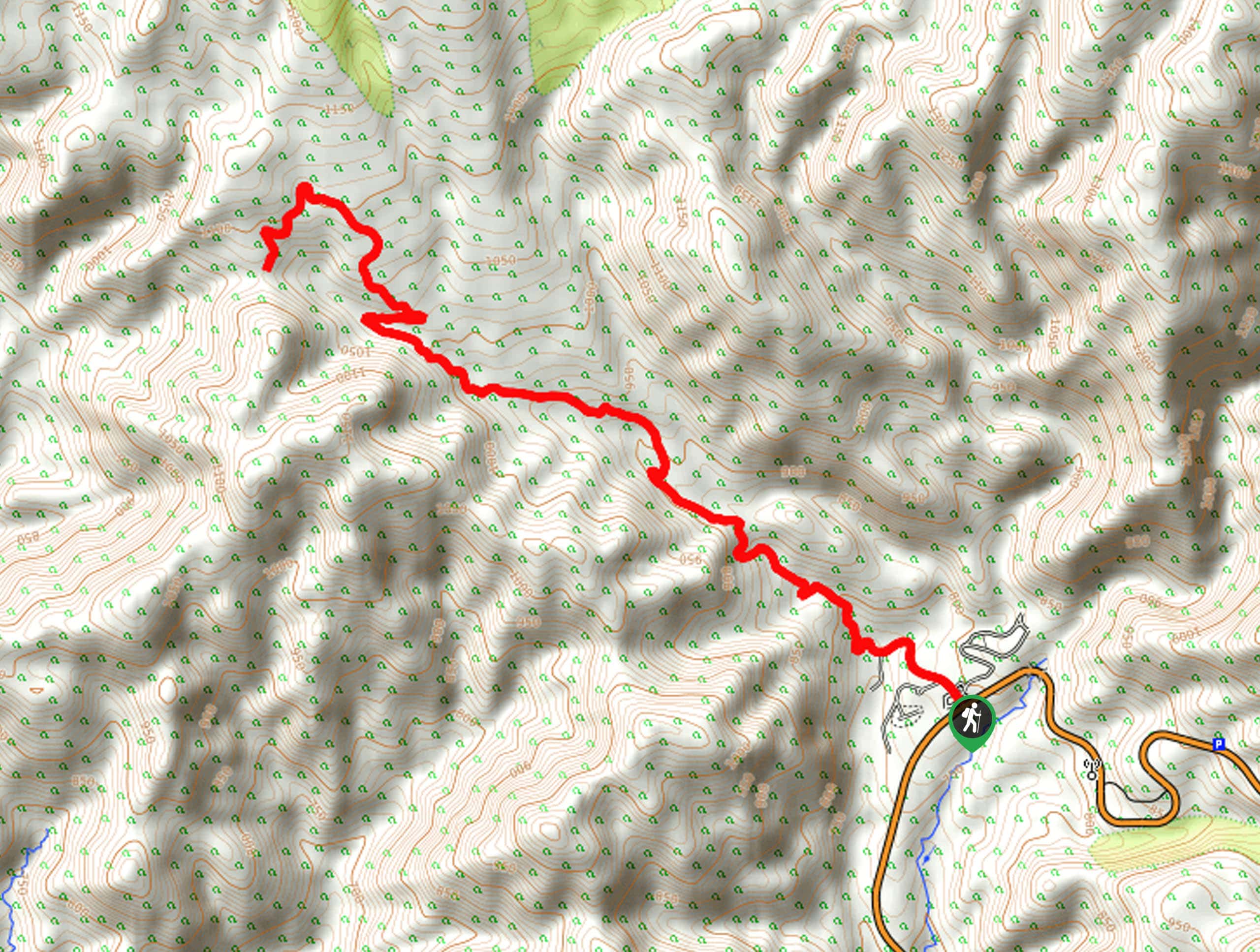
Setting out from the trailhead, you will pass by the fire station and make your way to the northwest, where you will quickly cross over the West Fork of City Creek. From here, the route will continue on to the northwest through the undulating terrain of the mountains.
Eventually, the road will narrow and become quite overgrown, so keep an eye out for ticks! Take some time to appreciate the surrounding mountain and forest views, before the trail bends to the southwest and climbs slightly further uphill to the endpoint of the route. At this point, you can head back along the same route to retrace your steps back into the trailhead where you began.
Similar hikes to the Forest Service Road N22 Hike hike

Bluff Mesa Hike
The Bluff Mesa Hike is a fantastic adventure in Southern California that features a lovely woodland setting and can be…

Palm View Peak Trail
The Palm View Peak Trail is a great hiking route in the San Bernardino National Forest that features a solid…

Cram Peak Ridge Trail
The Cram Peak Ridge Trail is a fantastic, albeit difficult, hiking route in the San Bernardino National Forest that will…
Comments