Black Mountain Trail
View Photos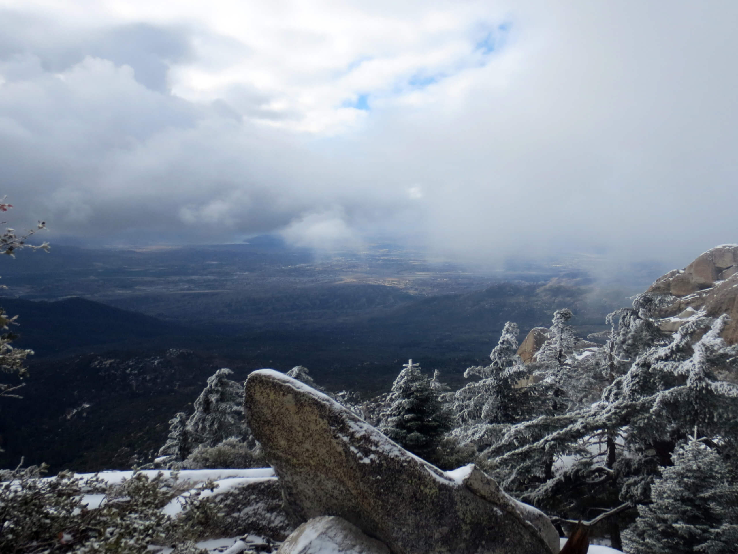
Black Mountain Trail
Difficulty Rating:
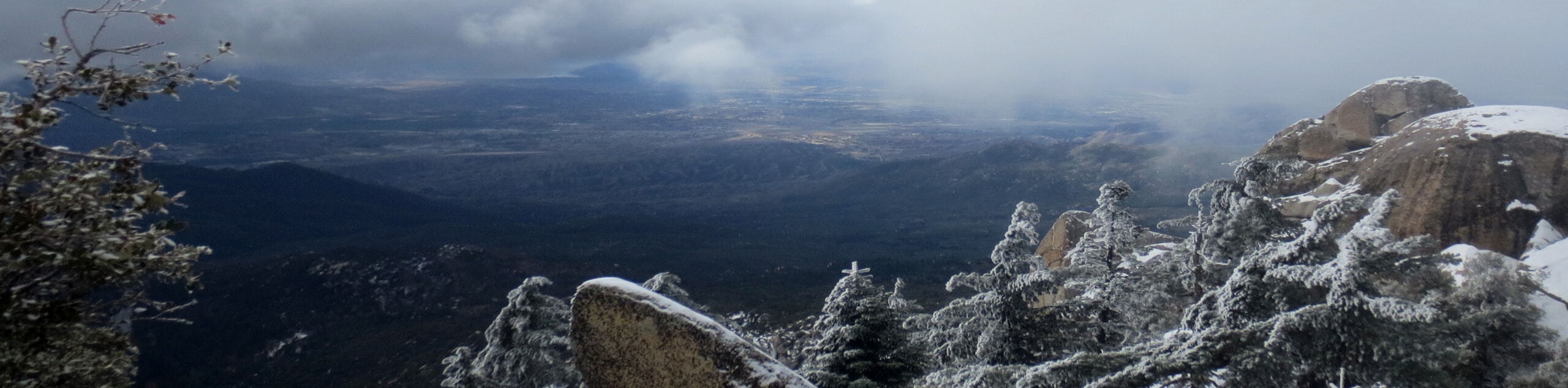
The Black Mountain Trail is a beautifully scenic, but physically demanding, hiking route in the San Bernardino National Forest that will take you to the top of the mountain for breathtaking views. While out hiking the trail, you will work your way uphill through the forest along a rocky and unrelenting slope, before arriving at the summit for views of San Gorgonio Mountain and San Jacinto Peak. Hikers should take note that it is a steady and unrelenting climb up to the summit, so make sure to bring plenty of water and snacks for the journey.
Getting there
The trailhead for the Black Mountain Trail can be found 12.3mi to the southeast of Banning along CA-243.

About
| Backcountry Campground | Boulder Basin Campground |
| When to do | May-December |
| Pets allowed | Yes |
| Family friendly | No |
| Route Signage | Average |
| Crowd Levels | Moderate |
| Route Type | Out and back |
Black Mountain Trail
Elevation Graph
Weather
Black Mountain Trail Description
Hiking the Black Mountain Trail is a challenging undertaking that features a steep uphill climb for the entirety of the route. Be sure to pack plenty of water and snacks, wear sturdy hiking boots, and bring hiking poles to help lessen the impact on your knees during the descent. Additionally, make sure that you check the weather prior to setting out on your hike, as conditions can change rapidly in the mountains.
While the trail is fairly rough and rugged, it will also reward you with breathtaking views of the surrounding California landscape. In addition to the beautiful woodland terrain, there is a fire tower lookout at the top of the trail that, when open, will provide far reaching views out to San Jacinto Peak to the southeast and San Gorgonio Mountain to the north. This hike will definitely give you a run for your money, but the feeling of accomplishment will be well worth the effort!
Setting out from the parking lot, you will pick up the trail leading to the southeast and begin following it uphill through the forest. The trail will continue to climb steadily uphill for the duration of the hike until you arrive at the summit of Black Mountain, so remember to pace yourself throughout the journey.
After 0.28mi along the trail, you will work through a series of switchbacks that traverse some very steep terrain, before continuing on for another 0.5mi. Here, the landscape will become quite a bit rockier, so take your time and watch your footing along the trail.
Once you have been hiking for roughly 1.96mi, you will arrive at a junction in the path. Keep left there and continue along the trail as it heads further uphill and bends to the northeast to meet up with the banks of Indian Creek. Following along the creek for a short distance, you will push further uphill as the trail bends east, eventually bringing you to the Boulder Basin Campground, which is a popular destination for rock climbers in the area.
From the campground, you will turn right along the road that leads to the southeast, following it for 0.6mi to eventually arrive at the summit of Black Mountain. Take some time here to explore the summit and revel in the beautiful views of the surrounding mountains, making sure to take the opportunity to head up the fire tower lookout if it is open. Once you have your fill of the scenery, you will head back along the same route to return to the trailhead where you began your adventure along the Black Mountain Trail.
Trail Highlights
San Gorgonio Mountain
Named after the Saint Gorgonius by Spanish Missionaries passing through the area in the early 17th Century, Gorgonio Mountain – also known locally as Old Greyback – is the highest mountain peak in Southern California, with a height of 11503ft.Located in the San Bernardino Mountain Range, the Mountain is notable for its pyramid shape and the fact that it is the 18th most-prominent peak in the United States.
Frequently Asked Questions
Can you access the fire tower lookout on Black Mountain?
As long as it is open on the day of your hike, you will be able to access the fire tower lookout on Black mountain for incredible views of the area.
Are dogs allowed to use the Black Mountain Trail?
Yes, dogs are permitted along the Black Mountain Trail.
Insider Hints
Wear sturdy hiking boots and bring hiking poles for this rugged trail.
You will need to purchase an adventure pass for this hike.
Bring plenty of water and snacks.
Similar hikes to the Black Mountain Trail hike

Palm View Peak Trail
The Palm View Peak Trail is a great hiking route in the San Bernardino National Forest that features a solid…

Cram Peak Ridge Trail
The Cram Peak Ridge Trail is a fantastic, albeit difficult, hiking route in the San Bernardino National Forest that will…
Highway 138 VOE Trail
The Highway 138 VOE Trail is a fantastic hiking route north of the Valley of Enchantment that will see you…
Comments