James Irvin Trail
View Photos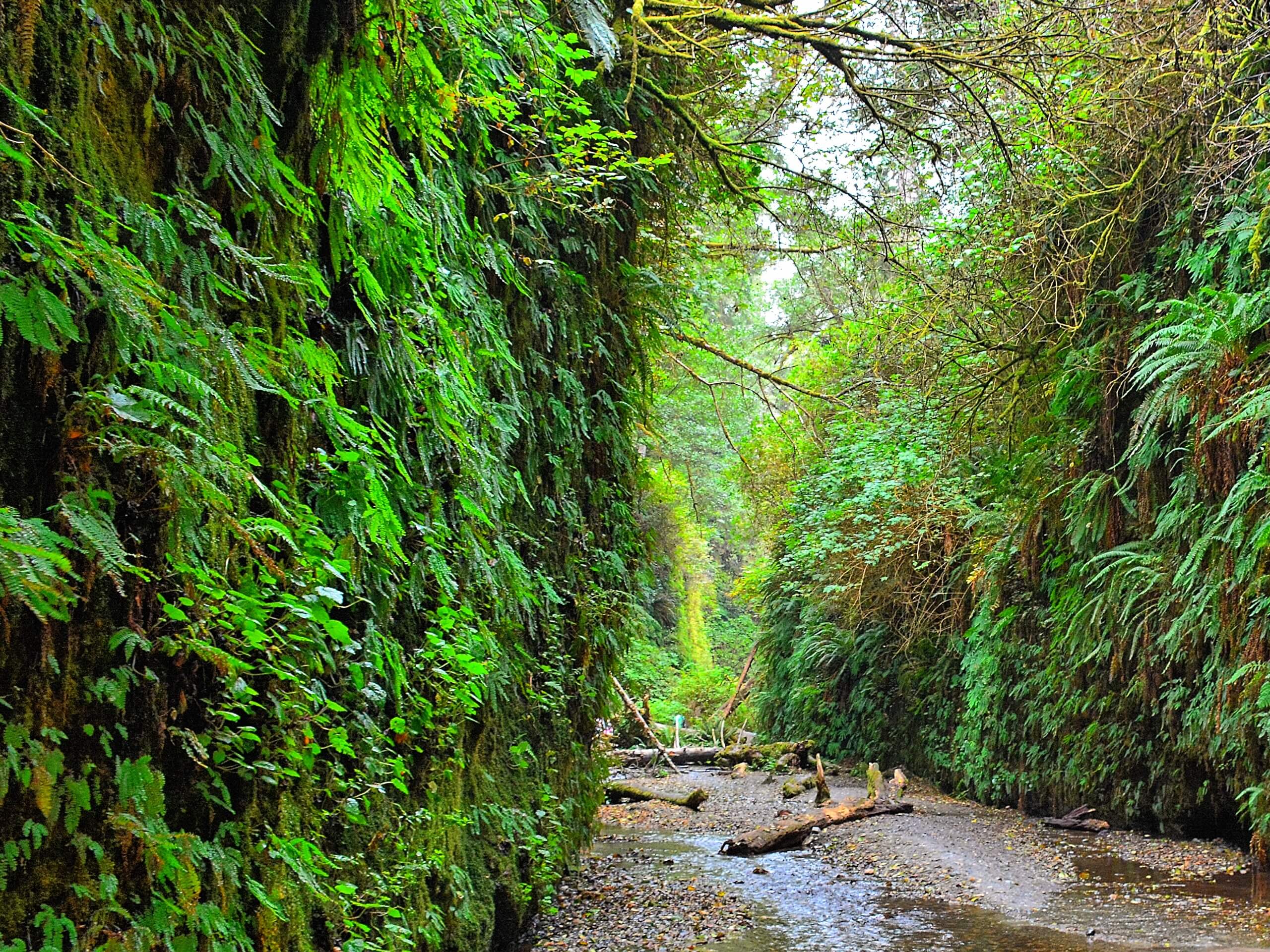
James Irvin Trail
Difficulty Rating:
The James Irvin Trail boasts an unforgettable journey through a coastal primeval redwood forest. This enchanting adventure explores a quintessential redwood grove before opening to the Pacific Ocean and the famous Fern Canyon. This magical hike is well worth adding to your Redwoods National and State Parks itinerary.
Getting there
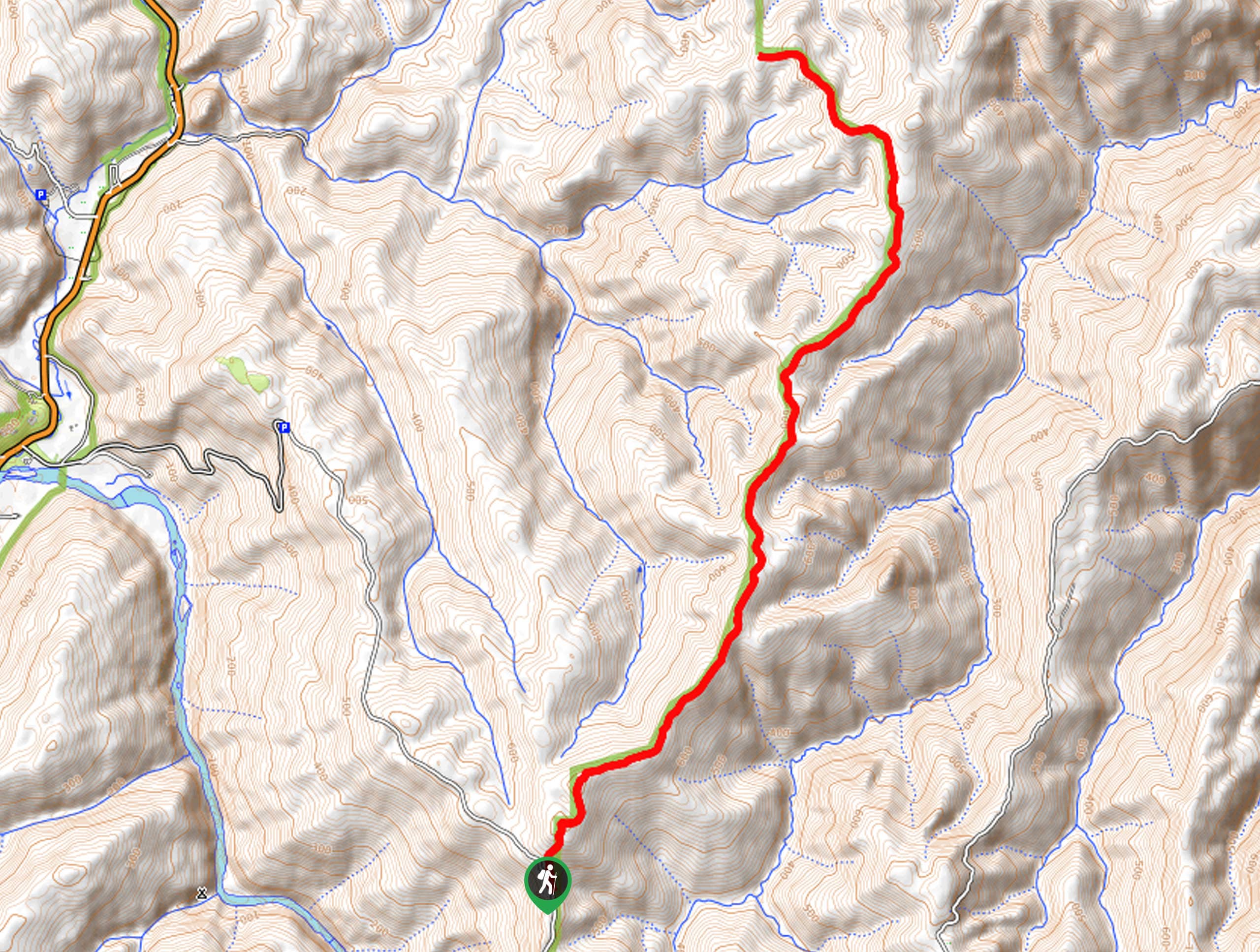
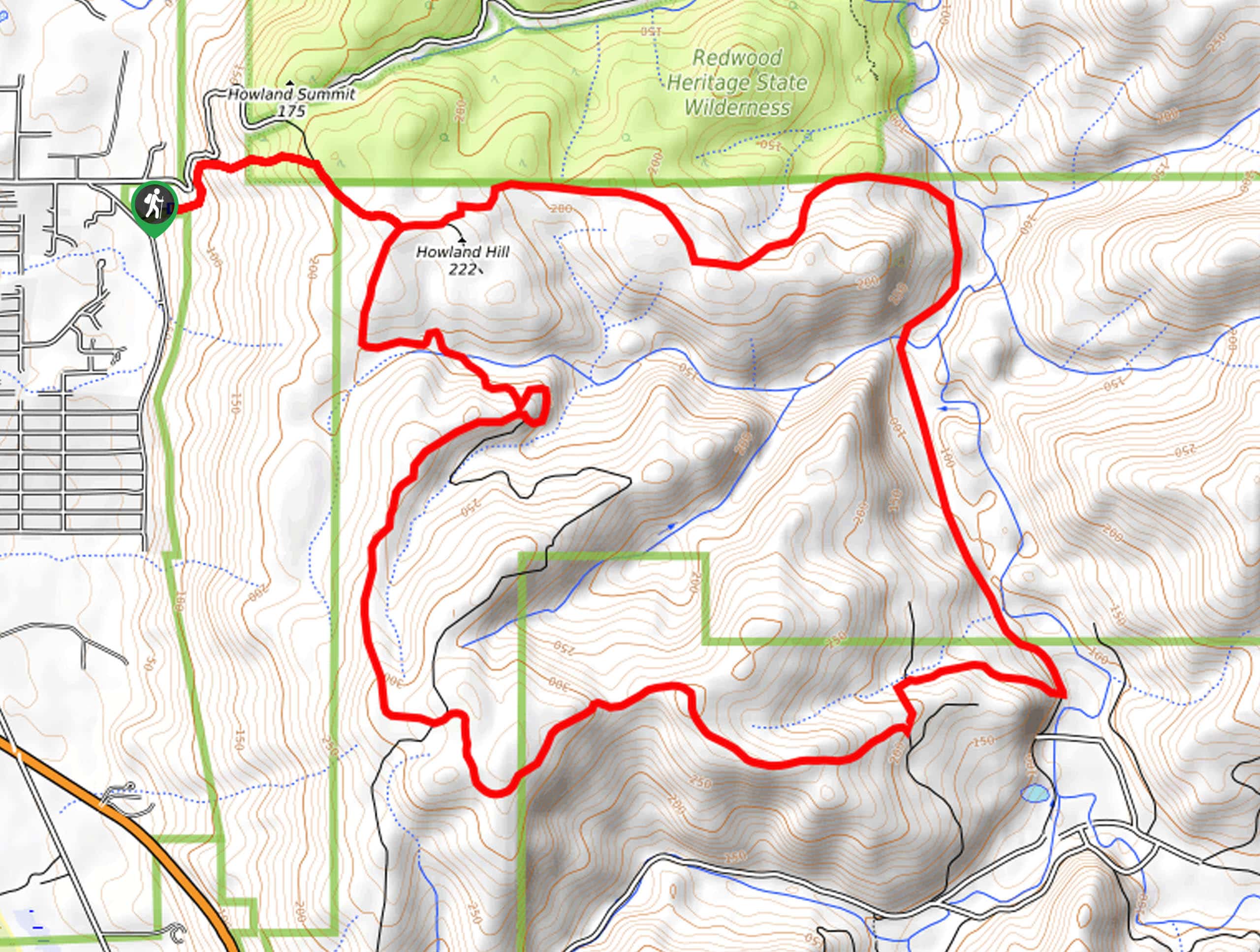
Access the James Irvin Trail via the Prairie Creek Trailhead at the Prairie Creek Visitors Center off Newton B. Drury Parkway.

About
| Backcountry Campground | No |
| When to do | Year-round |
| Pets allowed | No |
| Family friendly | Older Children only |
| Route Signage | Good |
| Crowd Levels | High |
| Route Type | Out and back |
James Irvin Trail
Elevation Graph
Weather
James Irvin Trail Description
Immerse yourself in a sea of towering redwoods and lush vegetation along the James Irvin Trail. Boasting an unparalleled experience, this route offers picture-perfect scenery and a wonderful workout. Traveling into the dense woodlands, it is important to be mindful of wildlife. Roosevelt elk and black bears frequent in the area—and of the two, the Elk are commonly the most aggressive, so keep your distance! Incredibly scenic, this route attracts dozens of adventurers each day, so we encourage you to head out early to beat the crowds and secure a spot in the trailhead carpark.
The James Irvin Hike is a quintessential redwood grove trail with a little something extra. Reconnect with nature as you wander amongst the primeval forest lit by sunbeams and bounded by lush undergrowth. Notice the diversity of flora as you hike along the path lined with ferns, huckleberry bushes, wild mushrooms, and delicate violets. Unlike other redwood groves in the state, the James Irvin Trail guides adventurers to the famous Fern Canyon and the Gold Bluffs Beach—what more could you ask for? This magical nature walk affords anyone a good time. We love this hike, and we can guarantee you will too!
Setting out from the Prairie Creek Trailhead at the Visitors Center, the James Irvin Hike follows the Prairie Creek Trail before branching left onto the Nature Trail. This path will guide you over Godwood Creek to another trail junction. Here, veer right, and you will be diverted onto the James Irvin Trail. This route will follow along the drainage of Godwood Creek and into the old-growth forest. Keeping right at the next intersection, meandering amongst redwood, Sitka spruce, douglas fir, and western hemlock, you will be enchanted by the sights of the sunbeams piercing through trees.
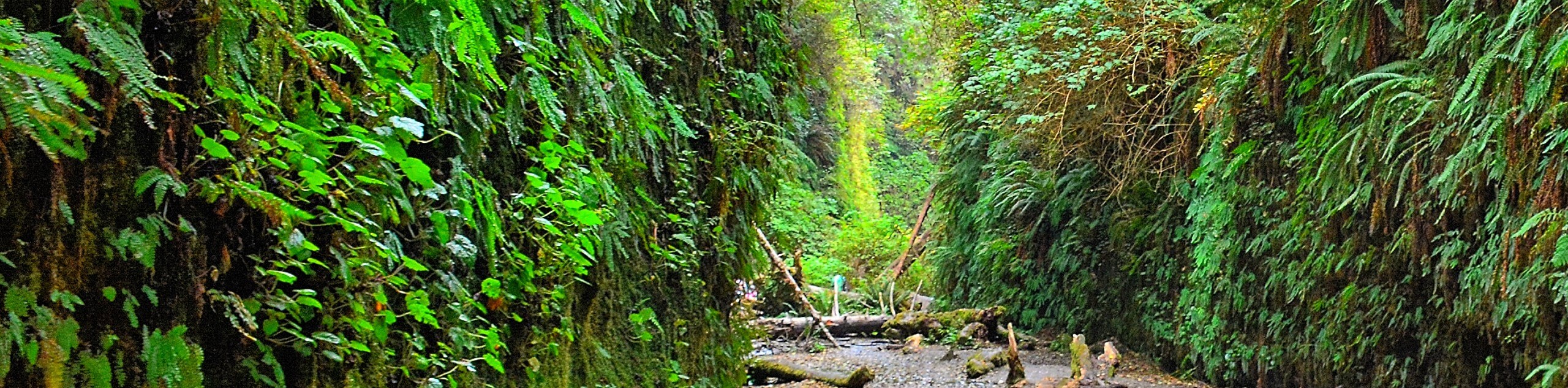
Eventually, you will reach a branch with the Clintonia Trail, keep right, and the James Irvin Trail will begin to run parallel to Home Creek. Hiking through the corridor bounded by the towering redwoods, you will be led over several footbridges. The closer you get to the coast, the more dense and lush the vegetation will become. Passing a charming cascade, you will be guided up the gulch and past the Friendship Trailhead. At this point, the path will likely become busier as you near Fern Canyon. From the James Irvin Trail, you will be granted impressive views of the lush canyon draped by vibrant ferns, intersected by the calm creek.
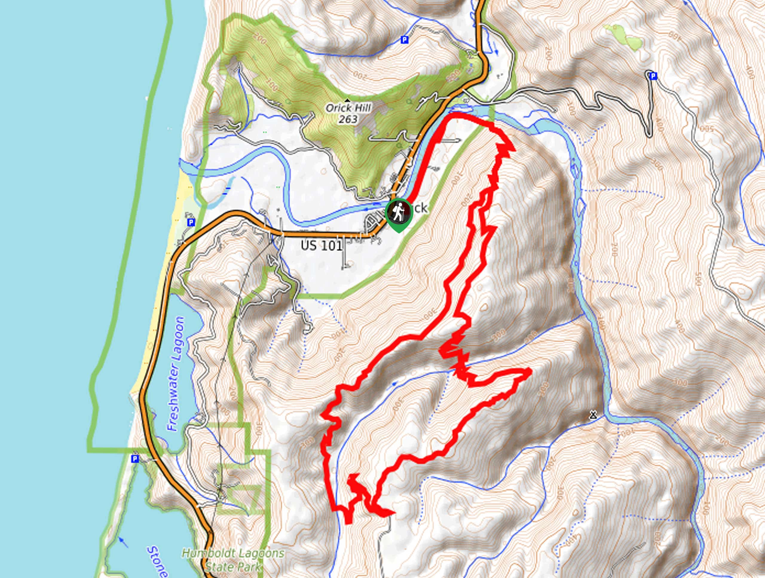
Continue hiking, and the route will eventually open to the Pacific Ocean. Admire the scene of the ocean in the west, and in the east, you will be granted an impressive view of Fern Canyon in the southeast. Appreciate the sight of the famous corridor, then merge onto the Fern Canyon Trail, tracking south. This path will ultimately deliver you to the trailhead and parking lot at Gold Bluffs Beach. If time permits, explore the beach and dip your toes in the chilly waters. From here, retrace your footing along the path all the way back to the trailhead—unless you want to explore Fern Canyon first. Either way, reconnect with the James Irvin Trail and head back the way you came!
Frequently Asked Question
When is the James Irvin Trail open?
The James Irvin Trail is open and accessible year-round.
How long is the James Irvin Trail?
The James Irvin Trail is a 10.4mi out-and-back hike in the Prairie Creek Redwoods State Park.
Where does the James Irvin Trail begin?
The James Irvin Trailhead and Car Park are located at the Prairie Creek Visitors Center off Newton B. Drury Parkway.
Insider Hints
The parking lot is often full by noon, so arrive early to beat the crowds!
If the parking lot is full, there is plenty of parking for any-sized vehicle along the Newton B. Drury Scenic Parkway
If time permits, we urge you to explore Fern Canyon at the trail’s end
Do not go near, or disturb the Roosevelt Elk, they can be aggressive
The boardwalks can be slippery—so take your time
Dress in layers as the damp environment can be chilly
Explore Gold Bluffs Beach at the turnaround point
Similar hikes to the James Irvin Trail hike
Holter Ridge via Lost Man Trail
The Holter Ridge via Lost Man Trail is a popular mountain biking route in Redwood National Park—but it is open…
McArthur Creek Loop
Discover the beauty and diversity of Northern California’s coast along the McArthur Creek Trail. This challenging day hike exhibits the…
Mill Creek Horse Trail
Indulge yourself in the magical scenery of California’s coastal rainforests along the Mill Creek Horse Trail. This secluded adventure provides…
Comments