Holter Ridge via Lost Man Trail
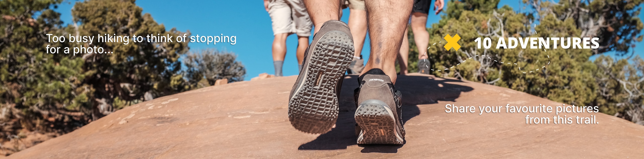
View Photos
Holter Ridge via Lost Man Trail
Difficulty Rating:
The Holter Ridge via Lost Man Trail is a popular mountain biking route in Redwood National Park—but it is open to hikers as well. Wander beneath the tree canopy of mixed conifers, and through the odd redwood stand. This trail makes for a great day hike.
Getting there
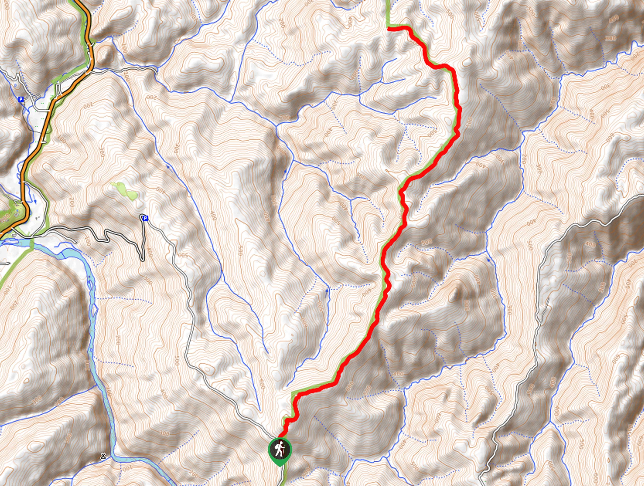
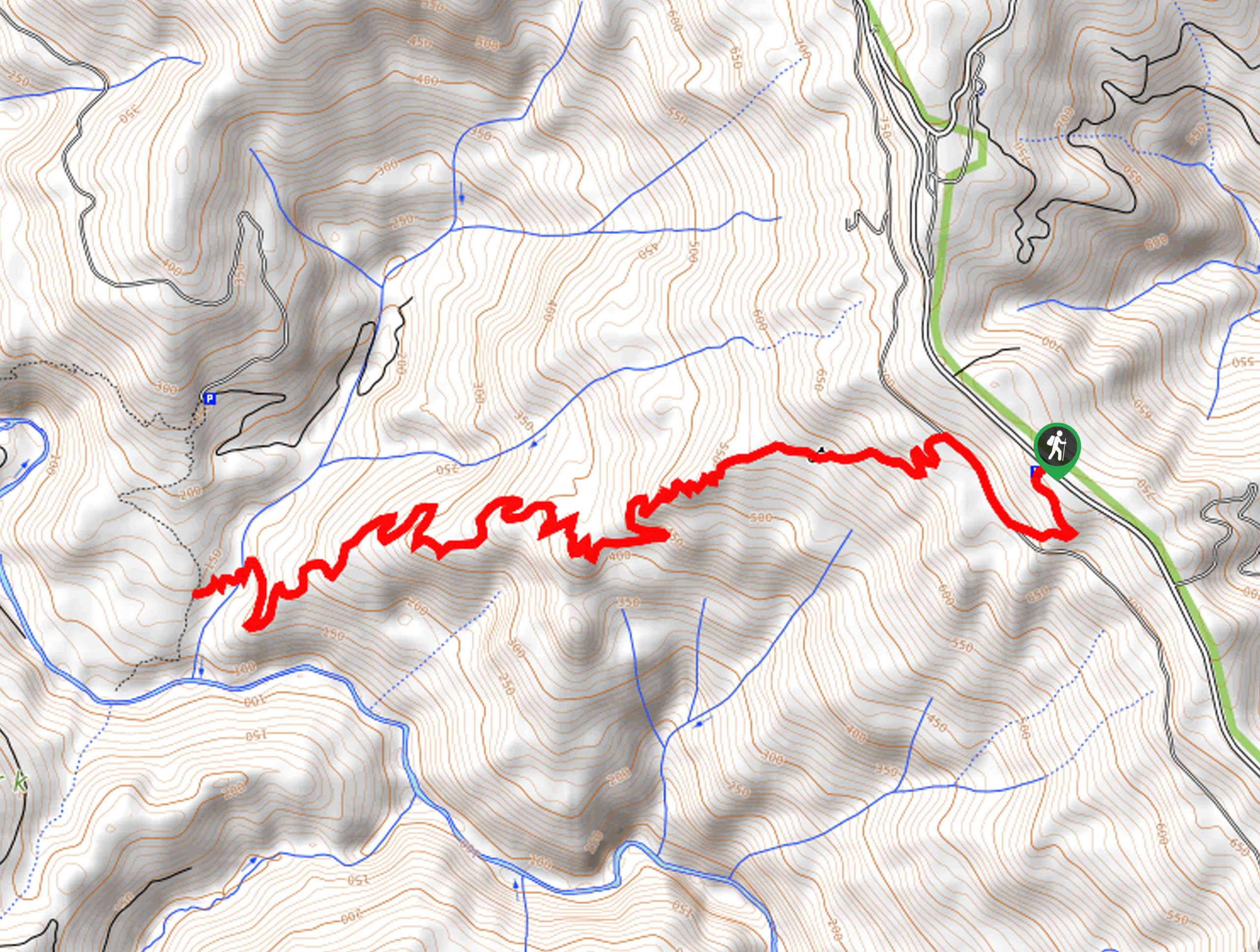
The Holter Ridge via Lost Man Trail is accessed via the Lost Man Trailhead off Bald Hills Road.

About
| Backcountry Campground | No |
| When to do | Year-round |
| Pets allowed | No |
| Family friendly | Older Children only |
| Route Signage | Average |
| Crowd Levels | Moderate |
| Route Type | Out and back |
Holter Ridge via Lost Man Trail
Elevation Graph
Weather
Holter Ridge via Lost Man Trail Description
Leading you through the enchanting forestlands adorned with streams and wildflowers, the Holter Ridge via Lost Man Trail boasts a scenic adventure. As you wander this shared route, it is important to keep an ear out for passers-by! Additionally, be wary of the tree routes and rocks that obstruct the path! As this trek is on the longer side and travels over uneven terrain, we encourage you to wear a sturdy pair of ankle bracing footwear! Lastly, you will be traveling deep into the wilderness, so be bear aware!
Embark on your adventure along the Holter Ridge via Lost Man Trail from the trailhead off Bald Hills Road. From here, the Lost Man Trail will guide you northeast, gradually climbing up the undulating terrain. Enjoy the shade of the looming redwoods, and the path will soon begin to drop into the forestlands. The forest will be lush with ferns, wildflowers, and mushrooms giving the route a whimsical ambiance.
Wandering along the border of the Redwoods National Park, you will ultimately reach your turnaround point when the Lost Man Trail diverts southwest deeper into the National Park. From here, turn around and retrace your footing along the path back to the trailhead.
Similar hikes to the Holter Ridge via Lost Man Trail hike
McArthur Creek Loop
Discover the beauty and diversity of Northern California’s coast along the McArthur Creek Trail. This challenging day hike exhibits the…
Mill Creek Horse Trail
Indulge yourself in the magical scenery of California’s coastal rainforests along the Mill Creek Horse Trail. This secluded adventure provides…
Dolason Prairie Trail
Compared to the quintessential Redwoods National and State Park hikes, the Dolason Prairie Trail offers a unique experience—traveling through high…
Comments