
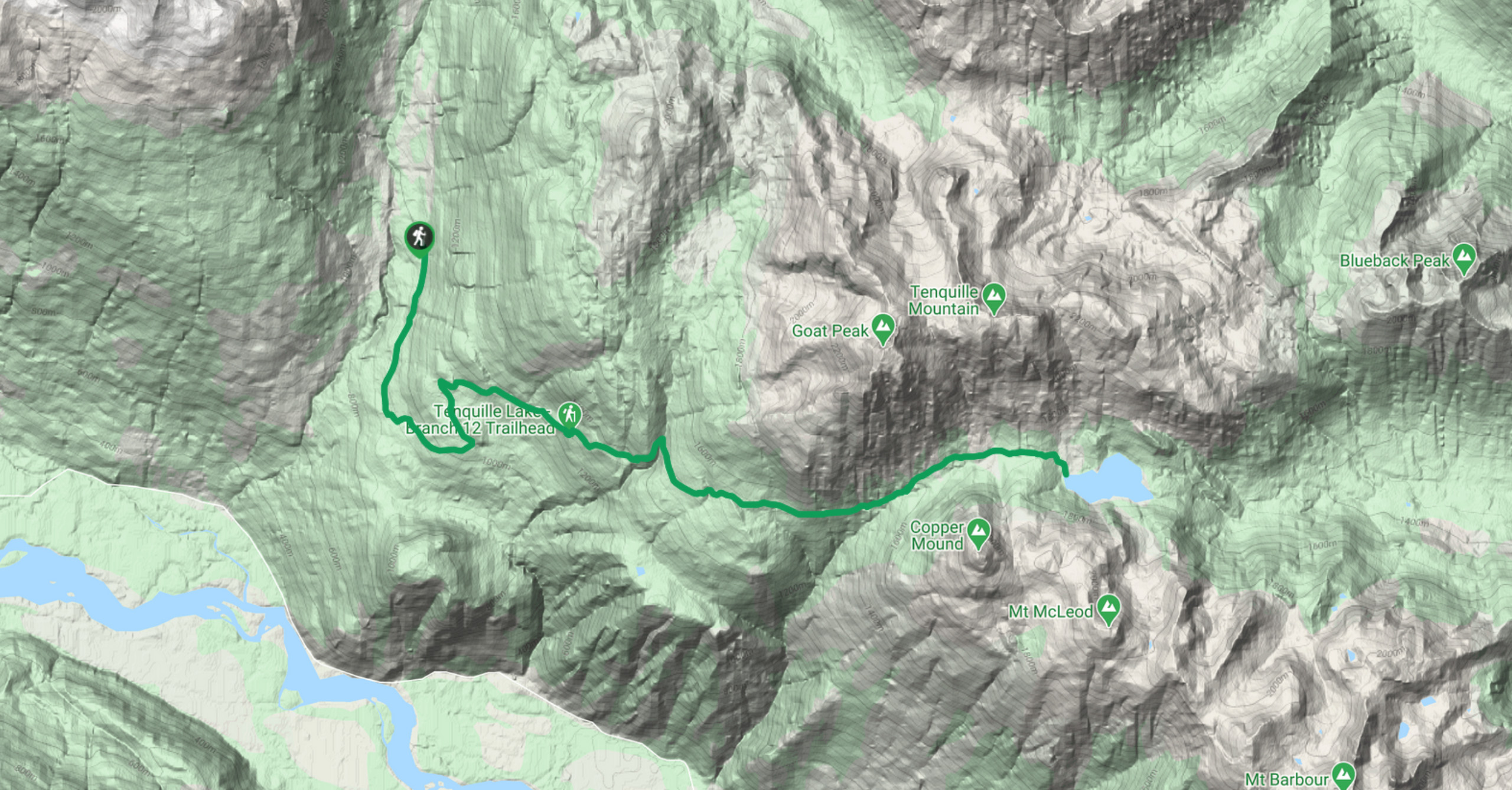
Tenquille Lake Trail
View PhotosTenquille Lake Trail
Difficulty Rating:
The Tenquille Lake Trail is a 14.4mi out-and-back hiking route near Pemberton that offers scenic alpine views and the opportunity to experience a peaceful lakeside setting. Hiking along the trail will take you on old logging roads, through forests, and across alpine meadows until you reach the picturesque Tenquille Lake. Here, you will be able to soak in the views of the tranquil lake and its spectacular surrounding mountain backdrop.
Getting there
To reach the start of the Tenquille Lake Trail from Pemberton, head north on Pemberton Meadows Road for 13.4mi and make a right turn onto Lillooet FSR. After 0.9mi, turn left at the first cross street and continue for 4.6mi. Here, you will veer slightly to the right and drive for 2.7mi, turning right again onto Hurley River FSR. Continue for about 4.3mi, where there will be a sharp bend in the road. You’ll find the trailhead on the outside edge of this bend.

About
| When to do | May–October |
| Mountain Huts | Tenquille Lake Cabin |
| Pets allowed | Yes - On Leash |
| Family friendly | No |
| Route Signage | Average |
| Crowd Levels | Moderate |
| Route Type | Out and back |
Tenquille Lake Trail
Elevation Graph
Weather
Tenquille Lake Trail Description
The Tenquille Lake Trail is a lengthy hiking route near Pemberton that climbs through various terrain on the way to an alpine lake. The trail utilizes a defunct forest service road before breaking into the alpine terrain on the approach to the lake. As the journey is long, hikers should wear proper hiking footwear to traverse the trail comfortably. Additionally, the area around the lake is known to be inhabited by both grizzly and black bears. Take all precautions, such as travelling in groups and bringing bear spray to avoid any potentially dangerous encounters.
This hiking route is a scenic adventure that will take you through the beautiful forests around Pemberton and into the backcountry as you hike between mountain ridges and arrive at the serene waters of Tenquille Lake. Here, you can look out over the picturesque lake with its spectacular mountain backdrop. Standing in the alpine meadow, you’ll be surrounded by Goat Peak and Tenquille Mountain to the north and Copper Mound directly to the south. With the Tenquille Lake Cabin and numerous locations for camping, this trail makes for the perfect single or multi-day hiking destination.
Setting out from the parking area on Hurley River FSR, follow the trail south as it makes its way along the Branch 12 Trail. This is an old, decommissioned forest service road that meanders through the woods and climbs steadily uphill. In the first section of the hike, you’ll cross over four creeks before the trail turns to the east and climbs a steeper hill.
As the trail continues through the forest, it will eventually break out from the dense tree cover and open into the beautiful alpine meadow. As you follow along this stretch of trail on the approach to Tenquille Lake, you’ll be surrounded by stunning views of rolling hills, fragrant wildflowers, and rugged mountains.
The trail will eventually run parallel to Wolverine Creek, and you’ll arrive at a junction. Keep straight to continue on a course for the lake. After crossing over what seems like an endless amount of mountain streams, you will arrive at the peaceful waters of Tenquille Lake. Explore the picturesque surroundings that make up the alpine landscape and admire the impressive views of Goat Peak and Tenquille Mountain to the north and Copper Mound standing directly opposite to the south. After you’ve had enough of the beautiful lakeside atmosphere, head back along the Tenquille Lake Trail to return to your vehicle.
Insider Hints
Bring bear spray, as grizzly and black bears frequent the area.
Wear proper hiking footwear.
Hiking poles can help save your knees on the long return journey.
Similar hikes to the Tenquille Lake Trail hike
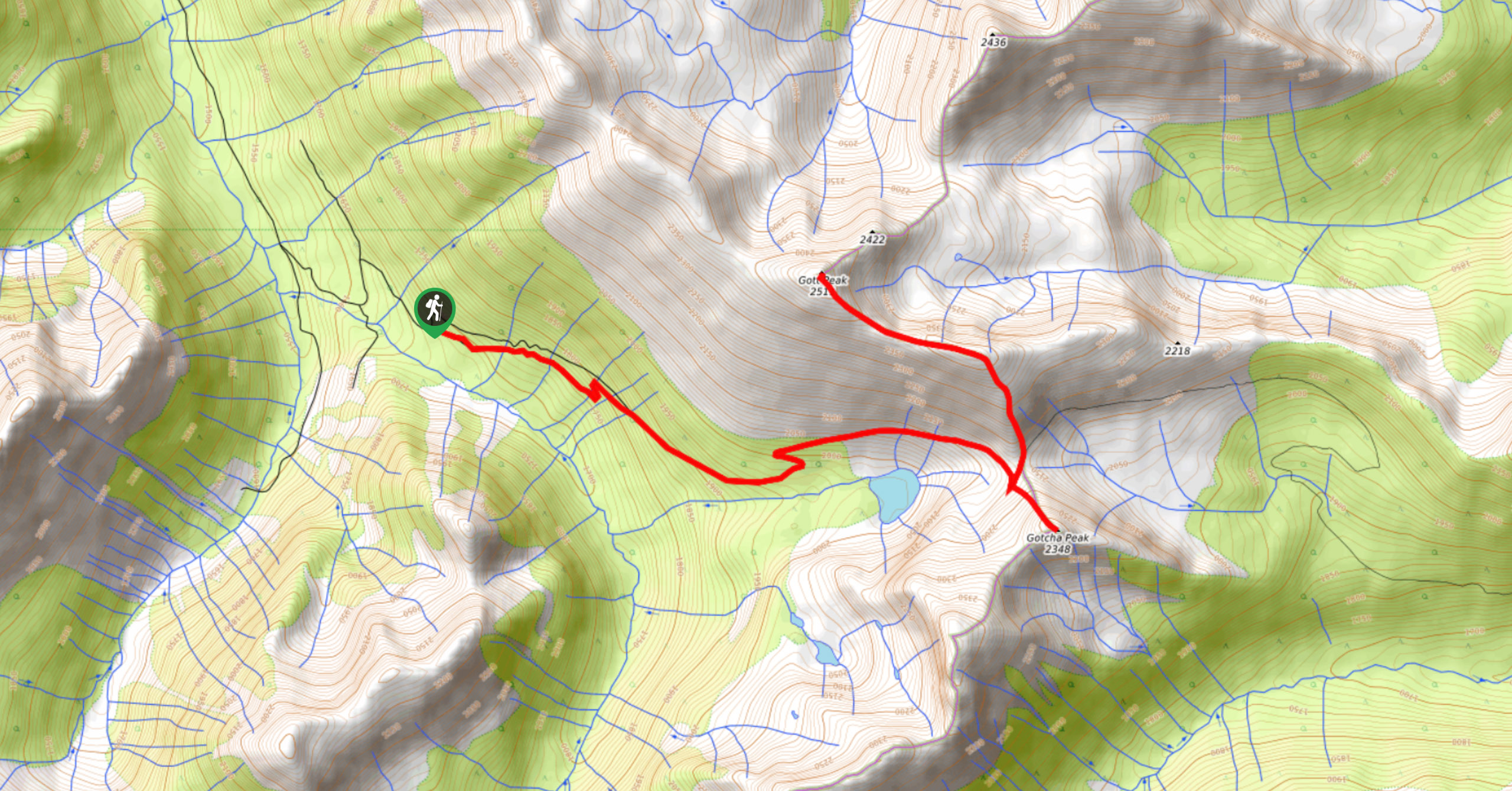
Blowdown Pass to Gott Peak
Blowdown Pass to Gott Peak is a difficult out-and-back trail that climbs uphill to summit Gotcha and Gott Peaks. Along…
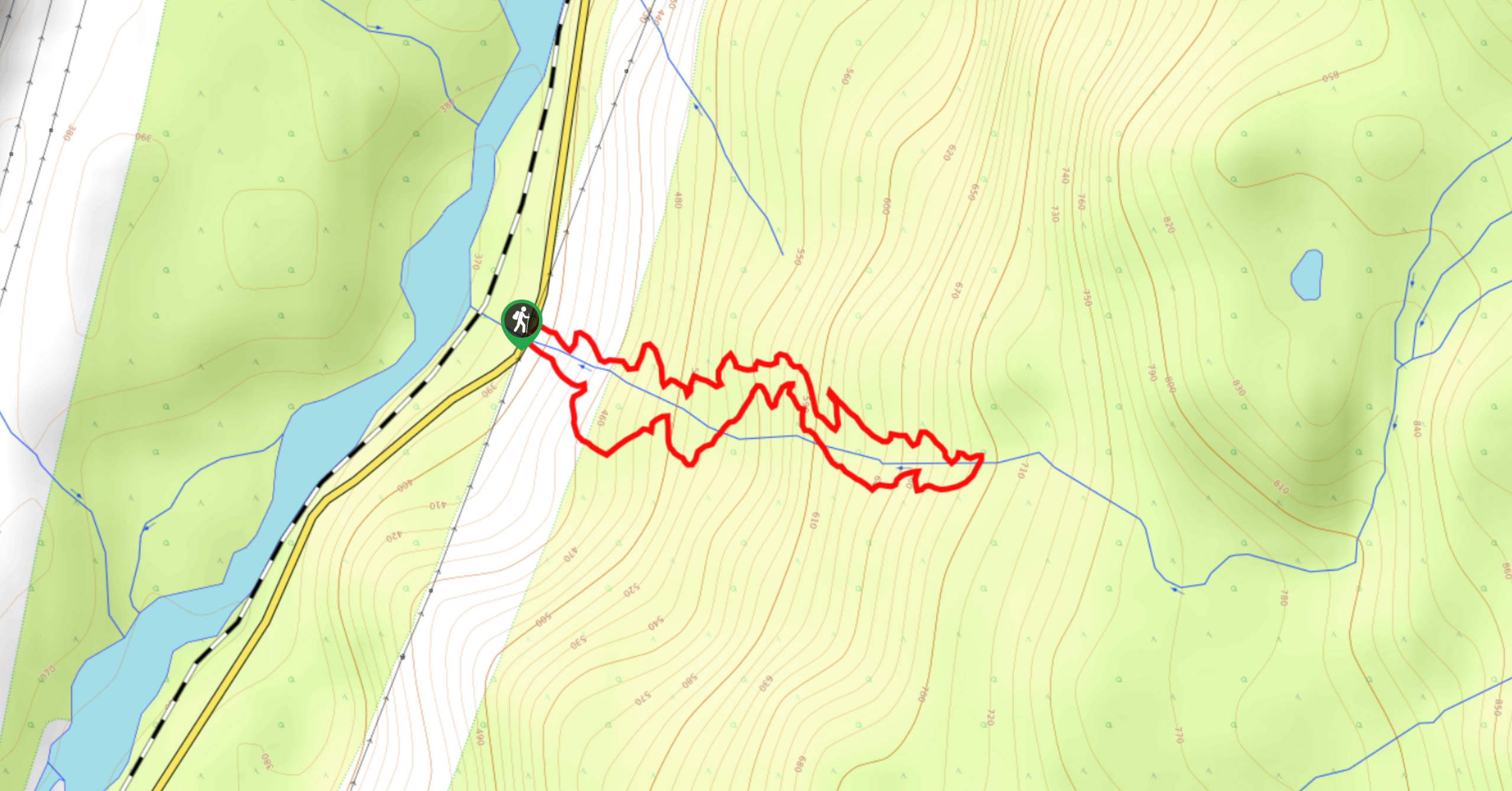
Cool Creek Canyon Hike
The Cool Creek Canyon Hike is a 1.3mi loop route near Pemberton that features spectacular mountain views and…
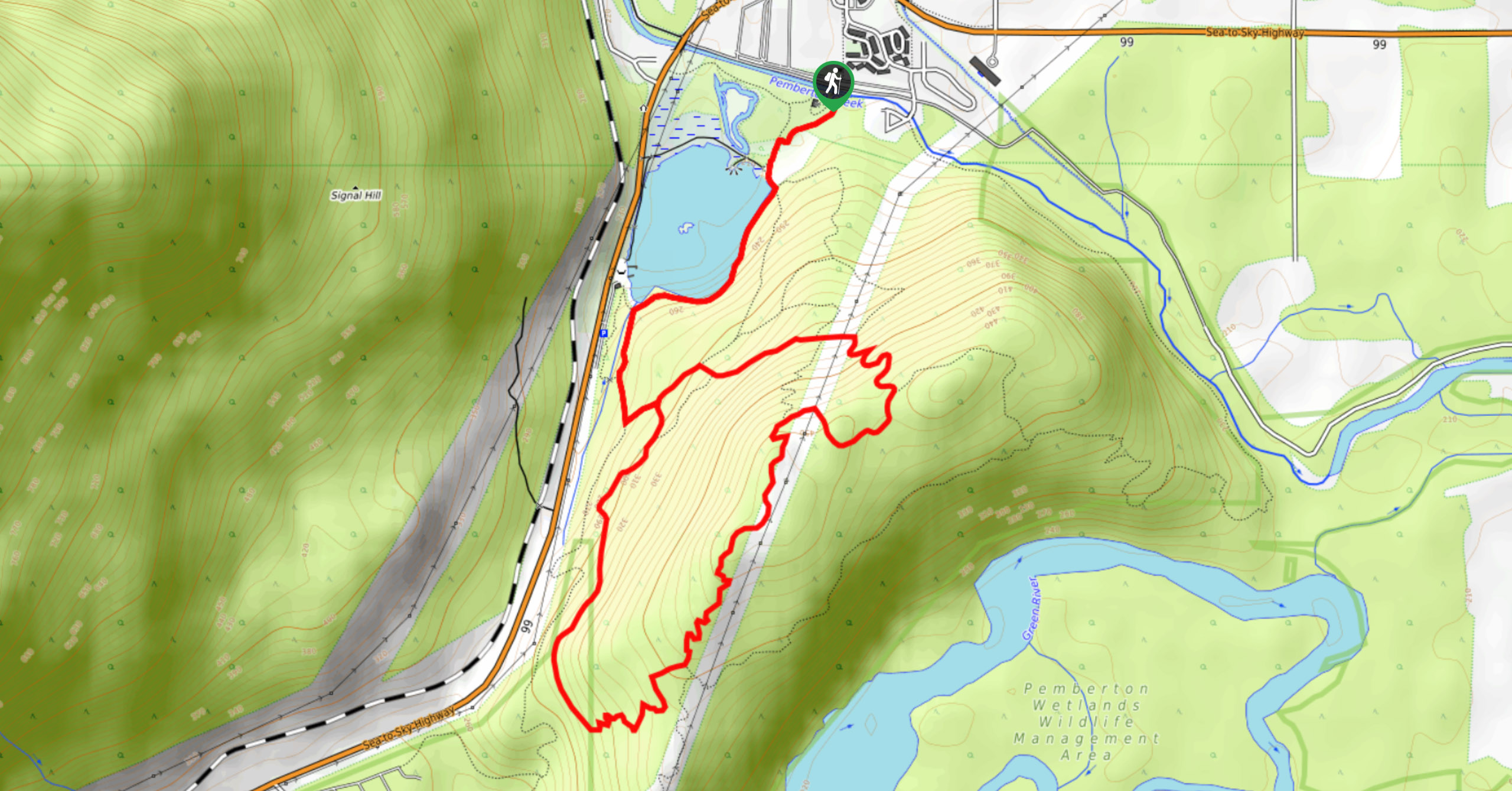
One Mile Lake Trail
Hiking around One Mile Lake will take you on a 4.3mi trek through the woodlands south of Pemberton.…
Comments