
Newbrough and River North Tyne Circular Walk
View Photos
Newbrough and River North Tyne Circular Walk
Difficulty Rating:
The Newbrough and River North Tyne Circular Walk is a long distance route in Northumberland that will take you through some picturesque stretches of farmland to reach a riverside setting. While out walking the trail, you will leave the village of Newbrough behind, traversing the open farmland to the northeast to eventually arrive at the winding banks of the River North Tyne. This is a wonderful route if you are simply looking to explore the vast countryside of Northern England.
Getting there
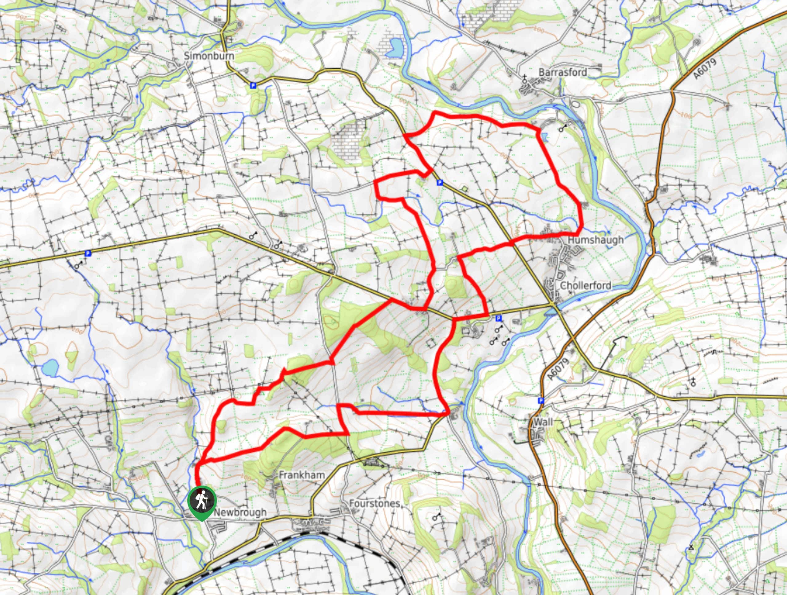
The trailhead for the Newbrough and River North Tyne Circular Walk can be found 0.2mi north of the Red Lion Inn in Newbrough.

About
| Backcountry Campground | No |
| When to do | Year-Round |
| Pets allowed | Yes - On Leash |
| Family friendly | No |
| Route Signage | Average |
| Crowd Levels | Low |
| Route Type | Lollipop |
Newbrough and River North Tyne Circular Walk
Elevation Graph
Weather
Newbrough and River North Tyne Circular Walk Description
If you are looking for a long distance walking adventure that will expose you to the beauty of Northumber;and’s farmland and a charming riverside setting, then the Newbrough and River North Tyne Circular Walk is a great option to do so.
Setting out from the trailhead, you will make your way to the north along the road for a short distance, before branching off to the right in order to leave the village of Newbrough behind. Once you are on the trail, you will follow it to the northeast as you traverse a variety of terrain including farm fields and small patches of woodland. After meeting up with B6319, follow it north until you reach Military Road, where you will make a right. Just before the Chesters Roman Fort Museum, head to the northeast to pass by Humshaugh, where you will eventually arrive at the banks of the River North Tyne.
Here, the trail will bend to the northwest and take you along the river for a short distance, before heading back to the southwest to cross B6320. Continuing on in the same direction, you will make your way across Military Road once more, enjoying the scenic views of the surrounding farmland as you make the return leg of the walk back into Newbrough.
Similar hikes to the Newbrough and River North Tyne Circular Walk hike

Hadrian’s Wall: Steel Rigg to Lanercost
Walking Hadrian’s Wall: Steel Rigg to lanercost is a fantastic - albeit lengthy - adventure that will lead you across…

Hadrian’s Wall: Wallsend to Heddon on the Wall
Hadrian’s Wall: Wallsend to Heddon on the Wall is the first section of the long distance Hadrian’s Wall Path walking…

Scotch Gill Woods Walk
The Scotch Gill Woods Walk is a short and easy-going adventure in Morpeth, Northumberland that will take you through a…
Comments