
Coe Crag and Long Crag Circular Walk
View Photos
Coe Crag and Long Crag Circular Walk
Difficulty Rating:
The Coe Crag and Long Crag Circular Walk is a fun woodland adventure in Northumberland that will take you through a rugged bit of forest in order to traverse two hilltops. While out on the trail, you will pass through the atmospheric landscape of Thrunton Wood, before climbing uphill to the summits of Coe Crag and Long Crag. There is a bit of navigation required through the thick brush of the woodland terrain, but that is all part of the adventure!
Getting there
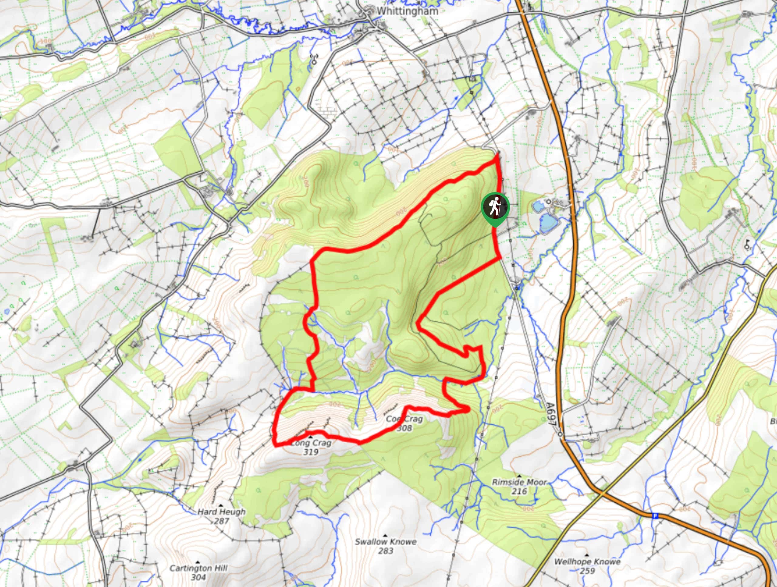
The trailhead for the Coe Crag and Long Crag Circular Walk can be found at the Thrunton Wood car park, located 6.7mi northeast of Rothbury.

About
| Backcountry Campground | No |
| When to do | March-October |
| Pets allowed | Yes - On Leash |
| Family friendly | Older Children only |
| Route Signage | Average |
| Crowd Levels | Moderate |
| Route Type | Circuit |
Coe Crag and Long Crag Circular Walk
Elevation Graph
Weather
Coe Crag and Long Crag Circular Walk Description
If you aren’t overly concerned with taking in jaw-dropping views and are looking for a walking route that will allow you to relax in a peaceful woodland setting, then the Coe Crag and Long Crag Circular Walk will be a great option for you top get outside and enjoy the natural beauty of Northumberland.
Setting out from the Thrunton Wood car park, you will head south along the road for a short distance, before branching off to the southwest in order to enter the dense cover of the forest. After winding between the trees and crossing over Cow Burn, you will exit the cover of the forest and climb uphill to traverse the summit of Coe Crag.
Once you have taken in the views, continue on to the west across the undulating terrain to traverse the summit of Long Crag, before heading downhill to the north. Here, you will re-enter the forest and revel in its natural beauty on the return to the car park where you began your adventure.
Similar hikes to the Coe Crag and Long Crag Circular Walk hike

Hadrian’s Wall: Steel Rigg to Lanercost
Walking Hadrian’s Wall: Steel Rigg to lanercost is a fantastic - albeit lengthy - adventure that will lead you across…

Hadrian’s Wall: Wallsend to Heddon on the Wall
Hadrian’s Wall: Wallsend to Heddon on the Wall is the first section of the long distance Hadrian’s Wall Path walking…

Scotch Gill Woods Walk
The Scotch Gill Woods Walk is a short and easy-going adventure in Morpeth, Northumberland that will take you through a…
Comments