
Goathland and Mallyan Spout Walk
View Photos
Goathland and Mallyan Spout Walk
Difficulty Rating:
The Goathland and Mallyan Spout Walk is an awesome adventure in North York Moors National Park that will expose you to the natural and manmade beauty of the region. While out on the trail, you will make your way through a charming village to visit a gorgeous waterfall before heading across the open countryside on the return leg. While this is a short walk, there are some sections that are not suitable for less-mobile walkers.
Getting there
To get to the trailhead for the Goathland and Mallyan Spout Walk from Sleights, head south on Coach Road for 2.5mi and turn right onto Cow Wath Bank, following it for 2.2mi. Turn right onto Beck Hole Road and turn right after 157ft to enter the car park.

About
| Backcountry Campground | No |
| When to do | Year-Round |
| Pets allowed | Yes - On Leash |
| Family friendly | Older Children only |
| Route Signage | Average |
| Crowd Levels | High |
| Route Type | Lollipop |
Goathland and Mallyan Spout Walk
Elevation Graph
Weather
Goathland and Mallyan Spout Walk Description
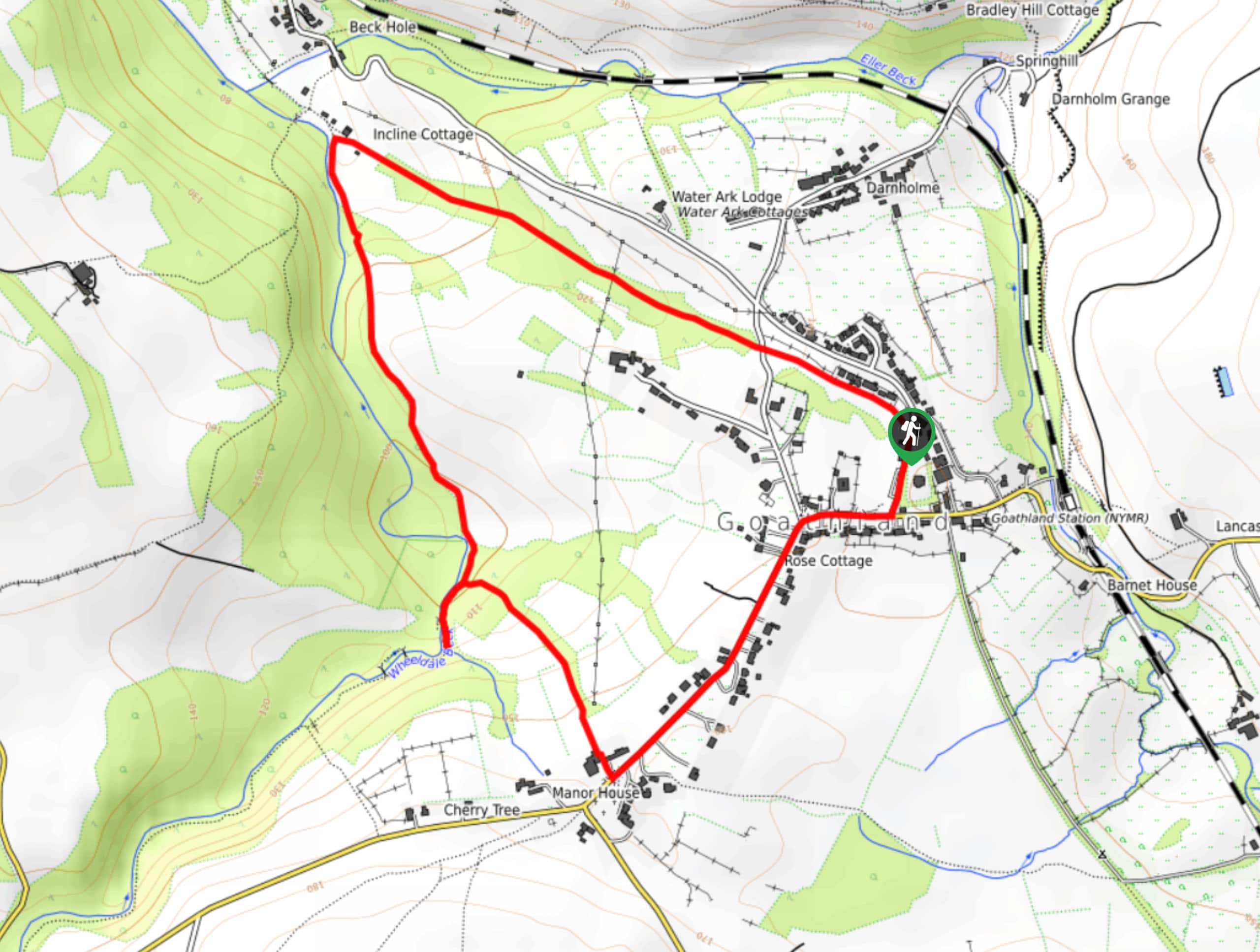
If you are after a fairly quick and relatively easy way to experience some stunning sights in the North York Moors, then look no further than the Goathland and Mallyan Spout Walk. Featuring a charming village that was used as a set on the TV show “Heartbeat”, as well as a gushing waterfall and picturesque countryside, this is an amazing adventure that should definitely be sought out if you are in the area. There are some fairly rough sections along the trail, so make sure to wear proper walking boots.
Setting out from the car park, you will head to the southwest and make your way through the village of Goathland, admiring its charming streets and quaint cottages. From here, you will descend a valley and head through the forest, clambering over a stretch of rocky and slippery terrain to reach the beautiful sight of the Mallyan Spout waterfall. Continue along the trail as it follows along the winding banks of the West Beck River to eventually meet up with the old rail line. Follow this to the southwest in order to make your way back to the trailhead.
Similar hikes to the Goathland and Mallyan Spout Walk hike

Kirkbymoorside and Gillamoor Walk
The Kirkbymoorside and Gillamoor Walk is a great outdoor excursion along the southern edge of North York Moors National Park…

Farndale Railway Walk to Blakey Ridge
The Farndale Railway Walk to Blakey Ridge is a lengthy but easy-going route that will allow you to experience the…

Botton and Blakey Ridge Circular Walk
The Botton and Blakey Ridge Circular Walk is a rugged and beautiful adventure that will allow you to experience the…
Comments