
Forge Valley Woods Walk
View Photos
Forge Valley Woods Walk
Difficulty Rating:
The Forge Valley Woods Walk is a lovely adventure in North York Moors National Park that features easy to navigate terrain and a charming riverside setting. While out walking this route, you will follow closely along the banks of the River Derwent and traverse a boardwalk for views of local wildlife and the surrounding landscape of the gorge. This is an amazing outdoor excursion that is perfectly suitable for the entire family.
Getting there
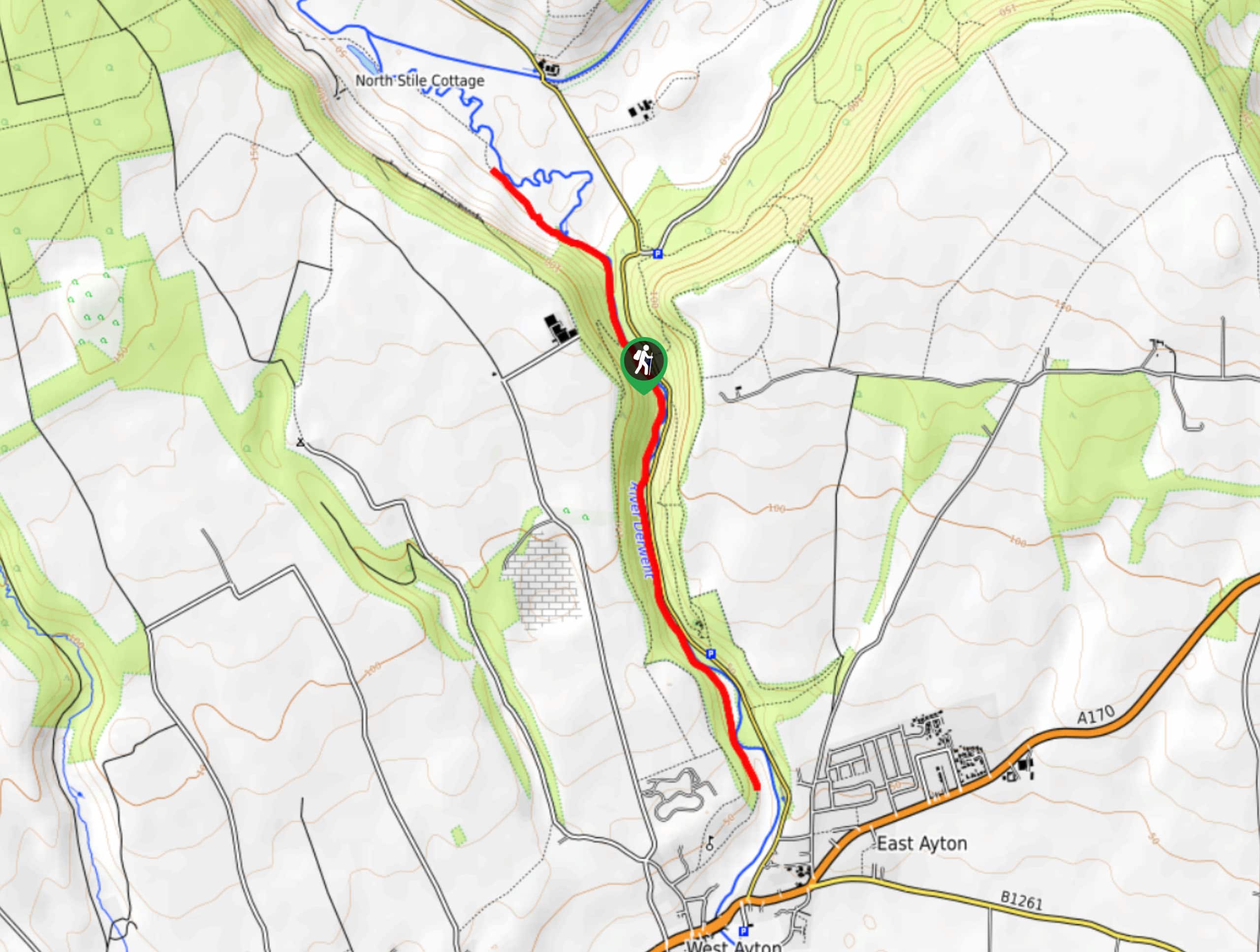
To get to the trailhead for the Forge Valley Woods Walk from East Ayton, head north on Castlegate for 0.3mi and keep straight onto Seavegate for another 1.3mi. Turn left here to enter the car park.

About
| Backcountry Campground | No |
| When to do | Year-Round |
| Pets allowed | Yes - On Leash |
| Family friendly | Yes |
| Route Signage | Average |
| Crowd Levels | Moderate |
| Route Type | Out and back |
Forge Valley Woods Walk
Elevation Graph
Weather
Forge Valley Woods Walk Description
If you are after a relaxing outdoor adventure that will get the entire family on the trails for some good exercise and the chance to spot local wildlife, then the Forge Valley Woods Walk is a great way to do so. The route features very little elevation gain and there are lengthy stretches of boardwalk throughout, making navigation a breeze and allowing you to fully immerse yourself in nature.
Before setting out from the car park, take a few minutes to check out the information board that provides an insight into the landscape and species of animals that are native to the area. From here, you will cross the bridge over the River Derwent and keep left at the junction, utilizing the boardwalk to make your way south through the forested gorge.
Keeping an eye out for fish and otters in the river, you will eventually reach the southernmost point of the walk at a kissing gate on the edge of a field. Turn back here and retrace your steps, keeping left at the junction near the bridge in order to explore the northern portion of the route. Here, you will exit the tree cover into a meadow and reach a stile. Turning back to make your way to the bridge crossing, keep an eye out for the plentiful birds in the area, entering once again into the tree cover on the return leg of the walk.
Similar hikes to the Forge Valley Woods Walk hike

Kirkbymoorside and Gillamoor Walk
The Kirkbymoorside and Gillamoor Walk is a great outdoor excursion along the southern edge of North York Moors National Park…

Farndale Railway Walk to Blakey Ridge
The Farndale Railway Walk to Blakey Ridge is a lengthy but easy-going route that will allow you to experience the…

Botton and Blakey Ridge Circular Walk
The Botton and Blakey Ridge Circular Walk is a rugged and beautiful adventure that will allow you to experience the…
Comments