Unnecessary Mountain Hike
View Photos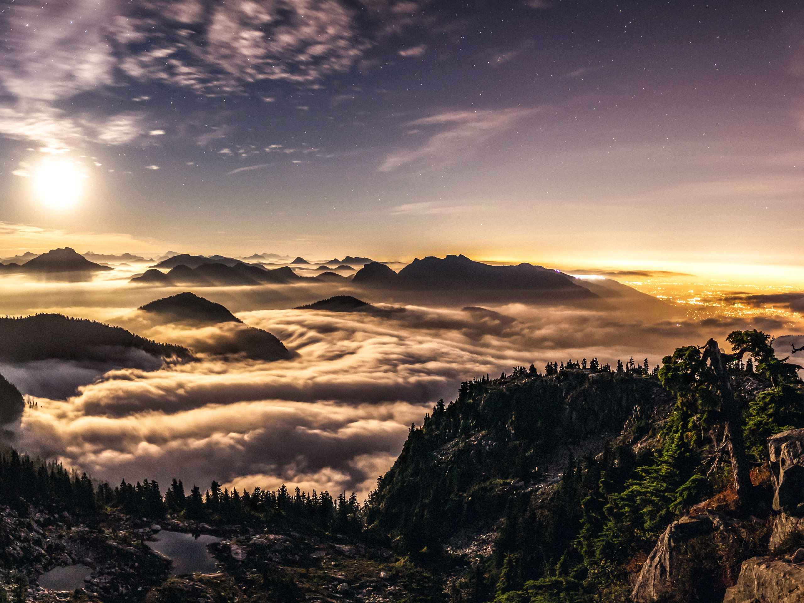
Unnecessary Mountain Hike
Difficulty Rating:
The hike up to Unnecessary Mountain will take you along the Howe Sound Crest Trail, with some truly stunning views that stretch across the North Shore. Take in the sights as you traverse the summit of St. Mark’s before scrambling up the steep ridge to the north peak of Unnecessary Mountain.
Getting there
To get to the Unnecessary Mountain trailhead from Vancouver, drive along the Trans Canada Highway/BC-99 and take the exit to the right for Cypress Bowl Road. Continue on Cypress Bowl Road for 9.3mi until you reach the Black Mountain Lodge/Cypress Mountain Ski area. You will find a parking lot on the left hand side.

About
| When to do | May-October |
| Backcountry Campsites | No |
| Pets allowed | Yes - On Leash |
| Family friendly | No |
| Route Signage | Average |
| Crowd Levels | Moderate |
| Route Type | Out and back |
Unnecessary Mountain Hike
Elevation Graph
Weather
Unnecessary Mountain Hike Description
The Unnecessary Mountain Hike is a moderately trafficked out-and-back, with technical sections of exposed rock and a steep scramble to the final summit. Patience is required when traversing St. Mark’s, as the area around the summit is prone to bottlenecks due to high levels of foot traffic. Hikers should be prepared for all trail conditions and bring proper hiking footwear, including crampons or spikes, to help navigate the ice and/or snow that can be found along the route.
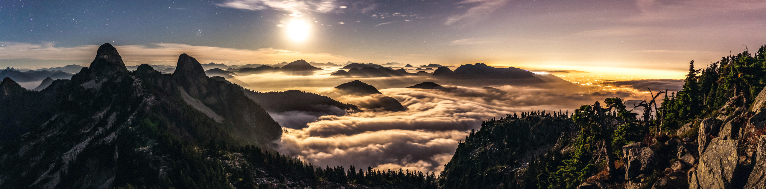
Stretching along a 9.8mi portion of the Howe Sound Crest Trail, the Unnecessary Mountain Hike is actually quite the opposite, as it offers the opportunity to summit several peaks and witness some unparalleled 360° views of the surrounding area. The name comes from the fact that the summit of the mountain used to be a part of the route heading up to the Lions. This route has since been altered, rendering the mountain “unnecessary,” in regards to its former purpose. The odd name aside, this trail is one of the best in the North Shore, allowing you to summit St. Mark’s before reaching Unnecessary Mountain and its commanding view over the entirety of Howe Sound.
To access the Howe Sound trailhead that will take you to Unnecessary Mountain, head to the north end of the parking area and follow along the path that skirts beside the Cypress Creek Lodge until you reach a junction in the trail. Turn right here, and you will very quickly be faced with another fork in the trail, this time heading left. After crossing over Cypress Creek, you will reach a third junction. Follow the trail to the right as you begin to climb uphill and into the ski area.
Keep along this route as you make your way uphill, staying left on the trail until you reach a large green water tower. Just before the water tower, there will be a trail to the right. Follow this path uphill and through the trees until the trail merges with a gravel road. Head left and follow the gravel road until the point where it begins to narrow and transition back into a trail. You will now find yourself on the Howe Sound Crest Trail, making your way toward the summits of St. Mark’s and Unnecessary Mountain.
About 1148ft after entering the forest, you will approach a map of the surrounding area and a junction in the trail that heads left. This leads to Bowen Lookout, a detour that can be skipped, as better views of Bowen Island are available from the summit of St. Mark’s. Shortly after the map, there will be a clearing in the forest where hikers will be able to see the Lions off in the distance.
Continue on the trail as it climbs uphill before opening up into a quaint mountain meadow and crossing over a series of wooden bridges. After this scenic portion of the hike, the trail will begin to steepen, climbing up several switchbacks before levelling out along the top of the ridge. After a brief respite, the trail will once again begin to climb up another set of switchbacks that are even steeper than the last.
Having reached the St. Mark’s Summit, the trail will once again begin to level out, and hikers will be able to explore the various viewpoints of the surrounding area. Be mindful of the steep drop-offs as you take in the beautiful views of Howe Sound, Bowen Island, and Mount Gardner. As this is a popular hiking destination, there may be a lot of other hikers on and around the summit of St. Mark’s; however, the rest of the route to Unnecessary Mountain will be far less busy as you make your way back to the main trail.
Continuing north to the final prize of Unnecessary Mountain, the trail will become more rugged but still well defined by a series of trail markers. This will be the most physically demanding part of the hike, as hikers will descend 574ft from St. Marks and will have to climb back up another 400m to Unnecessary Mountain within a 1.2mi stretch.
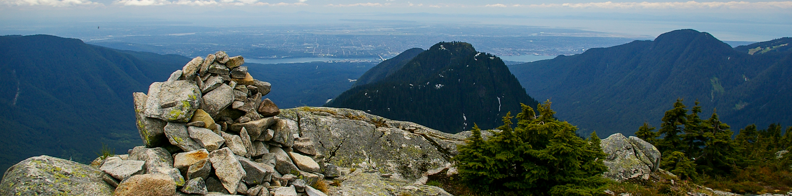
On the approach to the south peak, there is a small, unnamed peak that you can use to rest if you so choose. From here, hikers will have a sweeping view that stretches out to the east with layers of mountains in the distance.
Continue on to the south peak; there will be a sign welcoming you to the summit. Look back along the ridge for beautiful views of St. Mark’s, Black Mountain, and Mount Strachan. You will also be able to look out to the north to see the Lions stretching up into the blue sky, as well as the north peak of Unnecessary Mountain. Keep moving along the trail as it descends once again before making the steep scramble up the ridge to the north peak. This portion of the trail is very rugged and will likely require hikers to use their hands to climb the ridge to the summit.
Having finally reached the summit of Unnecessary Mountain, take in the stunning 360° views of Howe Sound to the west, the expanse of North Vancouver to the east, and of course, the imposing Lions to the north. Rest here awhile to gain back some energy and enjoy a scenic mountain-top lunch before making your way back along the ridge and past St. Mark’s to return to the parking lot at the Cypress Mountain Ski area.
Hiking Route Highlights
St. Mark’s
St. Mark’s is the first peak that you will summit on this hike, and for good reason. In recent years, it has become an iconic local spot for day hikes with a picturesque view of the surrounding area. Trails have since been widened to accommodate the influx of hikers looking to reach the summit, making the area even more accessible.
The Lions
Famous throughout the greater Vancouver area, the Lions are a distinctive pair of pointed mountain peaks that really stand out on the North Shore. Both of these mountains stand over 1600m tall and some of the most recognized Vancouver-area landmarks, inspiring the name for the Lions Gate Bridge.
Insider Hints
Bring poles to help lessen the impact on your knees during the long downhill return.
Bringing dogs on the trail is not encouraged, as there are technical sections of the hike, and a very steep scramble in the final stretch.
Bring a lot of water, as there are no additional sources along the trail.
Bugs along the trail can be bad, especially during the summer months if there isn’t a breeze.
Wear proper hiking footwear, as sections of the trail can be very muddy depending on the time of year.
Due to the high altitude and terrain, ice and snow can be found along the trail. Make sure to bring crampons or spikes to traverse these areas.
Similar hikes to the Unnecessary Mountain Hike hike
Hike to South Needle
The Hike to South Needle follows along an extension of the trail to Lynn Peak, passing by the viewpoint and…

Lynn Lake Trail
The Lynn Lake Trail is a lengthy hike through the Lynn Headwaters backcountry that is sure to get you off…

Old Buck and Bridle Trail Loop
The Old Buck and Bridle Trail Loop is an amalgamation of the Old Buck, Bridle, and Baden Powell trails that…
Comments