Hike to South Needle
View Photos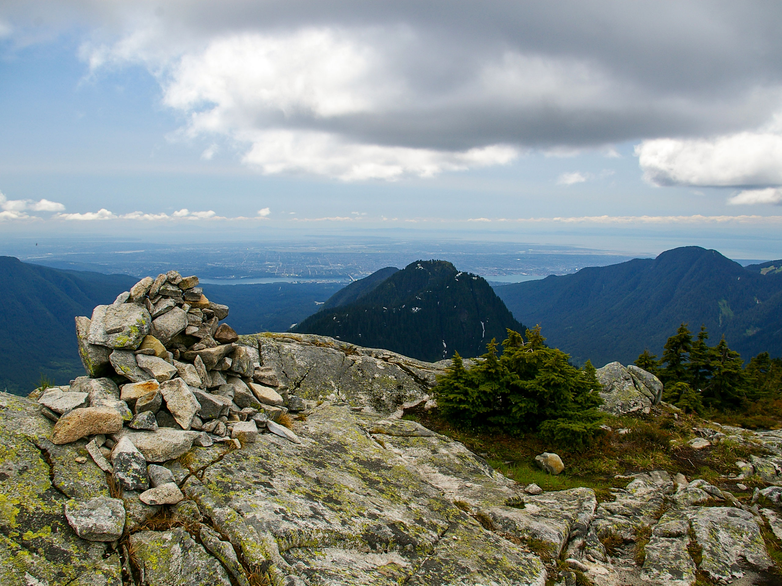
Hike to South Needle
Difficulty Rating:
The Hike to South Needle follows along an extension of the trail to Lynn Peak, passing by the viewpoint and on to the south and north peaks before reaching South Needle further along the Lynn Ridge. This is a dangerous route along an unofficial trail, but for experienced hikers the reward is worth the effort, as South Needle offers some stunning views of the surrounding area. This route will take longer than you think, so leave early to tackle this relatively untravelled trail.
Getting there
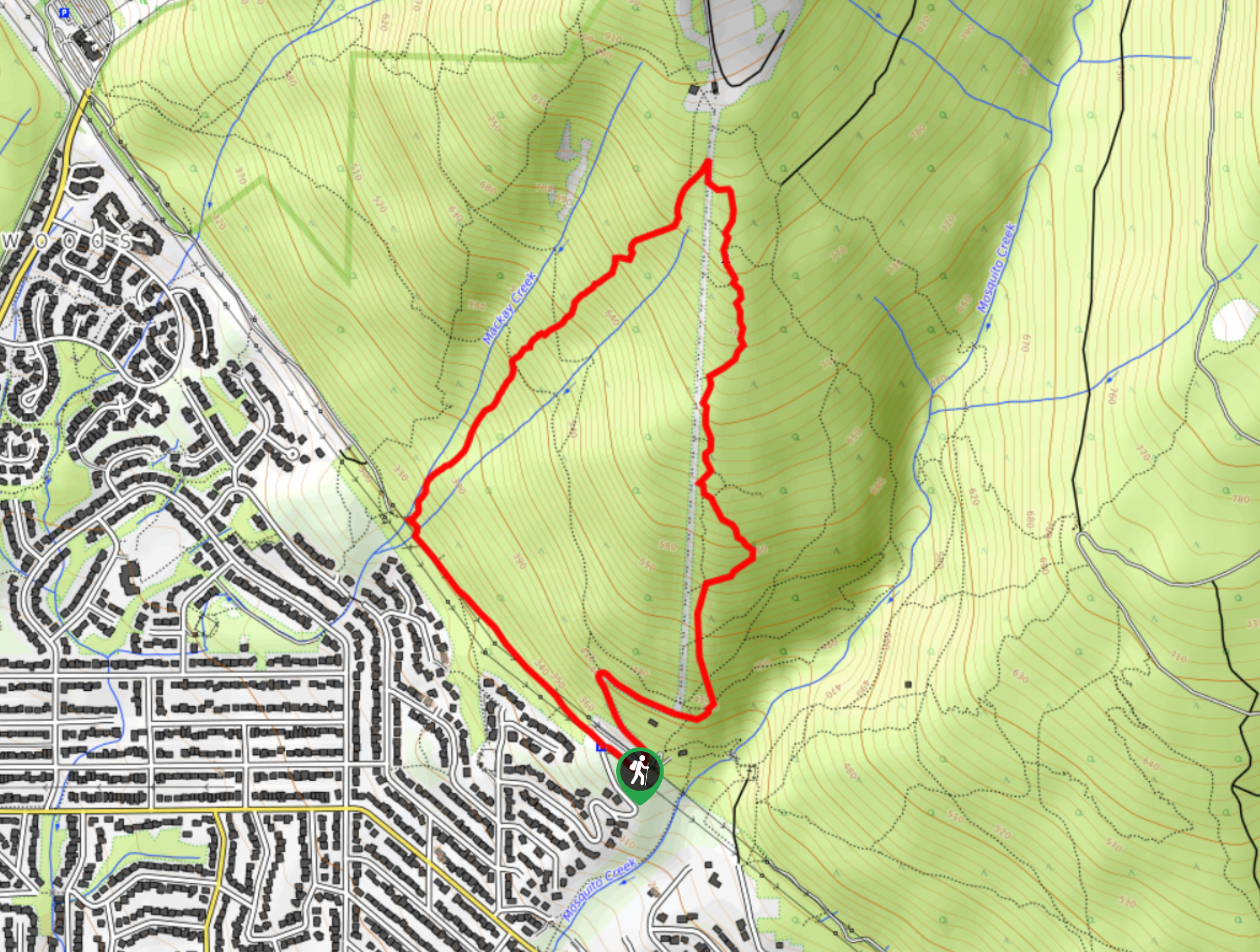
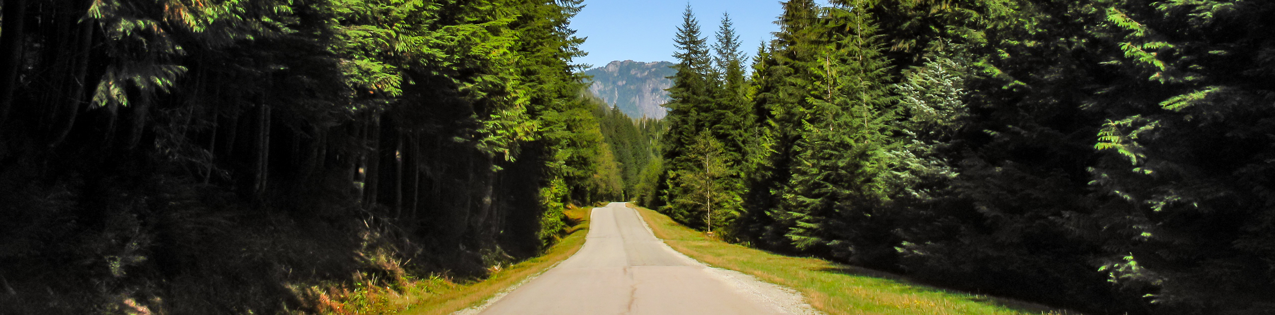
To get to the parking lot at the trailhead for the Hike to South Needle, drive north on the Trans Canada Highway/BC-1 W, and cross over the Ironworkers Memorial Bridge. Leave the highway, taking the exit on the right for Mountain Highway. Make a right turn after 1.6mi onto Lynn Valley Road and follow it for 1.9mi to arrive at the parking lot.

About
| When to do | June-September |
| Backcountry Campsites | No |
| Pets allowed | No |
| Family friendly | No |
| Route Signage | Average |
| Crowd Levels | Low |
| Route Type | Out and back |
Hike to South Needle
Elevation Graph
Weather
Hike to South Needle Description
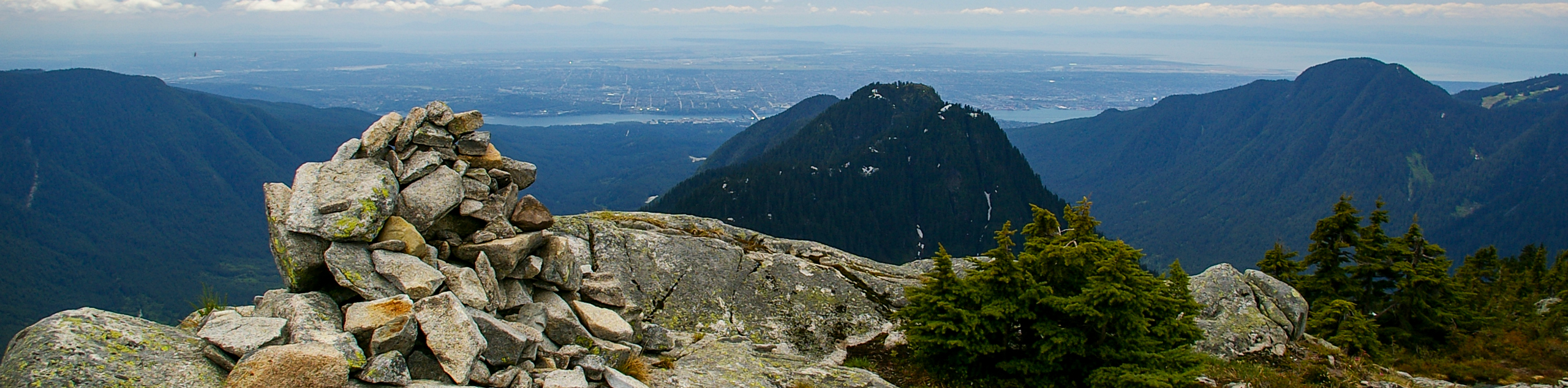
The hike to South Needle is a difficult 8.8mi out-and-back that is only recommended for experienced hikers, due to a strenuous elevation gain and the fact that the final portion of the route stretches beyond the officially sanctioned trails of Lynn Headwaters Regional Park. As such, it is not a maintained trail and has seen several hikers need to be rescued after becoming stranded on the steep slopes. In all, the hike is physically demanding but equally rewarding, as the views from South Needle are far better than those found on nearby Lynn Peak.
After registering at the trailhead, follow the trail to the south to make your way around the lower portion of the Lynn Loop. After the trail swings northward, take the trail to the right to set off toward Lynn Peak, climbing uphill as the trail works its way through the trees. After 1.9mi, you will reach a viewpoint that seems like the end of the trail. To the left of the main trail, the markers will change from orange to pink, signifying an extension of the trail. Follow this to continue along the ridgeline to the southern and northern Lynn peaks.
Continue along the ridge through a series of drops and climbs, eventually passing over Lynn Peak on your way to South Needle. This last portion of the hike is technical, with extremely steep slopes on the eastern side of Lynn Ridge. As you exit the tree cover on South Needle, you will have stunning views to the south along the ridge that you just traversed, as well as sweeping views of nearby North Shore mountains. After you’ve taken in the sights, carefully make the return journey along the same trail to the carpark below.
Similar hikes to the Hike to South Needle hike

Lynn Lake Trail
The Lynn Lake Trail is a lengthy hike through the Lynn Headwaters backcountry that is sure to get you off…
Mackay Creek Trail Loop
The Mackay Creek Loop Trail is an intense workout for hikers that love a steep incline along a short route.…
Seymour Valley Trail
The Seymour Valley Trail is a 14.9mi out-and-back that follows alongside the Seymour River and is primarily used…
Comments