Seymour Valley Trail
View Photos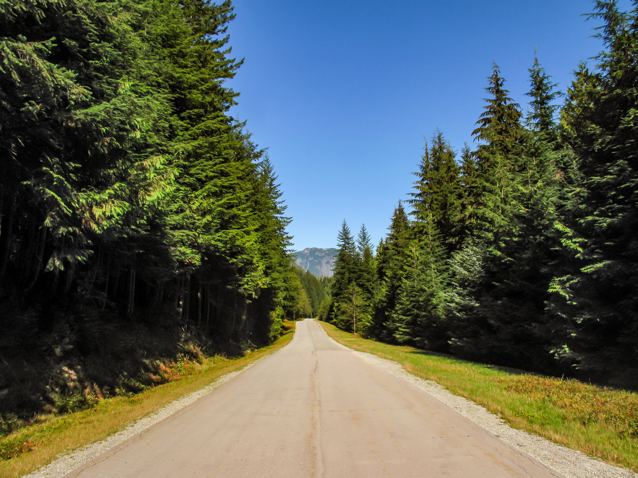
Seymour Valley Trail
Difficulty Rating:
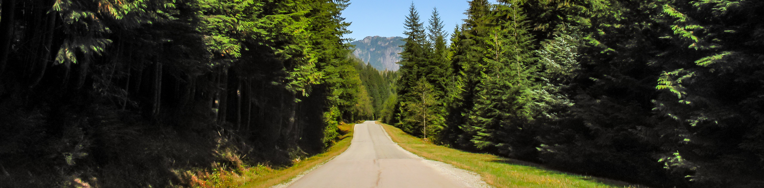
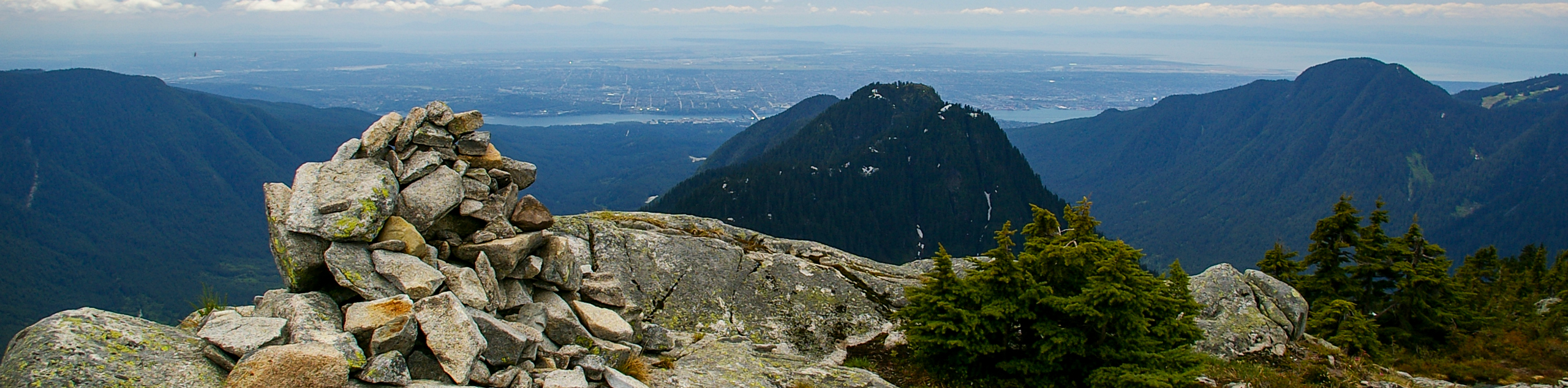
The Seymour Valley Trail is a 14.9mi out-and-back that follows alongside the Seymour River and is primarily used as a biking trail. The wide paved paths and gentle terrain make this route popular with families and the initial stretch of trail up to Rice Lake is suitable for wheelchairs and strollers. Hikers that reach the end of the trail at Seymour Lake will be greeted with a lookout that has beautiful views of the lake and its mountainous backdrop.
Getting there
To reach the parking area for the Seymour Valley Trail from Vancouver, head north on Trans Canada Highway/BC-1 W and take exit 22B toward Mount Seymour Parkway. Quickly merge onto Fern Street, which will transition to Lillooet Road. Follow this for 0.8mi, turning left at the fork to keep on Lillooet Road and continue on it for another 2.1mi. The road will veer to the right as you pass by the Seymour-Capilano Water Treatment Plant and arrive at the parking lot.

About
| When to do | Year-Round |
| Backcountry Campsites | No |
| Pets allowed | No |
| Family friendly | Yes |
| Route Signage | Average |
| Crowd Levels | High |
| Route Type | Out and back |
Seymour Valley Trail
Elevation Graph
Weather
Seymour Valley Trail Description
The Seymour Valley Trail is a wide paved path that cuts through the lush forests of the Lower Seymour Conservation Area, travelling nearly parallel to the Seymour River as it winds its way toward Seymour Lake. At 14.9mi, this is a long out-and-back, but the paved path and gentle elevation changes make it doable in a day. As the trail is mainly used by bikers, make sure to keep an eye out and keep to the edge of the path if you are travelling by foot.
As mentioned, this is a lengthy trail that pushes through the dense forest on its way to Seymour Lake. This body of water is used as a drinking water reservoir, meaning that you won’t be able to access the area immediately surrounding the lake. The long journey is still worth the effort as you will be able to witness some beautiful scenery, including views of the lake in front of a majestic mountainous backdrop, as well as the experience of following along the trail through a beautiful stretch of West Coast Forest.
Setting out from the parking area north of the Seymour-Capilano Water Treatment Plant, follow the trail to the left as it crosses Rice Lake Road and passes by the roundabout. Continue along the Seymour Valley Trail as it heads north and skirts around Rice Lake. Past the Rice Lake Picnic Area, a fork in the trail will direct the Seymour Valley Trail to the right as you hike along the wide paved path that is surrounded by a dense forest of trees.
In 2789ft, you will reach another junction near the road. Follow the trail to the left and continue through the forest for another 4.3mi. Here, the trail will cross the Seymour Falls Dam Road that runs by the Stoney Creek Picnic Area. Cross the road to pick up the Old-Growth Trail on the other side and follow it for 2km to get to Seymour Lake. After taking in the amazingly scenic views from the Seymour Dam Lookout, make your way back along the trail to return to the parking area, having conquered the Seymour Valley Trail.
Similar hikes to the Seymour Valley Trail hike
Hike to South Needle
The Hike to South Needle follows along an extension of the trail to Lynn Peak, passing by the viewpoint and…

Lynn Lake Trail
The Lynn Lake Trail is a lengthy hike through the Lynn Headwaters backcountry that is sure to get you off…

Old Buck and Bridle Trail Loop
The Old Buck and Bridle Trail Loop is an amalgamation of the Old Buck, Bridle, and Baden Powell trails that…
Comments