Cypress Falls Hike
View Photos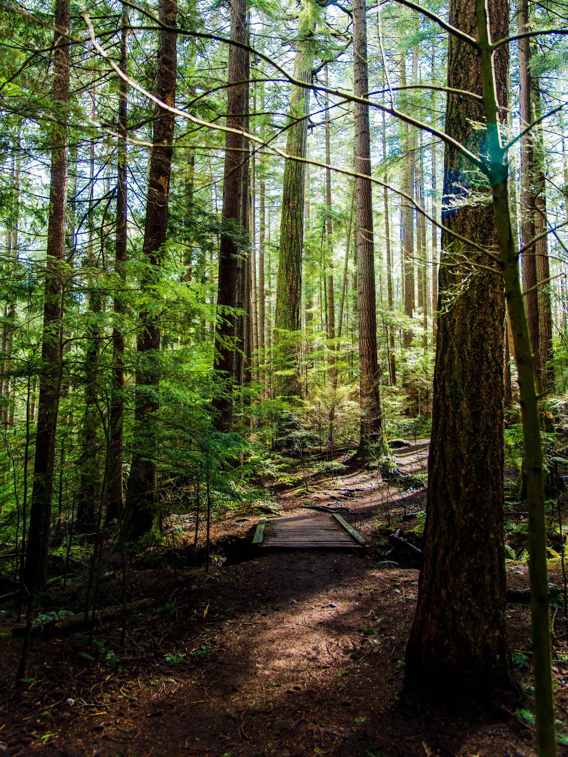
Cypress Falls Hike
Difficulty Rating:
The Cypress Falls Hike on the North Shore of Vancouver is a fantastic trail where you can experience a stunning pair of waterfalls set within a beautiful BC rainforest backdrop. This small park has a network of trails that allow you to head straight for the falls or meander through the forest to get lost in nature.
Getting there
To get to Cypress Falls Park from the Lions Gate Bridge, head northeast on BC-1A/BC-99 and use the right lane, merge onto Marine Drive toward Capilano Road. Turn left onto Capilano Road and follow it for 2625ft, merging onto the Trans Canada Highway/BC-1 West. Take exit 4 toward Woodgreen Drive and follow it until you reach Woodgreen Place. Turn right and you will reach the parking lot.

About
| When to do | Year-Round |
| Backcountry Campsites | No |
| Pets allowed | Yes |
| Family friendly | Yes |
| Route Signage | Poor |
| Crowd Levels | High |
| Route Type | Out and back |
Cypress Falls Hike
Elevation Graph
Weather
Cypress Falls Hike Description
The Cypress Falls Hike is a popular trail due to its scenic views, year-round accessibility, and easy terrain. As such, it is best to arrive early to get a parking spot and avoid any high-volume foot traffic along the trail. Hikers should be cautious of the sections of the trail that hug closely along the banks of Cypress Creek, as trail markings can be poor in some of these areas. While the trail is not difficult, be mindful of your proximity to the creek if you are out hiking with small children and/or dogs.
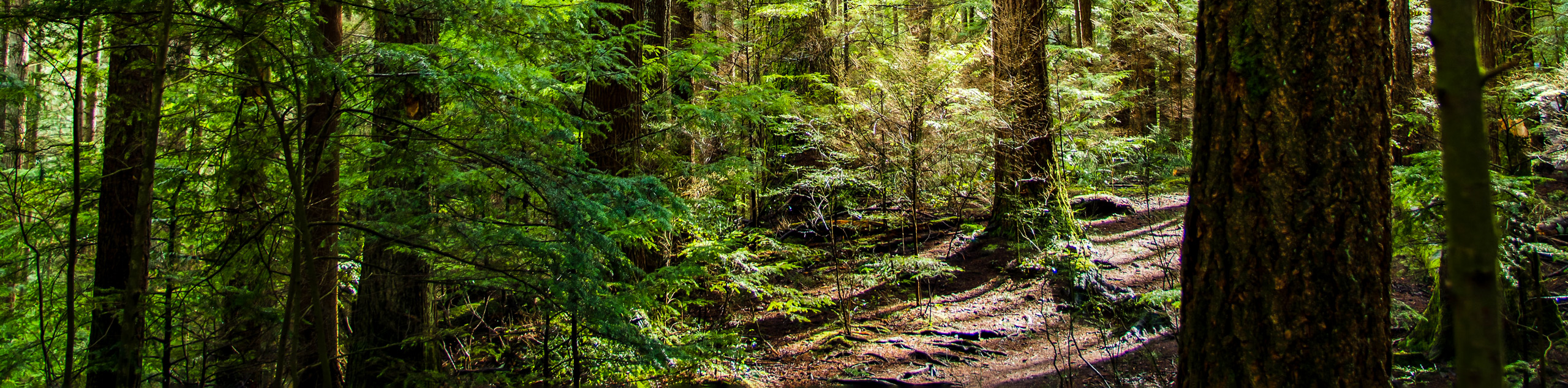
A short 1.3mi out-and-back, the Cypress Falls Hike is a perfect winter hiking option for times when many other trails at higher elevations tend to be blanketed with deep snow. Skirt along the banks of Cypress Creek as you walk through scenic forests of 300-year-old cedar and douglas fir trees, and cap off the day with beautiful views of both the upper and lower Cypress Falls.
Setting out from the parking lot at the end of Woodgreen Place, walk east along the trail as it drops down and into the forest. Continue on the trail as it veers north, reaching a junction where it splits into two parallel paths. Follow the trail to the left, as you will be returning using the path on the right. Move along the wide upper trail for a few hundred meters, passing by ancient, moss-covered Western Cedar and Douglas Fir trees until you reach the Lower Cypress Falls.
Within this area, there are two vantage points from which you can view the lower falls. Head down to the wooden fence below the main trail to catch a glimpse of the falls from below as the water passes over the rocks. The second vantage point sits atop the falls from a concrete platform. From here, you can take in the opposite view as you watch the rushing water crash down over the falls. This area is a great quick-access point from the parking lot for families with young children that are looking to experience the beautiful West Coast rainforest; however, be careful to stay clear of the edge of viewing platforms, as there are steep drops into the canyon below.
After taking in the views of the Lower Cypress Falls, ignore the wooden bridge that leads across the creek and continue north along the trail that climbs up the hill and to the left of the falls. The network of trails within the park can be poorly marked in certain areas, so continue north along the trail that follows alongside the creek for the most direct route to the upper falls.
Keeping the creek on your right, make your way up the hill until you reach a chain-link fence marking the boundary of the Cypress Falls Park. Hikers are permitted to use the trails on the neighbouring private land, so continue on past the fence to reach the upper falls.
As you get closer to the falls, you will begin to notice the sound of rushing water growing louder before the Upper Cypress Falls come into your view on the right. From the vantage point, you will be able to witness the power and beauty of the falls as they pour water down into the canyon below. After taking in the awesome sights, turn back and follow the path as it winds along the creek.
When you reach the area of the lower falls, take a few moments to cross over the wooden bridge and climb the short, steep path, where you will find an ancient grove of old-growth Western Cedar and Douglas Fir trees that date back over 300 years. After experiencing the beauty of these giants, head back over the bridge and follow the lower trail along the fence, as it eventually leads you back to the main trail and towards the parking lot.
Insider Hints
Head to this trail in the winter, when many trails at higher altitudes are covered with snow.
Watch children and dogs in the areas around the falls, as there are steep drop-offs.
Crossing the wooden bridge and following the trail will extend your hike along a beautiful stretch of forest, but reaching the upper falls on this side of the creek can be tricky.
Wear proper footwear, as the trail can become slippery when wet.
Similar hikes to the Cypress Falls Hike hike

Whytecliff Park - Panorama Ridge Trail
The Panorama Ridge Trail is a short trail within Whytecliff Park that is perfect for an afternoon stroll to get…

Old Buck and Bridle Trail Loop
The Old Buck and Bridle Trail Loop is an amalgamation of the Old Buck, Bridle, and Baden Powell trails that…

Goldie and Flower Lake Loop
The Goldie and Flower Lake Loop is a short trail that makes its way through the peaceful terrain surrounding these…
Comments