Hollyburn Mountain Hike
View Photos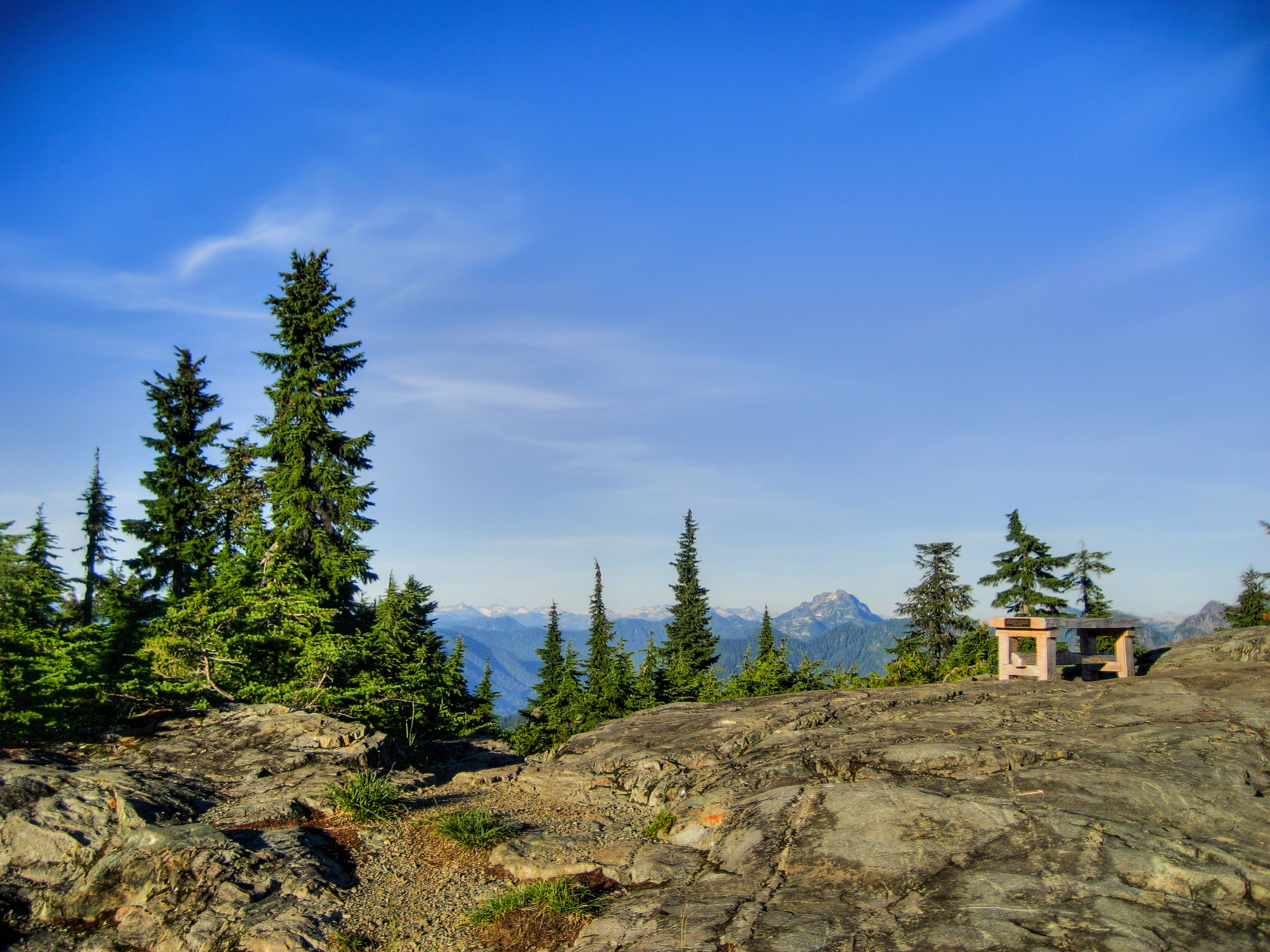
Hollyburn Mountain Hike
Difficulty Rating:
The Hollyburn Mountain Hike is a 4.3mi out-and-back trail in the Cypress Mountain area for hikers looking to reconnect with nature. Trek uphill through meadows full of berry bushes to reach beautiful views that stretch west to the Georgia Strait. This scenic trail is perfect for a weekend trek out of the city.
Getting there
To get to Eagle Bluffs from Vancouver, head west on the Trans Canada Highway/BC-1 and take the right exit for Cypress Bowl Road. Continue on Cypress Bowl Road for 8.1mi and make a right turn toward the Cypress Mountain Hollyburn Nordic Area. In 1640ft, the parking area will be straight ahead.

About
| When to do | July-October |
| Backcountry Campsites | No |
| Pets allowed | Yes - On Leash |
| Family friendly | Older Children only |
| Route Signage | Average |
| Crowd Levels | Moderate |
| Route Type | Out and back |
Hollyburn Mountain Hike
Elevation Graph
Weather
Hollyburn Mountain Hike Description
There are several points from which hikers can access the trail that will take them on the Hollyburn Mountain Hike, but this route will begin along Cypress Bowl Road at the Cypress Mountain Hollyburn Nordic Area. This trail maintains a fairly steady climb, so be prepared to face a bit of an incline as you make your way up to the peak. Additionally, hikers should wear proper footwear or snow gear (crampons, spikes, snowshoes) as the early and late season trail conditions can be very muddy and/or covered in snow and ice.
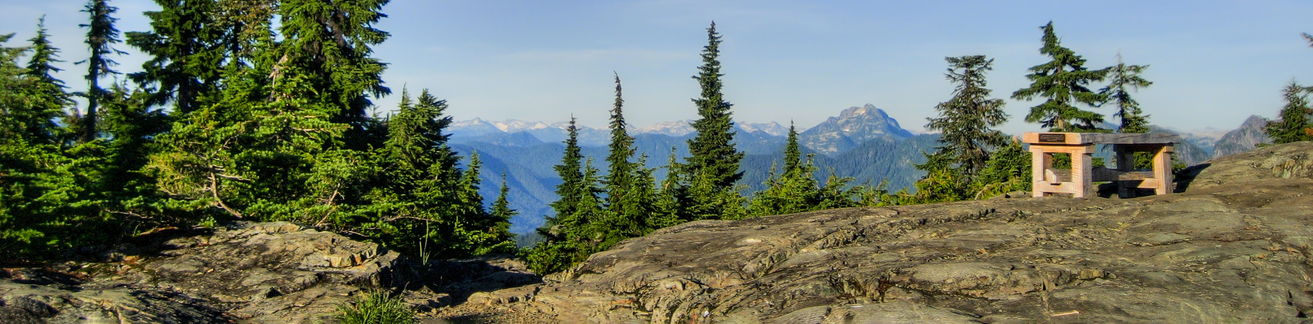
Seasonal trail conditions aside, the Hollyburn Mountain Hike is an amazingly scenic trek for anyone needing to reconnect with the wilderness and escape from the hustle and bustle of the city. Along the trail, hikers will catch some beautiful views of Vancouver and the Georgia Strait before taking in the stunning sights from the peak of Hollyburn Mountain, looking out over the Gulf Islands to the west, the Lions to the north, and nearby Grouse Mountain to the east.
Setting out from the parking area, walk beyond the BC Parks trail map and head to the left to begin an uphill climb along the trail next to the power lines. Continue up the trail for 1969ft, where you will walk past a series of lakes on your left. In another 1148ft, you will reach a junction with the Baden Powell Trail near the Fourth Lake. Follow this trail to the left, passing by the hut used by cross-country skiers in the winter, and skirting around Fourth Lake as you continue uphill.
Be mindful when hiking through this stretch of bush-covered meadow, as the late summer/early autumn season attracts bears that like to gorge themselves on berries prior to hibernating for the winter.
Keeping on the trail through the meadow for another kilometre, you will reach a junction in the trail marked for Hollyburn Mountain. Follow this trail to the right, climbing along the path as it weaves its way uphill. In approximately 1640ft, you will approach another junction with a short path to the right. Following this for a few meters will reveal a lookout to the east, where hikers will be able to spot Grouse Mountain and the surrounding area.
After taking in the westerly sights, head back to the junction and follow it to the right to continue on the trail to the peak of Hollyburn Mountain. Another short distance of 1804ft will see the tree cover along the ridge begin to dissipate as you make your way onto the rocky outcrop of the peak.
Climbing up to the pinnacle of Hollyburn Mountain, you will be rewarded with breathtaking views of West Vancouver, the Gulf Islands, and the Georgia Strait. Peering north, you will be able to make out the twin peaks of the Lions protruding majestically into the blue sky, and back to the east, you will once again be able to make out Grouse Mountain and Capilano Lake in the forefront.
Take a few moments to breathe in the fresh mountain-top air of Hollyburn Mountain, revelling in the beautiful sights of the Vancouver area before heading back down the trail through the meadows on your return journey to the carpark.
Hiking Route Highlights
The Lions
Visible throughout much of the greater Vancouver area, the Lions are a pair of pointed mountain peaks that stand out amongst the rest of the North Shore Mountains. Each standing over 1600m tall, these mountains are among the most famous Vancouver landmarks, even prompting the BC Lions to name their football team after them.
Capilano Lake
Located within the Capilano River Regional Park, this man-made lake provides the Vancouver area with 40% of its fresh drinking water and is capped by the Cleveland Dam on its southern end.
Insider Hints
Bring bear spray, as portions of this trail pass by areas where bears frequently forage.
Wear proper hiking footwear, as seasonal trail conditions can be muddy, snowy, or icy.
This trail can be buggy. Make sure to pack bug spray in warmer months.
Similar hikes to the Hollyburn Mountain Hike hike

Lynn Lake Trail
The Lynn Lake Trail is a lengthy hike through the Lynn Headwaters backcountry that is sure to get you off…

Old Buck and Bridle Trail Loop
The Old Buck and Bridle Trail Loop is an amalgamation of the Old Buck, Bridle, and Baden Powell trails that…

Goldie and Flower Lake Loop
The Goldie and Flower Lake Loop is a short trail that makes its way through the peaceful terrain surrounding these…
Comments