Mount Strachan hike
View Photos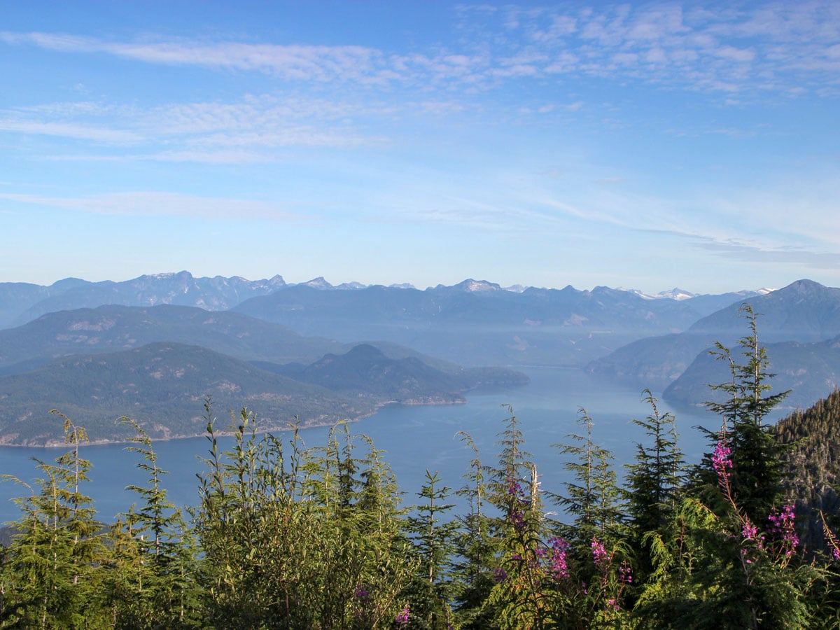
Getting there
The hike to Mount Strachan starts from the Cypress Mountain Resort parking lot. Take Highway #1 West and take Exit #8 onto Cypress Bowl Rd. Follow this highway for 9.3mi to the downhill ski parking lot.

About
| When to do | July to October |
| Backcountry Campsites | No |
| Pets allowed | Yes - On Leash |
| Family friendly | No |
| Route Signage | Average |
| Crowd Levels | Low |
| Route Type | Circuit |
Mount Strachan
Elevation Graph
Weather
Route Description for Mount Strachan
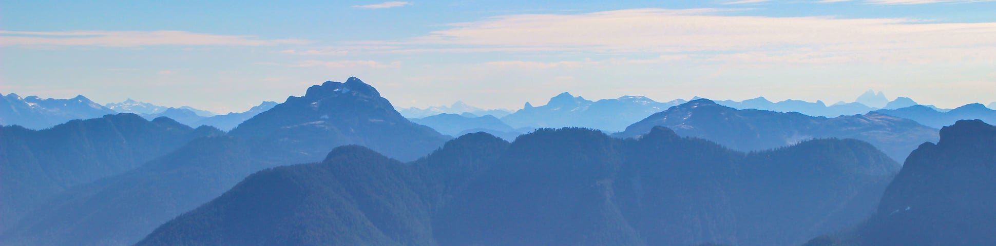
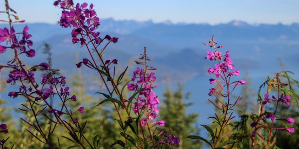
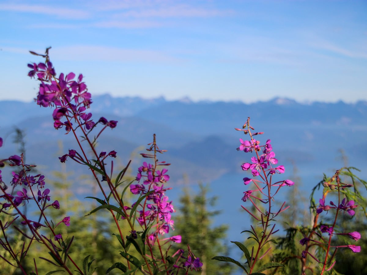
The Mount Strachan hike may be a tad more difficult than nearby St. Mark’s Summit, but it offers quieter trails and stunning panoramic views of the Sea to Sky Mountains on one side and views of the Howe Sound on another.
We like to hike the Mount Strachan hike in a clockwise loop starting from the Cypress Mountain Resort parking lot.
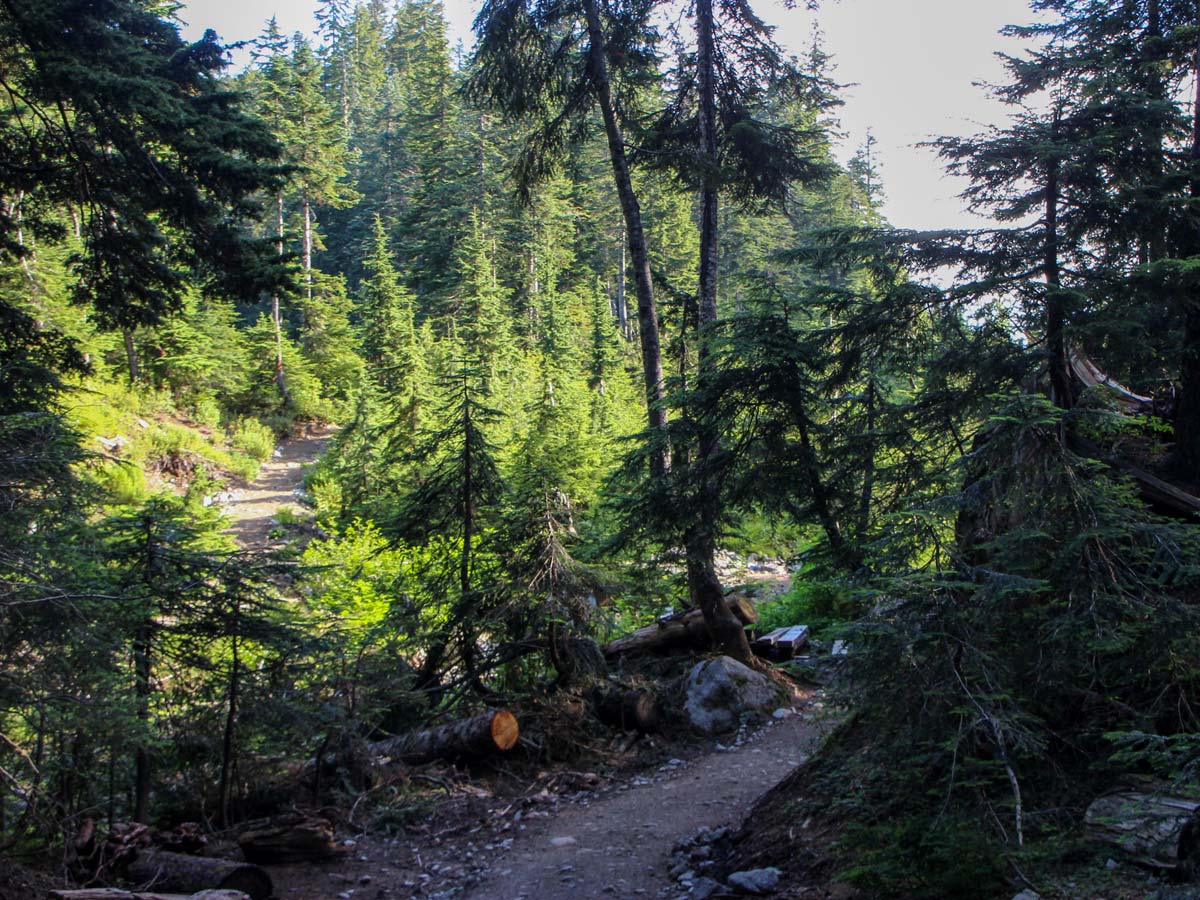
From the parking lot, walk to the large Cypress Creek Lodge. Standing directly in front of the lodge, you’ll see the Lions Express Quad Chairlift. Towards the bottom of the chairlift, find a marker for the Howe Sound Crest Trail. Press forward onto the trail and into the trees.
Immediately, the path forks again. The marker will tell you to go right for Howe Sound Crest Trail, but you want to head straight in the direction of the Bowen Lookout for a more scenic hike.
Soon, you will come to another junction with another chairlift on your left – the Eagle Express Quad Chair. Continue straight until you reach another junction, marked for Bowen Lookout.
Follow the signs for Bowen lookout, until you pop out onto a gravel road. Go left onto the road. Follow the easy trail over a small stream and then head uphill again.
If you’ve never seen the view from Bowen Lookout before, detour off the trail for 1640ft to the peak, it’s a nice view. Retrace your steps from Bowen Lookout back to the come back to the trail and head left onto the trail – in the same direction you were walking before into the forest.
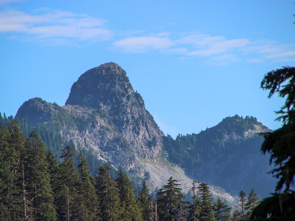
Walking uphill, it’s not long before you hit a major junction. You’ll know you’ve arrived when you spot a large map for the Howe Sound Crest Trail. Go left from this point, keeping a lookout for The Lions off in the distance. From this point, you are following the route to the St. Mark’s Summit.
It is imperative that from this point, you pay close attention to find the trail to Mount Strachan.
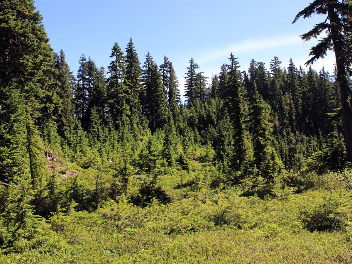
Around 2.2mi into the hike you will come to Strachan Meadows. There are two small, wooden bridges going over a creek. The trail to Mount Strachan is off to your right between these small bridges. Between the two bridges on your right, you will see an overgrown trail into the brush. It’s hard to see, but it’s there. Go right onto the trail.
This part of the trail is bushy and can be hard to follow, look up into the tree branches for trail markers.
Tackle a steep debris chute, commonly known as Christmas Gully. Continue to scramble all the way up to the top if safe to do so, don’t do this while there is still snow. This gully is snow bound well into spring and summer.
On your left, find a trail that veers into the trees, follow it and climb parallel to the gully for about 10 minutes, before you come back to Christmas Gully. Go up the centre of Christmas Gully all the way to the top, keeping an eye out for loose rocks.
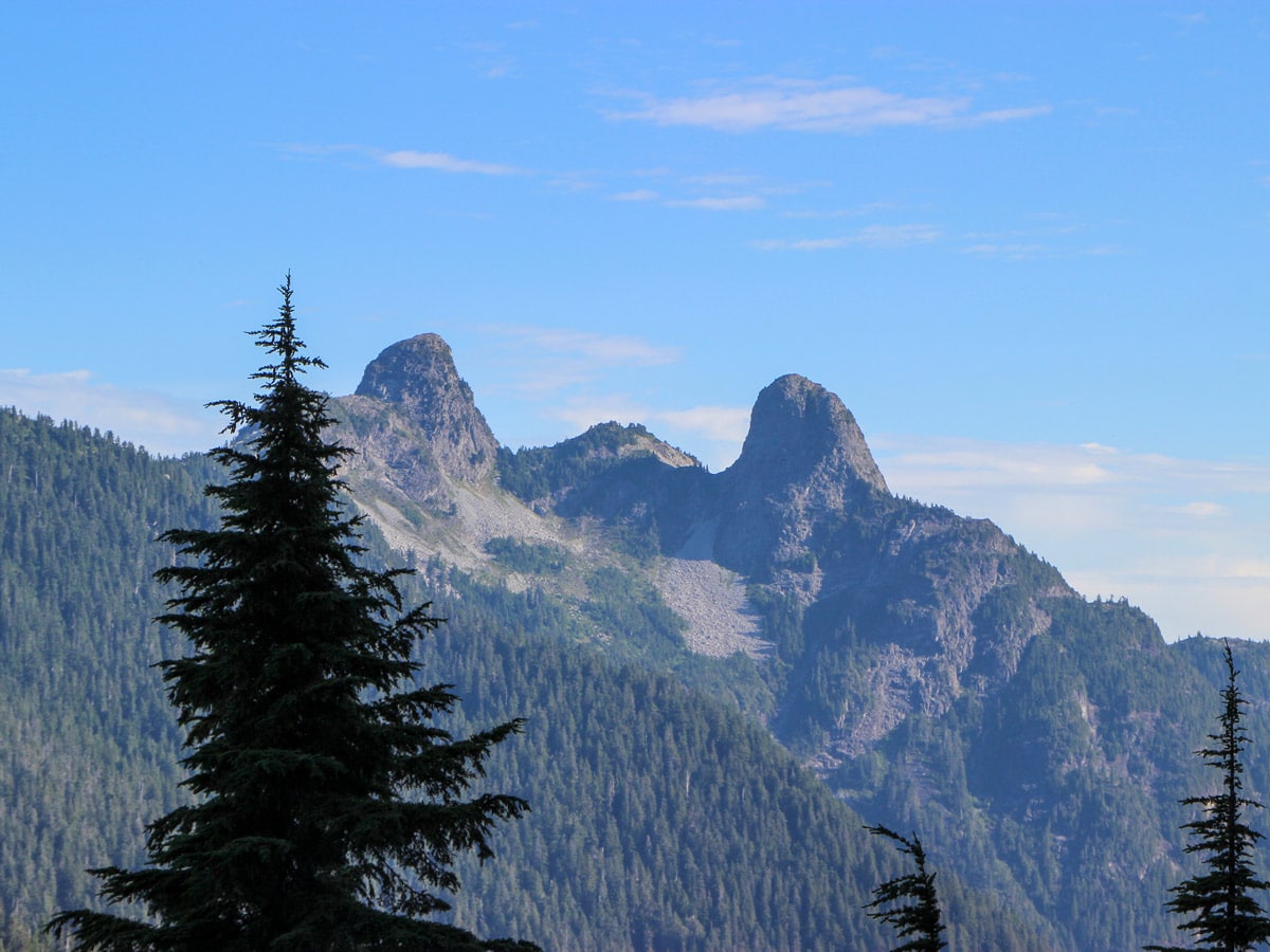
At the top enjoy the stunning views behind you, and you will also find a clearing between the two summits of Mount Strachan. Head to the left to tackle the 10-minute scramble up the north summit of Mount Strachan first. Follow the bright orange rocks.
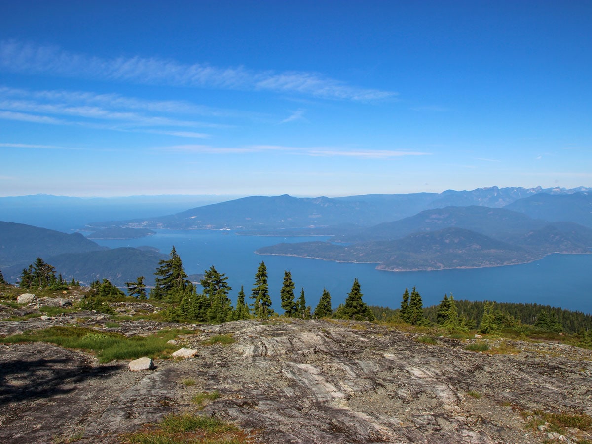
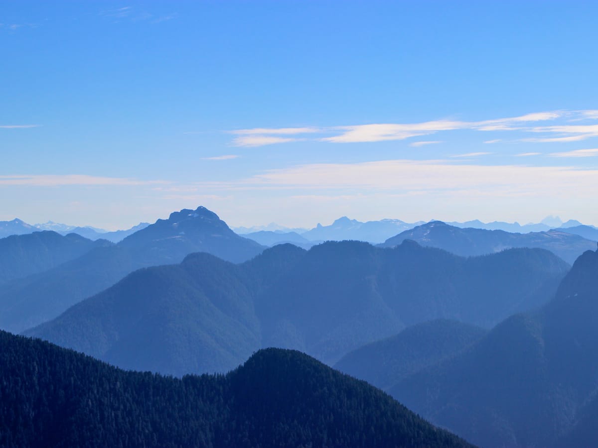
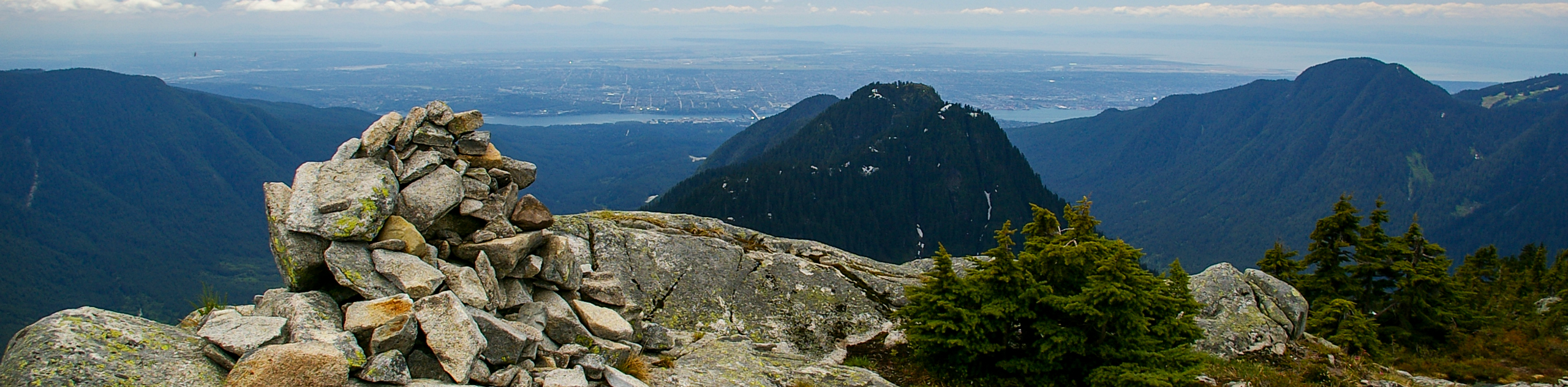
You’ve made it! Enjoy panoramic views stretching from the North Shore to the Sea to Sky mountains. You’ll also notice Golden Ears, The Lions and if you’re lucky, Mount Garibaldi.
When ready, retrace your steps back to the clearing at the top of the gully. This time head to the south peak which is now directly across from you.
Prepare your aching muscles for another hike to reach the south peak, where you’ll find views overlooking Howe Sound.
Continuing to follow the trail on the southern side of South summit of Mount Strachan. You should find yourself next to the Sky Chair chairlift.
While it may feel like you’re on the way home, this is where things get tricky, as the trail can be very hard to spot from here. Take your time to find the trail markings, you may think you’re on the path only to find a dead end.
Don’t be discouraged, the trail should be down a ways and left from the chairlift. You should find two bright orange markers, where the path heads into the trees a few meters, then becomes a defined path once more.
Once the trail drops down sharply, you will know you are on it.
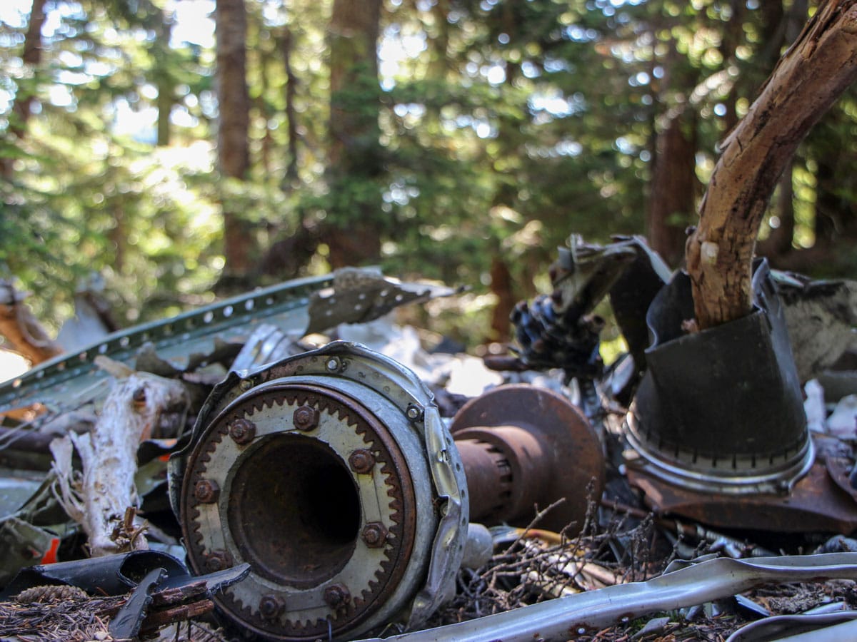
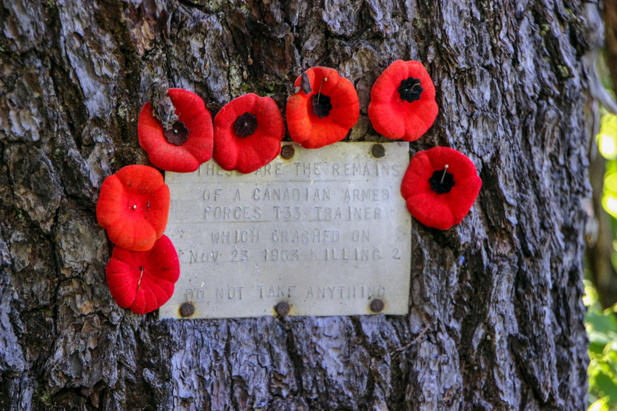
Follow the steep trail as it zig-zags back and forth. In about 20 minutes you will find the wreckage of the T-33 military jet along the trail. Please be mindful of the historical importance and of those who lost their lives in the wreckage. Do not touch the plane.
Pressing onwards, continue until the trail turns into a gravel road/ski run, from this point on it’s an easy hike down to the lodge and the parking lot.
Insider Hints
Snow starts early in the winter and persists late into the year. When there is snow, avalanche risk exists.
Bears are common on the Mount Strachan hike outside of winter. This is not a route for the inexperienced hiker.
Note: Instead of descending the ski run/ gravel road, you can stay on the trail which continues shortly before it merges to the ski run. This adds significant time and technical terrain to the hike. If you’re tired, just go down the ski run.

Similar hikes to the Mount Strachan hike
Hike to South Needle
The Hike to South Needle follows along an extension of the trail to Lynn Peak, passing by the viewpoint and…

Lynn Lake Trail
The Lynn Lake Trail is a lengthy hike through the Lynn Headwaters backcountry that is sure to get you off…

Old Buck and Bridle Trail Loop
The Old Buck and Bridle Trail Loop is an amalgamation of the Old Buck, Bridle, and Baden Powell trails that…
Eric Parats 5 years ago
Enchanting and captivating scenery throughout the journey! Mount Strachan is the most undiscovered hike on the North Shore. The first section is under forest cover, and it is quite rough but manageable if you're strong enough.
Brandon Houston 5 years ago
It was a great opportunity to see the all-embracing beauty scenery at the top. There are lot's of stuff to maneuver around. Then it becomes mostly open to the sun. And it becomes rocky, meaning very rocky!
Kenneth D. 5 years ago
Amazing hike with terrific views. The trail is not well marked and doesn't even show up on any maps or signposts.
Rixy H. 5 years ago
going down on the trail from the south summit can be tricky because of the lack of markers...the steep climb at the end of the creek was slippery as well..overall great hike, the views were simply stunning.
Nathan R. 5 years ago
Great hike and views at the top, definitely worth checking out both North & South peaks. We saw bears on the path back down. Very relaxed, but always keep an eye open!
Jude L. 5 years ago
Wear good boots because there are some muddy sections downhill. It's a tough climb, but the views are stunning at the top. This is a fun technical trail, especially if you enjoy a bit of trail searching.
Nadeem Medulla 5 years ago
There are two peaks to Mount Strachan and it may be tempting to stop at the first peak. The first peak has great views but to get to the remarkable views, you need to get to that second peak. Fun and enjoyable.