
Capilano River Regional Park hike
View Photos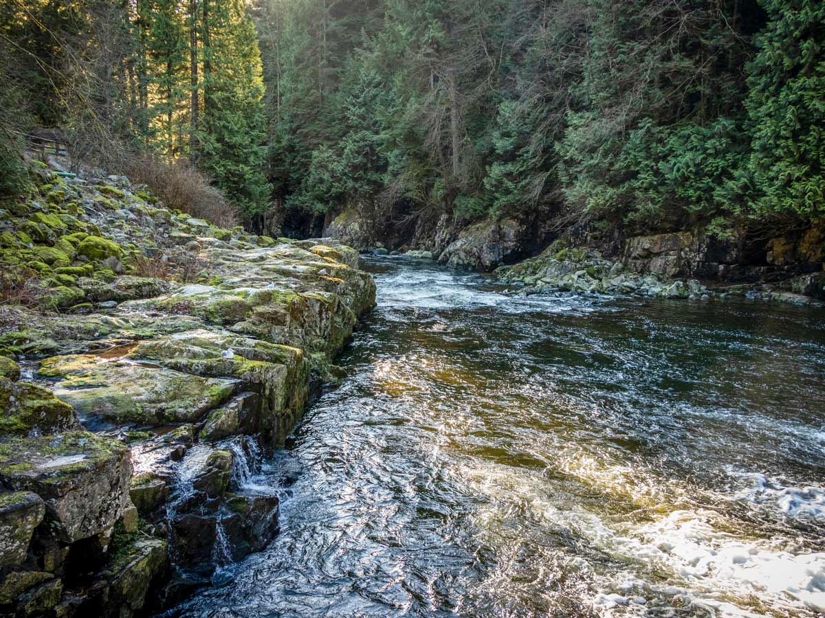
Capilano River Regional Park hike
Difficulty Rating:
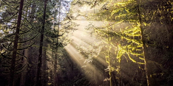
Wander in one of Metro Vancouver’s oldest parks, the Capilano River Regional Park. Choose from trails spanning over 16.2mi, featuring highlights like the incredible Capilano Canyon, the Cleveland Dam, the Capilano River, and a salmon hatchery. Feel small among the impressive canyon walls of jutting cliffs then observe the rushing white-water of the river for a quick outdoor adventure.
Getting there
From the Upper Levels Highway (HWY #1), take exit #14, heading north onto Capilano Road. Capilano Road will turn into Nancy Green Way. Follow Nancy Green Way past the Capilano Suspension Bridge, passed the signs for the salmon hatchery, and turn left into the parking lot which is clearly signed for the Cleveland Dam.

About
| When to do | All seasons |
| Backcountry Campsites | No |
| Pets allowed | Yes - On Leash |
| Family friendly | Yes |
| Route Signage | Average |
| Crowd Levels | Moderate |
| Route Type | Circuit |
Capilano River Regional Park
Elevation Graph
Weather
Route Description for Capilano River Regional Park
To start the Capilano River Regional Park hike, head to the west side of the Cleveland Dam parking lot where you’ll find a trail map to get orientated. First, head up the concrete stairs, leading to the large field overlooking the man-made Capilano Lake. Here ,you can find the reservoir that supplies about 40 per cent of Metro Vancouver’s drinking water.
From this point, you’ll have unparalleled views of The Lions overlooking Vancouver. Look northwards, where Grouse Mountain can be spotted.
Follow the path as it drops down to the main road. Involve little ones in learning about the local history through interpretive signs about the Cleveland Dam and the park itself. Then head to the top of the dam along the paved road.
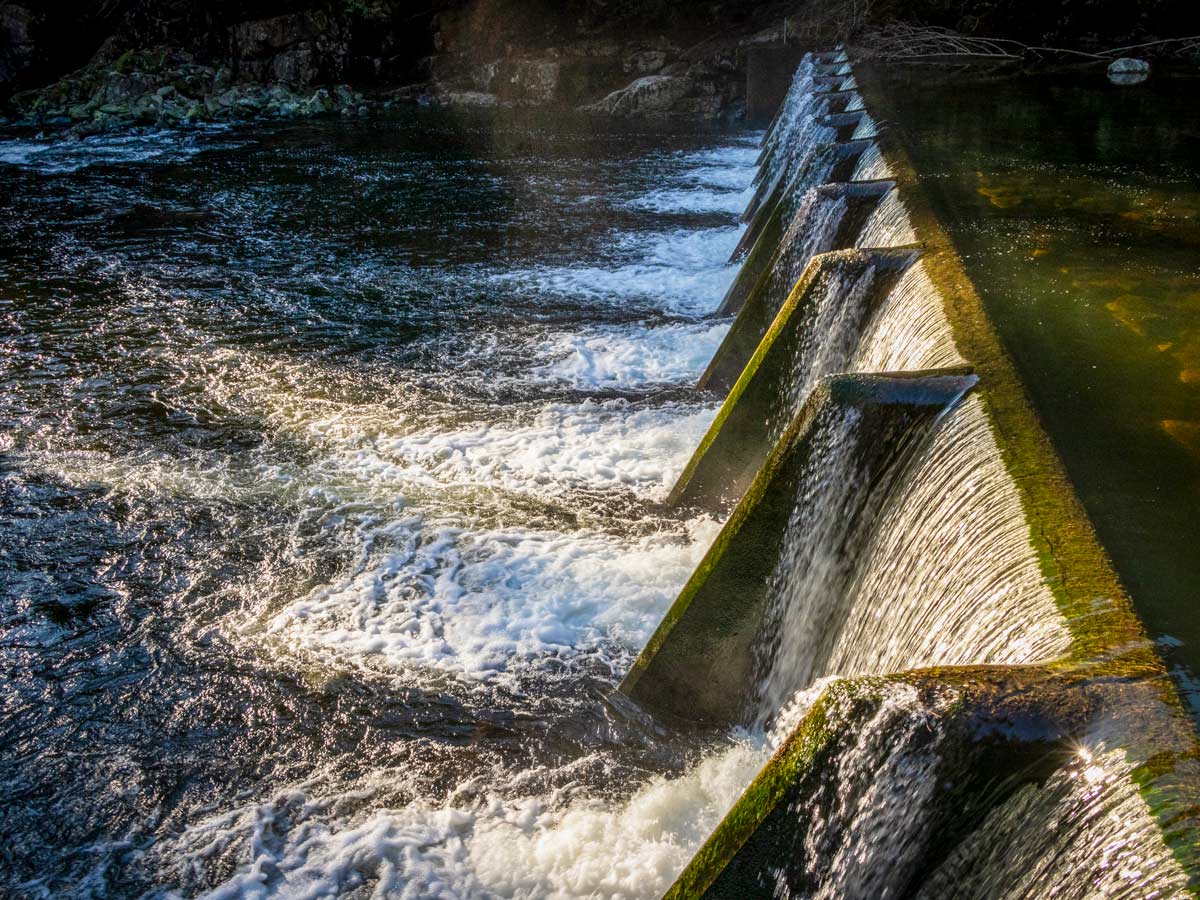
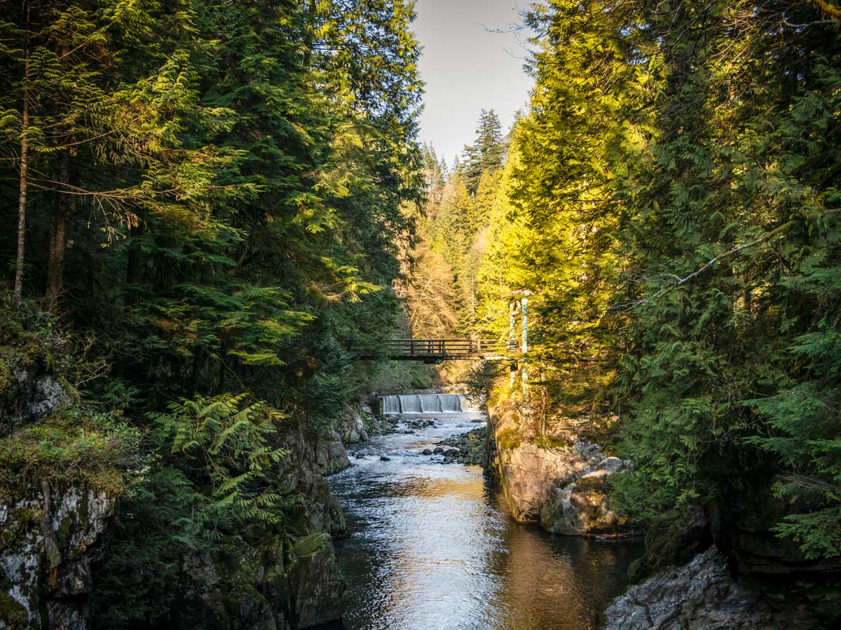
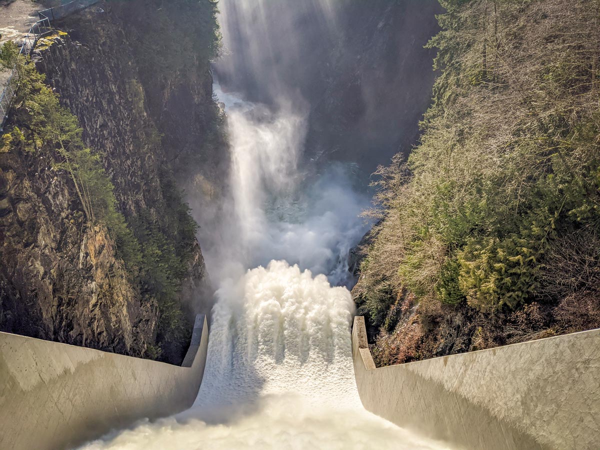
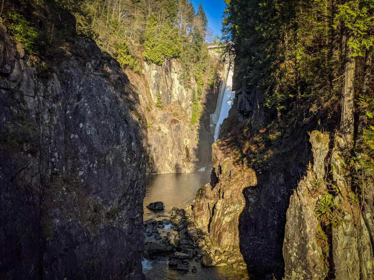
Standing from the top, look down to spot the incredible Capilano Canyon. You’ll likely hear the man-made falls before you see it, plunging from 318ft high. The flow of the water can vary depending on the level of Capilano Lake ,but is always an impressive sight.
Continue over the dam and towards the far left, gravel path that heads downwards.
Arrive at another junction where the trail narrows and splits. Go left, onto the Trans Canada Trail, and continue downhill.
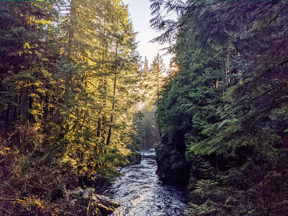
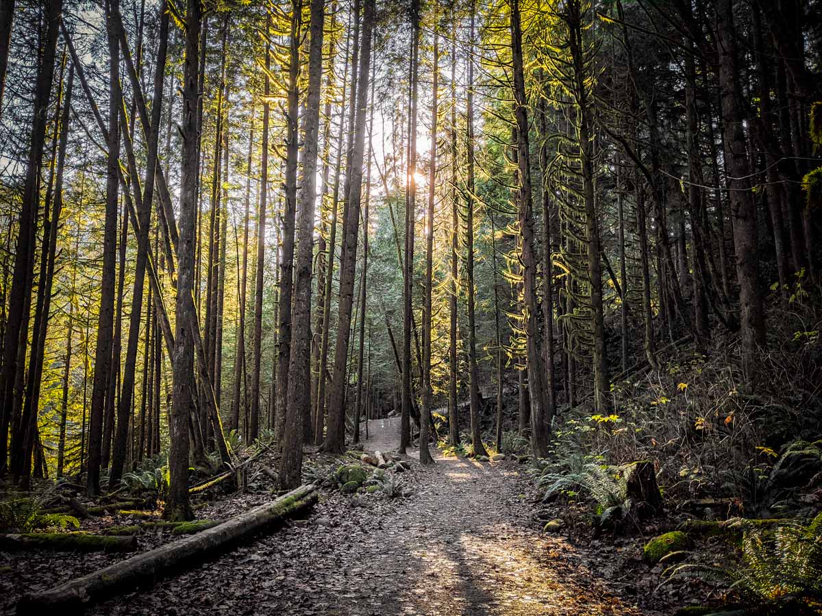
Listen, as the water trickles down the rocky canyon through the dense forest on the left-hand side.
When you arrive at the Capilano-Pacific Trail, take a right and continue until you reach Ambleside Park and its beach. We’ll leave that for another day, and this time we’ll stay straight continuing down the wide dirt path.
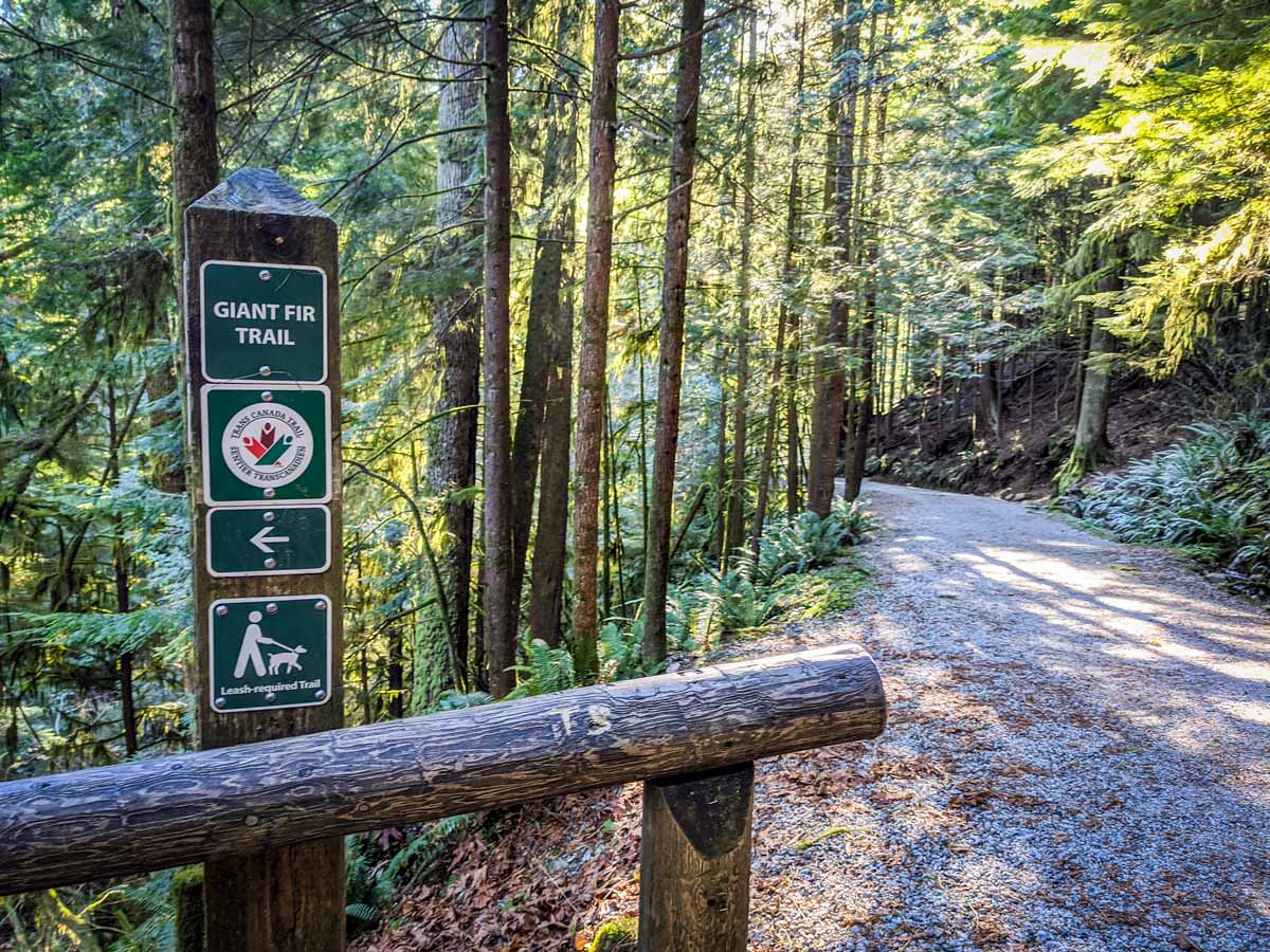
Press onwards until you see a sign for the Giant Fir Trail. Go left onto this trail, and down a series of wooden steps.
As you round the bend in the trail, you’ll come face-to-face with ‘Grandpa Capilano’ on your left. This is an 800-year-old Douglas fir tree, towering over 200ft high and is 8ft in diameter. Find a sign here, which explains the science behind the ecosystem of the area.
The trail eventually turns upstream and you will soon reach a clearing, where two more impressive fir trees stand tall.
Follow the trail as it drops to a junction. You’ll see a sign marked for the Second Canyon Viewpoint. Go left here.
Little ones will delight in crossing a wooden platform overlooking the Capilano Canyon and the lower portion of the Cleveland Dam, where you can often feel mist from the falls.
From the platform, you can also spot the Capilano Salmon Hatchery across the river.
From here, double back towards the previous junction. This time, veer left, following alongside the roaring river. This is the Second Canyon Viewpoint Trail.
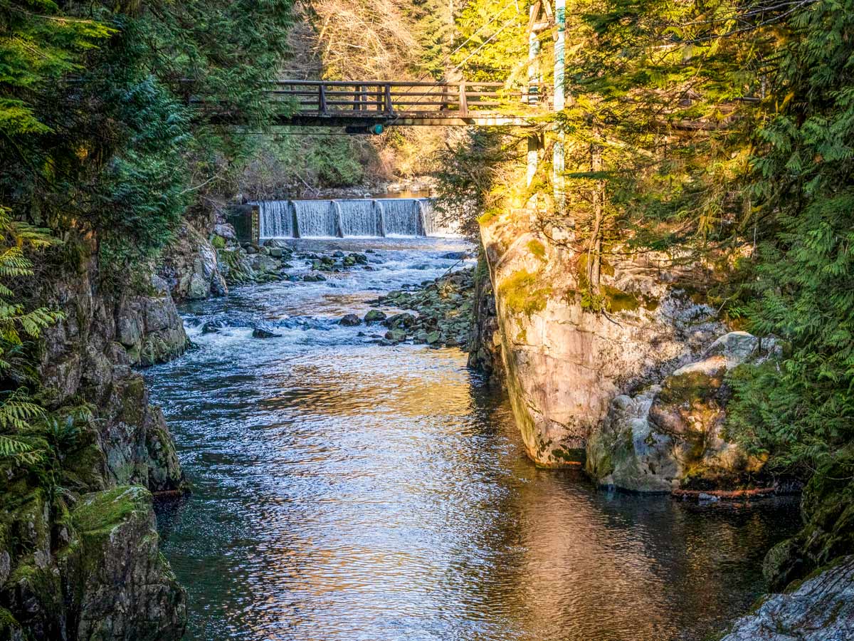
Continue onwards, always keeping the river to your left. Once you see the Cable Pool Bridge, cross over the bridge, which provides another perspective into the beautiful canyon.
Following our trail map, head towards the Cable Pool Bridge, and just beyond it to the Capilano Salmon Hatchery.
This spot is open to the public and perfect for education learning for the little ones. Depending on the time of year, you might even get to see some adult salmon up close.
Exit the hatchery and take the Palisades Trail. The trail begins between the hatchery parking area and entrance, and begins climbing up a set of stairs.
Once you reach the top, find a gravel road, take a left onto the road for one final look at the dam.
Get huffing and puffing with a steady uphill climb, until you reach a large platform, where you can get an up-close view of the dam and down into the canyon below.
After viewing the dam, return the way you came for only a few meters, until you hit stairs on your left, following them all the way back to the parking lot.
Insider Hints
If you want to extend your Capilano River Regional Park hike, you can keep following the Coho Loop Trail to the south and loop back over the Pipeline Bridge. Or, you can carry even further south along the Chinook Trail before doubling back.
The Cleveland Dam area has picnic tables and large grassy fields, so having a picnic might be a great way to end your hike!

Similar hikes to the Capilano River Regional Park hike
Whytecliff Park - Panorama Ridge Trail
The Panorama Ridge Trail is a short trail within Whytecliff Park that is perfect for an afternoon stroll to get…

Goldie and Flower Lake Loop
The Goldie and Flower Lake Loop is a short trail that makes its way through the peaceful terrain surrounding these…
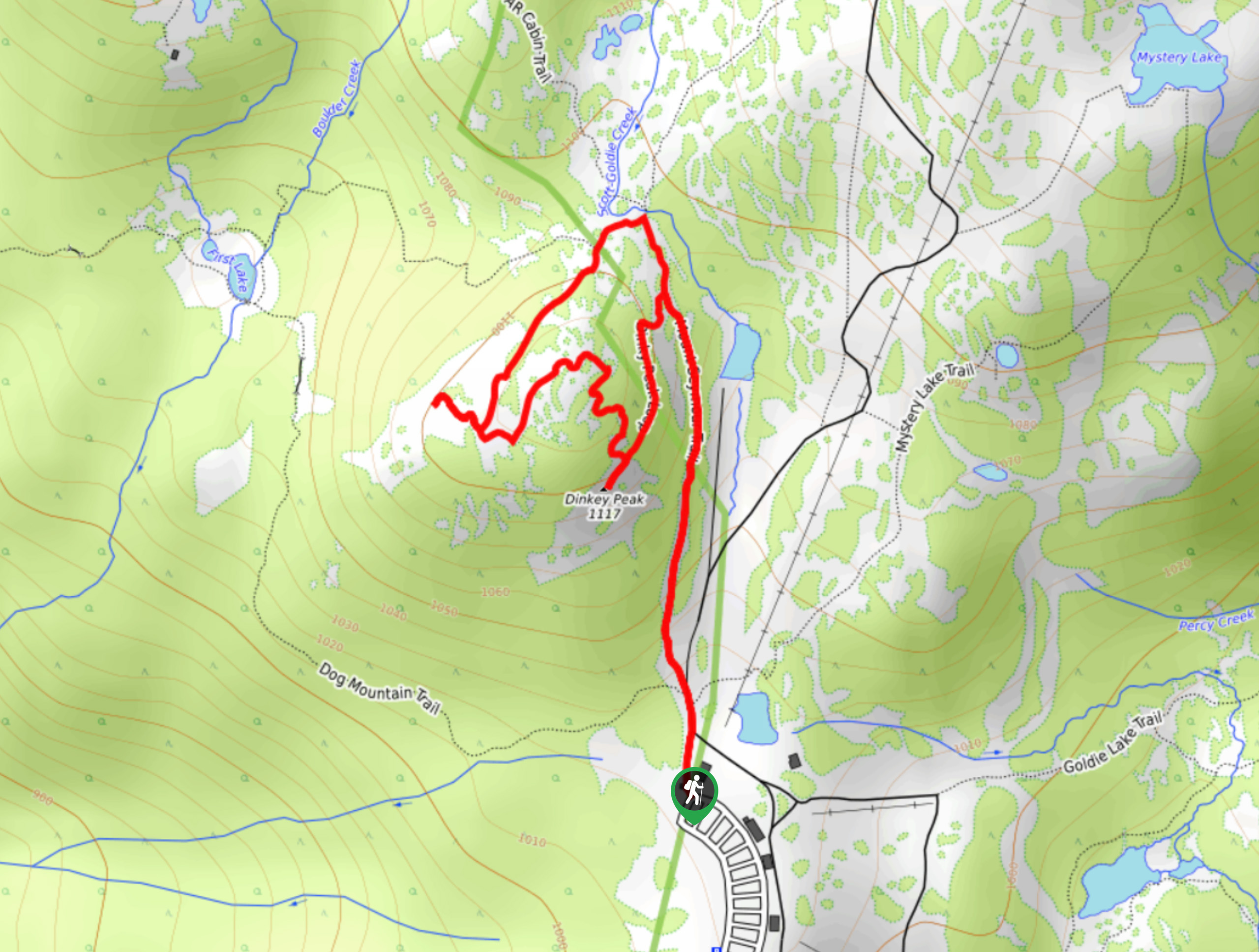
Dinky Peak Trail
The Dinky Peak Trail is a less-travelled path in Mount Seymour Provincial Park, partly because it can be tricky to…
Shad J. 4 years ago
Amazing place, beautiful views, and great exercise. Must see in North Shore if you love the great outdoors and you love exploring new places!
Kevin Dufont 5 years ago
Make your way to Capilano River Regional Park. Parking and admission are free, and the park offers spectacular local scenery and easy, accessible trails suitable for all family members, including furry ones.
Heinrich P. 5 years ago
Even though it's considered a family-friendly hike, I don't recommend it for small children. I really enjoyed walking along the river though. I managed to take tons of shots for the gram.
Rixy H. 5 years ago
the place is absolutely amazing! saw lots of fish in the river...it's still fun even though the trails are terribly marked and it's easy to get lost...overall, it was a fun adventure.
Dan G. 5 years ago
Beautiful and lovely easy trail. A must-see location in North Shore district.
Macky O. 5 years ago
Easy hike. There are several steep paths, rocks, roots along the way. The views and the atmosphere are incredible.
loneranger 5 years ago
Beautiful river. Great low-risk walk. Perfect place for unwinding.
Amethyst S. 5 years ago
The vast river was lovely and the environment was simply perfect. Time here is slow, and there's not much traffic.
genevaoftheeast 5 years ago
The calmness of this place was on a different level. Walking around the area was a therapeutic experience.
Noah Copper 5 years ago
River looks fantastic! There are nice picnic area and free parking! A suitable place for families.