Quarry Rock Hike from Deep Cove
View Photos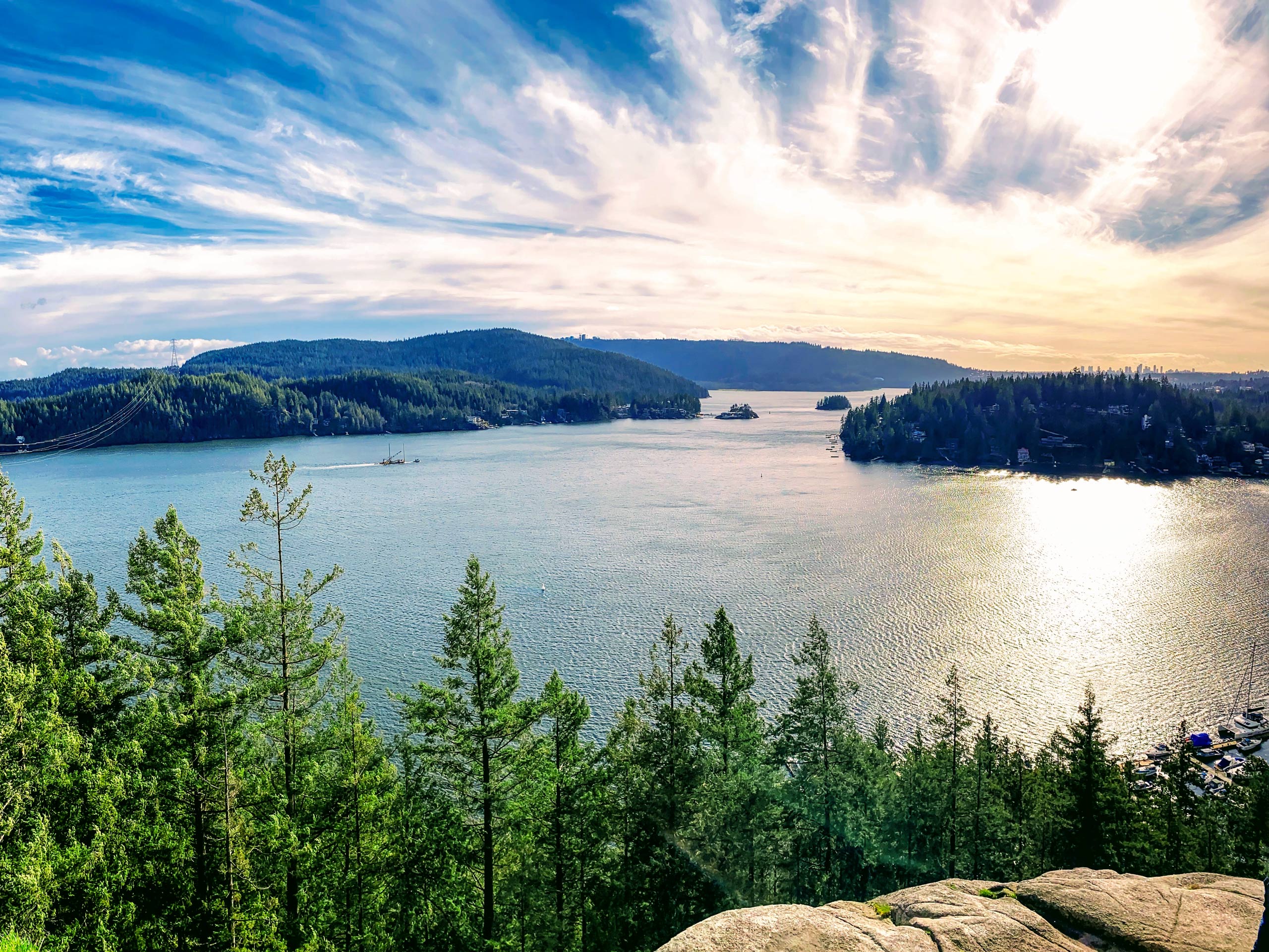
Quarry Rock Hike from Deep Cove
Difficulty Rating:
The Quarry Rock Hike from Deep Cove is a short, 2.3mi out-and-back route that is a popular destination for family hikes and school trips due to its easy terrain and scenic views. The trail includes several newly built wooden bridges to improve accessibility. Catch the stunning views of the Indian Arm and Belcarra Mountains to the east before heading back down the trail to Deep Cove for a treat at Honey Doughnuts and Goodies.
Getting there
To get to the parking lot at Panorama Park from Vancouver, travel along the Trans Canada Highway/BC-1 W and cross over the Ironworkers Memorial Bridge. Take exit 22B for Mount Seymour Parkway and follow it for 3.4mi. Turn left onto Deep Cove Rd and continue for 0.7mi. The road will veer slightly to the right, becoming Gallant Ave. After 328ft, turn left onto Panorama Dr. The parking lot will be on your right.

About
| When to do | Year-Round |
| Backcountry Campsites | No |
| Pets allowed | Yes |
| Family friendly | Yes |
| Route Signage | Average |
| Crowd Levels | High |
| Route Type | Out and back |
Quarry Rock Hike from Deep Cove
Elevation Graph
Weather
Quarry Rock Hike from Deep Cove Description
This short route from Deep Cove is an easy day hike that takes you out onto the rocky outcrop after gaining elevation through a series of stairs. As such, it is an extremely popular hike for families and school trips, making it necessary to arrive early to grab a parking spot and beat some of the crowds up the trail.
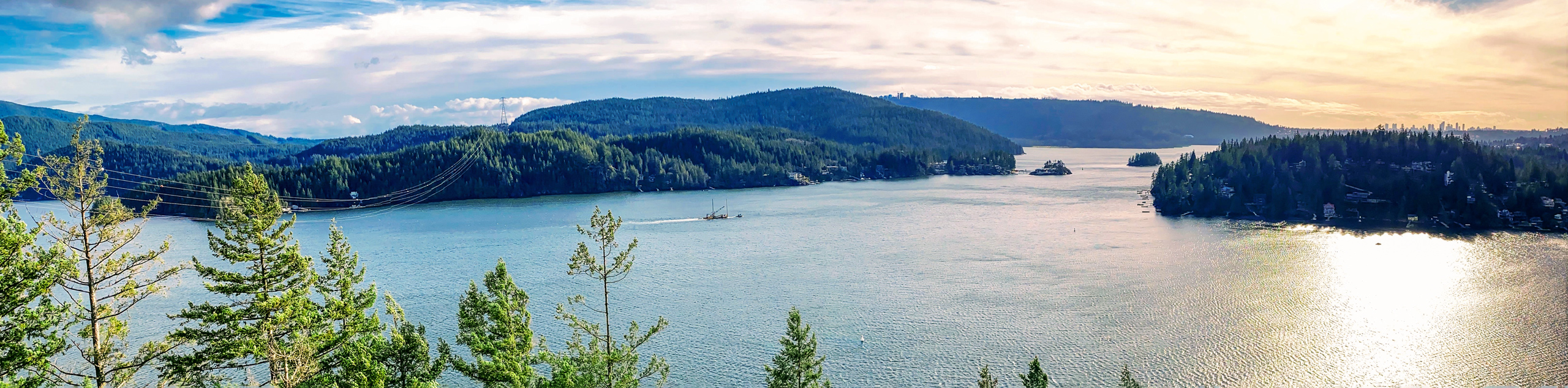
The Quarry Rock Hike is a short out-and-back trail that offers some of the best views of the Indian Arm and the Belcarra Mountains. The well-maintained trail skirts along the northern edge of Deep Cove to reach the Quarry Rock (sometimes called Grey Rock) lookout, where hikers can take in these amazing views.
The Quarry Rock Hike from Deep Cove is one of the easternmost portions of the Baden Powell Trail. To find the trailhead, leave the parking area and make your way north along Panorama Drive for 1148ft. Keep an eye out for a sign on the left side of the street and make your way up the driveway towards the wooden steps that mark the beginning of the trail. Take note of the blue and white trail post marked with a fleur de lis symbol. This marker can be found along the length of the Baden Powell Trail and will help guide you along your hike to Quarry Rock.
Quickly make your way up the stairs, over the root-covered portion of the path, and into the mixed forest of Douglas Fir and Hemlock trees. The hike to Quarry Rock is representative of many North Shore trails in that you will cross over bridges that span mountain streams and tramp through areas of densely populated forest. Newer bridges have been installed along this hike in recent years to make the trail more accessible. As you hike along the path, you will soon come up on one of these bridges spanning Panorama Creek. Cross the bridge and continue on the trail as it gradually begins to level out.
As you move along the trail, you will notice slight changes in elevation as you make your way through the various ravines that cut through the area. Cross over the large wooden bridge at Cove Creek and continue on for 550m until you reach a second large bridge that spans Francis Creek. After making your way across it, you will begin a brief uphill climb to the rocky outcrop of Quarry Rock.
Roughly 328ft after the bridge, you will be faced with a trail junction. Ignore the path to the left, as it will continue along the Baden Powell Trail. Take the trail right, and you will eventually emerge from the tree cover at the rocky outcrop of Quarry Rock.
Be sure to make your way up to the highest point of the lookout to catch the stunning views of the ancient glacial fjord of Indian Arm. Bask in the clear backdrop as you spot Burnaby Mountain to the south, Eagle Ridge and the Belcarra Mountains to the east, and the area around Deep Cove where you started your journey. Find a spot away from the crowd to relax and have a quick snack before making your way back along the trail and down to the parking lot along Panorama Drive.
Hiking Trail Highlights
Indian Arm
The Indian Arm is an ancient fjord that was carved out by glaciers during the last Ice Age. George Vancouver first mapped the area where its steep slopes open into the Burrard Inlet, and Dionisio Alcalá Galiano thoroughly explored the Indian Arm in June of 1792.
Belcarra Regional Park
The Belcarra Regional Park is a 1,100-hectare nature area located northeast of where the Burrard Inlet joins with the Indian Arm. The area is home to a number of mountains and lakes that are popular with the many hikers from the Vancouver area. Historically, Belcarra was a popular destination for picnics, as boats would ferry people across from Coal Harbour for short day trips. The park also contains a First Nations archaeological site that has helped refine the historical record of the area.
Insider Hints
Arrive early for parking as this is a highly-trafficked trail.
Watch out for the sign marking the trailhead on the left side of Panorama Drive. You will need to walk along a residential driveway to access the stairs at the base of the trail.
Grab a coffee and a sweet treat after your hike at Honey Doughnuts and Goodies.
This trail is currently closed due to COVID-19 restrictions.
Similar hikes to the Quarry Rock Hike from Deep Cove hike
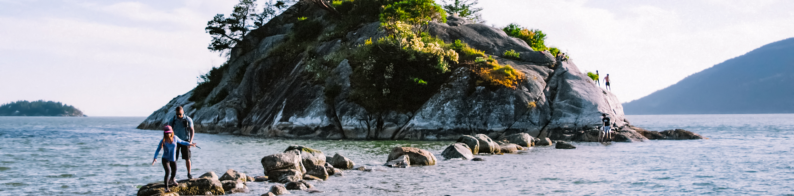
Whytecliff Park - Panorama Ridge Trail
The Panorama Ridge Trail is a short trail within Whytecliff Park that is perfect for an afternoon stroll to get…

Goldie and Flower Lake Loop
The Goldie and Flower Lake Loop is a short trail that makes its way through the peaceful terrain surrounding these…
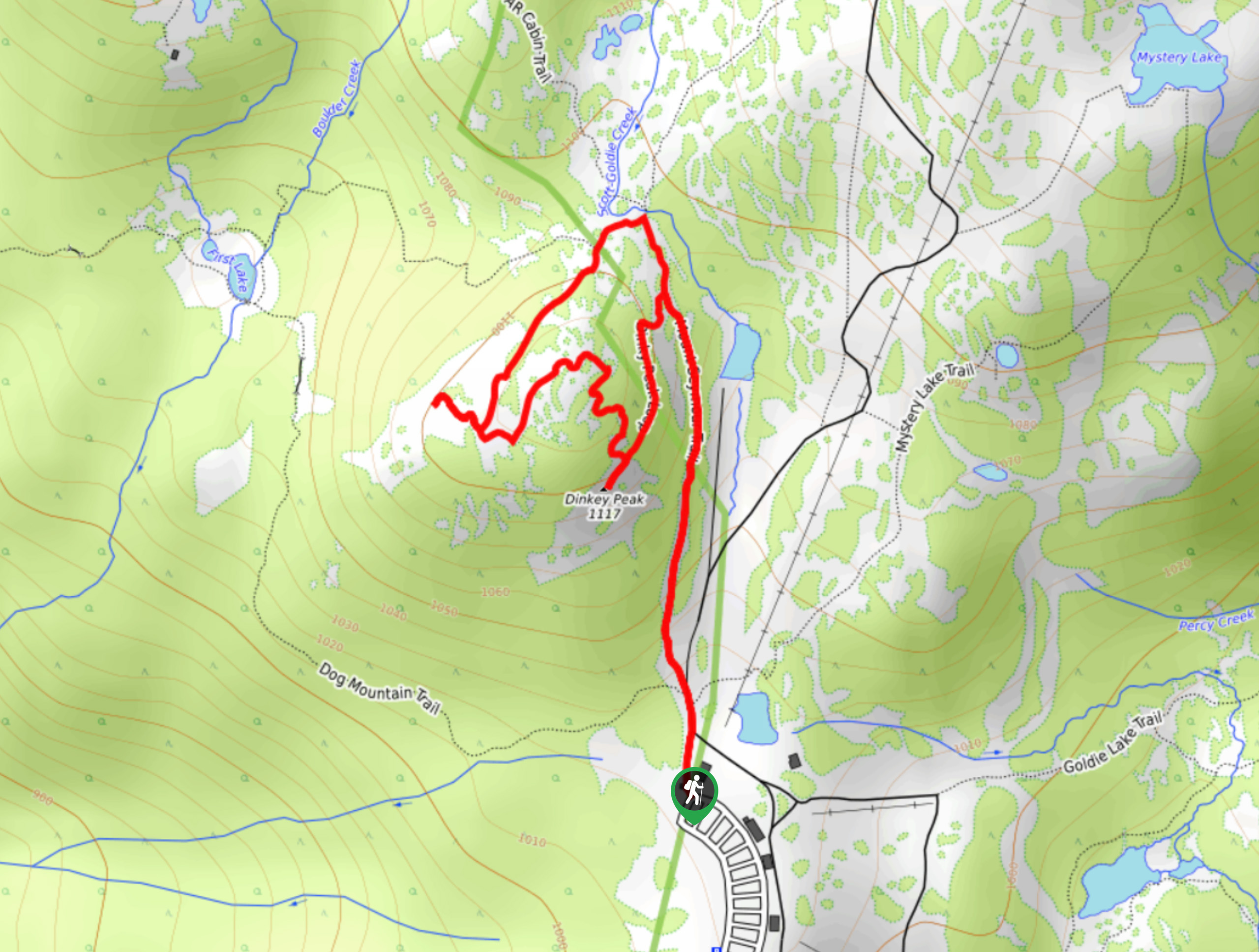
Dinky Peak Trail
The Dinky Peak Trail is a less-travelled path in Mount Seymour Provincial Park, partly because it can be tricky to…
Comments