BCMC Trail
View Photos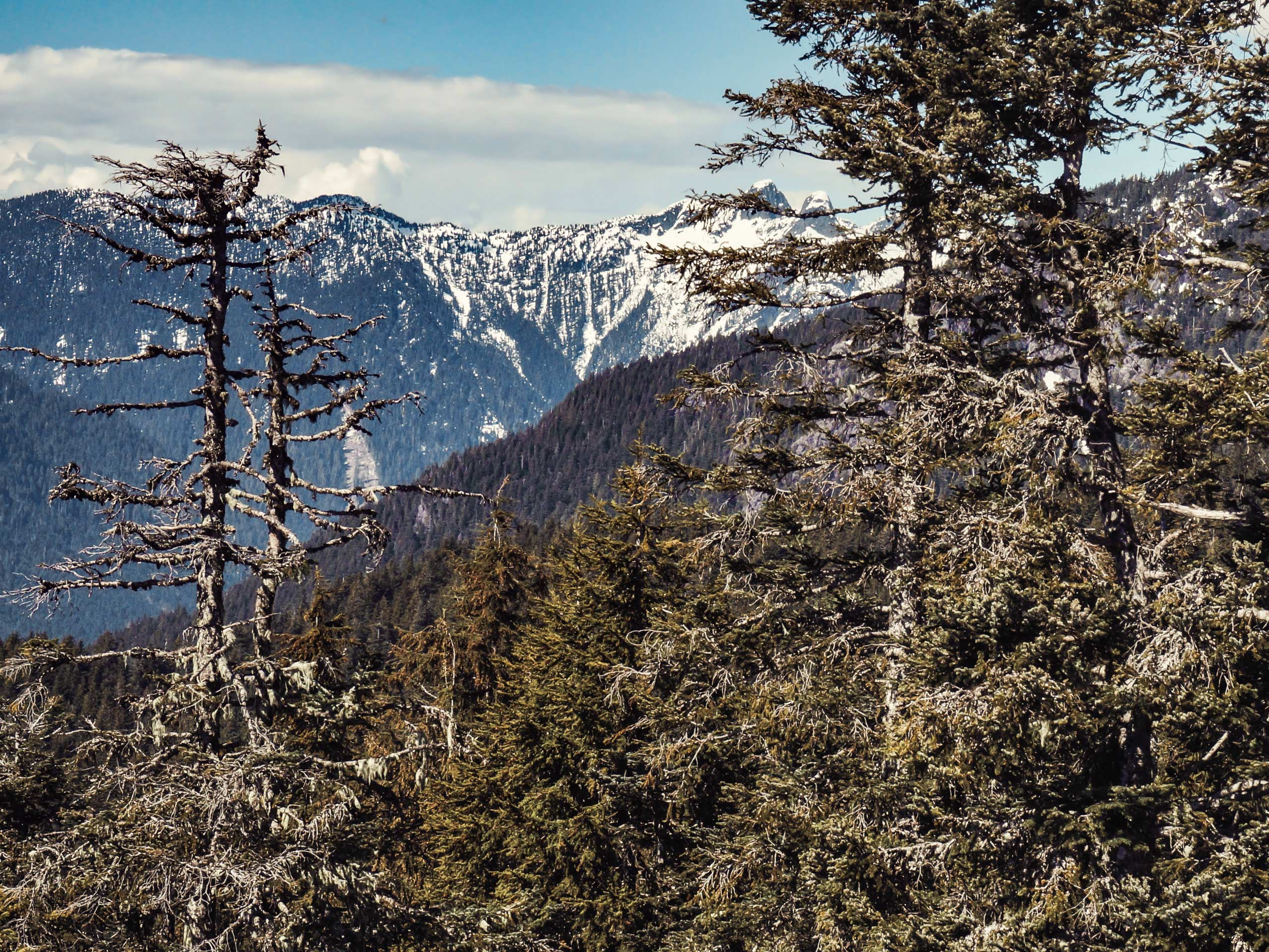
BCMC Trail
Difficulty Rating:
The BCMC Trail is a workout based hike in Vancouver’s North Shore that allows hikers to break a sweat while climbing a short but steep incline. Sharing the same mountain as the Grouse Grind, and often compared to it in terms of length and intensity, this hiking route is more rugged and less maintained than its neighbour, making it an ideal option for a great workout without the crowds.
Getting there
To get to the BCMC trailhead from Vancouver, follow Trans Canada Highway/BC-1 West across Ironworkers Memorial Bridge to North Vancouver. Take the exit for Capilano Road and turn right to continue on Capilano Road for 2.8mi and you will arrive at the Grouse Mountain parking lot.

About
| When to do | Year-Round |
| Backcountry Campsites | N |
| Pets allowed | No |
| Family friendly | Older Children only |
| Route Signage | Average |
| Crowd Levels | High |
| Route Type | One Way |
BCMC Trail
Elevation Graph
Weather
BCMC Trail Description
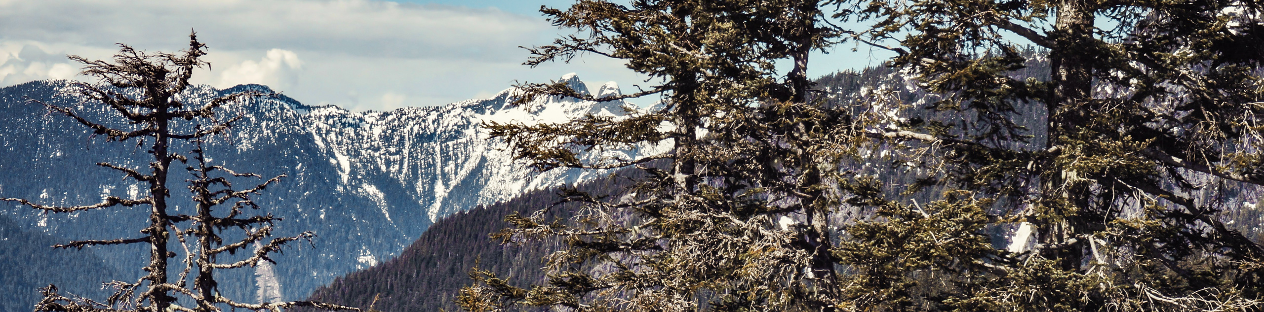
The BCMC Trail is a tough physical challenge for hikers looking for an intense climbing workout experience, packaged into a short hike. While this point-to-point trail is less populated than the Grouse Grind that runs almost directly parallel to the west, it shares the same parking lot and trailhead, so be sure to arrive early to beat the crowds. Unlike the Grouse Grind, which is a one-way trail, hikers on the BCMC can choose to return along the same route if they wish; however, the hike is categorized as a one-way, as the route is steep and most hikers use the gondola to reach the base of Grouse Mountain.
The 1.4mi BCMC Trail is the same type of workout hike as the Grouse Grind, combining a short overall distance with an intense elevation gain. The trail’s name is derived from the British Columbia Mountaineering Club that designed the route for training purposes. However, the club is no longer affiliated with the trail, leaving it to become the more rugged, rough, and less-maintained cousin of the Grouse Grind. While it may be a lesser-used alternative, the BCMC Trail still provides hikers with an amazing workout and some truly stunning views of the surrounding area.
To get to the BCMC trailhead from the parking area at the base of the Grouse Mountain gondola, head to the right and go past the area generally used by climbers for stretching. Head east through the gate and over the small bridge, where you will come upon a junction in the trail.
Ignore the trail to the left, as this is the route for the Grouse Grind. Take the path to the right to continue on the Baden Powell Trail as it begins to gradually climb up through the forest. After 656ft, you will pass by another junction where the trail reconnects with the Grouse Grind. Keep moving straight along the Baden Powell Trail for another 100m, where another junction to the left will mark the beginning of the BCMC Trail.
On this path, you will begin the steep climb up Grouse Mountain. Be sure to follow the yellow diamond trail markers and their white, numbered counterparts. These are numbered 1-50, and will provide an indication of how far along the trail you are. This initial section of the trail is fairly rocky, so take your time and watch your footing as you make your way uphill.
Keeping on track, the trail continues to climb uphill through a series of switchbacks and rugged portions of exposed tree roots and rocks. At the 11th marker, you will see a junction to the left that leads up the Flint and Feather trail, an alternate route sandwiched between the BCMC and Grouse Grind trails. Ignore this trail and keep on the main path.
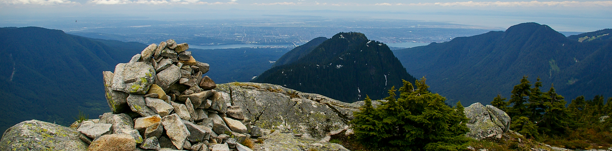
After getting to route marker 25, there will be a large sign marking the trail’s final kilometer. Continue on as you pass through a stretch of old-growth forest where the trail begins to level out. The remainder of the hike has a less steep incline than the initial stretch. As you make the final push up the hill, you will approach a gravel trail. Follow this to the left, and you will be at the top of Grouse Mountain, just to the east of the chalet.
Take some time to soak up the beautiful, sweeping views of Vancouver and the surrounding area, or refuel after a tough hike with a drink and a bite to eat at the chalet. From here, you can either hike back down the BCMC Trail or purchase a gondola ticket for $15 to make your way down to the parking area. Note that it is not possible to hike down the Grouse Grind Trail due to extremely high volumes of foot traffic.
Frequently Asked Questions
Which is harder Grouse Grind vs BCMC?
The BCMC trail has very similar stats to the Grouse Grind. But the BCMC is what the Grind used to be: a rough, steep, relatively unmaintained route with no stairs. This makes it more rugged than the Grind.
Can you hike down the BCMC?
Yes. Unlike the Grouse Grind, hikers can utilize the BCMC trail to descend the mountain; however, it has a steep decline, so many people opt to use the gondola. A gondola ticket can be purchased for $15 on weekdays and $20 on weekends and holidays.
Insider Hints
Make sure to utilize the toilet facilities at the gondola, as there are none along the hiking trail.
As the hike is strenuous, bring enough high energy snacks and at least 1L of water to keep your body fuelled.
Although it is not a long trail, ensure that you wear proper, sturdy hiking footwear, as the route is very steep.
Wear clothing that is appropriate for the day’s conditions. Keep in mind that weather conditions can be 10º cooler at the top of the mountain than at the bottom.
Unlike the Grouse Grind, this trail is open in the winter season. Make sure you have proper gear (i.e. crampons) to help navigate the slippery slope.
Similar hikes to the BCMC Trail hike
Hike to South Needle
The Hike to South Needle follows along an extension of the trail to Lynn Peak, passing by the viewpoint and…

Lynn Lake Trail
The Lynn Lake Trail is a lengthy hike through the Lynn Headwaters backcountry that is sure to get you off…

Old Buck and Bridle Trail Loop
The Old Buck and Bridle Trail Loop is an amalgamation of the Old Buck, Bridle, and Baden Powell trails that…
Comments