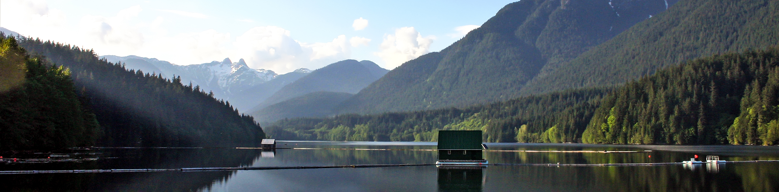
Capilano River Loop
View Photos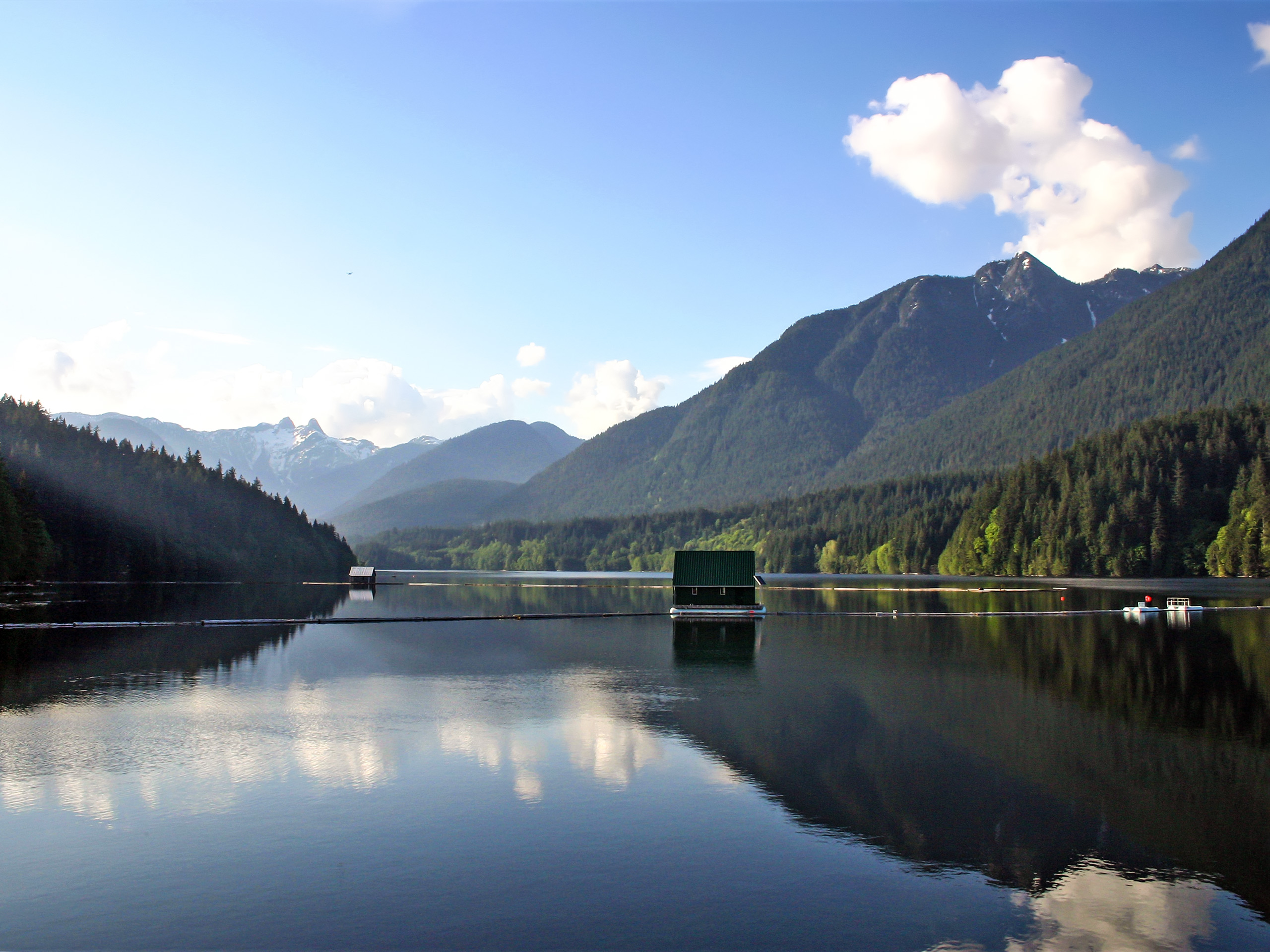
Capilano River Loop
Difficulty Rating:
The Capilano River Loop is a great day hike option for hikers looking to make their way through various types of terrain. Although it’s rated an easy hike, the trail has some changes in elevation and allows you to pass through dense rainforests and steep river canyons. Make sure to spend some time at the Capilano River Hatchery to learn about salmon species, and cross the Capilano Suspension bridge to catch some gorgeous scenery.
Getting there
To reach the parking area at Capilano River Regional Park from Vancouver, follow the Trans Canada Highway/BC-1 West, and take exit 14 to merge onto Capilano Rd. Follow this road for 1.6mi, and the parking area will be on your left.

About
| When to do | Year-Round |
| Backcountry Campsites | N |
| Pets allowed | Yes - On Leash |
| Family friendly | Yes |
| Route Signage | Average |
| Crowd Levels | High |
| Route Type | Circuit |
Capilano River Loop
Elevation Graph
Weather
Capilano River Loop Description
The Capilano River Loop is an 5.1mi day hike on Vancouver’s North Shore that attracts large volumes of hikers and joggers due to its easily navigable terrain and beautiful view. As a result, it is best to either arrive early enough to beat the crowds or aim to complete the hike on a weekday, as foot traffic will be significantly reduced.
High foot traffic aside, the Capilano River Loop is an easy trail that passes through a variety of terrain, including dense sections of West Coast rainforest, and steep canyon cliffs that have been carved out by the river below. Hikers looking for highlights along the trail will be able to catch some awesome views above the rushing waters of Cleveland Dam, marvel at the engineering wonder of the Capilano Suspension Bridge, or visit the Capilano Salmon Hatchery to learn about the different types of salmon that are native to the area.
Setting off from the parking area at Cleveland Park, make your way toward the dam, which helps stem the water from flooding the canyon below and provides Vancouver with a main source of drinking water. At this early point in the hike, you will be able to spot the Lions and Grouse Mountain in the backdrop on your right.
After taking in the views from atop the dam, cross over to the far side and make your way to the left, where there will be a clearing and the start of two trails. Take the trail to the right and follow it as it begins to climb uphill. From here, the ground will begin to level out, and you should look for a wooden gate on the left.
The trail will continue beyond the gate as you walk through a mixed forest of Douglas Fir and Hemlock trees. Descend the Upper Shinglebolt Trail, and once you get to the bottom, head left, up and over a section of tree roots where you will reach a junction in the trail. Take the path to the right and continue downhill for a few minutes before reaching another junction where Shinglebolt Trail meets the Capilano Pacific Trail.
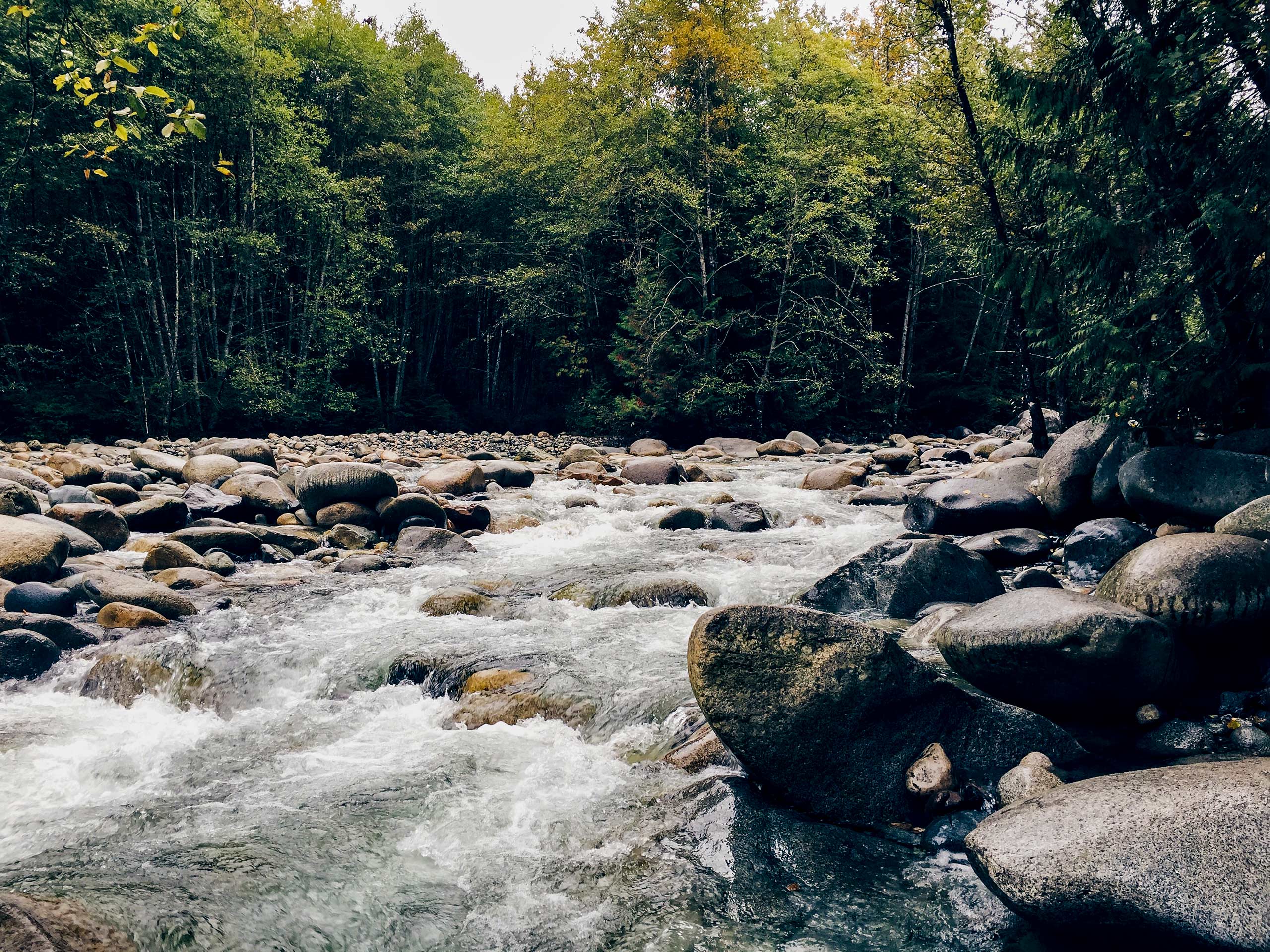
Take the path to the right as you continue to descend along the trail. Here, you will cross over several wooden bridges that span the creeks running down into the canyon below. Keep on the trail as you head south through this scenic section of the hike, passing through densely packed rainforest and over a few more wooden bridges. Just off the trail to the left, there is a small vantage point where you can take in the expanse of the steep canyon slopes below.
Continuing on the main trail, keep left as you move through the forest for another 1640ft. Here, you will need to climb up a section of stairs before reaching a junction with a gravel road. Follow the road to the left as you pass by a fenced area marking the Capilano Suspension Bridge.
Move south along the Capilano Pacific Trail for 0.6mi until you approach a gate with a wooden trail map. This marks the end of the trail, and although the route could be extended another 2.2mi down to Ambleside Beach, for the purpose of this canyon hike, hikers will need to turn back and head up the same trail to complete the loop.
Backtracking north, continue along the Capilano Pacific Trail as you once again pass by the fenced-off area of the Capilano Suspension Bridge on your right. Immediately after this area, make sure to take the dirt path to the right, heading back down the stairs and into the forest.
After retracing your steps over the wooden bridges, you will hit the junction that reconnects with the Shinglebolt Trail on your left. Ignore this and follow the trail to the right, as you will begin the loop around to the other side of the canyon.
After a short distance, you will reach a 4-way intersection in the trail. Follow the trail to the right, which will soon begin to descend further into the canyon. After reaching the bottom of the hike, the trail will meet up with a gravel road. Continue along the dirt ridge on the opposite side of the road, where a short walk to the right will reveal a narrow path, leading you to a fence where you can catch some views of the river below.
To the right, you will find Pipeline Bridge, which stretches across the Capilano River and offers an amazing chance to watch the rushing water directly below. Take a moment to snap a few pictures of the majestic backdrop on display, or scurry quickly across the bridge if heights aren’t exactly your favourite thing. Once you reach the opposite side, take the Coho Loop Trail on your left.
At this point, hikers will continue on the trail as it skirts around the edge of the canyon on the left. After 2133ft, you will reach the Capilano River Hatchery. Take some time here to explore the area and learn about the various species of salmon that are native to the region and the conservation methods being used to protect their population.
Upon leaving the hatchery, look for the Palisades Trail on your left to continue on with your hike. Here, the trail will begin to climb uphill as you make your way back up towards the dam. After a few hundred meters, the trail will cross over a gravel service road used to access the dam. Leave the trail and take this road to the left, following it beyond the water treatment plant, until you spot a sign on your left. Follow the trail marked out by the sign to reach a vantage point where you can view the Cleveland Dam from below.
After taking in the view, make your way back to the main trail and continue uphill toward the dam, where you will approach the starting point of the hike. Take a few minutes and soak up some final views of the Capilano River Canyon far below before heading back to the carpark having completed your journey.
Hiking Trail Highlights
Cleveland Dam
Completed in 1954, the Cleveland dam stands tall at 299ft and was built to stem the waters of Capilano Lake to use as a freshwater drinking source for the Lower Mainland.
Capilano Suspension Bridge
The Capilano Suspension Bridge is one of the most popular tourist sites around Vancouver. Originally built in 1889, the bridge spans 459ft and sits 230ft off the canyon floor below. Although the area around the bridge can be accessed from the trails on this route, the bridge is part of a private facility, and, as such, hikers need to pay a fee to cross it.
Capilano River Hatchery
Completed in 1971, the Capilano River Hatchery was built to restore the local salmon population after their numbers had declined following the construction of the Cleveland Dam. The hatchery hosts 238,000 visitors annually, and admission is free to the public.
Frequently Asked Questions
How much does it cost to access the Capilano River Hatchery?
The Capilano River Hatchery offers free admission to the public.
How much does the Capilano Suspension Bridge cost?
Admission at Capilano Suspension Bridge costs about $47 for adults, $43 for seniors, $35 for students (with ID), $28 for youth (ages 13-16), $15 for children (ages 6-12) and free for kids age 5 and under. Taxes are extra.
How much weight can the Capilano Suspension Bridge hold?
The Capilano Suspension Bridge can hold 123 tons.
Insider Hints
Arrive early or on off-peak days to beat the crowds, as the area also draws tourists for the Capilano Suspension Bridge and the Capilano River Hatchery.
There are many alternate trails in the area that break off from the main route and offer some beautiful views of the canyon. Don’t be afraid to explore, but be careful to stay on designated trails.
There are multiple areas to get some great views of the rushing water. Try from the viewing areas above and below the dam.
The Hatchery is currently closed due to COVID-19 restrictions.
Similar hikes to the Capilano River Loop hike
Whytecliff Park - Panorama Ridge Trail
The Panorama Ridge Trail is a short trail within Whytecliff Park that is perfect for an afternoon stroll to get…

Old Buck and Bridle Trail Loop
The Old Buck and Bridle Trail Loop is an amalgamation of the Old Buck, Bridle, and Baden Powell trails that…

Goldie and Flower Lake Loop
The Goldie and Flower Lake Loop is a short trail that makes its way through the peaceful terrain surrounding these…
Comments