Lynn Loop Trail
View Photos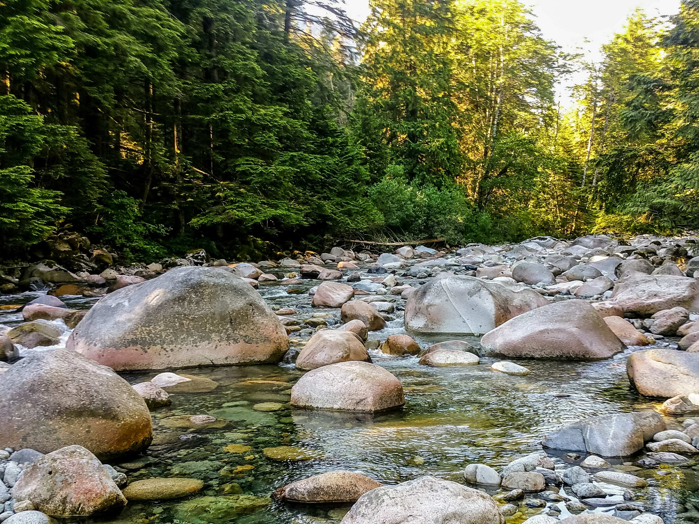
Lynn Loop Trail
Difficulty Rating:
The Lynn Loop Trail is an excellent day hike option for beginner hikers and weekend warriors alike. Offering beautiful stretches of mixed forest with several elevation changes, the trail starts and finishes along the rushing waters of the Lynn Creek, with Mount Fromme looming in the backdrop.
Getting there
To get to the Lynn Loop trailhead from Vancouver, drive north along the Trans Canada Highway/BC-1 W, crossing over the Ironworkers Memorial Bridge. Exit to the right towards Mountain Highway, driving for 1.6mi, before turning right onto Lynn Valley Rd. Continue for 1.9mi and you will reach the parking area.

About
| When to do | Year--Round |
| Backcountry Campsites | N |
| Pets allowed | Yes - On Leash |
| Family friendly | Older Children only |
| Route Signage | Average |
| Crowd Levels | High |
| Route Type | Circuit |
Lynn Loop Trail
Elevation Graph
Weather
Lynn Loop Trail Description
The Lynn Loop Trail is a fairly easy hike with some sections of steep incline, so be sure to arrive early or on an off-peak day, as it is a popular trail for hikers and trail runners alike. Ensure that you bring proper footwear, as the trail crosses several streams along its upper portion, and can become fairly muddy and icy in the winter months.
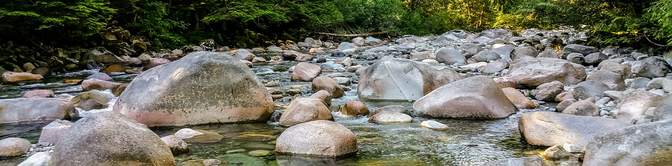
This is one of the many scenic day hike options within the Lynn Headwaters Regional Park on Vancouver’s North Shore. Located along the southern slope of South Lynn Peak, this short 3.4mi loop offers hikers a day of respite from the bustle of the city, as you meander through the densely forested trails along the rushing waters of Lynn Creek.
To reach the Lynn Loop trailhead, make your way to the north end of the parking lot, passing by the yellow gate and onto the pathway that will lead toward Lynn Creek. Follow this path as you pass by the buildings on your right, and you will soon reach a bridge crossing. Making your way across the rushing waters of Lynn Creek, look to the left to catch a glimpse of Mount Fromme towering overhead. Continue on straight over the bridge to reach the junction in the trail next to the large signboard.
After utilizing the map to familiarize yourself with the park’s trail system, take the gravel service road to the right and follow it for 1148ft. On your left you will notice a sign for the Lynn Loop Trail. Follow this path to make your way along the Southern edge of the loop where the trail will begin to climb steeply.
As the trail begins to flatten, you will find yourself walking through a beautiful mixed forest of cedar and hemlock trees, passing by a trail sign for a lookout on your left. Hikers that wish to take a brief detour can follow this trail for 656ft to reach a small, rocky vantage point that offers a view of Vancouver Island in the distance.
Continuing on the main trail as it winds its way through the forest for 1.2mi, you will eventually reach a junction with the Headwaters Trail on your right. Keep following the trail to the left to continue along the Lynn Loop trail as it begins to descend through a series of switchbacks and stairs. You will soon hear the sound of Lynn Creek rushing past along the trail, and large piles of log debris will come into view—the destructive result of large windstorms in the area.
Move down the trail as it joins back up with the gravel service road, and follow it for 1.1mi until you reach the signboard at the beginning of the loop. Along this last portion of the trail, you will catch the occasional glimpse of Lynn Creek popping in and out of view and hear the steady sound of its rushing water as you meander down the path that skirts alongside it. Having completed the route, head back over the bridge, crossing Lynn Creek one last time on your return to the carpark.
Hiking Trail Highlights
Mount Fromme
From the bridge near the start of the trailhead, hikers will be able to catch a great view of Mount Fromme in the backdrop. While also home to several hiking trails, Mount Fromme is best known as a mountain biker’s paradise, containing a wealth of downhill trails that have helped make a name for the North Shore riding style.
Insider Hints
This trail is popular with hikers and trail runners. Arrive early to secure a parking spot. Alternatively, there are other parking lots further down Lynn Valley Rd.
If you sign in at the trailhead, don’t forget to sign back out as you are leaving.
Wear proper footwear, as the upper portions of the trail can become very muddy and/or icy in the winter.
The trail can be buggy in the summer months. Bring bug spray.
Similar hikes to the Lynn Loop Trail hike
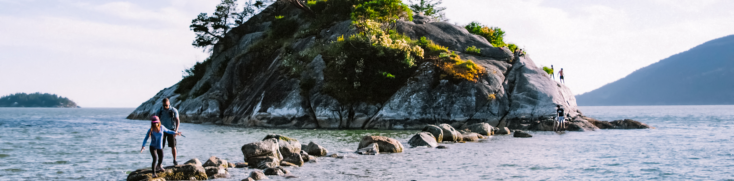
Whytecliff Park - Panorama Ridge Trail
The Panorama Ridge Trail is a short trail within Whytecliff Park that is perfect for an afternoon stroll to get…

Old Buck and Bridle Trail Loop
The Old Buck and Bridle Trail Loop is an amalgamation of the Old Buck, Bridle, and Baden Powell trails that…

Goldie and Flower Lake Loop
The Goldie and Flower Lake Loop is a short trail that makes its way through the peaceful terrain surrounding these…
Comments