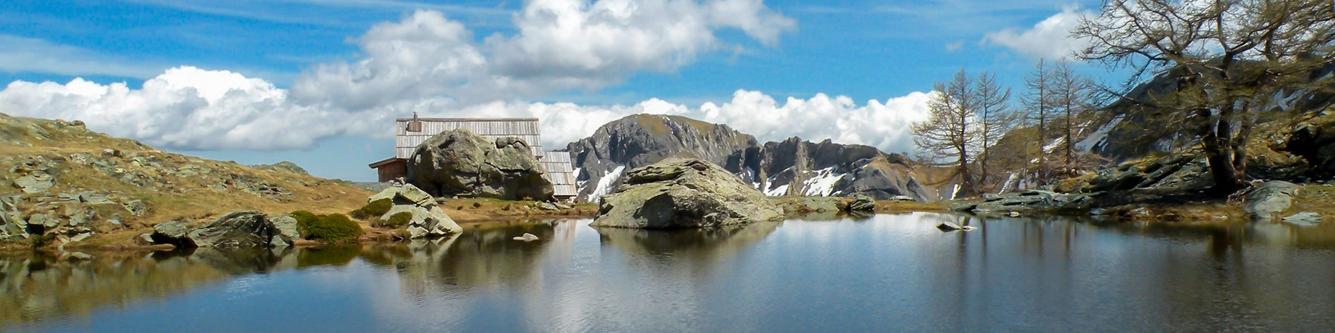
Fontanalba hike
View Photos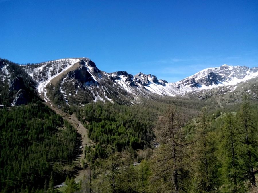
Fontanalba hike
Difficulty Rating:
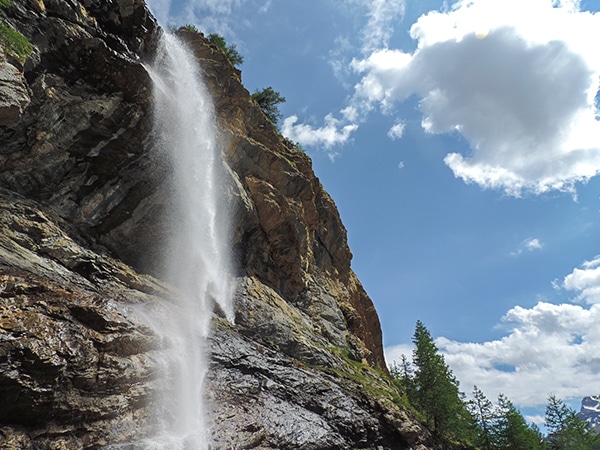
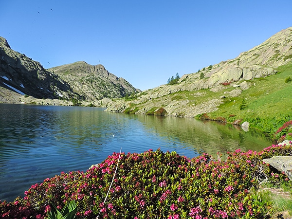
In the heart of the Mercantour National Park, “the valley of wonders” is an exceptional open archaeological site, where thousands of prehistoric engravings have been recorded. It is long, but it's also an easier hike, where you will walk past some mountain lakes and chamois and ibex goats!
Getting there
From Nice, head to Ventimiglia, then take the SS20 towards the “Colle di Tenda” until San Dalmas de Tende. From there, turn left onto the narrow and tortuous Route D91 up to Casterino for 9.3mi. Once in Casterino continue 1.2mi past the last hotel and park at the shepherd’s house

About
| When to do | June to end of October |
| Backcountry Campsites | Yes, Close to the Fontanalba hut, in Casterino or Tende |
| Toilets | Yes, in Casterino |
| Family friendly | No |
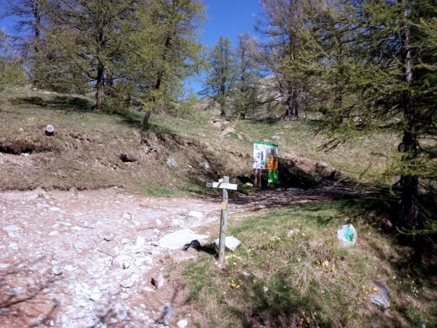
| Route Signage | Average |
| Crowd Levels | Moderate |
| Route Type | Out and back |
Fontanalba
Elevation Graph
Weather
Route Description for Fontanalba
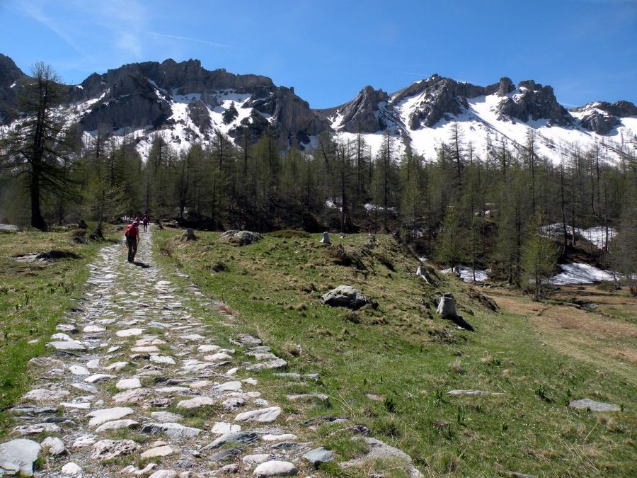
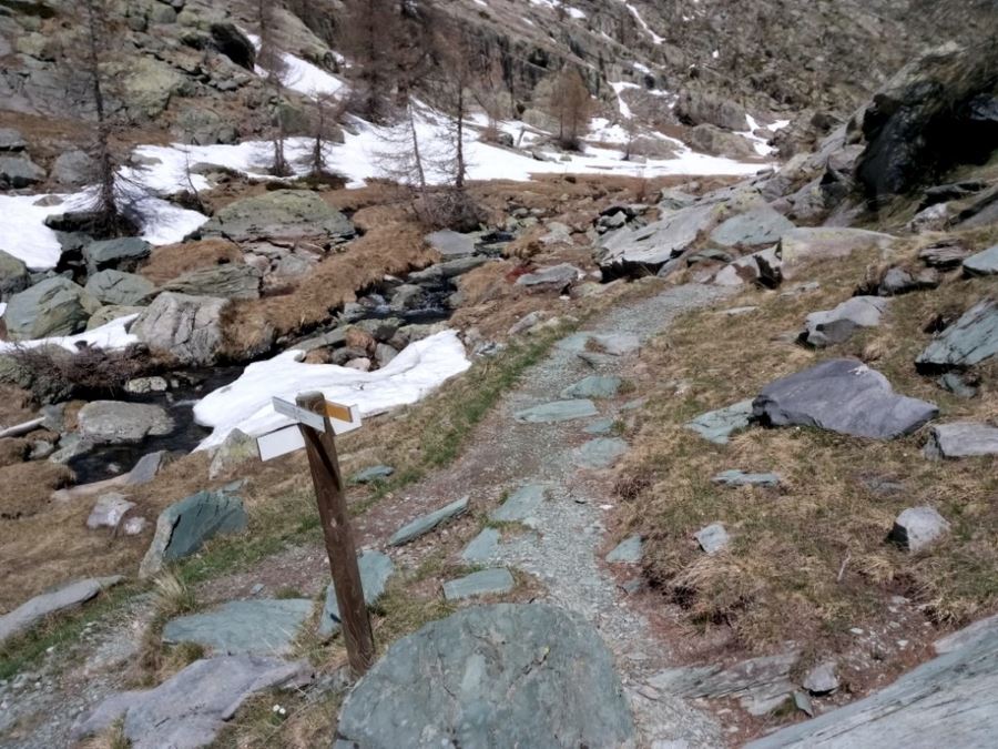
From where you’re parked, take the dirt road on the left, following signs to “Fontanalba”. The road, built in the ‘30s for the war, steeply rises, but then – after twenty minutes of walking – flattens out, overlooking the panoramic valley of Fontanalba. Mount Bego, a sacred mountain for the ancients, stands in the background.
After about one hour of walking, you will reach a junction with a sign for the Lac de Grenouille, or Lake of the Frogs, which, with a deviation, you can reach in fifteen minutes.
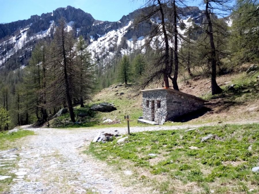
If you continue straight, you will arrive – after fifteen minutes – at the Gias of Fontanalba, where the road divides. If you head straight down you go back to Casterino; if you go right you’ll continue up to Fontanalba. After another quarter of an hour, you reach the refuge of Fontanalba, which is closed for repairs, but could be open in 2018. You will leave with the refuge to your right.
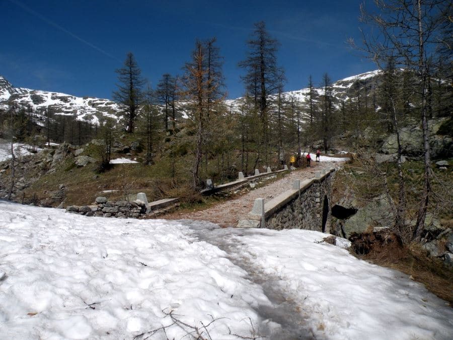
The road will delve into a forest of larch trees. Pay attention. The rocks are particularly unstable here and after the thunderstorms there may be rockslides. Continue up to the bridge where – in summer – you can normally meet a ranger who will give you information about the accessibility to the area of rock engravings.
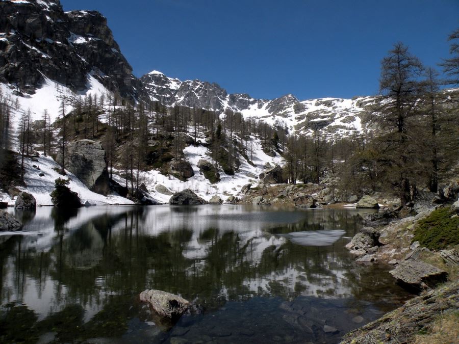
After crossing the bridge, you’ll see a path on the left indicating to “Lac Vert”. The lake is a good place to have break or relax under the shade of the trees, and it’ll only take 10 minutes to get to. Here you can enjoy some of the most beautiful scenery in the Roya Valley.
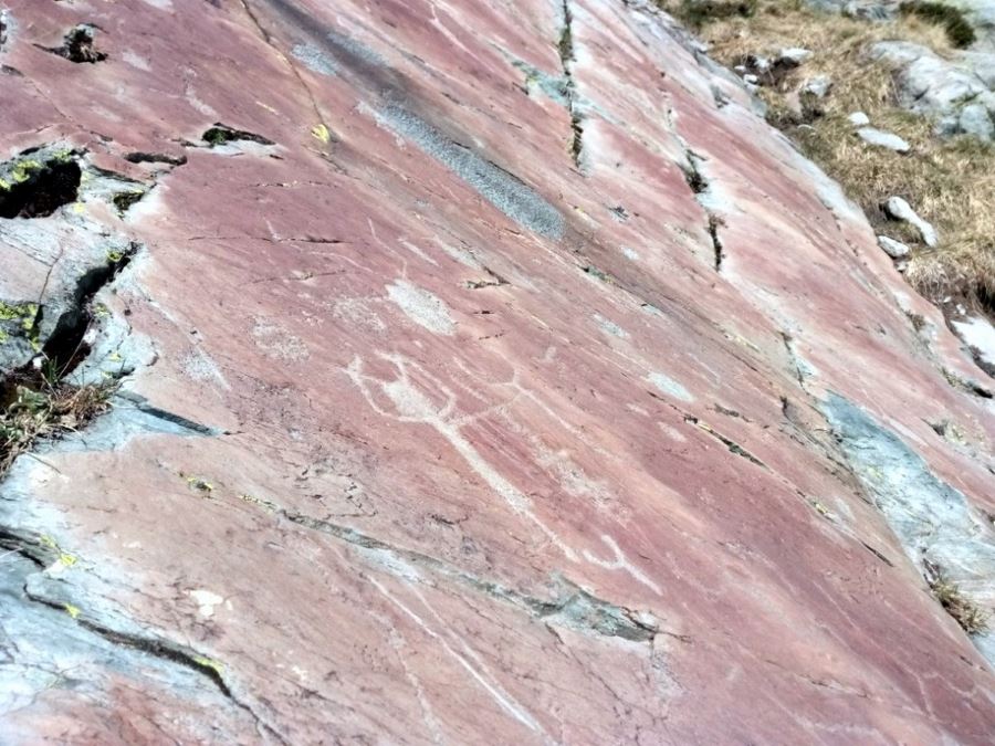
Walk along the lake. After ten-minutes of climbing, you’ll reach a junction. The path on the right brings you to the first rock engravings, which are visible a few hundred meters.
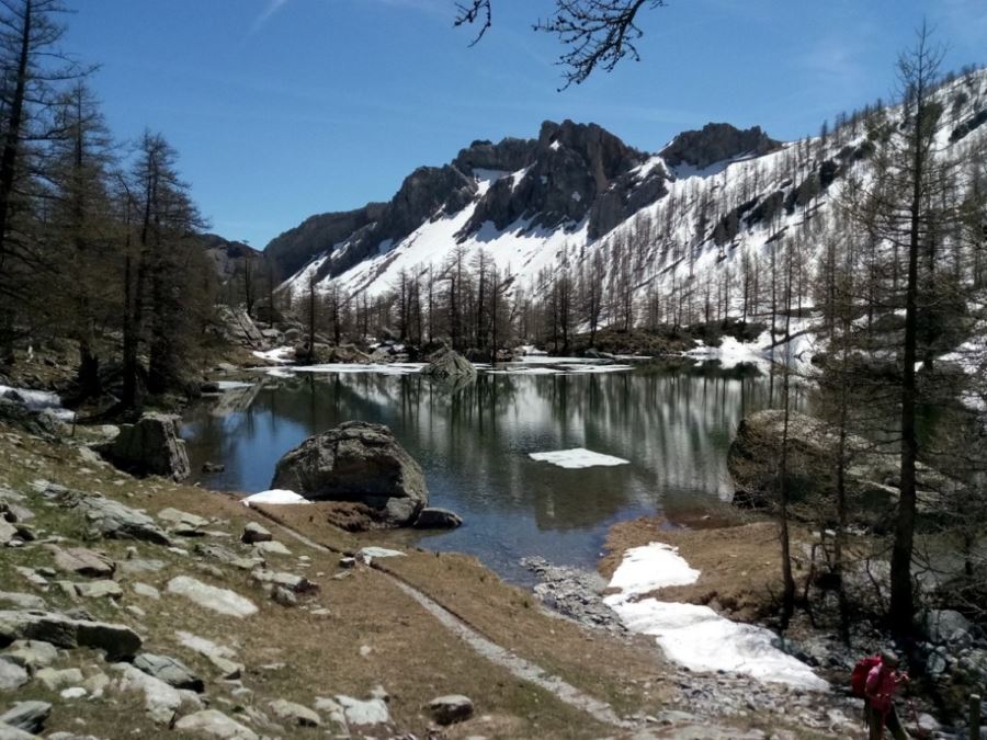
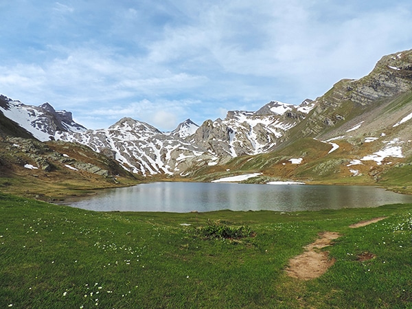
Going back to the junction, you’ll continue close to a little river and that’ll lead you to the Lac Jumeaux, (twin lakes) where you can relax and eat lunch.
To finish the tour, you can continue up to the Ranger’s shelter. To the left of the shelter are some panoramic views. Here the views of the valley and the Ligurian Alps are truly exceptional.
A little further and you begin to walk down through the “Via Sacra” (the “Sacred Road”), one of the most famous sites rich in rock engravings of the Neolithic and Bronze Age. A descriptive panel reveals some of the meanings of these engravings.
At the bottom of the Via Sacra, continue on the right along the path. After a quarter of an hour, on this military road, you’ll arrive at the bridge from before.
Insider Hints
Lac des Grenouilles is a beautiful lake and it’s surrounded by marmot colonies, so see if you can spot any!
If you are interested in understanding the significance of rock engravings, you can ask for an authorized guide, which will take you, for an extra half an hour, to visit some particularly significant engravings within the regulated area, closed to the public.
Curious where to stay around here? Check out the Tourism Office of Tenda.
Check out the Musee des Merveilles while you’re in the area. Their exhibits add more context to the Valley of Wonders and tell some fascinating stories.

Similar hikes to the Fontanalba hike
Lauzanier
The wonderful hike to Lauzanier has a stunning landscape, which is courtesy of the glaciers that carved the Lauzanier valley.…
Lac de Sagnes
Hiking to the beautiful Lac de Sagnes in the late afternoon exalts the beauty of this landscape. The Lac des…
Lacs de Vens
This superb hike of the Vens Lakes and the Collet de Tortisse has interesting, unique geological structures, like a limestone…
Rolando Acciaio 4 years ago
A beautiful lake and magnificent site to spend a day there and I would definitely recommend it
Karina M. 4 years ago
Absolutely beautiful! Well worth it! A wonderful hike.
Ariel R. 5 years ago
Amazing site! Glad to see the prehistoric engravings. It tells so much about our early ancestors.
Mina P. 5 years ago
Wonderful views of the valleys and the trees. I'm happy to see the prehistoric engravings. Absolutely worth it.
Mercury Q. 5 years ago
Lac des Grenouilles is a beautiful lake surrounded by marmot colonies. The engravings are awesome. Check out the Musee des Merveilles while you’re in the area too.
Arjean M. 5 years ago
Relaxing views of mountain lakes. There are good spots to rest near the lake. You can enjoy some of the most beautiful scenery in the Royal Valley.
Cole Anx. 5 years ago
Fontanalba is a remarkable place! There are outstanding valleys and lots of trees.
Дженнифер Дилан 5 years ago
This was one of the best hikes in my life!
Kim Pillar 5 years ago
The view from the top is awesome. Worth to visit for sure. Memorable hiking experience.
Adel Hamdani 5 years ago
If you're looking for a challenge, this one is for you. It's moderately easy, but it's still a good workout!