Lac de Sagnes hike
View Photos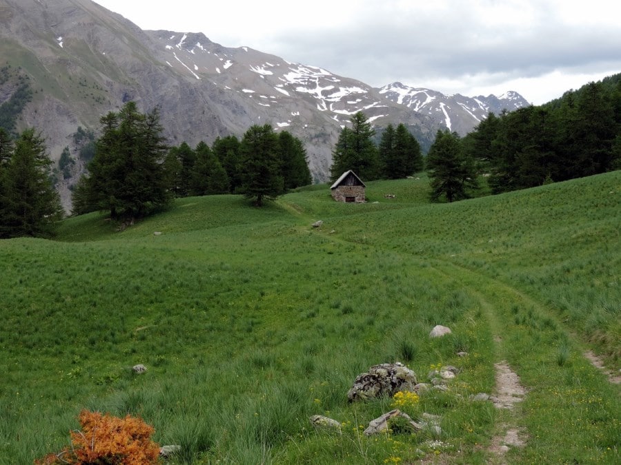
Lac de Sagnes hike
Difficulty Rating:
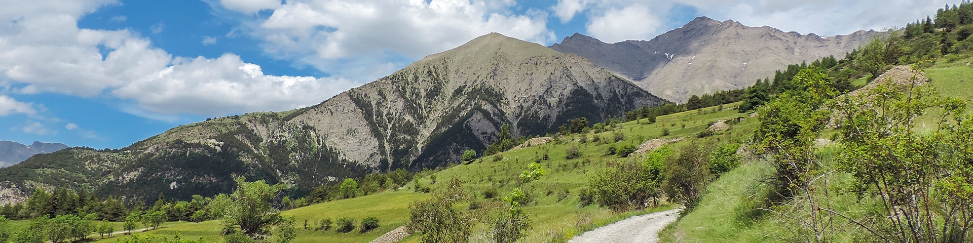
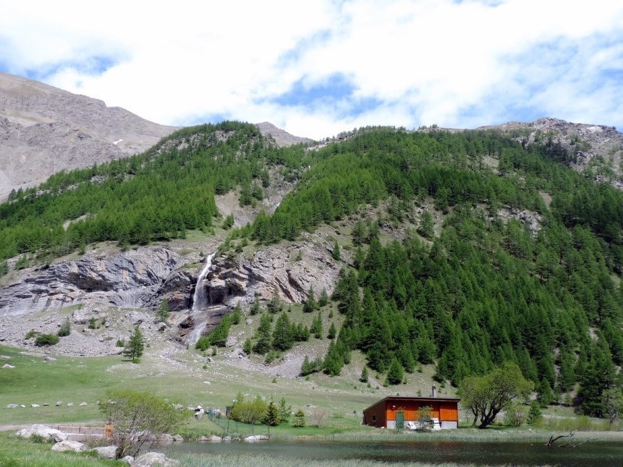
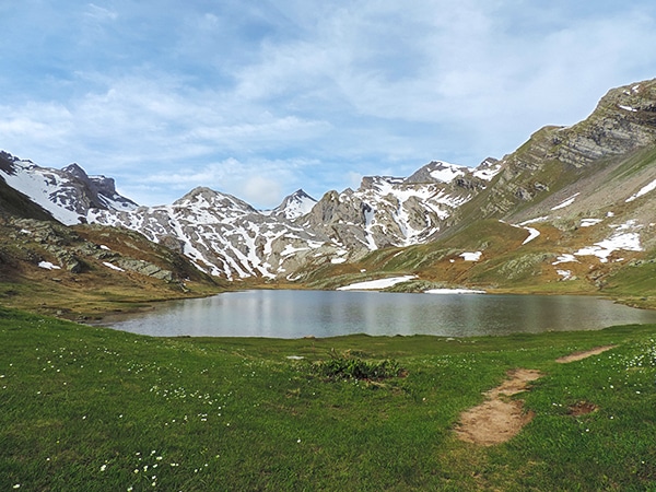
Hiking to the beautiful Lac de Sagnes in the late afternoon exalts the beauty of this landscape. The Lac des Sagnes has exceptional scenery, where rocks, water and vegetation meet in harmony. It’s a gorgeous, meditative walk.
Getting there
In Jausiers you’ll want to find the town of Lans. From Lans find the Farm House Lodge called Deux Pailles et de Bois on Le Serret street. Go east for 279ft and take a sharp left to stay on Le Serret then turn left again to stay on Le Serret. Stay on the road as it changes to Les Faviers and then Les Brayes (maybe 1640ft total). You can park your car on the right of the road, where there’s a little road that goes to the hamlet of Le Pouzévians.

About
| When to do | May to early November |
| Backcountry Campsites | In Jausiers or from 7 p.m. to 9 a.m. on site |
| Toilets | Yes, in Jausiers |
| Family friendly | No |
| Route Signage | Average |
| Crowd Levels | Moderate |
| Route Type | Circuit |
Lac de Sagnes
Elevation Graph
Weather
Route Description for Lac de Sagnes
From the where you parked, if you look back down Les Brayes road you’ll see a path to the right that starts off going north. Continue on this path for 1km and then take the path going left, pointing in the direction of Lac des Sagnes.
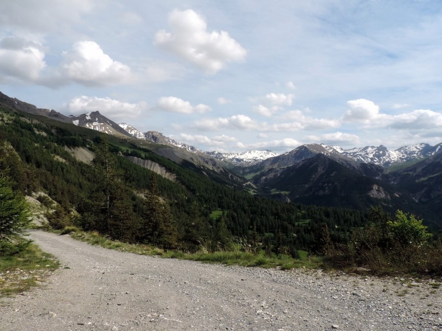
The path goes through the coniferous woods. It goes from one side of the mountain to the other up until you get to a dirt road. Soon after that you’ll reach the crossroad at 6142ft.
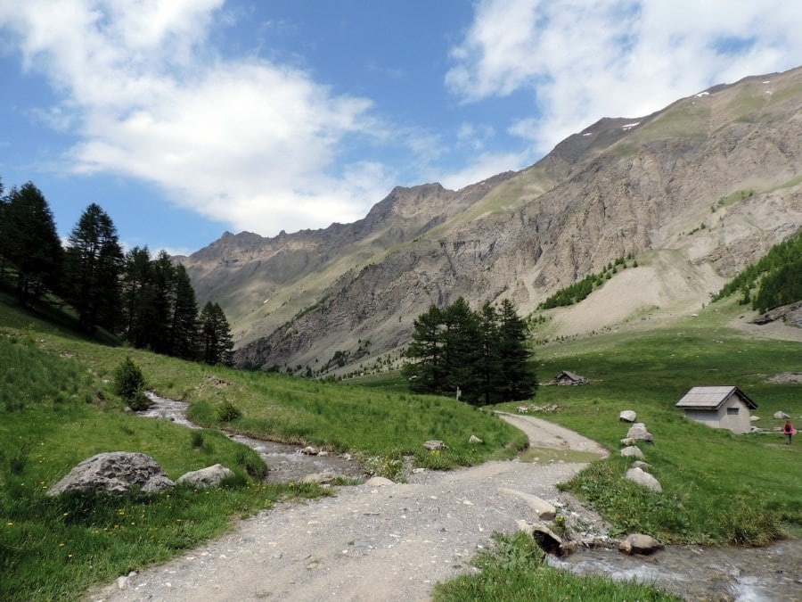
Continue on that dirt road along the side of the valley. After 3.7mi from the starting point you’ll find a little traditional hut. The valley opens up here as the larches mingle with the grasslands.
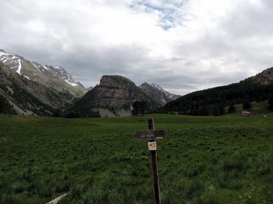
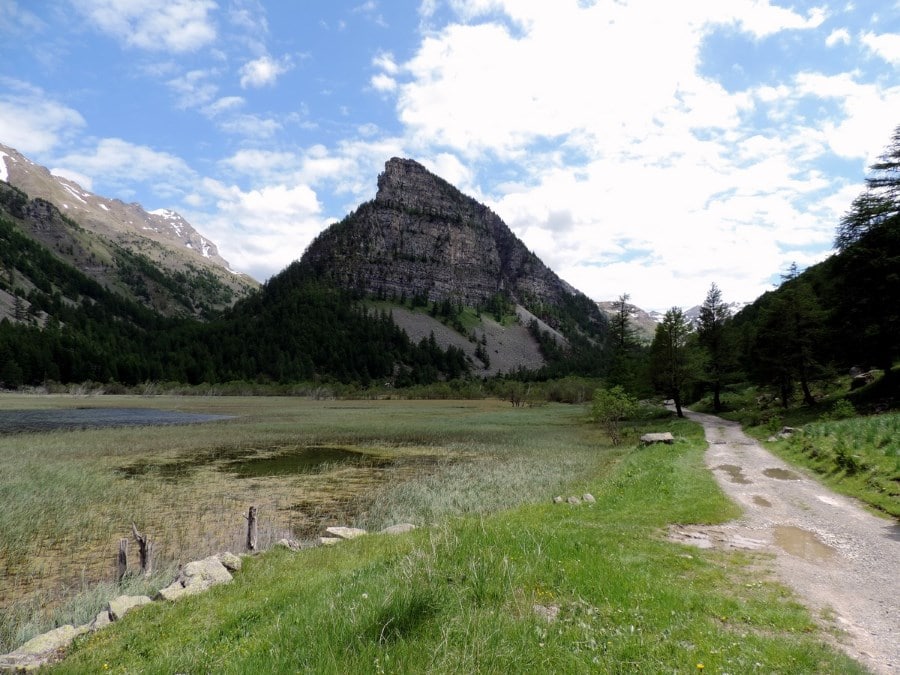
After 1.9mi more you’ll arrive at a lookout showing you the Tour des Sagnes. The Tour is a unique, pointed geological formation that shoots above La Lac de Sagnes.
Close to the hamlet of Le Brec, you’ll take the path on the left side that goes down. After half an hour or so, you’ll arrive to the shore or the lake (5971ft).
The return could be on the path you came; however, we like taking the longer, alternate route that takes you along the valley floor. From the lake, take the right-hand path that starts along the Torrent d’Abries. When the path splits, take the left-hand path, away from the river. Follow this path, and it eventually intersects with the path you came up on. At this point you can go right and retrace your path up or you can take the road to the left, which is quite longer but is more panoramic at the end.
When you arrive in view of the hamlet le Pouzévians, after some turns, you can take a path that brings you directly to your car.
Insider Hints
The hike could be nice by mountain bike. Some people think biking in is the best way to reach the lake.
From the lake, you can go to the Col de Raspaillon (8245ft). You can reach in 2 hours by foot.
This hike shouldn’t do in summer on Sunday, because the dirt road open to 4x4 driving enthusiasts.
If you want to stay near here, check out Jausiers or Barcelonnette. Their tourism pages will have lots of info on where to stay and what to eat.

Similar hikes to the Lac de Sagnes hike
Lauzanier
The wonderful hike to Lauzanier has a stunning landscape, which is courtesy of the glaciers that carved the Lauzanier valley.…
Lacs de Vens
This superb hike of the Vens Lakes and the Collet de Tortisse has interesting, unique geological structures, like a limestone…
Le Mont Mounier
Being one of the highest limestone massifs in the region, Le Mounier has some of the best scenery in the…
Arnie Q. 5 years ago
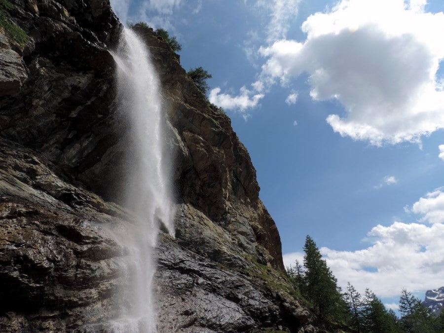
Takes a lot of climbing skills for it. The waterfall view is really amazing. You can take a lot of good pictures here.
Karen S. 5 years ago
It offers exceptional scenery, where rocks, water, and vegetation meet in harmony. It was reasonable to visit again.
Ramesh Patel 5 years ago
Viewing the waterfalls was really amazing. The meadows and mountains are definitely worth the trip.
Aiza S. 5 years ago
The hike is difficult but it's totally worth it. I enjoyed it. The hike could be nice by mountain bike.
Grendy Noire 5 years ago
Beautiful views. Very strenuous climb up. Leg burning but fun experience.
Mustafa P. 5 years ago
Good hike! I complete it in 8.33 hours. I was out of breath the whole time. Just glad I was able to see the majestic views.
Jake Reeli 5 years ago
Excellent views. With the high elevation, you can expect to see exceptional scenery!
Gorki00 5 years ago
Lac de sagnes is very hard. I had to climb a lot up. But it is very nice. I enjoyd it a lot
M du norte 5 years ago
LAc des Sagnes had amazing views! beautiful pictures!