Le Mont Mounier hike
View Photos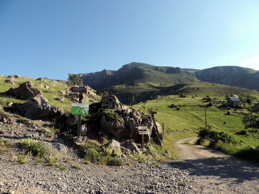

Le Mont Mounier hike
Difficulty Rating:
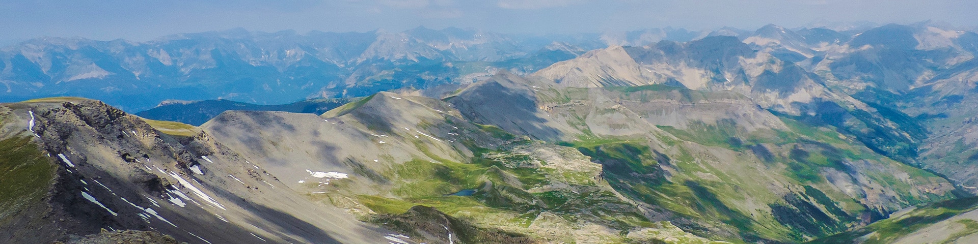
Being one of the highest limestone massifs in the region, Le Mounier has some of the best scenery in the Southern Alps. Stunning views, a lunar landscape and a beautiful crest to climb, this walk has it all.
Getting there
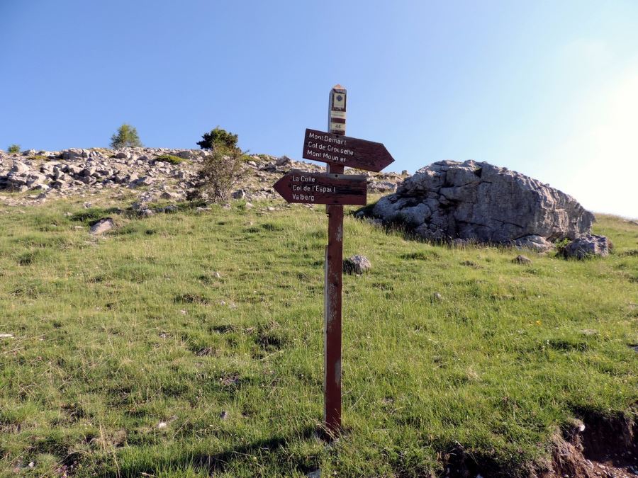
Make your way to Valbert. Once there, look for the signs to the Mercantour National Park House, following in the direction of Col de l'Espaule. You should reach the Col de l'Espaule after 5km. Park the car here.

About
| When to do | June to early October |
| Backcountry Campsites | In Beuil 7 km away, or from 7 p.m. to 9 a.m. on site |
| Toilets | Yes. In Valberg |
| Family friendly | No |
| Route Signage | Average |
| Crowd Levels | High |
| Route Type | Out and back |
Le Mont Mounier
Elevation Graph
Weather
Route Description for Le Mont Mounier
From where you parked your car, continue on the track, following in the direction of Mont Mounier.
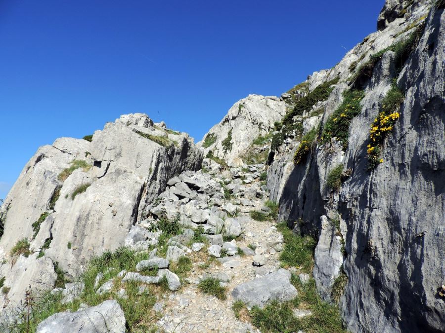
This road will reach the hamlet of La Colle in 0.9mi, then you must take the path that branches off the left hand side of the road and then curves right. As it curves right, you’ll walk below a rock cliff.
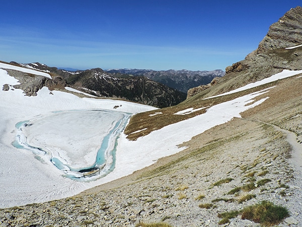
The path will go up, crest a hill, and then up along a rocky cliff before finally reaching a high and dry plateau. From here you enter the National Park itself!
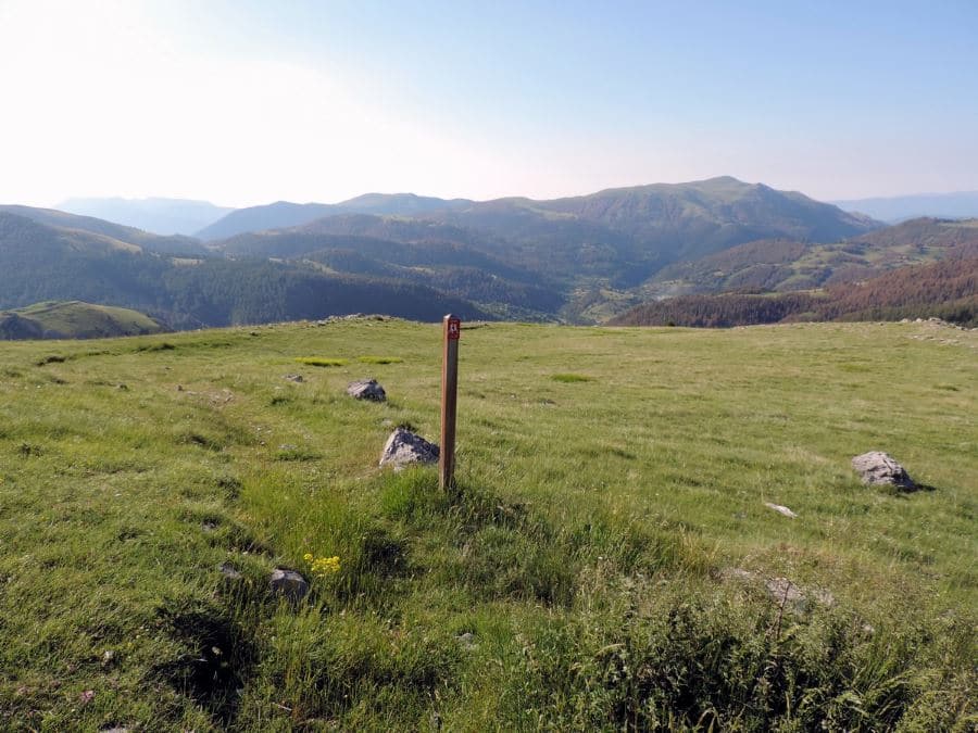
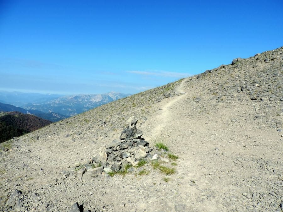
Through this landscape the path continues, switch-backing on top of this ridgeline. You’ll pass a marker saying your altitude is 7874ft. There is another path here that goes down, don’t follow it. Stay on this ridgeline.
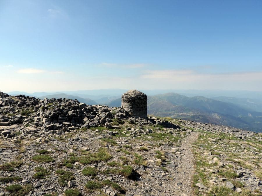
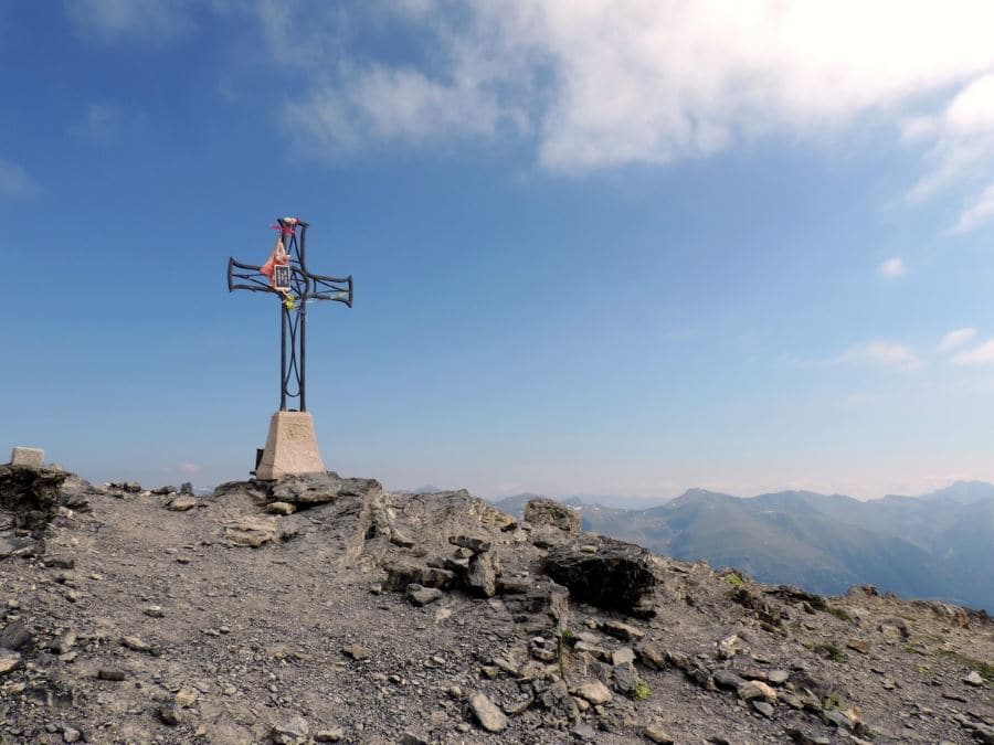
After an hour or so, you’ll arrive to the crest of Col de Crousette (8734ft), and you’ll continue on the crest until the Petit Mounier where you can see ruins of an observatory from 1893.
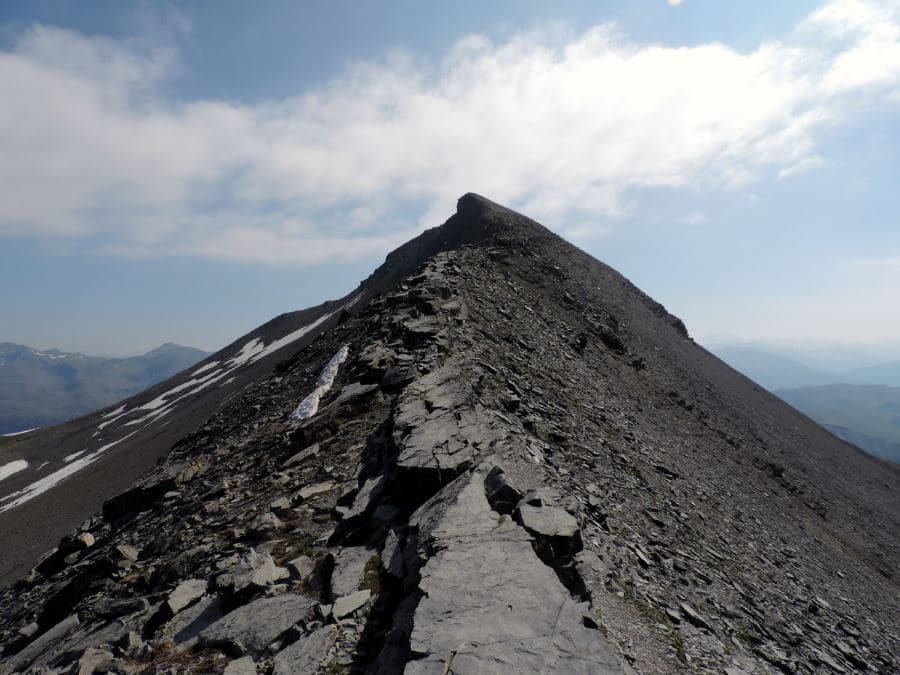
After a little pass the crest becomes narrower than before but never dangerous (if you stay on the trail). The path goes up and up, onto the final crest.
After all that altitude gain, you’ll arrive on the peak! The stunning view will be all you want in this moment, and that is exactly what you get: a just reward for hard work.
From the peak it’s possible to see south towards the Mediterranean Sea and the Corse, or the higher peaks of the Northern Alps towards the north. To the west the Provence Prealps seems without end.
The return is on the same path.
Insider Hints
The hike we proposed is the easiest by car and by foot, but the Mounier could be reached from South-East (Roubion on the Tinée Valley), or from Roya (close to Saint Etienne de Tinée) on the North side.
On the way in you can stop somewhere in the Gorge de Daluis, aka the red canyon.
Valberg, Beuil, or Roubion make great jumping off points. Each Cities' tourism page will give you lots of options to choose from.

Similar hikes to the Le Mont Mounier hike
Lac de Sagnes
Hiking to the beautiful Lac de Sagnes in the late afternoon exalts the beauty of this landscape. The Lac des…
Lacs de Vens
This superb hike of the Vens Lakes and the Collet de Tortisse has interesting, unique geological structures, like a limestone…
Sommets des Garrets
One of the most beautiful hikes in Mercantour National Park. You have a superb view on the Lac d’Allos, very…
Antoanette Lavroutte 4 years ago
Aug. 14 2020 One for the books! I brought my friends from canada here one time and they can't forget how beautiful it was.
Slavka Pochodi 4 years ago
One of the most beautiful hiking In Mercantour National Park
Lorde P. 5 years ago
Le Mounier has some of the best scenery in the Southern Alps. The hike is quite difficult, but the views are just amazing.
Karen S. 5 years ago
One of the best hikes I did. The crest becomes narrower than before but never dangerous. It will take a lot of climbing skills on this one.
Aiza S. 5 years ago
Stunning views! The lunar landscape and a beautiful crest to climb. You can stop somewhere in the Gorge de Daluis. Jaw-dropping views of the landscapes.
Lisa B 5 years ago
This region is so interesting! The landscape on Mont Mounier is quite unique and the views from the top are stunning.
Sebo 5 years ago
Le Mont Mounier hike was one of the best hikes in France that I've done.