Sommets des Garrets hike
View Photos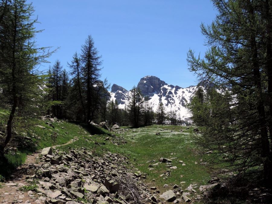
Sommets des Garrets hike
Difficulty Rating:
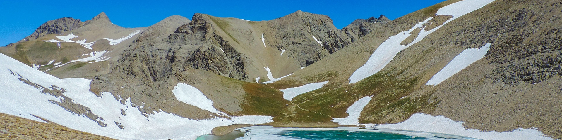
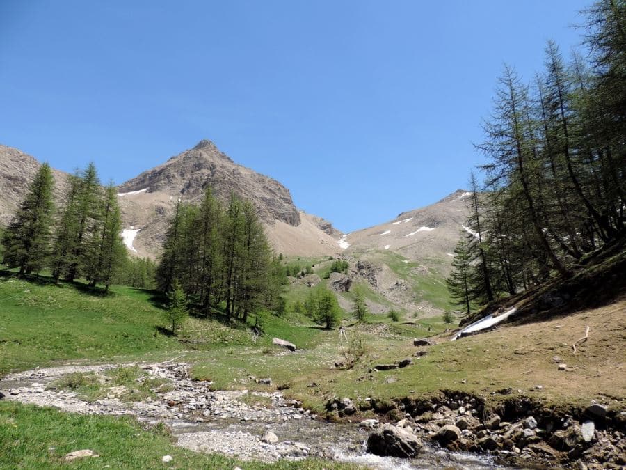
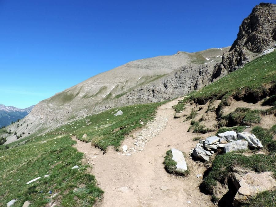
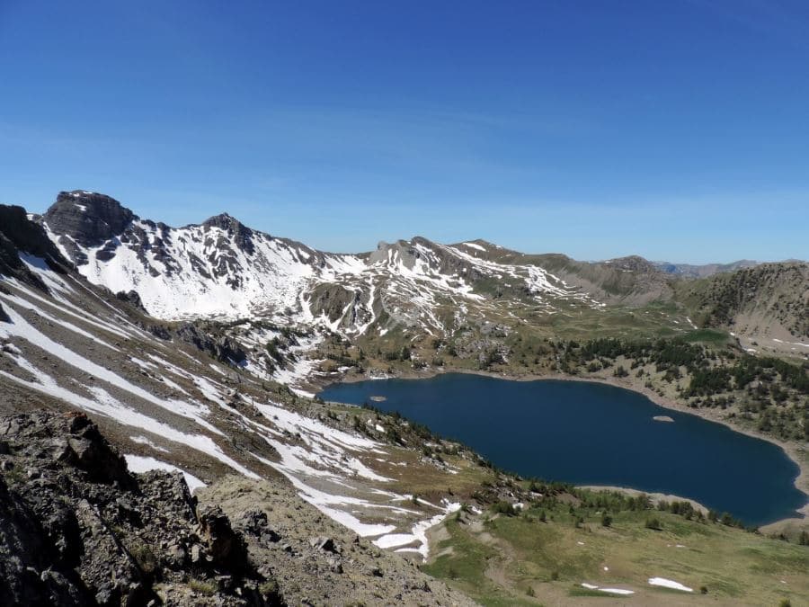
One of the most beautiful hikes in Mercantour National Park. You have a superb view on the Lac d’Allos, very panoramic. You’ll walk on limestone rocks, through larch forests and grassy slopes, and you can find rare plants and birds: jewels for connoisseurs. But, it comes at a price: a lot of gradual altitude gain.
Getting there
From Nice airport go up the valley of the Var by the RM 6202 and then by the D4202 until you reach Allos. At the first crossroad, go right on the D2 to Lac d’Allos. You’ll reach the starting point after 7.8mi. The parking costs 8€ per car per day.

About
| When to do | June to end of October |
| Backcountry Campsites | In Allos or from 7 p.m. to 9 a.m. on site |
| Toilets | Yes. Refuge Lac d'Allos |
| Family friendly | No |
| Route Signage | Average |
| Crowd Levels | Moderate |
| Route Type | Lollipop |
Sommets des Garrets
Elevation Graph
Weather
Route Description for Sommets des Garrets
From the parking lot take the only path that starting near the little house. After ten minutes, you’ll arrive at the first glacier threshold, where there once was an ancient lake, now a nice bog. The path will reach a trail that will arrive from the left. Ignore it.
After 30 or so minutes (if you’re going at a good speed), go along to the left you’ll get to the second glacier threshold, from here you can see the Lac d’Allos 7310ft.
At the lake go left. You can stop at the Refuge du Lac for some refreshments (we highly recommend this) and then continue left.
Follow the path that goes up in the direction of the Col de la Petite Cayolle.
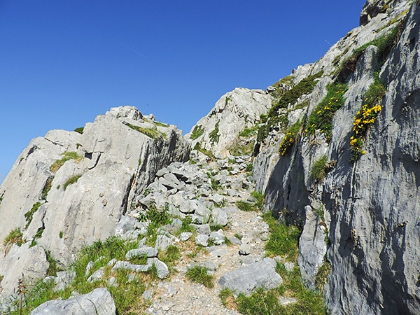
When you reach a large grassy plain, you should find a sign that says 7408ft. From here, take the path on the right and continue direction Col de la Petite Cayolle.
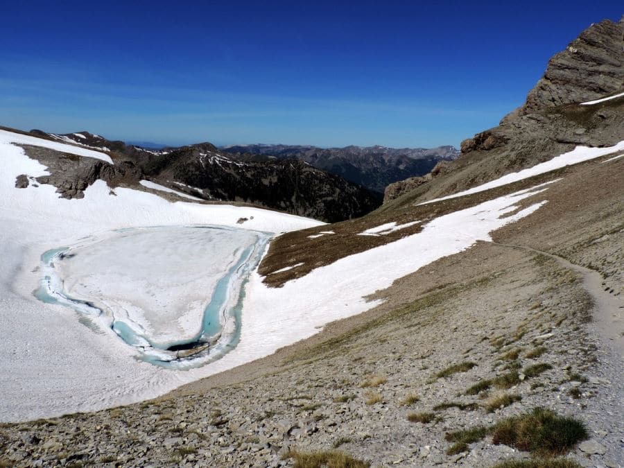
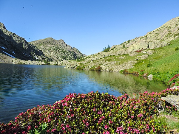
The path goes into the Ravin de Meouille and then reaches the edge of the Lac de la Petite Cayolle (8491ft). The lake is nestled within the limestone scree, where the snow remains until June.
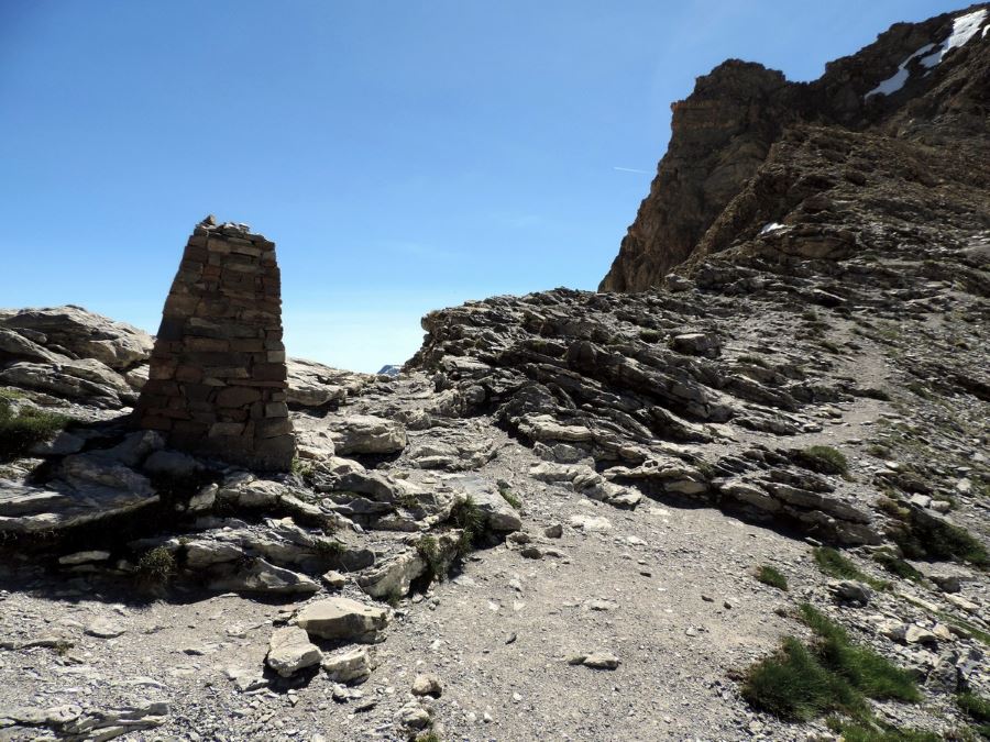
In front of you there’s the Col de la Petite Cayolle (8658ft) that you can reach in twenty or more minutes. From here you’ll have a view on the Western Alps: from the Monte Bianco to the Maritime Alps.
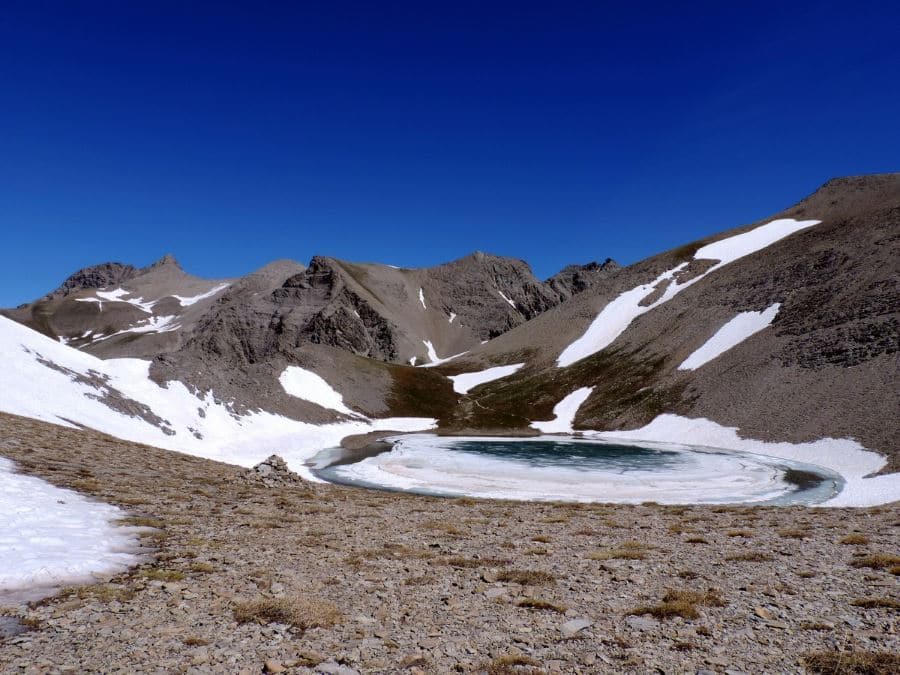
Then, continue right. The path skirts around the lake. You’ll see the little pass (8730ft) the divides it from the Lac de Garrets (8599ft).
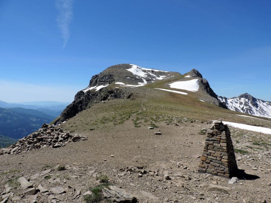
From the lake, you can continue up, following the path and you arrived in on to the flat crest of the Sommet du Lausson (8678ft) and the Pas du Lausson (8537ft). From here, on the right, you have the trail that falls towards the Lac d’Allos.
The path downhill brings you to the trail you originally went uphill on, in the Ravin de Meouille, at (7713ft a.s.l.).
The return is on the same path or, if you want, from the signal at 7408ft, there a direct path the goes down to the Plateau du Laus.
Insider Hints
If you still have energy, you can go up until the Mont Pelat 10007ft, one of the highest peaks of this region. From here you have a panoramic view of Provence and - with a clear sky - you can see all the way to the Corse.
Try staying at The Refuge du Lac d’Allos. The food is great, the lodging is simple and you are right beside the lake.
Another option is the Refuge de la Cayolle. An equally charming establishment although it doesn’t have the benefit of being lakeside.

Similar hikes to the Sommets des Garrets hike
Lac de Sagnes
Hiking to the beautiful Lac de Sagnes in the late afternoon exalts the beauty of this landscape. The Lac des…
Lacs de Vens
This superb hike of the Vens Lakes and the Collet de Tortisse has interesting, unique geological structures, like a limestone…
Le Mont Mounier
Being one of the highest limestone massifs in the region, Le Mounier has some of the best scenery in the…
Antoanette Lavroutte 4 years ago
Not for the faint hearted. This hike will push you to the limits but the view up there was worth it!
Slavka Pochodi 4 years ago
Magnificent hiking place. The extraordinary view alone justifies the effort to climb
Vincent V. 4 years ago
This trail was an awesome, rewarding and challenging!
Dolores S. 4 years ago
Superb! Alright, Altitude sickness is a real thing. Take rest when you're tired and keep hydrated.
Mina P. 5 years ago
Superb view of the plains and grass. A hike not for the faint-hearted. It has extraordinary surroundings.
Arnie Q. 5 years ago
It takes a lot of effort to complete it, but it's a definitely rewarding hike. You can see everything there. Enjoyed it a lot.
Karen S. 5 years ago
One of the most beautiful hikes in the park. Amazing panoramic view of Lac d’Allos. You’ll walk on limestone rocks, through larch forests and grassy slopes, and you can find rare plants and birds around the area.
Kim Pillar 5 years ago
This trail is fantastic, also it's rewarding and challenging at the same time. Bring lots of water on this hike.
Adel Hamdani 5 years ago
A fairly easy hike. Breathtaking views of a natural environment with shades of greenery at the foot of the mountain. One of the most beautiful places I've been to.
Jake Reeli 5 years ago
A good hike for seasoned hikers. The trail near the top was very difficult but rewards you with amazing views. Highly recommended for veteran hikers.