Lacs de Vens hike
View Photos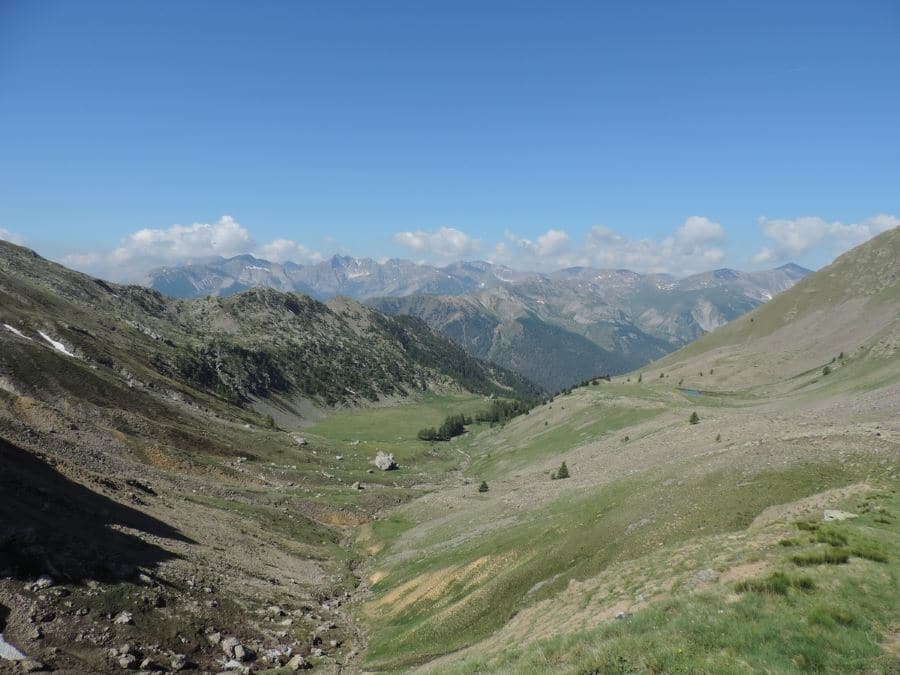
Lacs de Vens hike
Difficulty Rating:
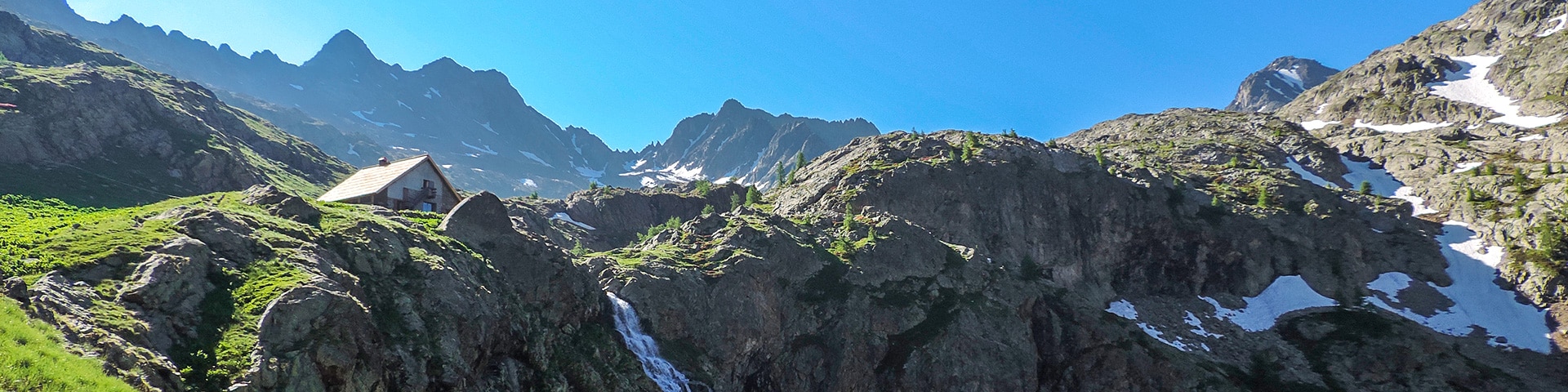
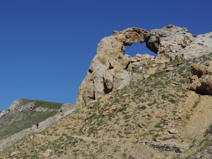
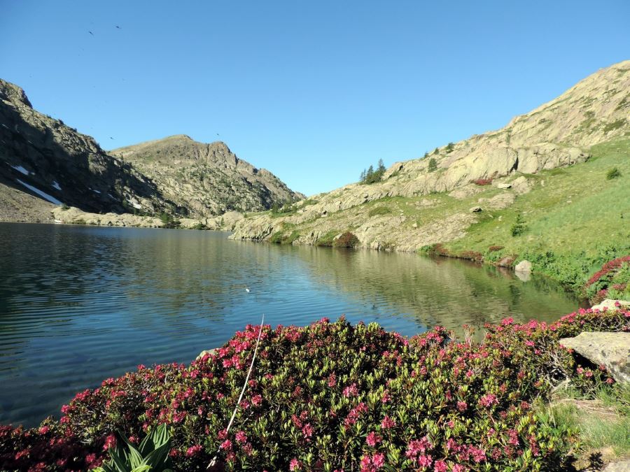
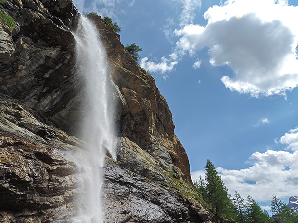
This superb hike of the Vens Lakes and the Collet de Tortisse has interesting, unique geological structures, like a limestone bridge. Vens Lakes are among the most beautiful lakes in this area and when you reach the lakes a nice mountain hut is waiting for you.
Getting there
Take the RM2205 in the direction Saint Etienne de Tinée. From Saint Etienne you continue on the D2205 in the direction of Col de la Bonnette; after almost 9km, after you’ve passed two bends, you’ll find parking on the left, and a dirt road on your right. Leave the car here and take the road at the signal n°20.

About
| When to do | June to end of October |
| Backcountry Campsites | In Saint-Étienne-de-Tinée or from 7 p.m. to 9 a.m. on site |
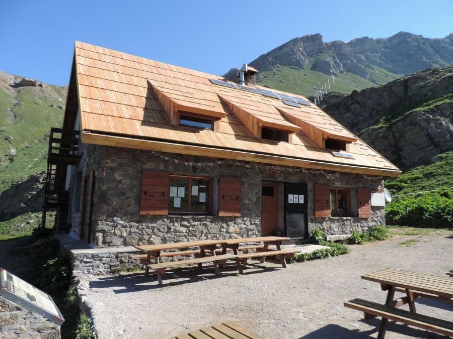
| Toilets | Yes, in the Refuge de Vens |
| Family friendly | No |
| Route Signage | Average |
| Crowd Levels | Moderate |
| Route Type | Out and back |
Lacs de Vens
Elevation Graph
Weather
Route Description for Lacs de Vens
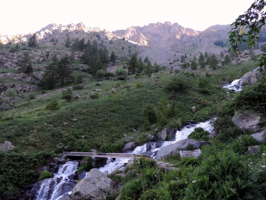
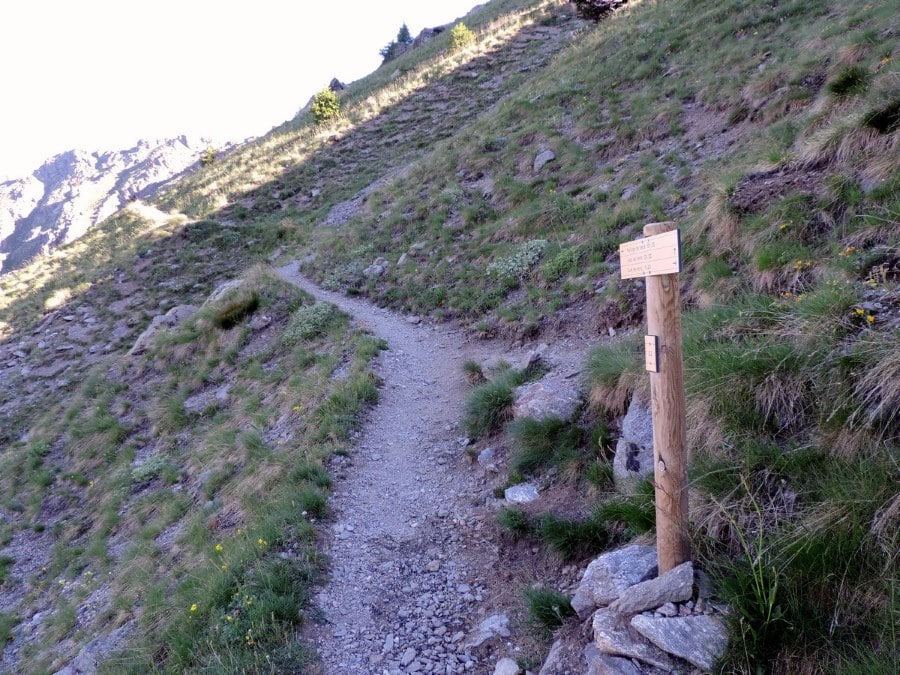
From parking you’ll take the road at signal n°20. After less than 1km the road ends and the path reaches a bridge on the little Vens River.
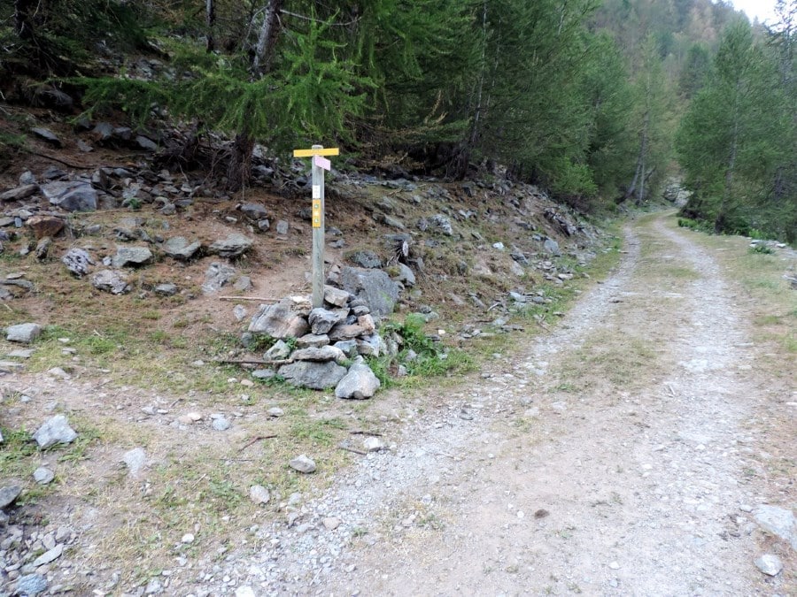
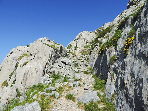
At the signal n° 21 take the path going to Lacs de Vens. The path goes up in a larch forest, through some rocky areas and over some prairies.
You’ll pass the river another time. After that, you’ll switchback up a rocky slope and, eventually arrive at signal n°22.
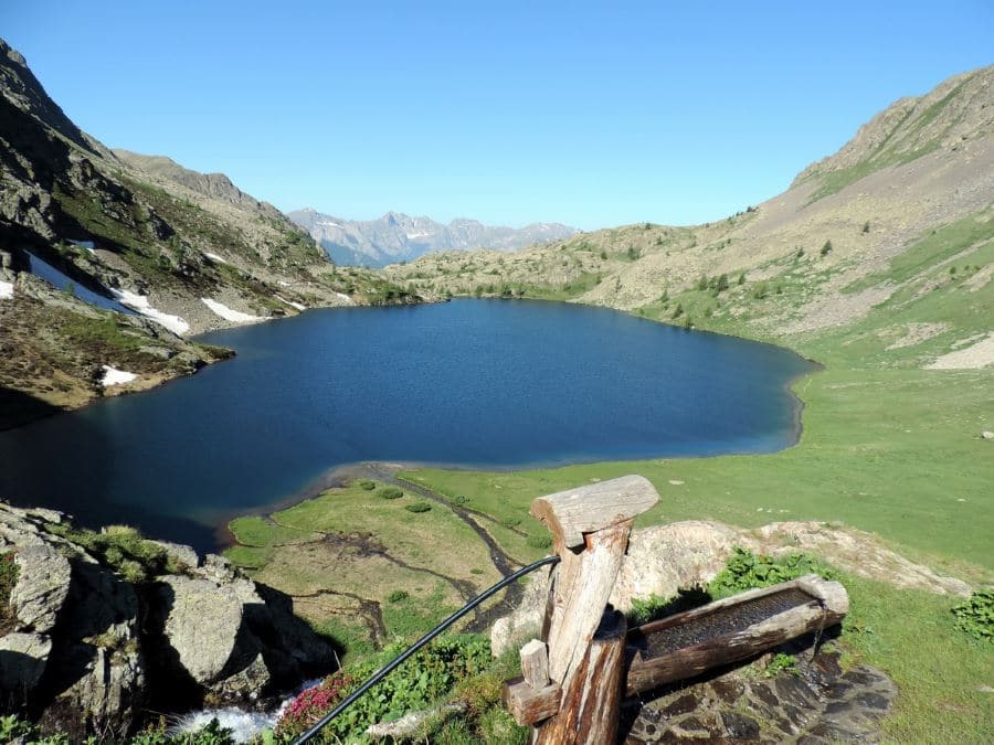
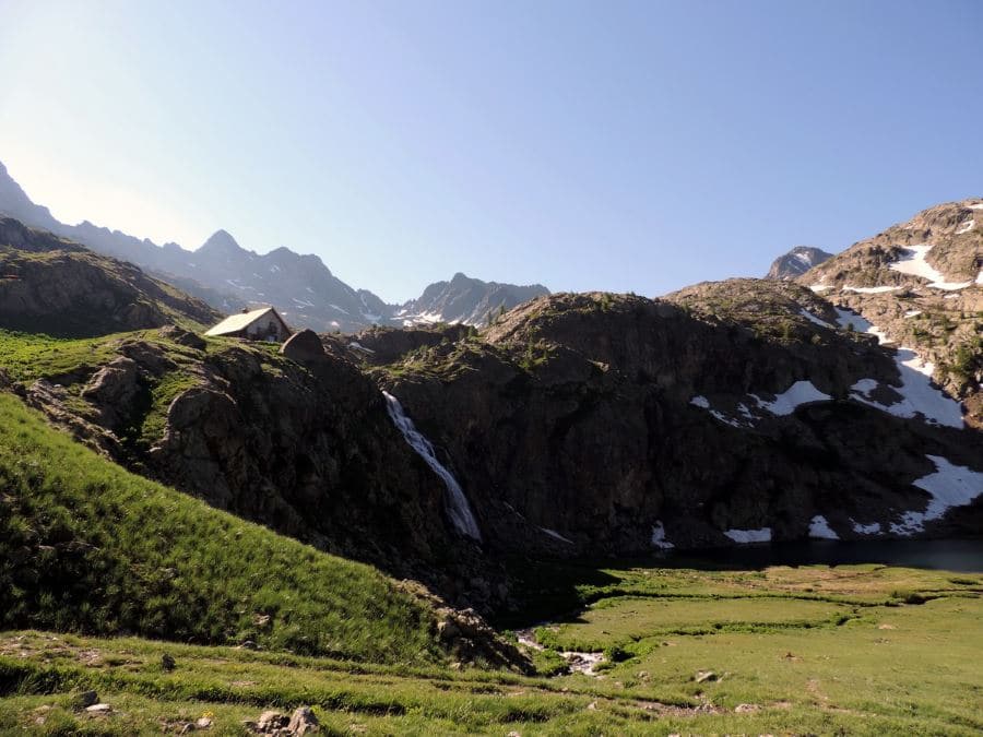
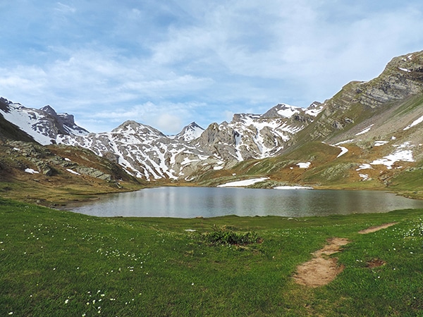
From here you’ll have to make a choice. The path on the left takes you directly to the hut, passing over lakes. On the right, towards the Pass des Pecheurs (the pass of fishermen, 7710ft), the path will take you up to the coast of the Lac de Vens Inferieure and, after that, Lac de Vens Superieure. This will then ultimately lead up to the Refuge de Vens (7762ft).
The hut is built on a cliff and has a nice view to the west and of the Mounier peak region.
From the refuge you can return on the same path back to your car (this is where our map ends); although, if you have the energy, you can continue onto the Collet de Tortisse (8507ft), to see the Arc de Tortisse. From that pass you can go until the Col du Fer (8478ft) and take the path that goes down into the Vallon de Tortisse. After half of an hour or so you’ll arrive at the Forestry hut of Tortisse (7388ft). You’ll then want to take the path on the left, in the direction of Lacs de Vens. You’ll reach the pass at 7946ft and then go down, crossing the path going uphill. From this point, the return to your car is on the same path.
Insider Hints
From the Col du Fer you can go down on the Italian side, until Ferriere (6234ft), a very nice and ancient hamlet, recently restructured. You can sleep here in the GTA refuge.
From the Col du Fer you can go down to the D2205 by the Vallon de Tortisse, reaching the D2205 to Le Prà (5577ft). If you walk 1.2mi up you’ll reach your car.
From the Collet de Tortisse you can go ahead on the right until you reach the Italian side and the Colletto di Panieris (8530ft). From there, go down until Prati del Vallone, where you can sleep in the Rifugio Talarico (5577ft).
From Saint Etienne de Tinée, by car, you can go up to the Col de la Bonnette (8907ft), one of the highest passes in the Alps. From here you’ll have a nice view of the Western Alps. You can continue until Jausiers, in the Ubaye Valley (see hikes 9 and 10).
Try staying at Rifugio Talarico while you’re in the area. It isn’t a fully stagged hut like some of the others in the are, but in the summer a nearby Holiday House does offer catering and hot showers.

Similar hikes to the Lacs de Vens hike
Lauzanier
The wonderful hike to Lauzanier has a stunning landscape, which is courtesy of the glaciers that carved the Lauzanier valley.…
Lac de Sagnes
Hiking to the beautiful Lac de Sagnes in the late afternoon exalts the beauty of this landscape. The Lac des…
Le Mont Mounier
Being one of the highest limestone massifs in the region, Le Mounier has some of the best scenery in the…
Antoanette Lavroutte 4 years ago
Worth the effort and good for my health, I don't recommend you bring your children as it is a challenging hike.
Felix Legrand 4 years ago
All of these lakes are beautiful, Recommended it!!
Vincent V. 4 years ago
Fantastic hike but be aware it's hard work but well worth it in the end. It is a paradise on earth.
Dolores S. 4 years ago
It was a plesant hike! It would be nice to be physically prepared before doing this hike to avoid altitude sickness.
Lorde P. 5 years ago
Superb hike! It has interesting, unique geological structures, like the limestone bridge. Fantastic view of the lake.
Arnie Q. 5 years ago
Fantastic hike with challenges along the way. The view of the lake was amazing. Great for photography.
Karen S. 5 years ago
The view is just mesmerizing. I can't wait to go back again.
Villon H. 5 years ago
Stunning hike. Takes a lot of effort to get to the summit. We'll take Johny here next year on his birthday!
Dayton M. 5 years ago
Perfect day hike in spring! Aside from the perfect weather, there are tons of colors to see.
Rowena D. 5 years ago
Awe-inspiring scenery awaits at the top. The mountain looks splendid.