
Lauzanier hike
View Photos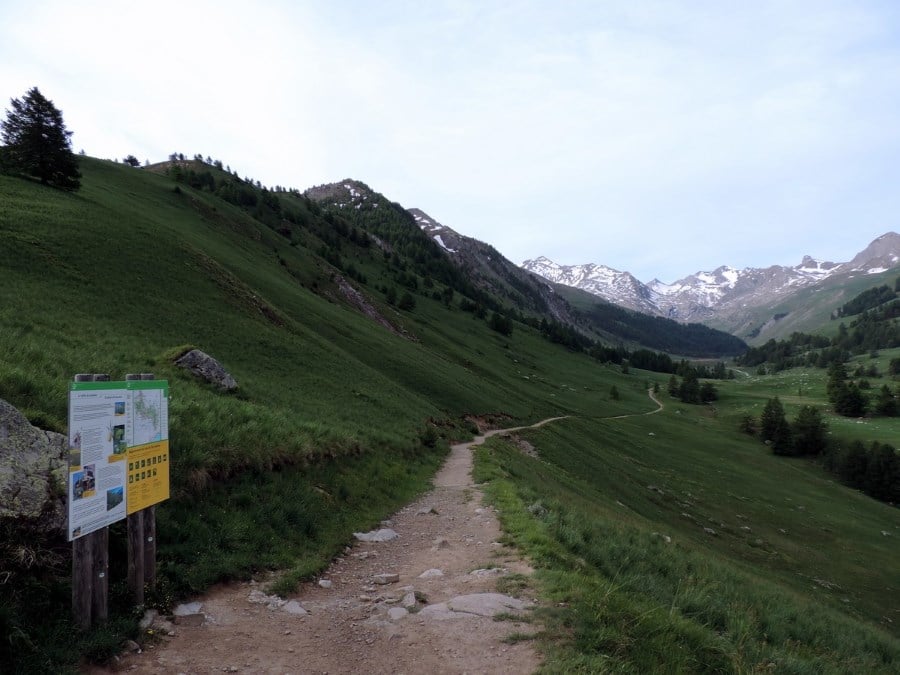
Lauzanier hike
Difficulty Rating:
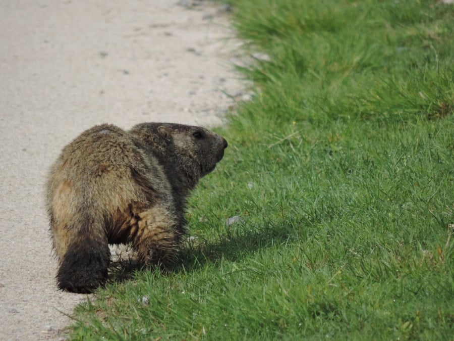
The wonderful hike to Lauzanier has a stunning landscape, which is courtesy of the glaciers that carved the Lauzanier valley. Agriculture is popular here as well as raising sheep. You might notice them. There is said to be 7,000 sheep in this area. Your hiking companions on this walk might be four-legged and fluffy.
Getting there
From Jausiers’s Town Hall, go east on Le Chef Lieu/D900 for 14.0mi then turn left. There is parking here just above the road: Parking de l'Orrenaye.

About
| When to do | June to early October |
| Backcountry Campsites | In Larche from 7 p.m. to 9 a.m. on site |
| Toilets | Yes. In Larche. |
| Family friendly | Yes |
| Route Signage | Average |
| Crowd Levels | Moderate |
| Route Type | Out and back |
Lauzanier
Elevation Graph
Weather
Route Description for Lauzanier
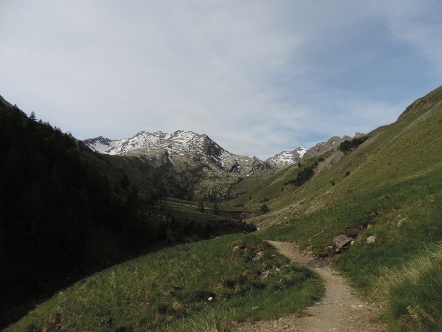
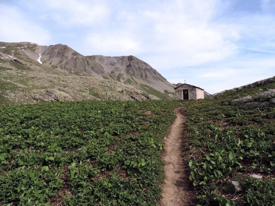
From the car park, you cross the road and take the path that goes down to the river, past the little bridge and continues southwest on a flat trail towards Lacs de Lauzanier.
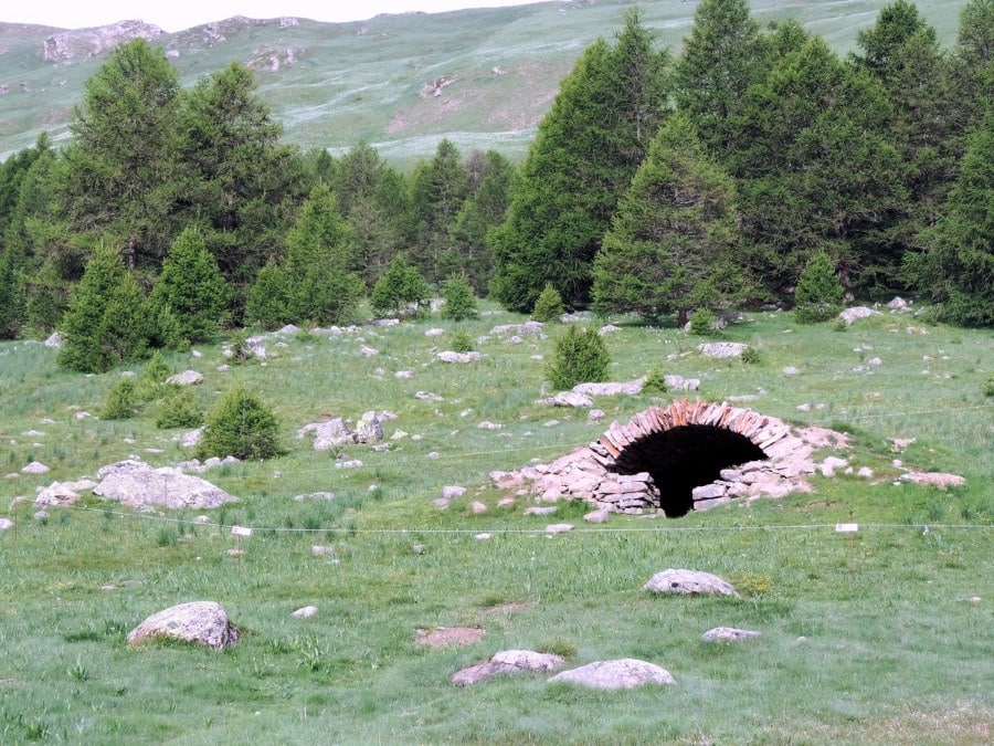
The path goes down to the grassy valley, crosses the river another time near a shepherd hut and, not long after, arrives at the entrance of the National Park.
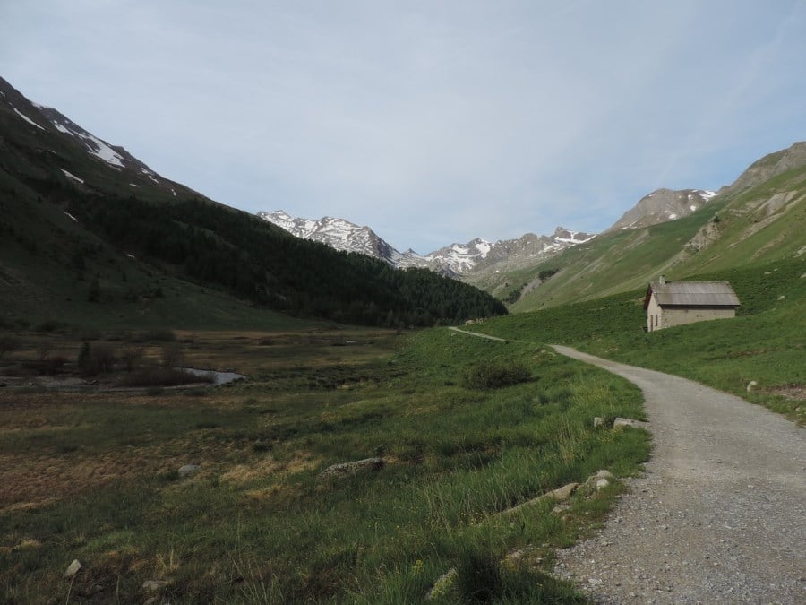
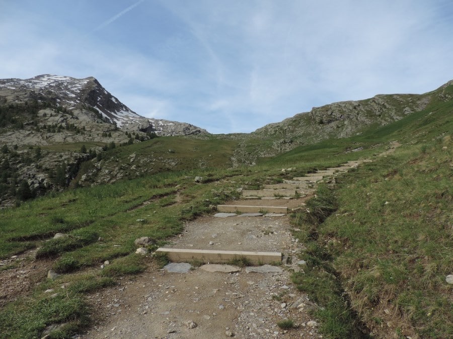
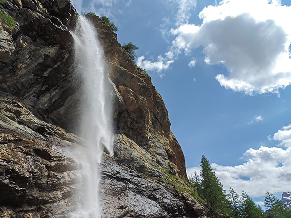
Now, continue your trek through the valley. The path goes up by a somewhat steep incline and then that becomes an even steeper incline, with rocky stairs built recently by the Park staff.
When you arrive at a little hut you have under an hour left.
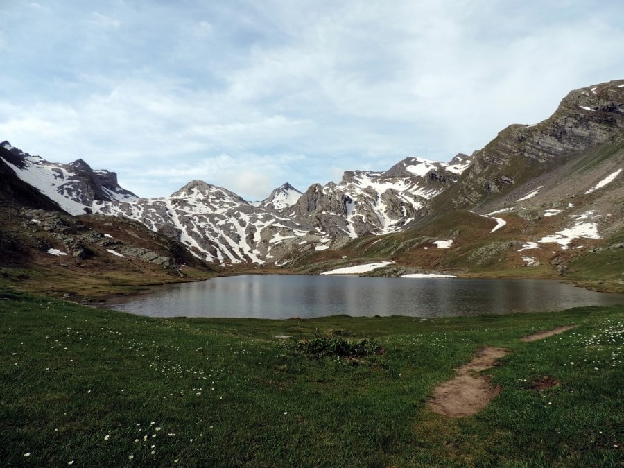
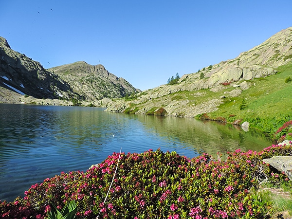
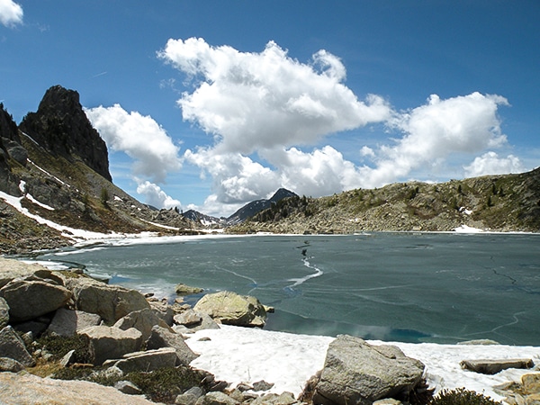
The lake is hidden until the end, behind the glacial threshold (7493ft), so when you arrive the view stuns you: behind the lake a collection of peaks mix with the valley as it goes up and invites you to continue.
Cherish this moment a little while longer. Then, when you’re ready, the return is on the same path.
Insider Hints
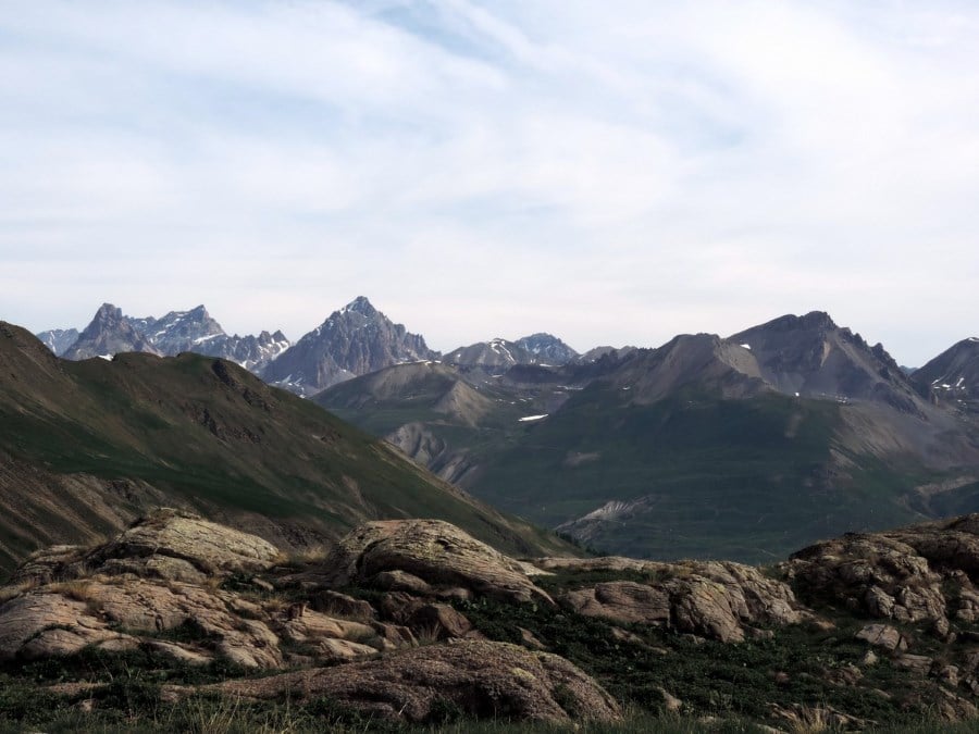
From the lake, you can continue in the valley to arrive at the Lac derriere la Croix (7966ft), or to the Pas de la Cavale (8763ft).
On a little track, without signage, you can reach the top of the Cime des trois Evéques (9409ft).

Similar hikes to the Lauzanier hike
Lac de Sagnes
Hiking to the beautiful Lac de Sagnes in the late afternoon exalts the beauty of this landscape. The Lac des…
Lacs de Vens
This superb hike of the Vens Lakes and the Collet de Tortisse has interesting, unique geological structures, like a limestone…
La Lac Nègre
This hike is a classic. "La Lac Nègre" is yours to discover all 12 hectares of this magnificent lake surrounded…
Felix Legrand 4 years ago
A magical valley, a very nice reward at the end. definitely a nice walk for a picnic
Dolores S. 4 years ago
Marvelous scenery! There are sheeps all around the area. They are lovely creatures.
Abraham W. 5 years ago
A wonderful and family friendly hike. It offers stunning views of the landscape. There's also a lot of sheeps there.
Aiza S. 5 years ago
There's a hidden lake at the end which is so cool. The sheeps are cute. The glacier is the most spectacular scene on this hike.
Lena H. 5 years ago
This was just such a wonderful experience. Lauzanier valley is simply gorgeous.
Ariel R. 5 years ago
This is actually better than what I've espected. I continued to Lac derriere la Croix and it was spectacular as well!
Minzy Lee 5 years ago
Lovely hike! This is a sheep lover's paradise. So many fluffy little sheep. I love all of them.
Villon H. 5 years ago
Simply beautiful. It was extremely cold at the top though. Air was very thin.
Elizabeth M. 5 years ago
it's so tricky but i like it...nice hike.. not crowded at all...
Adriadna Y. 5 years ago
This is an amusing hike I've enjoyed with my family. Fantastic experience.