Tristner Hike
View Photos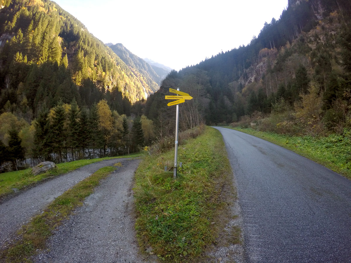
Tristner Hike
Difficulty Rating:
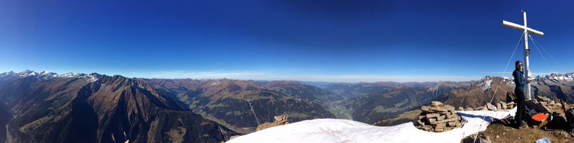
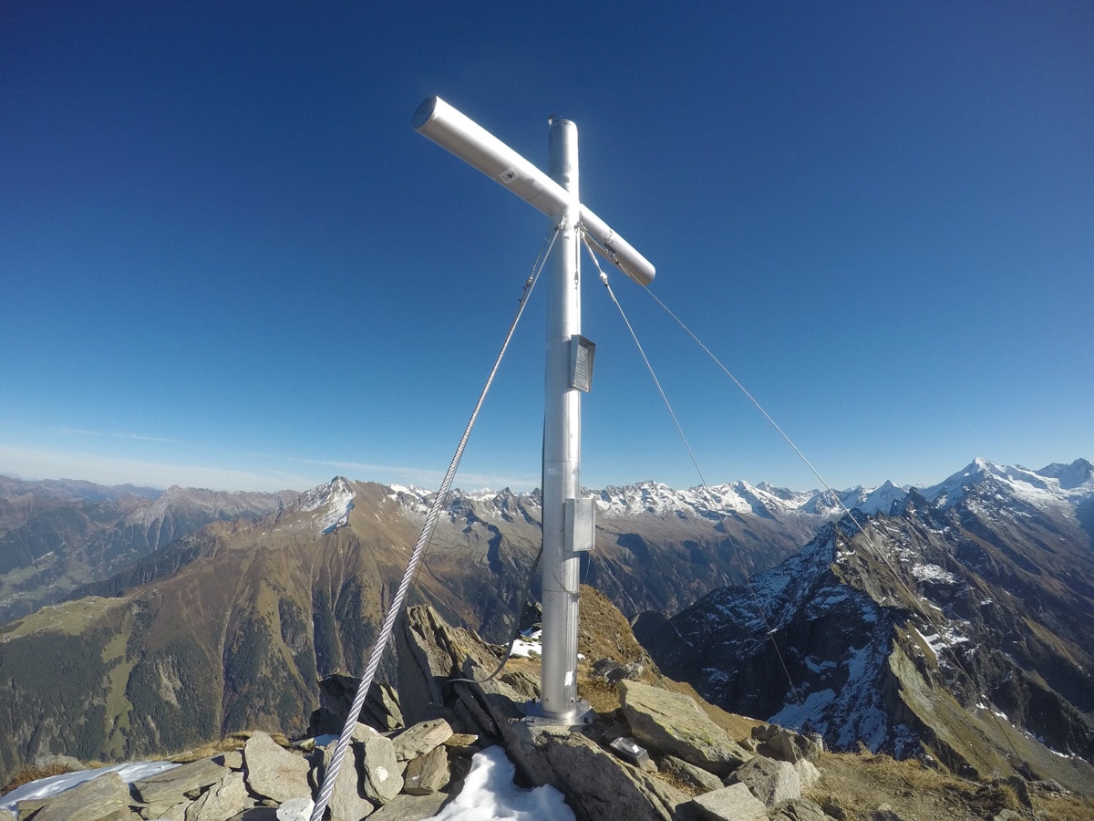
Steep! Adventurous! Rewarding! Getting to the summit of Tristner provides you with the most incredible view over the Zillertal; it can only be seen by sustained and experienced hikers.
Getting there
From Mayrhofen take the B169 towards Ginzlingsouth. Make a left to Ginzling and follow this street to the Naturpark Haus in Ginzling, where there is a parking lot.

About
| When to do | July to September |
| Backcountry Campsites | No |
| Toilets | No |
| Family friendly | No |
| Route Signage | None |
| Crowd Levels | Low |
| Route Type | Out and back |
Tristner Hike
Elevation Graph
Weather
Route Description for Tristner Hike
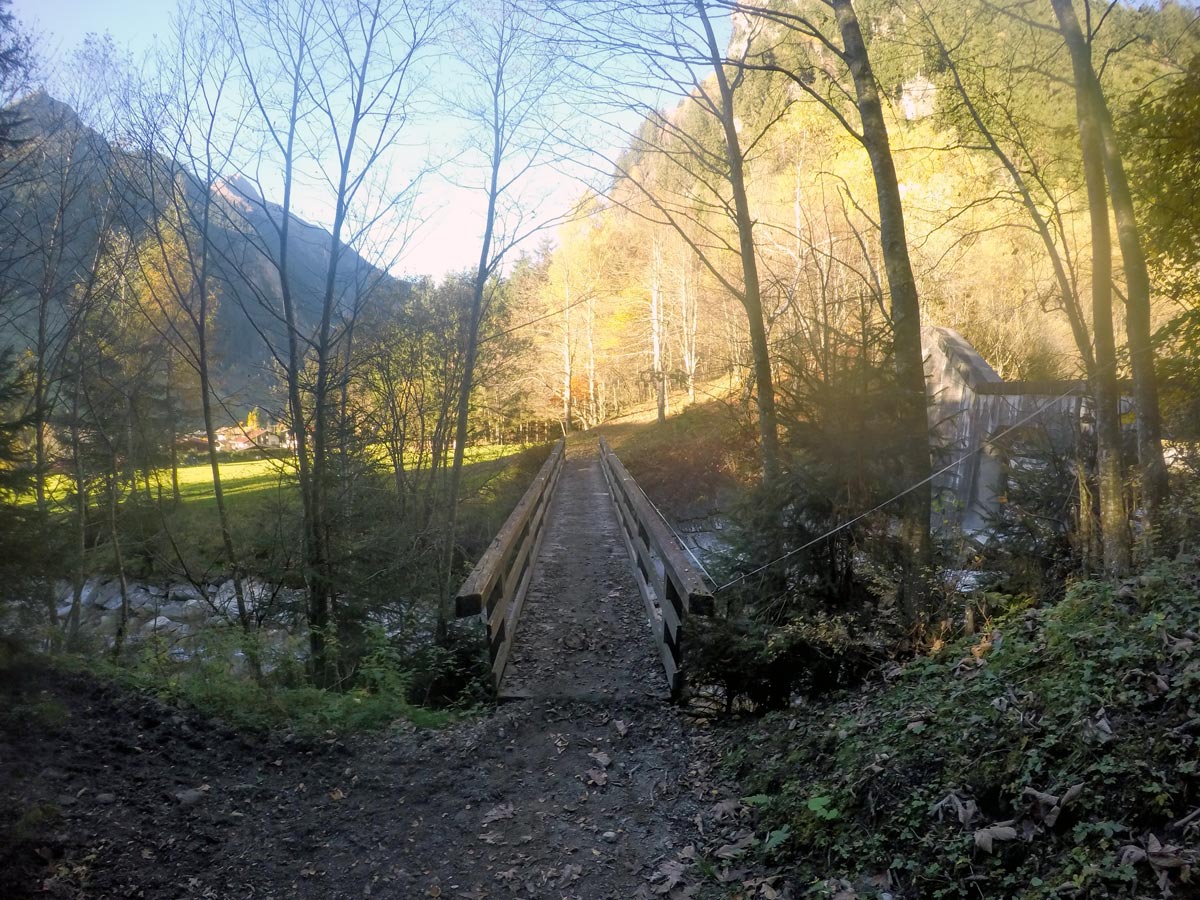
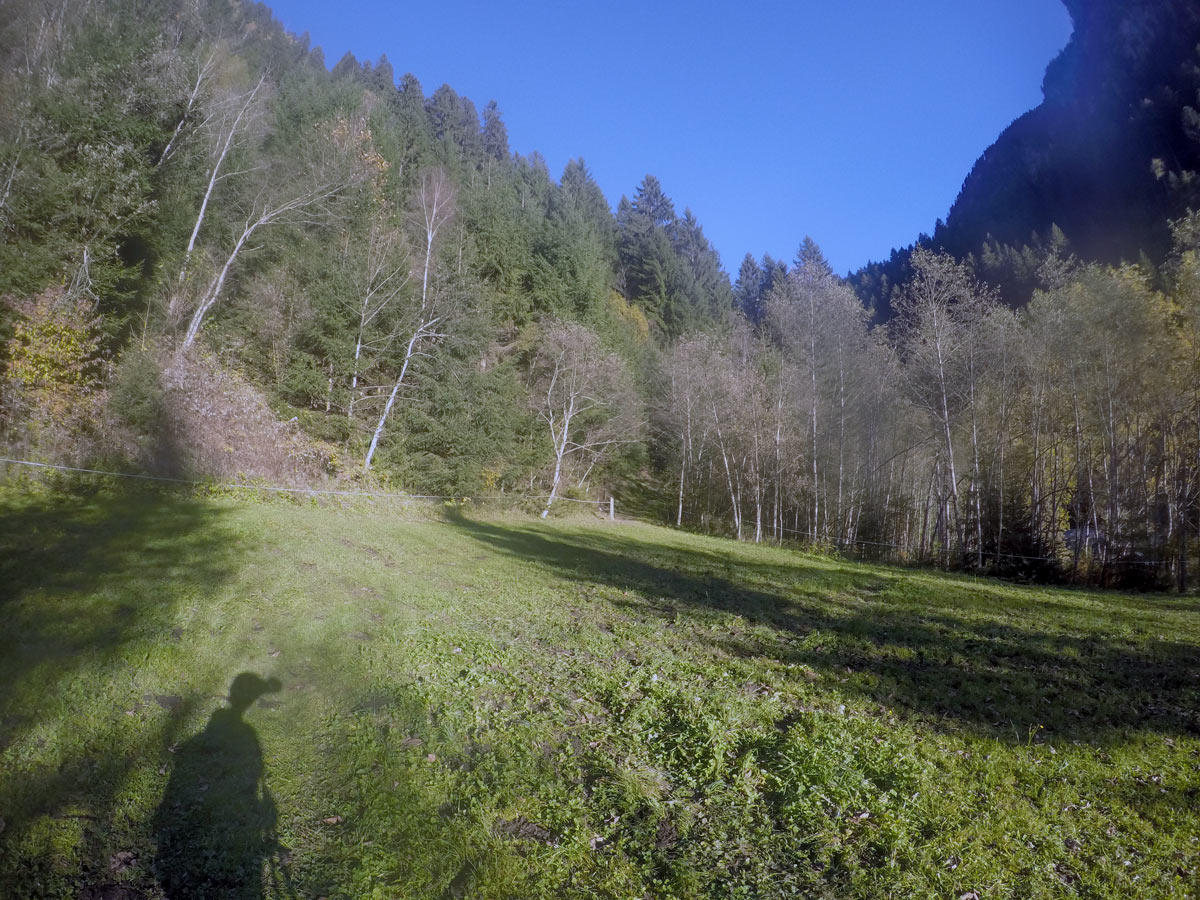
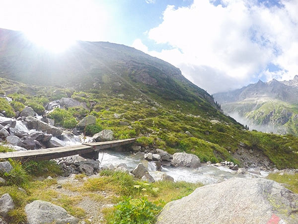
From the parking lot in Ginzling, start by following the asphalt road for 0.2km and make a left at the first signs saying “Rundwanderweg Ginzling” and walk down the gravel road for a few meters. Go left at the field to get to a small bridge as it leads you over the Floitenbach and up to the woods, crossing another small field.
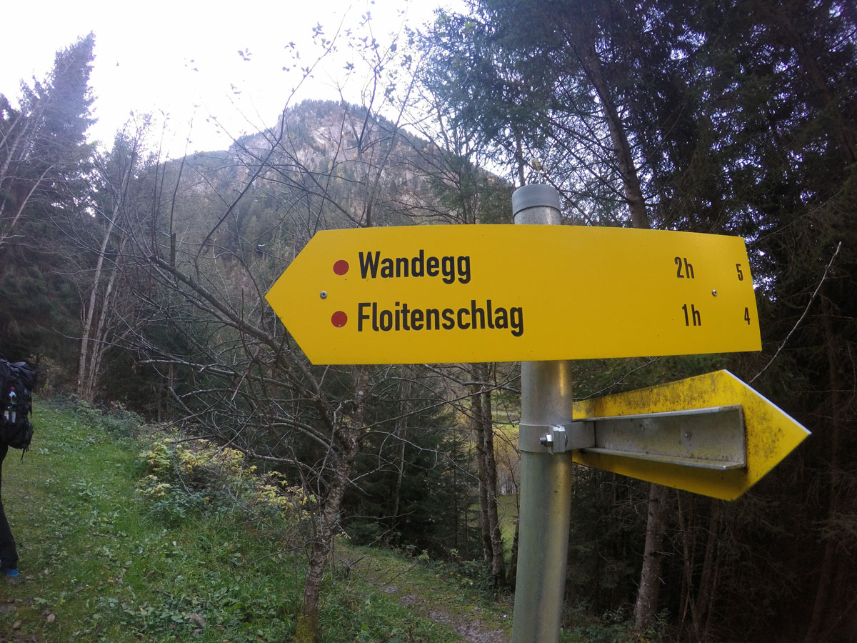
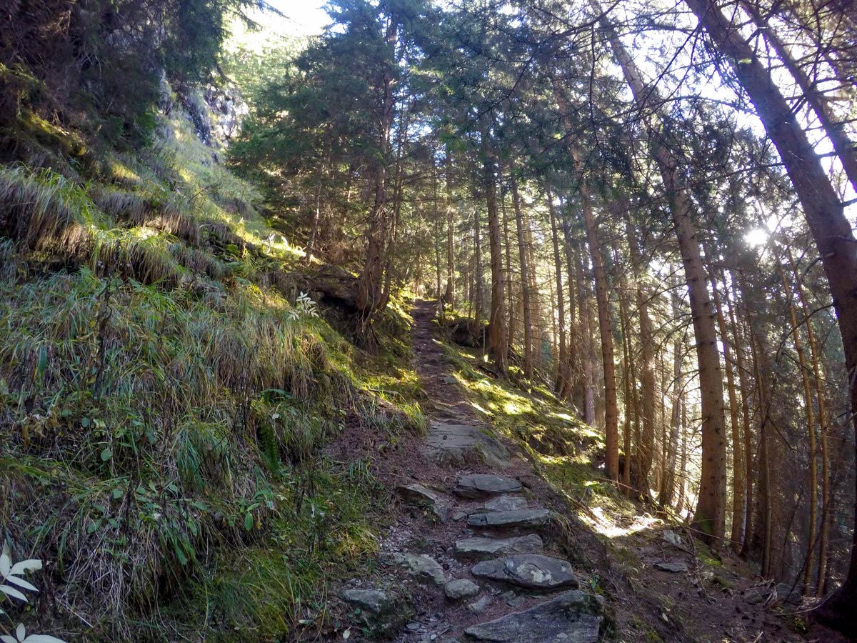
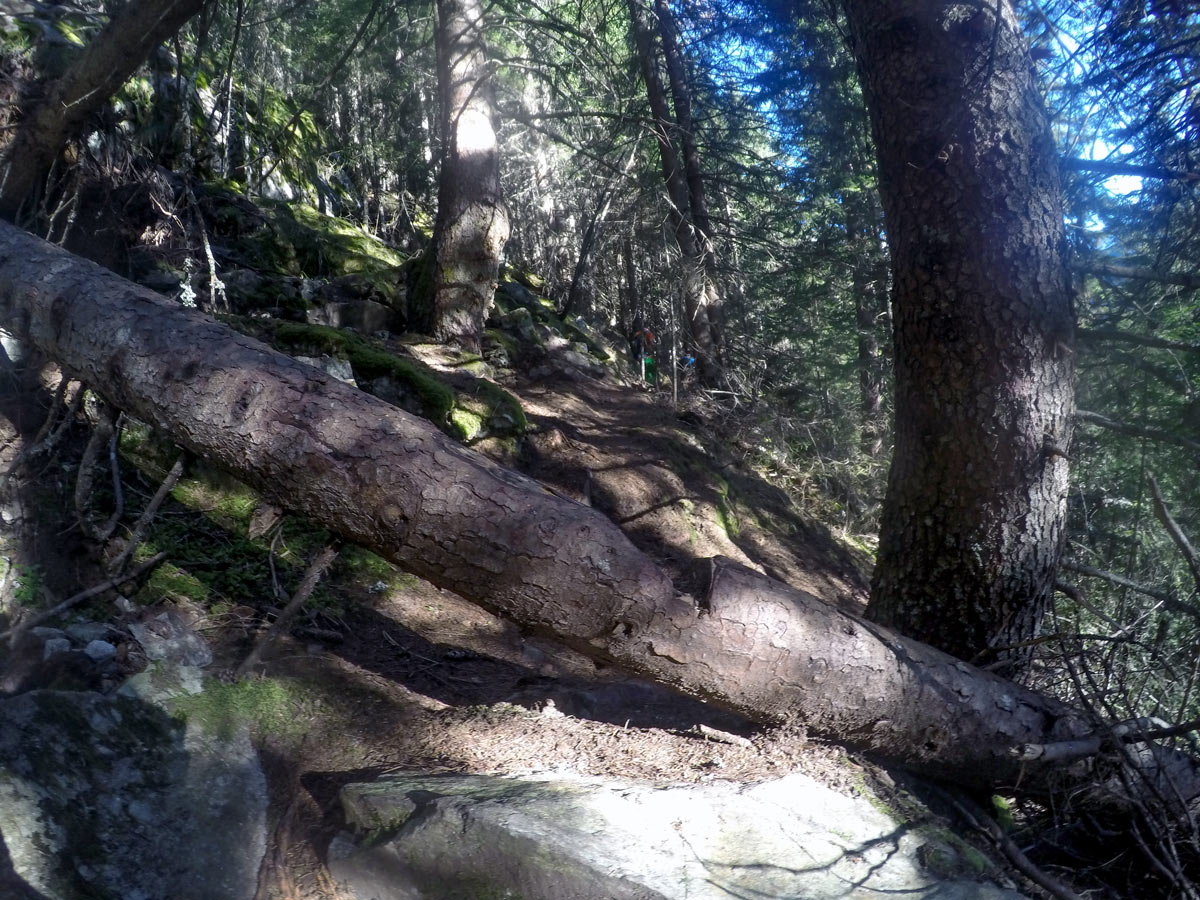
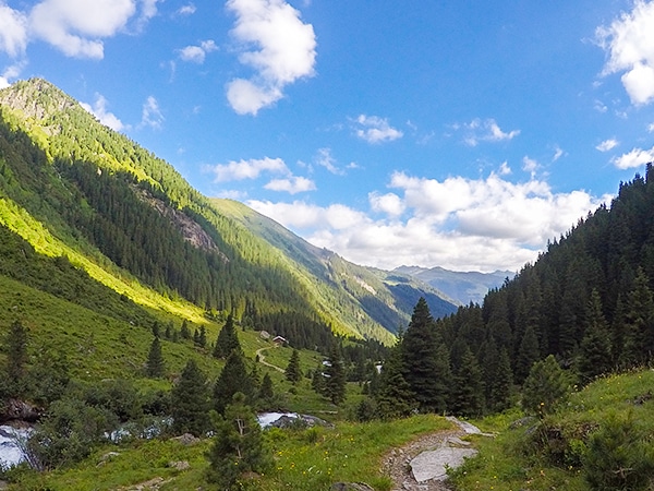
Follow this path as it goes through the woods. At the next yellow sign, turn right and pass two benches located close together to get to the steep trail up the woods.
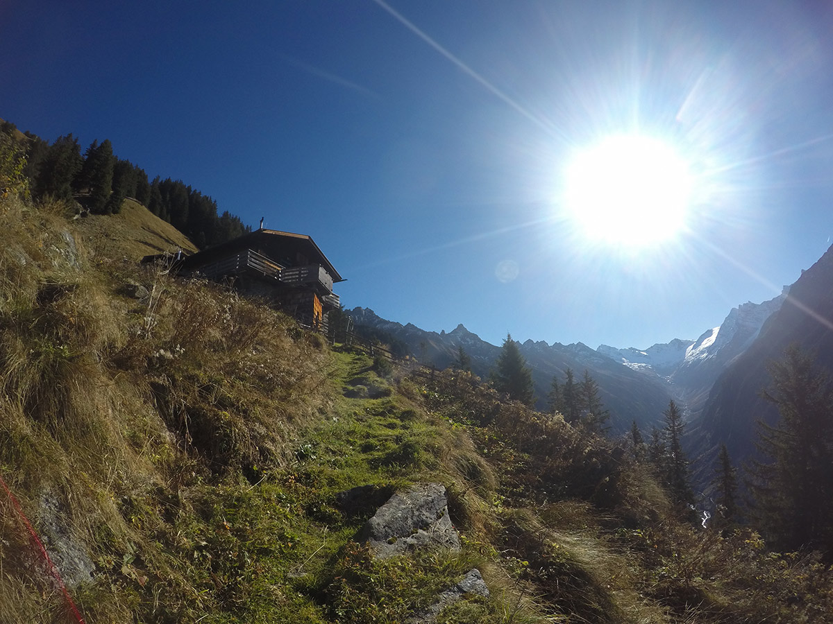
Stay on this path for 3km until you reach a private hunting hut; it is a perfect place for a short break and to top up your energy.
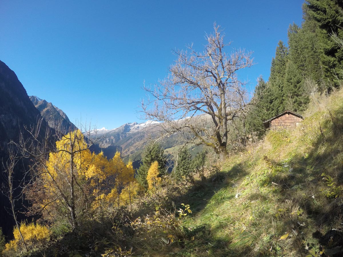
Further on the left side of the hut, the path continues, as you gain more altitude through the woods.
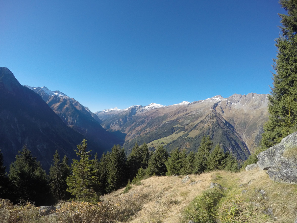
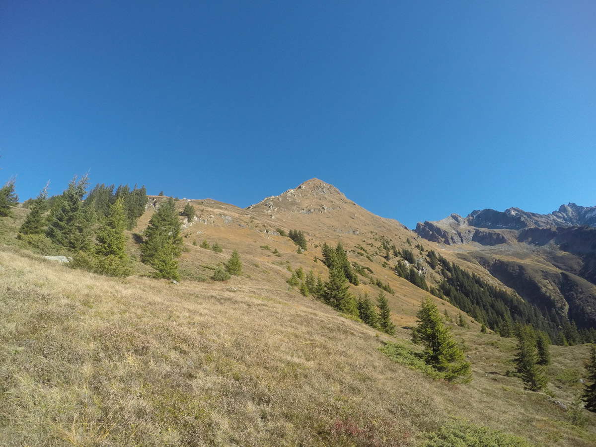
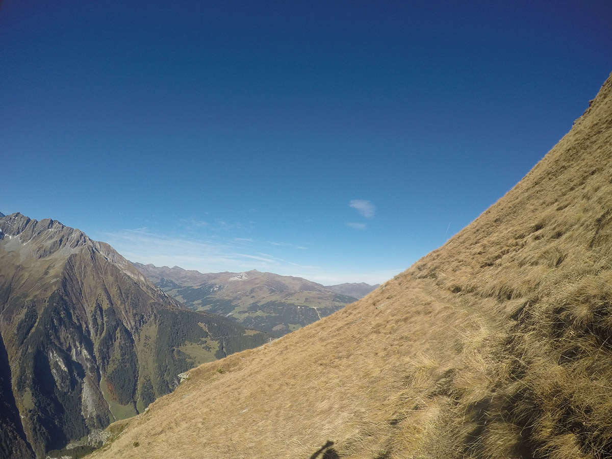
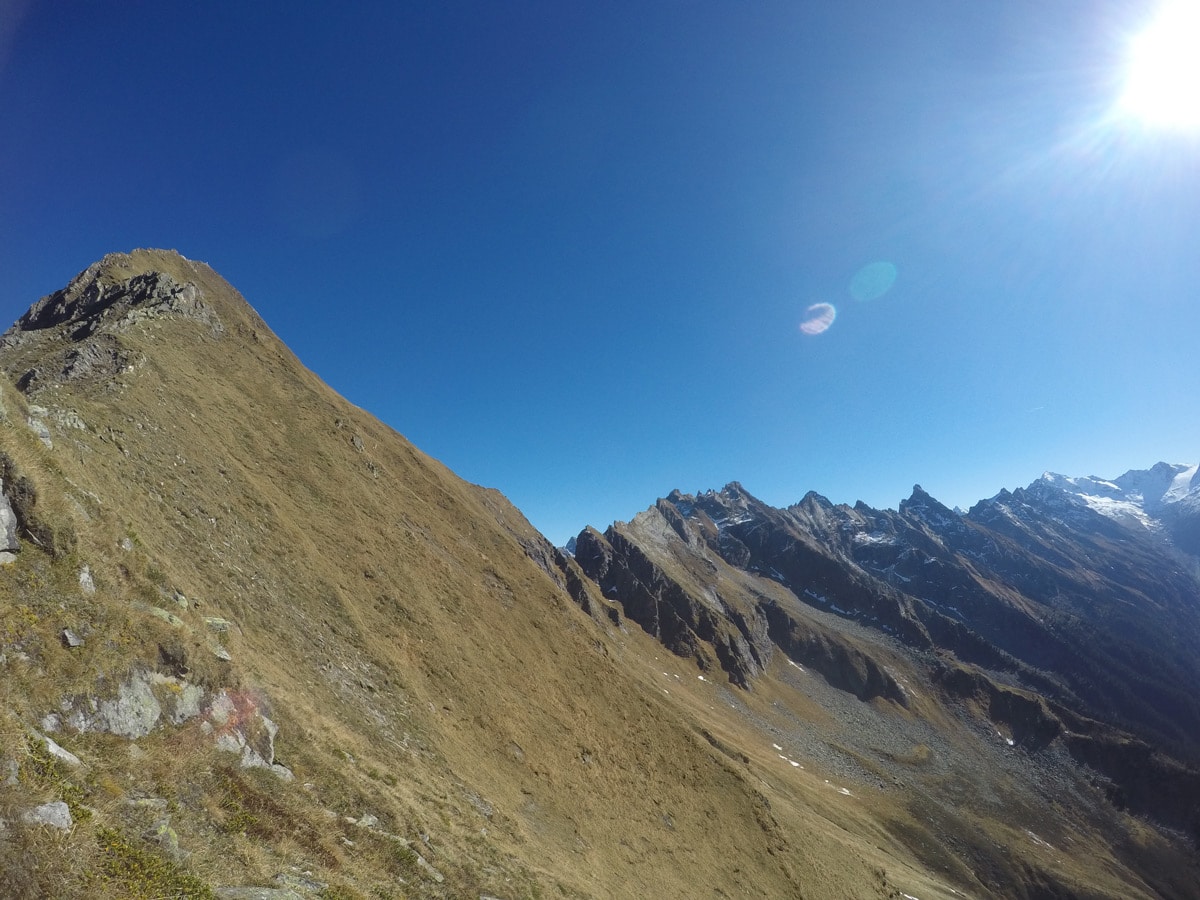
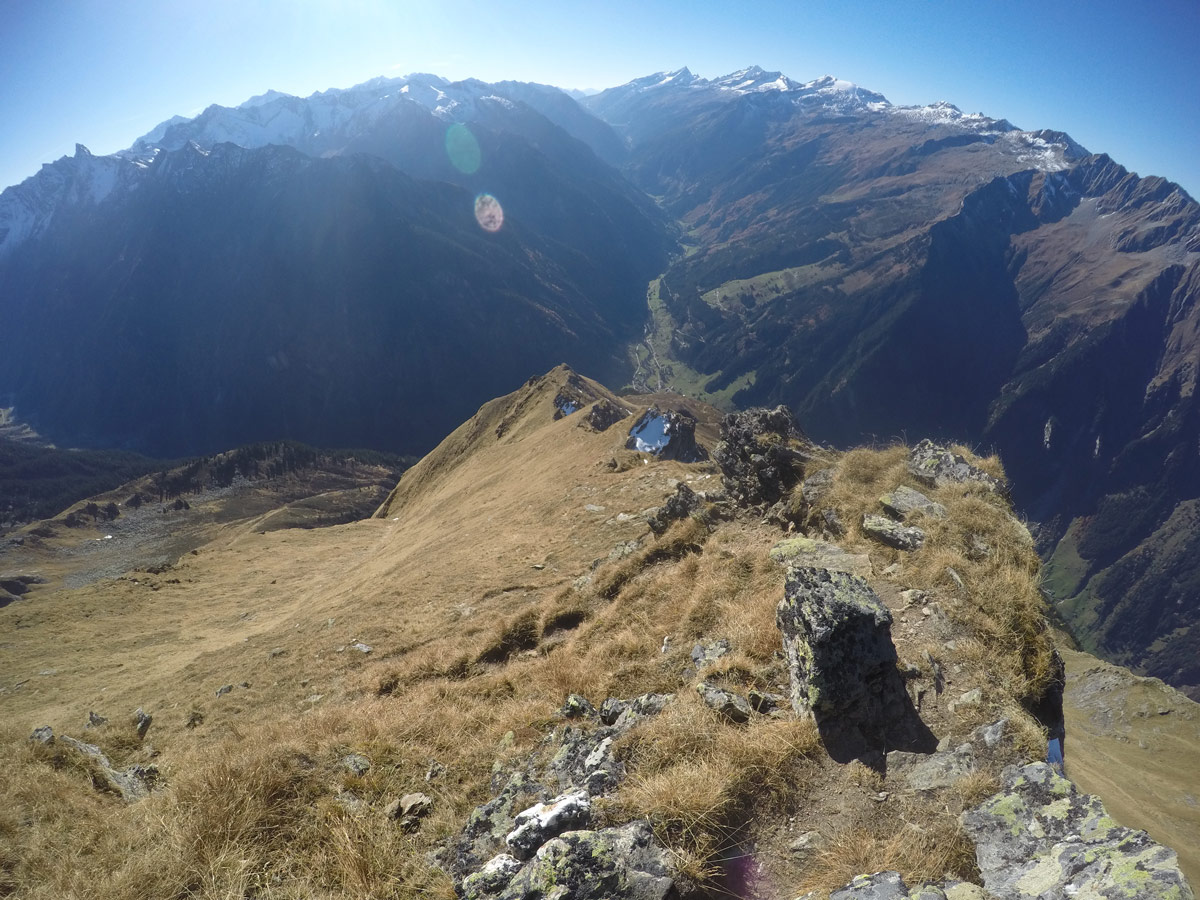
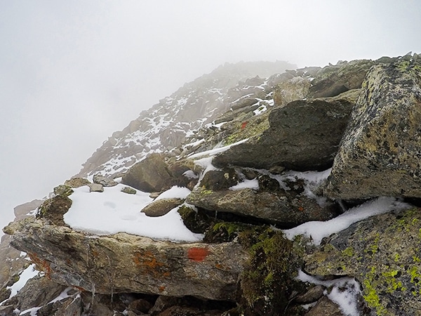
Soon you will leave the woods behind you. There are no signs or marks on this route, but you can easily see the one and only path up to Tristner. The path leads you over meadows until you see the first peak from the ridge, where you can already see the cross on top of the summit of Tristner. Follow the really steep route up the ridge until you reach the top. You will be rewarded with a stunning 360-degree view.
Take the same way back.
Insider Hints
There are no signs on this route that say “Tristner”.
On this hike, you will not see many people. Be sure you let somebody at the hotel or the tourist information in Ginzling know you are going up on this hike.
If you are already exhausted when you arrive at the hunting hut, this hike might not be continued. Enjoy the view from there and try another time.
Take your time and plan some extra rests for this one.
Be sure you have enough energy for hiking down, you will need your glutes and thighs for the way back.
Good hiking boots and sticks are highly recommended for this hike.
Do not choose this hike when it rained the last few days or when the weather forecast is unpredictable.
Click the link to find out more about hiking the Austrian Alps.

Similar hikes to the Tristner Hike hike
Plauener Hütte Hike
The Plauener Hutte route is a stunning hike near Mayrhofen that has it all including incredible views of mountains and…
Zittauer Hütte Hike
The hike to Zittauer Hütte offers a moderate hike for both the young and old. There is lots to see…
Ahornspitze Hike
The Ahornspitze hike is spectacular! The trail begins at the top of the Ahornbahn lift, which you take from Mayrhofen.…
Udo Huber 4 years ago
A great challenge to reach the top. The view was very rewarding.
Kamil Blajak 4 years ago
Fantastic views in all directions. Definitely worth a visit!
Jamie Parker 4 years ago
One of the best summit! It gives an amazing view over the Zillertal unlike any other!
Rixy Lily 4 years ago
This might not be everyone's cup of tea, but this is my favorite.
Yuyu Kishimoto 5 years ago
Breathtaking panoramic views. magnificent trail! well marked.
Guillana J. 5 years ago
It’s a great challenge hike with a beautiful view of the Zillertal. It's very exhausting, and definitely not suitable for beginners.
Adrian Cruz 5 years ago
Good views along the way to the top. Many great photo ops. Great experience.
Dawn C. 5 years ago
Magnificent view of the forest along the way. This hike is challenging. Definitely worth the visit.
Jimmy D. 5 years ago
Be careful of this hike because of its steep trail. It's a hike for most veteran hikers. This hike also provides you with the most incredible view over the Zillertal.
Lowell Hans 5 years ago
Great trail and beautiful views. Highly recommend.