Edge of The World Trail
View Photos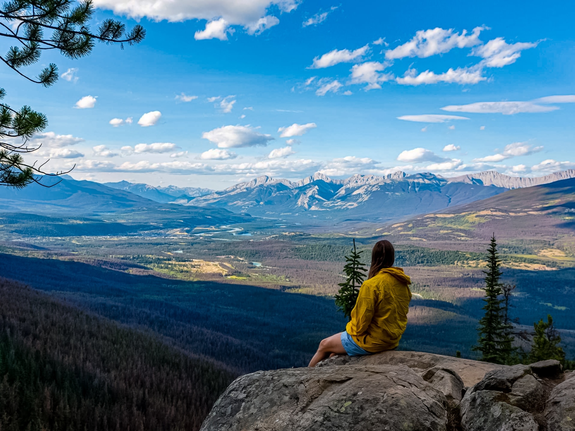
Edge of The World Trail
Difficulty Rating:
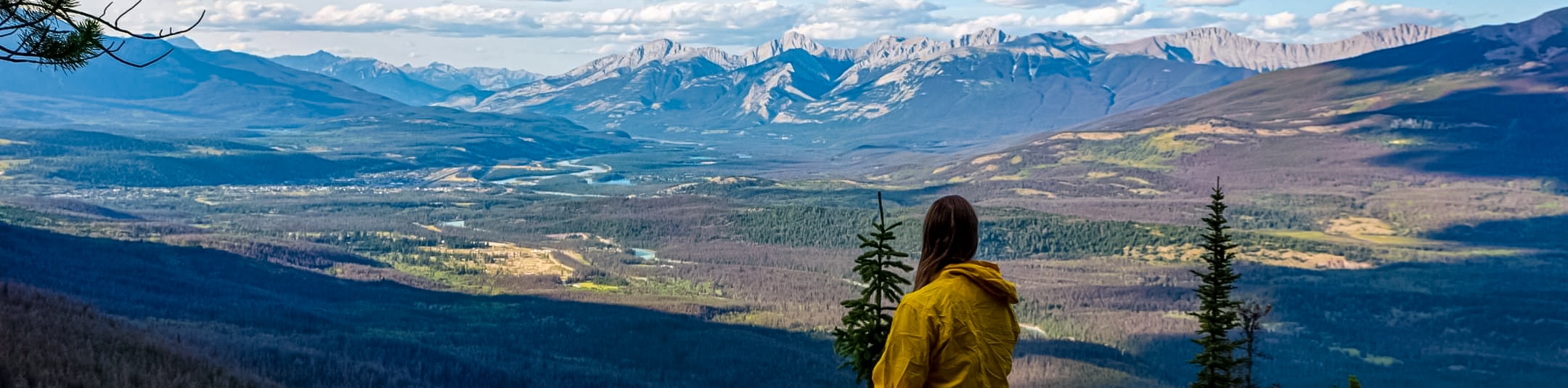
The trail to Edge of the World is a 0.7mi out-and-back trail that is well-maintained and moderately visited. If you are on the way to Marmot Basin, you should stop here for a quick stretch of the legs and an incredible view of Jasper National Park. This is an obvious dirt trail that is straightforward and comes to a viewpoint before turning around.
Getting there
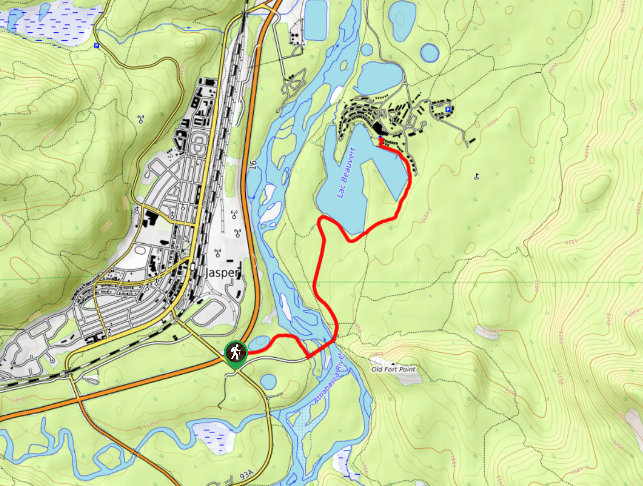
From the town of Jasper, travel southbound on Connaught Drive to join the Icefields Parkway (93N). The Edge of the World trail is nearby Marmot Basin Ski Resort, so you will be following signs for the resort. Travel south on the Icefields Parkway for 4.0mi and turn right onto 93A South. In 1.6mi, turn onto Marmot Road. Continue for 5.6mi Park on the side of the road in an unsigned area and watch for traffic.

About
| When to do | May-October |
| Backcountry Campsites | No |
| Pets allowed | Yes - On Leash |
| Family friendly | Yes |
| Route Signage | None |
| Crowd Levels | Moderate |
| Route Type | Out and back |
Edge of The World Trail
Elevation Graph
Weather
Edge of the World Trail Description
The hike to the Edge of the World is not an official Parks Canada trail and has no signage, so getting started might be the hardest part. Clock your odometer for this one and keep your eyes peeled for the pullout. If you arrive on a busy summer day, you might see other vehicles at the pullout.
If you are heading to Marmot Basin for other activities, this is definitely worth a stop. You’ll be able to park and quickly walk to the lookout point and back with no hassle.
From the side of the road, you’ll see a cutline running parallel to the road. Follow this and join the obvious trail for 1640ft. It opens up immediately to vast views below. You’ll be able to see many notable landmarks from above after gaining significant elevation on the drive up the Marmot Road.
The ski resort is closed during summer; however, you’ll be able to see sights from high above. The Edge of the World trail is an access route to waterfalls that are popular for ice climbing in the winter months. If you are heading to the ski resort in winter, the trail should be packed down enough to take a peak even in the snow.
Insider Hints
Be aware of the traffic in the area since there is no official parking space or pull out.
Nothing technical here! Consider this a flip flop walk and a trail you won’t need any preparation for.
If you are out for a scenic drive, head back to the 93A and continue on to Mount Edith Cavell Road for a stunning drive and another short viewpoint with options to extend.
Similar hikes to the Edge of The World Trail hike
Red Squirrel Trail
The Red Squirrel Trail takes hikers between the Old Fort Point Trail and Jasper Park Lodge. It is a short…
Wapiti Trail
The Wapiti Trail is a beautiful way to see the Athabasca River and connect the campground to town. If you…
Jasper Discovery Trail
The Jasper Discovery Trail is a great way to see the town of Jasper while taking in some interpretive information.…
Comments