Old Man Mountain Hike
View Photos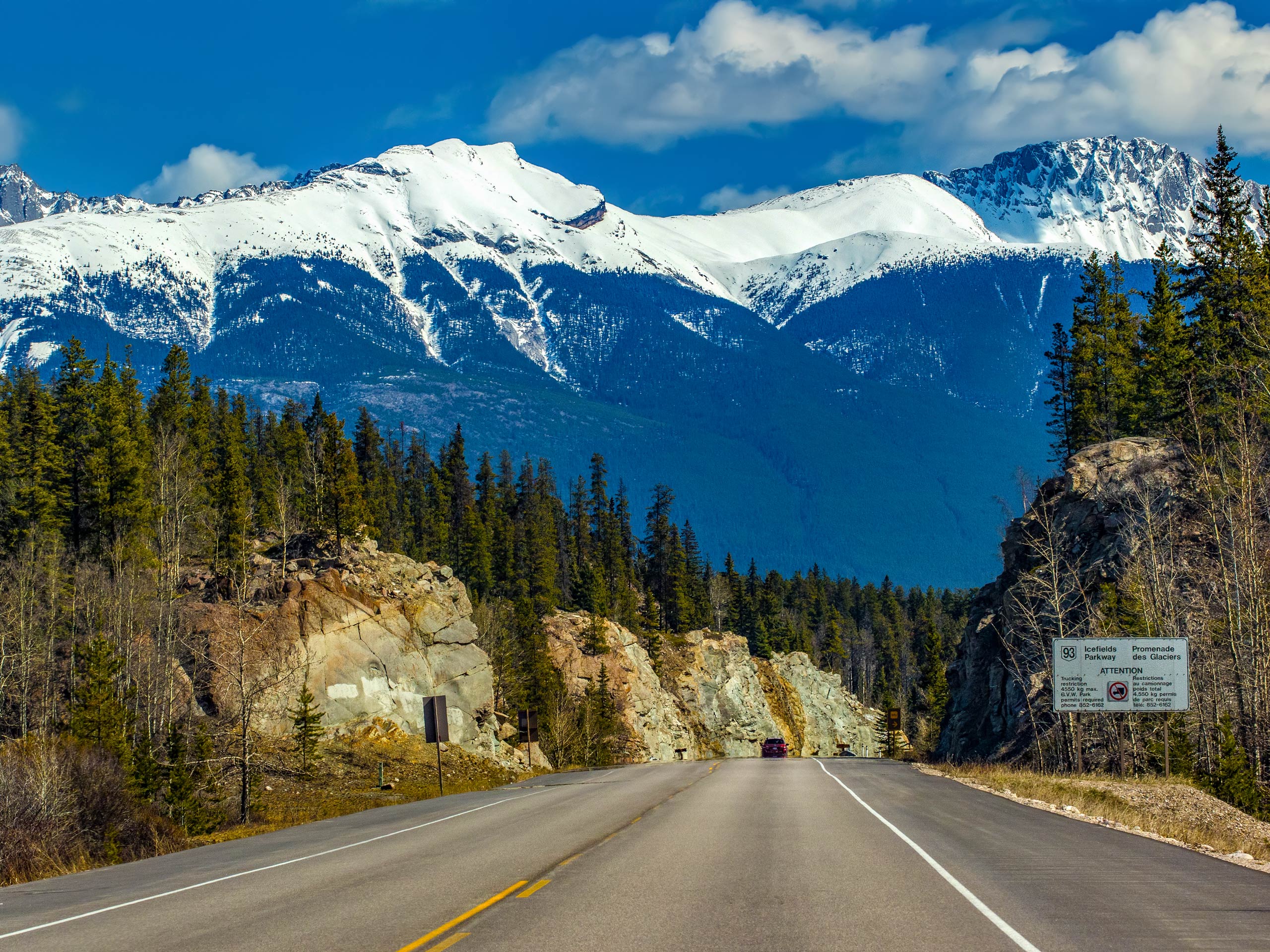
Old Man Mountain Hike
Difficulty Rating:
The popular Old Man Trail in Jasper is an easy scramble and a local favourite. It can seem like a tough push, but your efforts will be gallantly rewarded with jaw-dropping views from the top. Explore new heights on this full-day route in the Maligne area in Jasper National Park.
Getting there
To get to the Old Man trail/Roche Bonhomme route from the Town of Jasper, you will need to take Connaught Drive (16A) northbound out of town. Take a slight right curve and come to an intersection with Highway 16. Turn left onto the highway and take a right turn onto Maligne Lake Road. Follow this road for 3.7mi and turn left into the Maligne Canyon parking lot.

About
| When to do | May-September |
| Backcountry Campsites | No |
| Pets allowed | Yes - On Leash |
| Family friendly | No |
| Route Signage | None |
| Crowd Levels | Moderate |
| Route Type | Out and back |
Old Man Mountain Hike
Elevation Graph
Weather
Old Man via Roche Bonhomme Trail Description
The Old Man Trail is what the locals call Roche Bonhomme. It is a popular scramble for Jasper residents and makes for an excellent day out. It is important to have a good idea of the route before embarking on this scramble as you will need to know where you’re going. This hike covers 4364ft of elevation gain in just 2.6mi, so if you aren’t ready for some serious vert, maybe choose another trail.
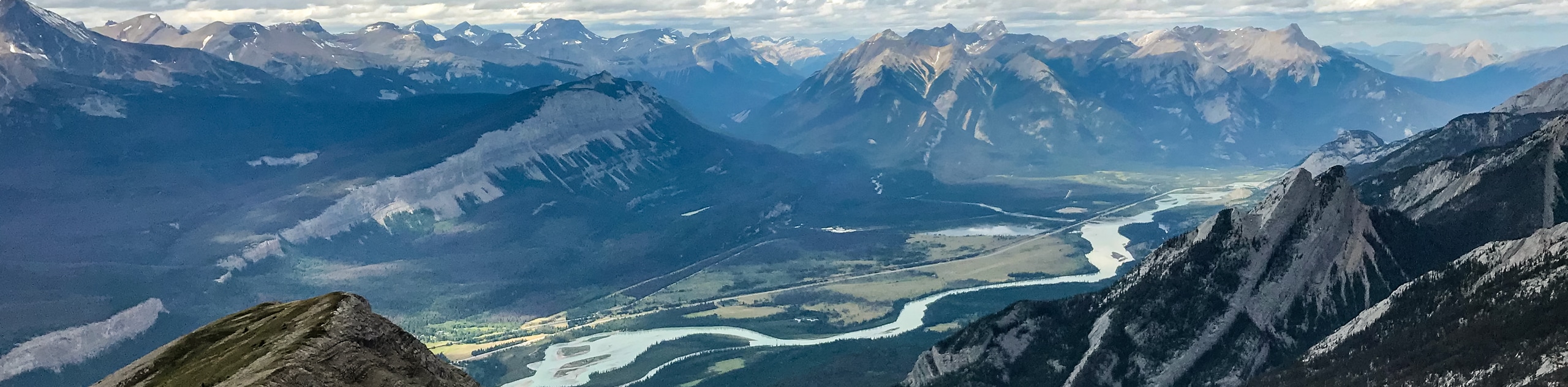
The Old Man Trail is perfect for those looking to tackle some vert and escape the crowds of the heavily populated Maligne area. Your efforts will be rewarded at the top with incredibly vast views. On a clear day, you will be able to spot the Jasper Townsite, the Jasper Park Lodge, and, of course, the otherworldly Maligne Canyon below.
One of the most difficult route-finding components of this trail is finding where it starts. From the Maligne Canyon parking lot, make your way to the Maligne Lake Road, where you came from. Turn left and walk roughly 1148ft up the road looking for a cairn. You will find a large cairn and a trail leading into the forest. This is not an official Parks Canada trail, so don’t expect to find convenient signs and regular maintenance like many of the other trails in Jasper.
Now that you’ve found the trailhead, follow the trail as it points straight up and through the woods. An obvious trail leads through the forest and two canyon sections. After the second canyon section, the trail’s grade begins to ease for a much-needed respite from the steepness below. You’ll find incredible wildflowers here if you arrive in the right season.
A large slab will come into view, and the trail becomes quite steep again to the left side of the slabs. There are some overgrown sections here that may require a little bit of bushwhacking, depending on the season.
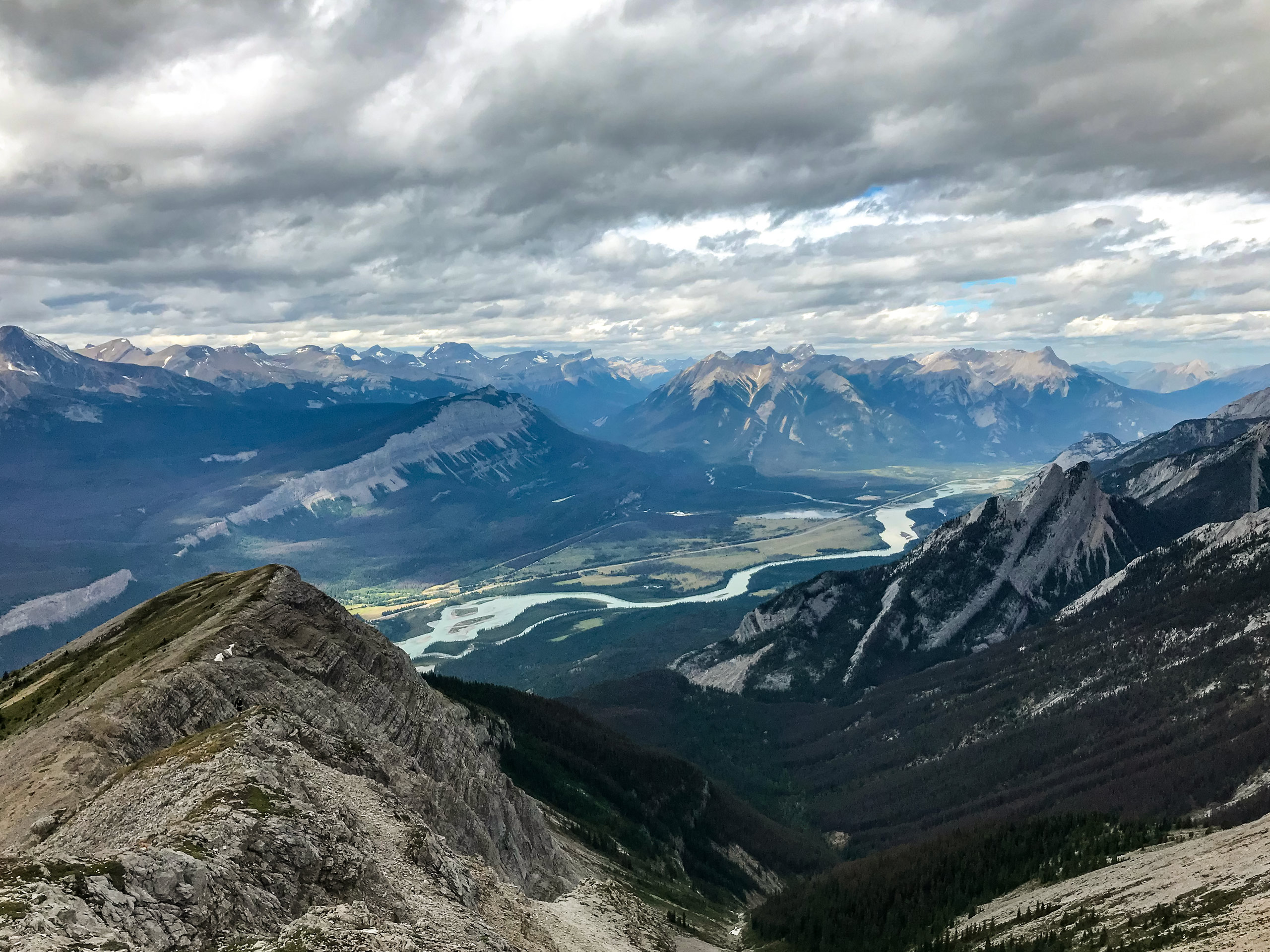
Reaching the treeline reveals panoramic views of various mountain ranges, including the Maligne, Victoria Cross, Trident, and Colin ranges. Here, the forest turns to scree, and a clear trail follows switchbacks up to the summit ridge of the Old Man Trail. You will reach the ridge and traverse until reaching the summit. The ridge is the true namesake of the trail as it resembles a man’s face horizontally. You will be hiking along the Old Man’s prominent features as the trail covers some high points along the ridge, which is designated as Old Man’s forehead, nose, and chin.
Prominent local lakes such as Edith, Patricia, and Trefoil are visible from the summit adding dimension to the incredible views. As you traverse the ridge, you’ll find cairns along the high points and even a moderately sized cave big enough to enter. Enjoy some time on top of the summit ridge if it isn’t too windy.
The descent can be difficult with the loose scree and steep forest trail. Watch out for dry trail conditions in the lower section. This can become extremely slippery in the middle of summer as the trails become dry and dusty. Make your way down the way you came and walk back to the Maligne Canyon parking lot, where you can refill water, use the public restrooms and even grab a bite to eat.
Hiking Route Highlights
Maligne Canyon
From the summit ridge of Old Man Mountain, you’ll be able to see the expansive formations of Maligne Canyon from high above. This is an excellent addition to your trip if you want to cool-down your legs and enjoy a gentle stroll through an inspiring natural feature.
Maligne Canyon is a canyon that is carved into the Palliser Formation, which is made up of limestone that was deposited into the Maligne area of Jasper. The canyon reaches depth of up to 164ft and the self-guided trail will lead you through catwalks, bridges, and interpretive viewpoints that wind through the canyon.
Insider Hints
You’ll need a hearty lunch for this full day hike and we suggest picking up some sandwiches and snacks from Patricia Street Deli. You won’t be disappointed with their selection, and you sure will be glad you decided to stop there when it’s time to break for lunch.
If your legs can handle it, take the leisurely stroll through the Maligne Lake interpretive trail when you return. This gentle trail shows off some of the natural wonders in Maligne Canyon and has multiple options to shorten or lengthen the distance.
If you are looking for a post-trail meal, head to Maligne Canyon Wilderness Kitchen and forget about driving back to town. You’ll be able to make up for those burned calories right where you started without wasting any time.
Take a drive up Maligne Lake Road to the lake itself. Watch for wildlife along the way, and try to time your arrival for sunset viewing
Be sure to know your route and bring plenty of food and water on this arduous hike.
Similar hikes to the Old Man Mountain Hike hike
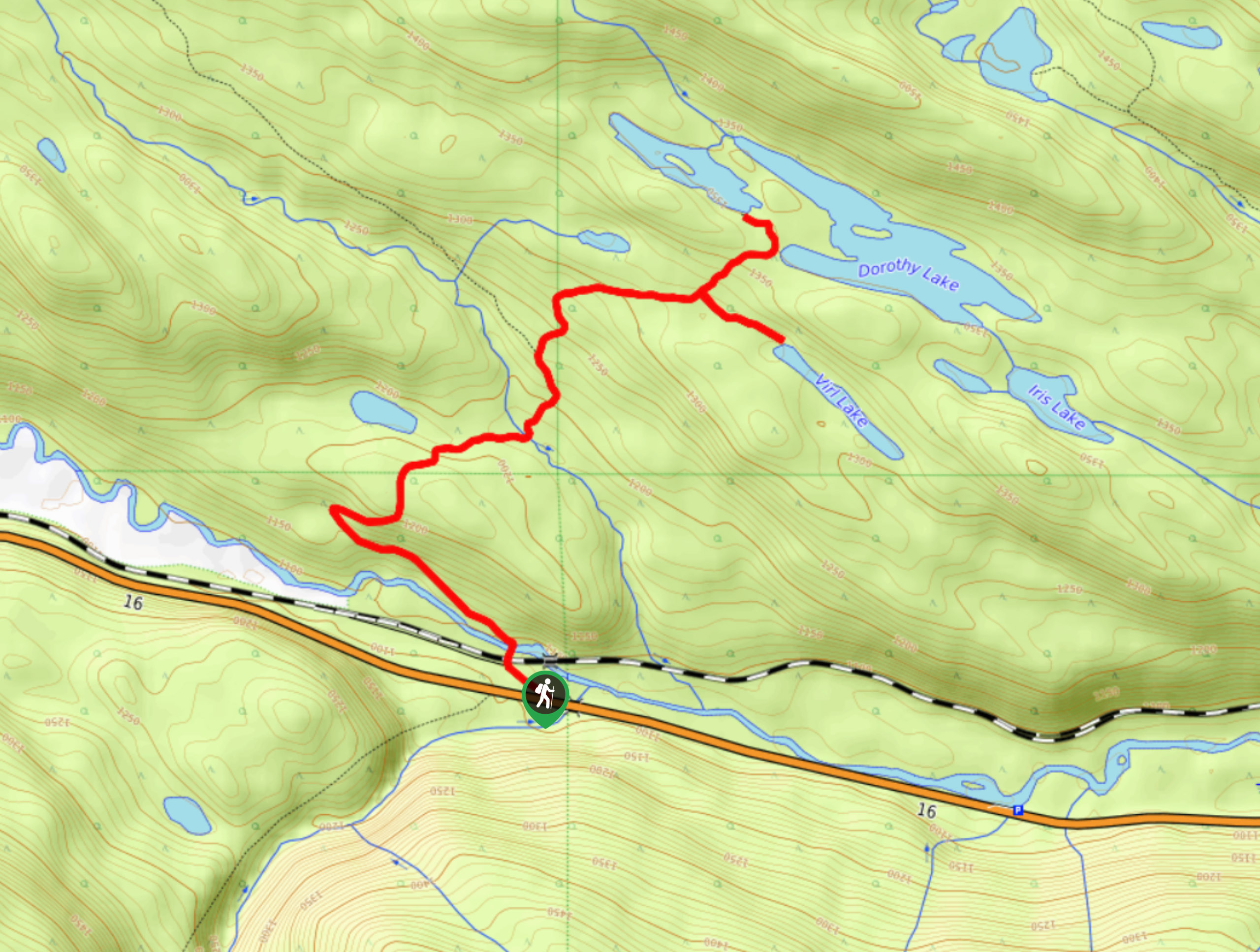
Dorothy and Christine Lakes Hike
The Dorothy and Christine Lakes trail is a beautiful forested trail west of Jasper. It features stunning lakes and has…
Mary Schaffer Loop Trail
The Mary Schaffer loop trail is a gentle circuit that explores the shores of Maligne Lake, offering interpretive signage and…
Whirlpool Valley Fire Road Trail
Taking the Whirlpool Valley Fire Road up towards the Whirlpool backcountry campground is a great day out that can be…
Comments