Old Coach Trail
View Photos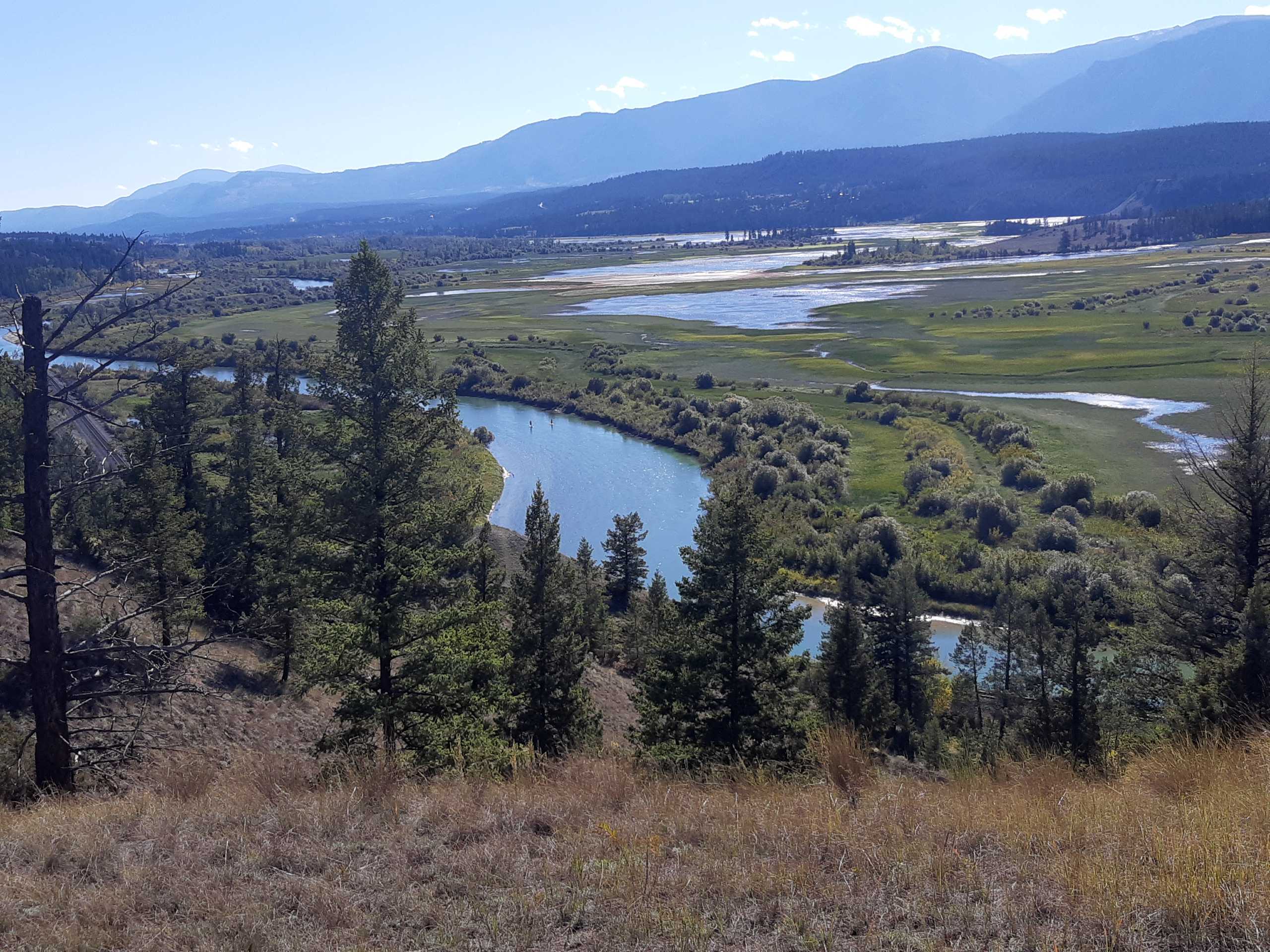
Old Coach Trail
Difficulty Rating:
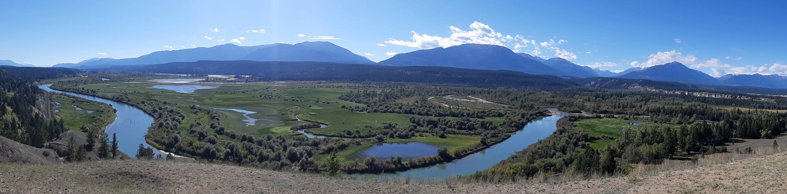
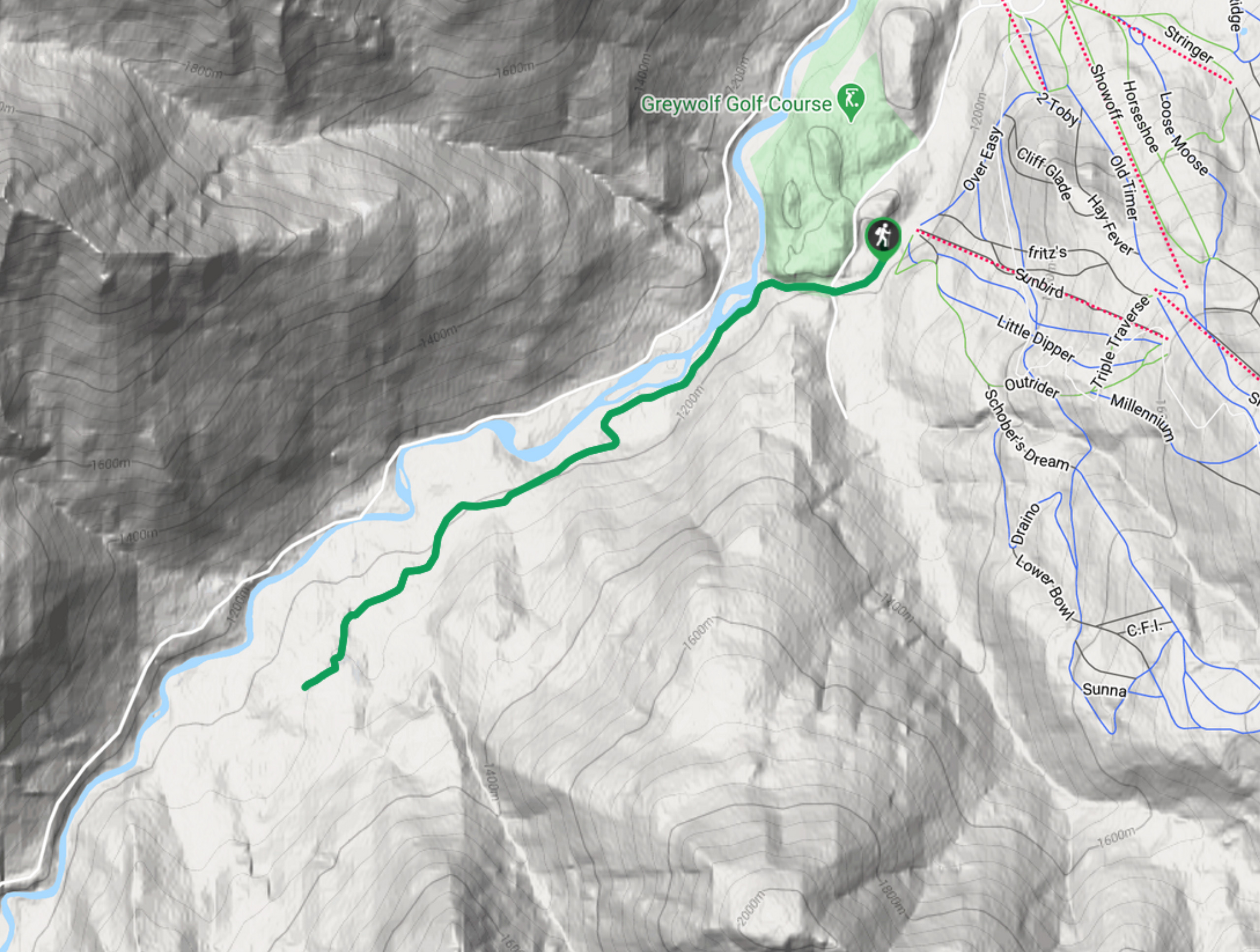
The Old Coach Road Loop is a 2.9mi hiking route near Invermere, BC, that follows along the Columbia Escarpment and provides a great sightline across the valley. The trail is relatively flat and made up of easy terrain, making it accessible for hikers of all skill levels. Bring some binoculars for the chance to view some wildlife along the Columbia River below the bluff.
Getting there
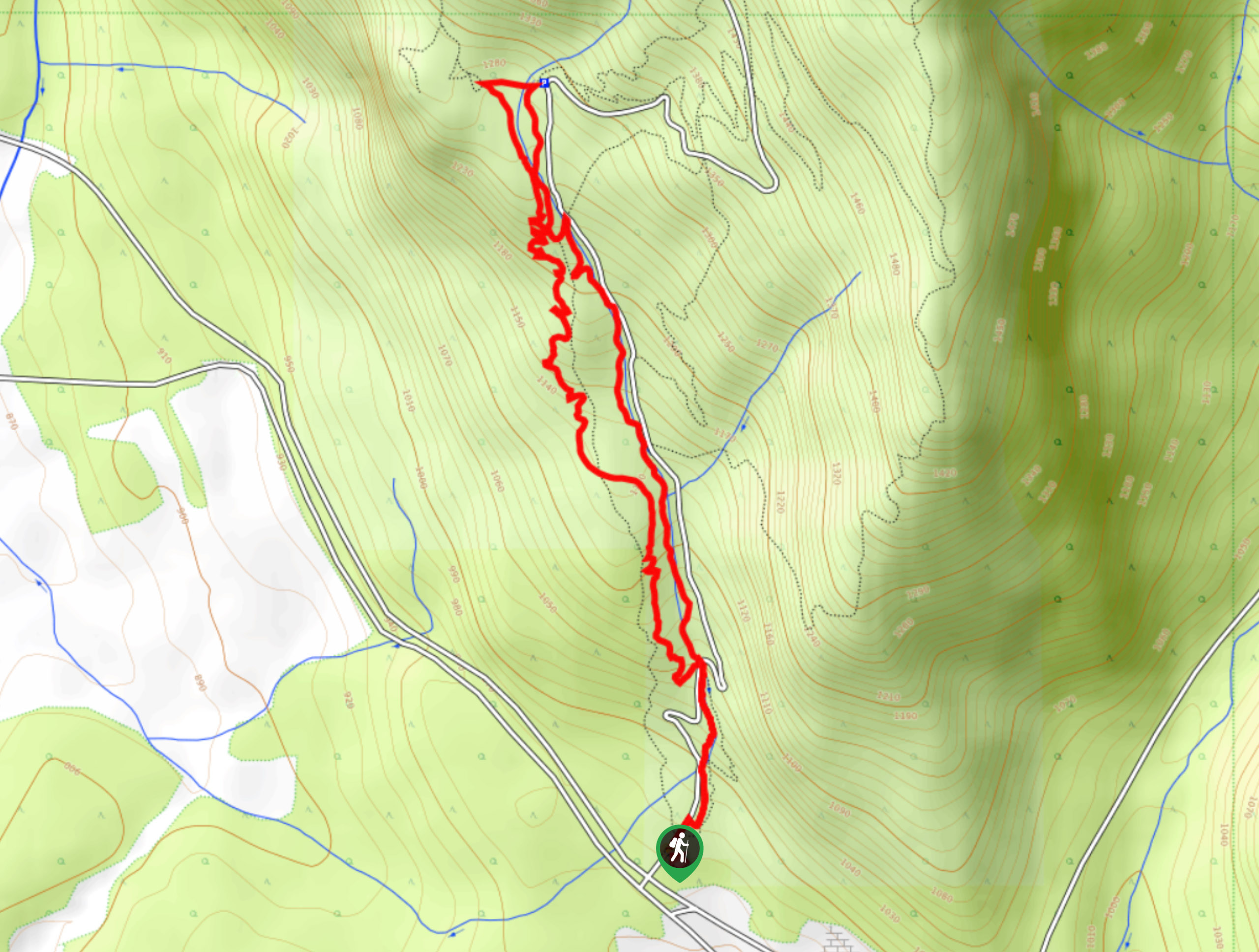
To access the trailhead for the Old Coach Road Loop from Highway BC-93 outside of Invermere, head northwest on BC-93 for 4.5mi and make a left turn. Turn left again immediately and continue down the road for 1148ft, where you will find the parking area.

About
| When to do | May–October |
| Backcountry Campsites | No |
| Pets allowed | Yes - On Leash |
| Family friendly | Older Children only |
| Route Signage | Average |
| Crowd Levels | Low |
| Route Type | Circuit |
Old Coach Trail
Elevation Graph
Weather
Old Coach Trail Description
Hiking along the Old Coach Trail Loop is a quick half-day hike from Invermere that will provide hikers with picturesque views across the valley and the chance to see some local wildlife. The trail passes through some light tree cover on the way down to the edge of the escarpment, where you will have a great sightline looking out over the Columbia River and the surrounding wetlands. This is a great place to look for some local animal species, including coyotes, various types of birds, and deer.
Continue working your way around the loop and take in the expansive view across the valley to the Purcell Mountain Range. After you’ve made it to the northernmost part of the trail, work your way back along the loop to return to the trailhead. Those looking to extend their hike can utilize any of the trails that branch off from the main route to create a longer loop through this scenic area without too much difficulty.

Similar hikes to the Old Coach Trail hike
Mount Swansea Tower
Mount Swansea Tower is a 3.8mi lollipop hiking route in the Swansea Mountain Recreation Site near Invermere that…
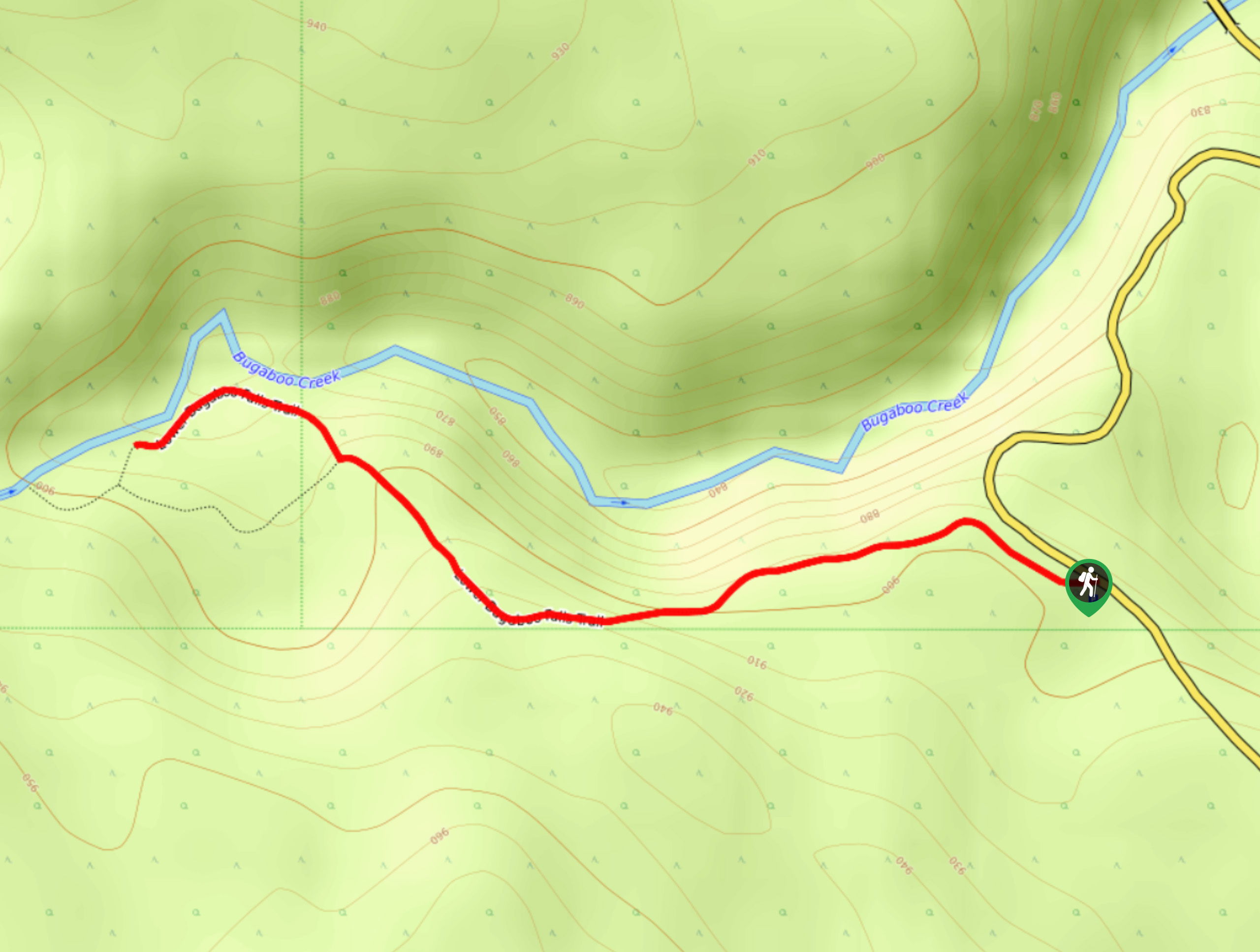
Lower Bugaboo Falls
Lower Bugaboo Falls is a 1.6mi out-and-back hiking route northwest of Invermere that will allow hikers to experience…
Hale Hut via Placer Trail
Hale Hut via the Placer Trail is a 4.2mi out-and-back hiking route at the Panorama Mountain Resort near…
Lukas Saville 3 years ago
A stunning trail, beautiful valley and just a nice place to walk around
Giedre 3 years ago
Went there for a walk just a few days ago. This is a pleasant and easy route with many nice overlooks towards the mountains and the Columbia Valley below. You can also walk this trail as a one-way to Radium Hot Springs