Brewer Lake
View Photos
Brewer Lake
Difficulty Rating:
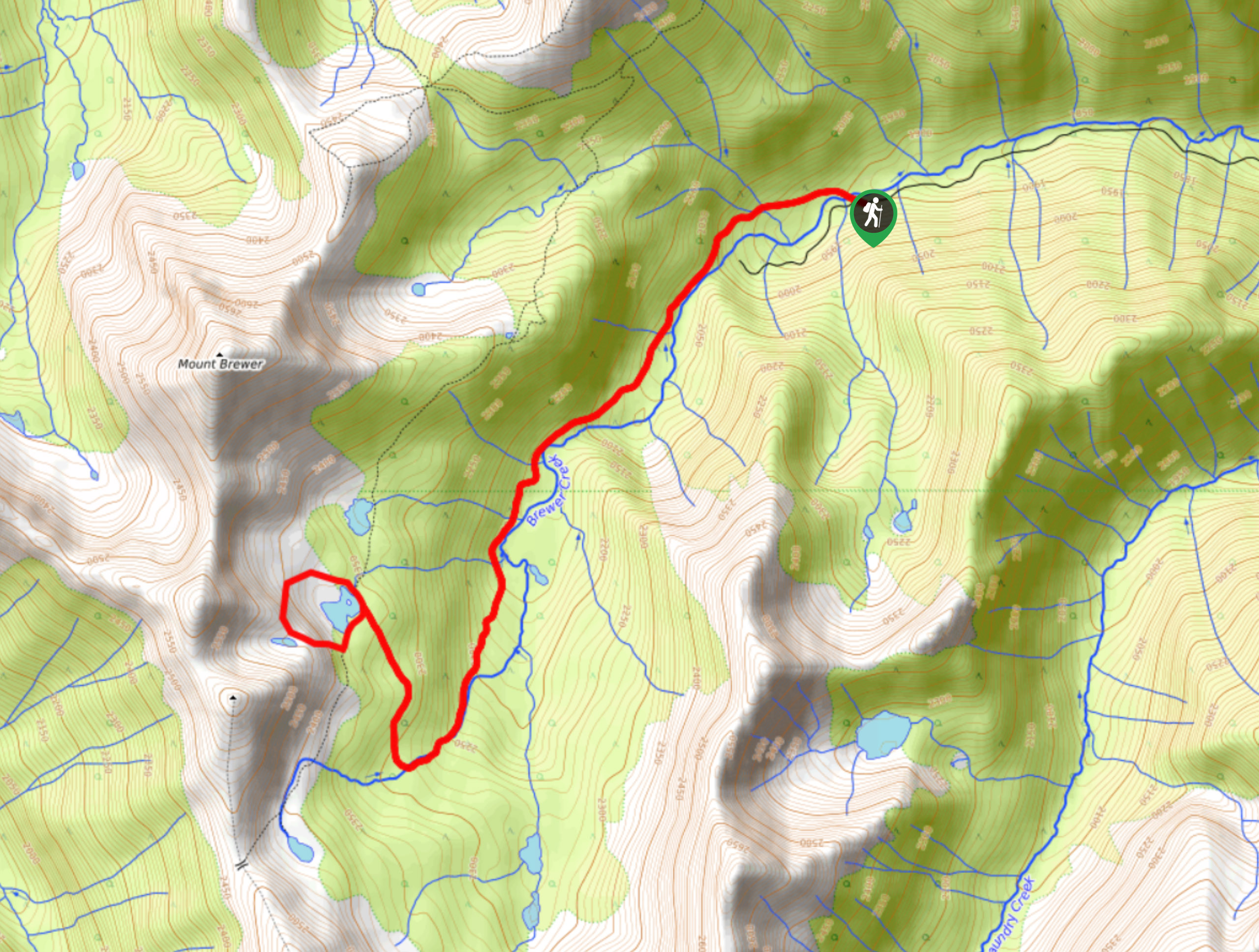
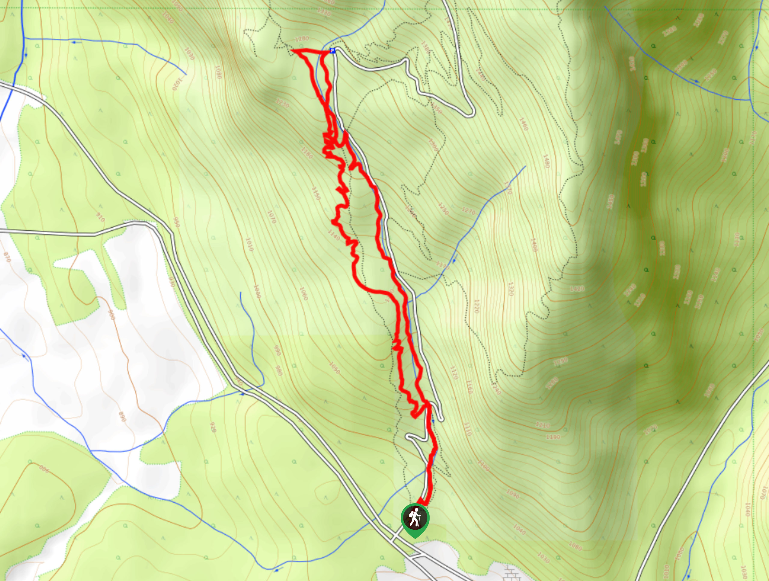
Brewer Lake is a 6.6mi lollipop hiking route near Invermere, BC, that will take hikers through some beautiful subalpine terrain on the way to the peaceful lake. Along the trail, you will have awesome views of the nearby mountain peaks, and if you time your hike for autumn, you will be able to take in the beauty of the golden larches in the area. Make sure to use a 4x4 high clearance vehicle for the rugged drive to the trailhead.
Getting there
To reach the trailhead for Brewer Lake from Invermere, head south on 13 Avenue for 1.1mi and continue straight on Westside Road for another 2.4mi. Turn right and follow the road for 3.9mi before making a left turn. In 4.1mi, make a right turn followed by another right in 1.8mi. From here, continue for 2.2mi and make a third right turn, following this road for 9.7mi to get to the trailhead.

About
| When to do | June–October |
| Backcountry Campsites | No |
| Pets allowed | Yes - On Leash |
| Family friendly | No |
| Route Signage | Average |
| Crowd Levels | Low |
| Route Type | Lollipop |
Brewer Lake
Elevation Graph
Weather
Brewer Lake Trail Description
The hike to Brewer Lake is a tough but beautifully scenic route that will take you through a small subalpine valley to reach the stunning waters of Brewer Lake. With 1962ft of elevation gain, this trail has a bit of an uphill climb; however, this is largely spread throughout the trail, and there are only a few steep sections along the route.
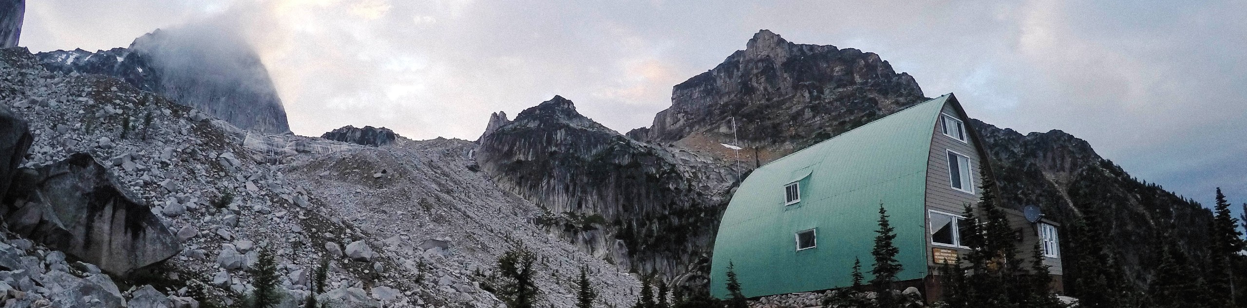
This beautifully forested trail follows closely alongside the flowing waters of Brewer Creek for the duration of the hike before turning to the west to arrive at the peaceful edge of the lake. When timed for the fall, this area is truly transformed as the numerous larches dotting the landscape paint the area in a warm golden colour. Take some time to explore the area surrounding the lake and absorb the views of nearby peaks such as Mount Brewer before heading back down the trail to return to your vehicle at the trailhead.
Similar hikes to the Brewer Lake hike
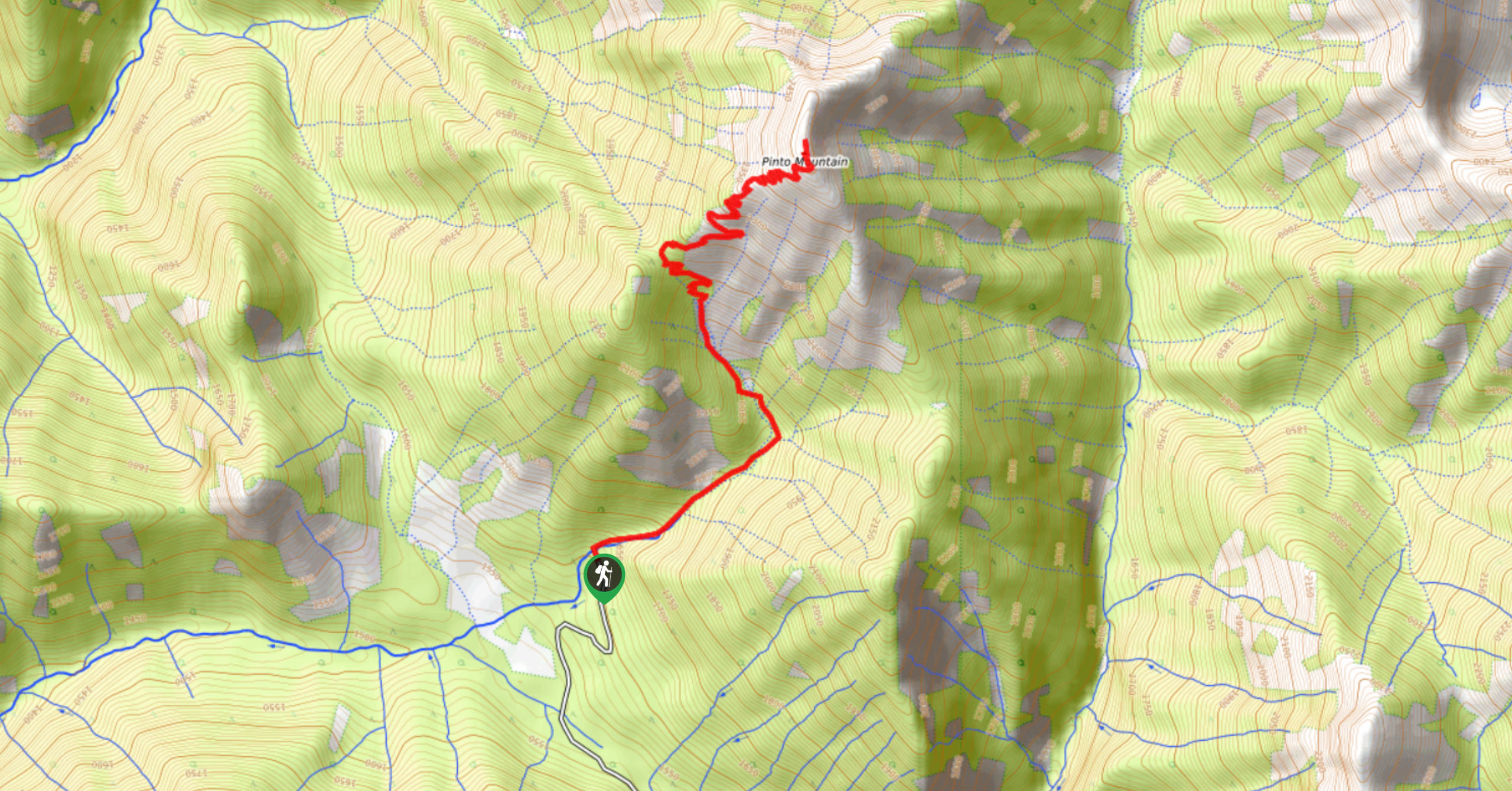
Pinto Mountain
The trail to the summit of Pinto Mountain is an 5.4mi out-and-back hiking route that will lead you…
Mount Swansea Tower
Mount Swansea Tower is a 3.8mi lollipop hiking route in the Swansea Mountain Recreation Site near Invermere that…
Conrad Kain Hut Trail
The Conrad Kain Hut Trail is a 5.6mi out-and-back hiking route near Invermere, BC, that climbs through beautiful…
Comments