
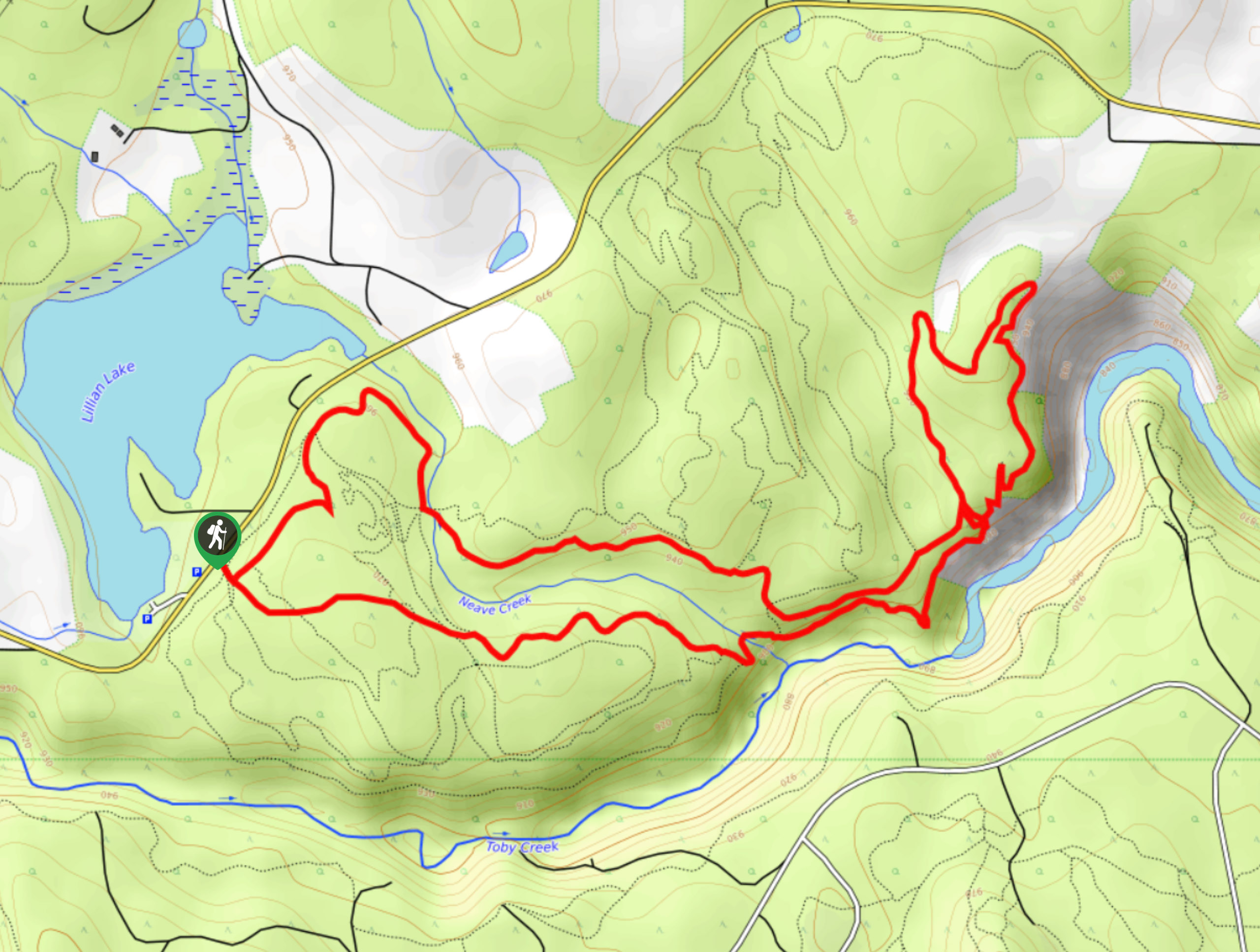
Apple Pie Loop
View Photos
Apple Pie Loop
Difficulty Rating:
The Apple Pie Loop is a 4.4mi hiking route in Invermere that forms a circuit within a dense network of multi-use trails in the area. This route will have you climbing gently uphill to reach a scenic lookout with views over the valley and Windermere Lake, with the Swansea and Four Points mountains in behind. Make sure to bring a GPS or trail map to stay on the correct course during your hike.
Getting there
To reach the parking area for the Apple Pie Loop from Invermere, drive northwest on Panorama Drive for 2625ft and continue onto Toby Creek Road. After 3.4mi, turn right to enter the parking lot.

About
| When to do | May–November |
| Backcountry Campsites | No |
| Pets allowed | Yes - On Leash |
| Family friendly | Yes |
| Route Signage | Average |
| Crowd Levels | Moderate |
| Route Type | Circuit |
Apple Pie Loop
Elevation Graph
Weather
Apple Pie Loop Description
The Apple Pie Loop is a fun, family-friendly hike in Invermere found within the intricate web of trails near the Lillian Lake Recreation Site. Both hikers and mountain bike enthusiasts use these trails, so keep an eye out while on the trail and remember to share the path with anyone trying to pass.
This route climbs uphill through some light forest cover along the flowing water of Neave Creek before arriving at an epic viewpoint overlooking the valley. From here, your sightline will include Toby Creek directly below you, Windermere Lake in the middle ground, and a host of mountains to the east, including Swansea Mountain, Four Points Mountain, and Mount Teggart. Continue along the loop to follow the trail back through the beautiful forest to the trailhead where you began your hike.
Similar hikes to the Apple Pie Loop hike
Mount Swansea Tower
Mount Swansea Tower is a 3.8mi lollipop hiking route in the Swansea Mountain Recreation Site near Invermere that…
Lower Bugaboo Falls
Lower Bugaboo Falls is a 1.6mi out-and-back hiking route northwest of Invermere that will allow hikers to experience…
Hale Hut via Placer Trail
Hale Hut via the Placer Trail is a 4.2mi out-and-back hiking route at the Panorama Mountain Resort near…
Comments